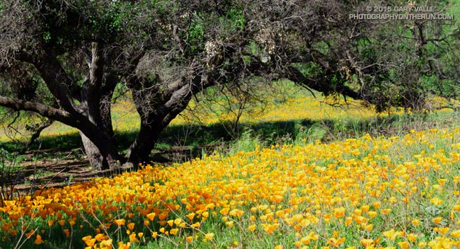
Poppies along the Two Foxes Trail in Pt. Mugu State Park. From Sunday’s run to Mugu Peak and back from the Wendy Drive trailhead in Newbury Park.

Poppies along the Two Foxes Trail in Pt. Mugu State Park. From Sunday’s run to Mugu Peak and back from the Wendy Drive trailhead in Newbury Park.
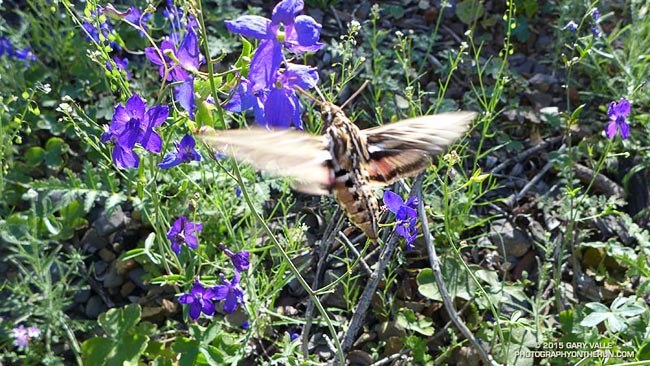
I was on the way back from Mugu Peak and about four hours into my run. I’d stopped at an exposure of Miocene age shale along the Upper Sycamore Trail. The gray-brown rubble is home to an intensely blue-purple wildflower called spreading larkspur (Delphinium patens ssp. hepaticoideum).
I’d just snapped a series of bracketed exposures of one patch of the flowers when suddenly there was the bumblebee-on-steroids buzzing of a hummingbird in front of me.
At least I thought it was a hummingbird. It sounded like a hummingbird and was about the right size. Its blurred wings were shaped like a hummingbird’s. It flew with the precision of a hummingbird, darting from flower to flower, deftly feeding on each blossom’s nectar using its oddly shaped beak.
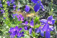
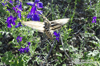
But it wasn’t a hummingbird — it was a hummingbird moth — a white-lined sphinx (Hyles lineata). I’d read about hummingbird moths, but to have one suddenly appear and start feeding on a larkspur plant I happened to be photographing was extraordinary.
Apparently the problem of feeding on the high-energy nectar in certain types of flowers is sufficiently definitive as to have produced a very similar evolutionary solution in wildly different organisms.
The sphinx moth is described as flying like a hummingbird, but which lineage produced this elegant solution first? It may have been the moth! A trace fossil of a sphinx moth found in Early Eocene Asencio Formation of Uruguay appears to predate the earliest known Oligocene fossils of hummingbird-like birds! In any case it appears that both hovering moths and birds co-evolved with the flowering plants on which they feed and pollinate.
Related post: Hummingbird Stories
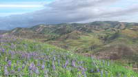
Following last year’s drought-induced hiatus goldfields are once again blooming in profusion on Lasky Mesa. The little yellow “belly flowers” tend to grow in low spots and along paths where rain water pools.
Race director Nancy Shura-Dervin picked a great year, and as it looks now, a great weekend for the inaugural running of the Ahmanson 12K Trails event.
The hills are lush and green; wildflowers are in bloom; valley oaks are sprouting fresh green leaves; and it’s looking like race day may be one of those “gotta run” kind of days.
According to today’s NWS forecast the area will see dry and warmer weather beginning Tuesday and continuing through race day. While there could be a remnant puddle here or there, four days will be plenty of time for the dirt roads to (mostly) dry out. The Cheeseboro RAWS automated weather station can be used to get an idea of the current weather in the vicinity of the race course.
Over the past 10 years I’ve logged approximately 6000 miles at Ahmanson Ranch (now Upper Las Virgenes Canyon Open Space Preserve) and the loop Nancy has selected for the course is a variation of a favorite.
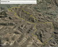
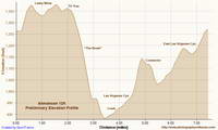
Here’s a Google Earth overview of the 12K course and a preliminary elevation-corrected profile generated in SportTracks. The course is about 7.4 miles long with an elevation gain of about 740 feet. (Note: The loop is run in the clockwise direction.)
Lasky Mesa has long been used to shoot movies, television, commercials, music videos, and even Internet games. Its wildland character and expansive views bely its urban location. For a few weeks one summer the Mission Impossible III bridge was a Lasky Mesa landmark. The aesthetically-shaped valley oak at the west end of Lasky Mesa is a favorite of production companies and I’ve spotted it in more than one commercial.
The Ahmanson 12K should be an outstanding event on an excellent course in conditions we haven’t seen at Ahmanson in several years.
For more information and photos see the Trail Run Events web site and the Upper Las Virgenes Canyon Open Space Preserve web site.
Some related posts: 10th Anniversary of the Acquisition of Ahmanson Ranch, Coyote Tag, It Was So Muddy That…, Ahmanson Ranch Trail Runs
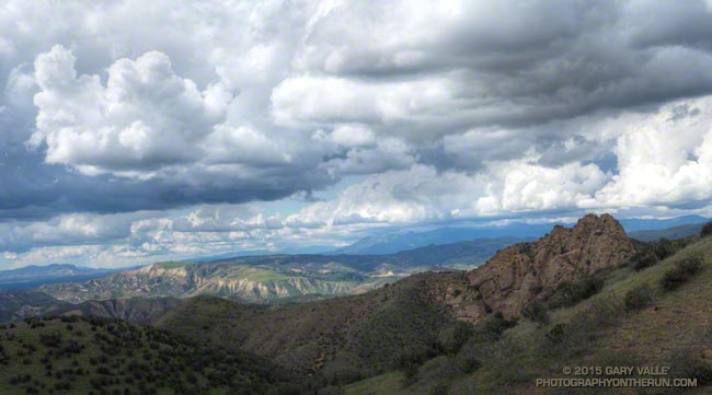
Instability associated with an upper low resulted in some pop-up showers and thunderstorms today.
As I ran up the Chumash Trail on the east side of the Simi Valley I kept a close eye on a cell that developed near Ladyface in the Agoura Hills. That cell didn’t track as much to the east as I thought it might, but other cells were developing to the east and south of Rocky Peak and Santa Susana Pass area and at one point I heard the rumble of thunder.
As it worked out, I only had a few sprinkles on the run, but drove home in the rain!