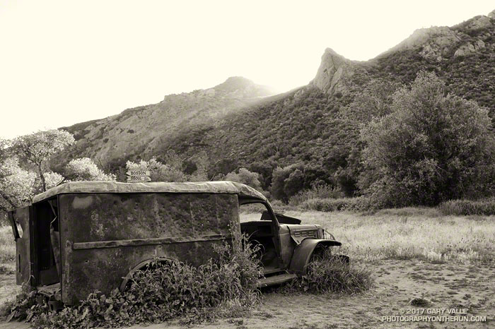
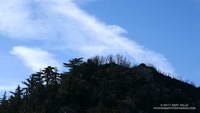
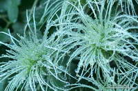
From Sunday’s Bulldog Loop in Malibu Creek State Park.

From Sunday’s Bulldog Loop in Malibu Creek State Park.
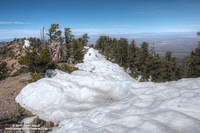
The two highest peaks in the front range of the San Gabriels, Strawberry Peak (6164′) and San Gabriel Peak (6161′) are about three miles apart as the raven flies and about 6 miles apart by trail. If you don’t mind running/hiking a third of a mile on Mt. Wilson Road, you can do both of them from Red Box as a 12 mile run/hike with a total gain of about 3000′.
Earlier this morning, I’d done San Gabriel Peak. It’s the shorter of the two ascents — from Red Box it’s about 2.4 miles to the summit. While the elevation gain is nearly the same as climbing Strawberry, it is a less strenuous and more straightforward peak. Except for a short stint on the service road below Mt. Disappointment, the grade of the San Gabriel Peak Trail is relatively constant — and the trail goes all the way to the summit.
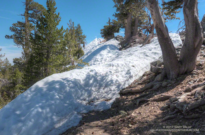
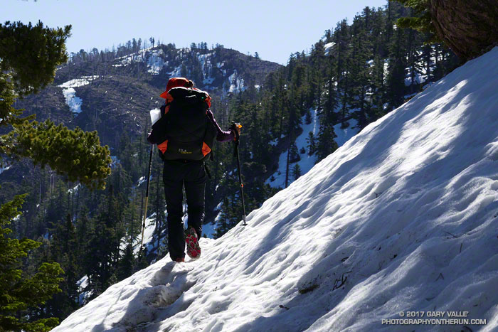
The route up Strawberry Peak is distinctly different. The initial 2.5 miles follows the Strawberry Peak Trail to Lawlor Saddle, gaining a moderate 500′ along the way. From there a steep, rough and sometimes rocky use trail ascends 950′ in a little over a mile to Strawberry’s summit.
That’s where I was now — nearly at the end of that brutal mile-long climb. My heart was racing and my legs felt like Jello. Reaching the crest of Strawberry’s final false summit, I jogged across the shoulder of the peak and on uncooperative legs climbed the final few feet to the summit.
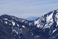
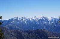
To the southeast, San Gabriel Peak and Mt. Disappointment stood across the canyon and further to the east, indistinct in the morning haze was snow-capped Mt. Baldy. To the west, the view extended past Josephine Peak and Mt. Lukins to the San Fernando Valley, Santa Monica Mountains and Santa Susana Mountains.
Recovery from the devastating 2009 Station Fire continues on both peaks. The amount, extent and size of Poodle-dog bush (Eriodictyon parryi) in the burn area is slowly diminishing. Some plants have died, but there are still viable plants of which to be wary. These plants were on the San Gabriel Peak Trail, above the notch, on the final climb to the summit of the peak. I don’t recall seeing any Poodle-dog bush on the ascent of Strawberry from Red Box, but it is still present on the west side of the peak.
Some related posts: Strawberry Peak, Switzer’s and the Old Colby Trail, Bear Canyon Loop Plus Strawberry Peak, After the Station Fire: Ten Miles – Four Peaks
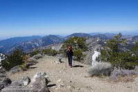
The two hikers stopped on one side of the broad chute and I stopped on the other. We were on the Pacific Crest Trail about a half-mile from Little Jimmy Campground and had paused to put on micro spikes before crossing the icy slope. It was the same chute that had been so unnerving for a couple hiking down from Little Jimmy on a chilly morning two weeks before.
After the hikers crossed we chatted for a moment about the snow. They were doing the PCT and I asked them what gear they used on Fuller Ridge — an infamous section of the trail on Mt. San Jacinto. They said they’d used micro spikes and ice axes. The segment had gone well, but at one point it had taken them four hours to do two miles!
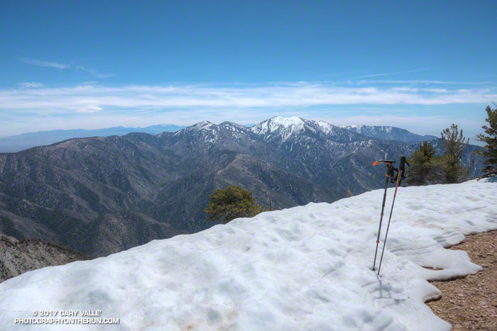
It’s not often there’s this much snow in April in the mountains of Southern California. After venturing to Mt. Hawkins a couple of weeks ago, I had wanted to get back to the San Gabriels and check out the snow on the higher part of the crest between Mt. Burnham (8997′) and Mt. Baden-Powell (9399′).
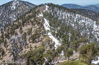
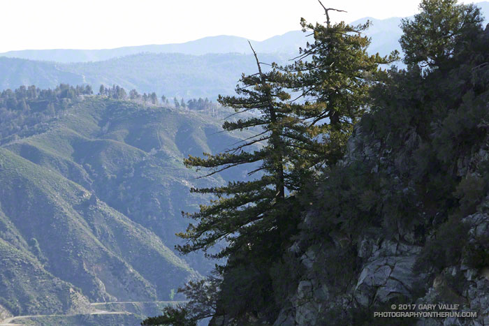
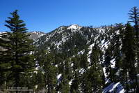
The photo on the left is a view west along the crest from the shoulder of Mt. Baden-Powell to Mt. Burnham and Throop Peak. Strong, southerly winds that accompany Winter storms blow from left to right across the crest, depositing extra snow in the wind-shadowed lee of the ridge. Snow accumulates along the ridge in dense, deep drifts, which in a big snow year can persist well into Summer.
The PCT between Mt. Baden-Powell and Throop Peak generally follows along the crest, tending to the north (right) side of the ridge and detouring around Mt. Baden-Powell and Mt. Burnham on their north slopes, and around Throop Peak on its southeast side.
Today, I stayed more or less on the crest between the summit of Baden-Powell and the PCT’s junction with the Dawson Saddle Trail, using the trail and snow where possible, but avoiding big drifts and steeper snow slopes. Between Throop Peak and Islip Saddle I stayed on the trail, and used micro spikes in a couple of places.
Lower elevation snow is melting relatively rapidly, but snow on the north-facing slopes at higher elevation could be around for weeks. Some patches and drifts may last into June or July. We’ll see!
On the summit of Baden-Powell I pondered Mt. Baldy and thought about Sam and his love of the outdoors and Mt. Baldy. His effusive spirit will linger there always, and we’ll smile when we encounter it.
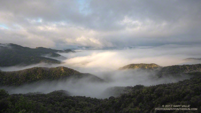
The first rays of sunlight illuminate the ridgetops, fog and clouds in the Santa Monica Mountains, following an overnight rainstorm.
From Saturday’s run to Temescal Peak and through a very wet Garapito Canyon.
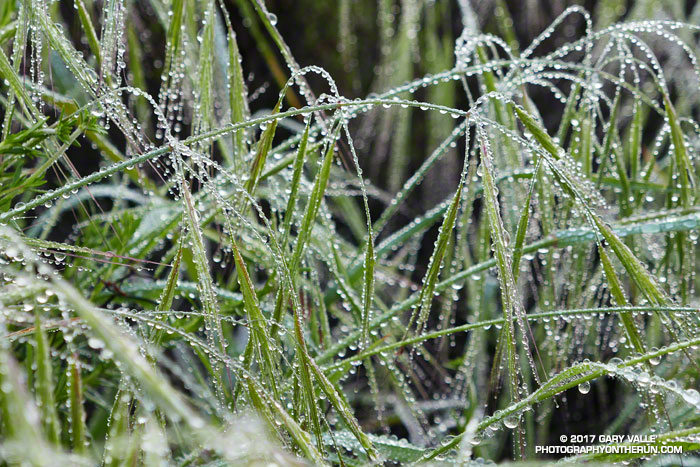
When I emerged from Garapito Canyon my shoes, socks, shorts and shirt were soaking wet. A group of hikers were nearby and one asked if it rained while I was down in the canyon. It hadn’t, but it might as well have.
Our wetter than normal rain season has produced a lush crop of annual grasses — some as tall as waist high — that have overgrown sections of many local trails.
Overnight, light rain had coated every blade of grass and every leaf and limb of brush along the Garapito Trail with water droplets. Running through the wet grass was like passing through the wet brushes of a refrigerated car wash.
I happened to be wearing Gortex-lined running shoes, which was laughable considering the amount of water that had run down my legs and into the shoes. They were just as wet as if I had waded through a creek. Well-fitting gaiters might have helped, and at least would have kept the foxtails out of my saturated socks.
Seasonal snowfall in the mountains of Southern California is inconsistent at best. According to Tony Crocker’s Your Guide to Snowfall, in the past 20 years SoCal snowfall has ranged from a record high of 267 inches during the strong El Nino of 1997-98, to a low of 29 inches in 2013-14 during our prolonged drought.
So far this season, Your Guide to Snowfall’s total for SoCal is 143 inches, which is a bit above average and far more than we’ve had in recent years. After seeing the amount of snow on the higher peaks of the San Gabriels from Mt. Waterman a couple weeks ago, I was curious to see what the conditions were on the PCT between Islip Saddle (6650′) and Mt. Baden-Powell (9399′).
Joining me on today’s adventure was Patty Duffy. An avid outdoorsperson and ultrarunner, Patty did the JMT last year, and will soon be embarking on an epic border-to-border journey on the Pacific Crest Trail. Epitomizing the “hope is not a strategy” approach to challenges, today she was using much of the gear she would be using on the PCT — and in addition — carrying a sleeping bag, tent, stove and two days food!
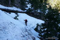
Even though we started an hour later than normal, and temperatures had warmed the past couple of days, the snow on the shaded, north-facing slopes was still icy. Two hikers on their way down from Little Jimmy had trouble crossing one slippery slope. They had no crampons or micro-spikes and threw dirt on the snow to get by. It was obvious when we reached the area they described – a northeast facing gully. The slope was steep enough that a fall would have been very serious. Steep slopes, chutes and gullies are common along the trail between Islip Saddle and Baden-Powell.
The question of what is appropriate gear for hiking an icy trail in this kind of terrain doesn’t have a simple answer. Boots, “real” crampons, and an ice axe provide a lot of security when crossing a steep, icy slope; but many other combinations of footwear, traction devices, poles, and self-arrest tools are commonly used. Conditions can rapidly improve or deteriorate and equipment can fail. Whatever combination of equipment is selected it’s important to understand its use and limitations.
After reaching an elevation of about 8000′, we stayed on the crest all the way to Mt. Hawkins (8850′) and the Mt. Hawkins lightning tree. The ridge route had the advantage of being mostly snow-free, but in places is quite rocky and steep. There are also a number of downed trees scattered across the ridge — vestiges of the 2002 Curve Fire.
In middle of Winter in 2014 there was so little snow on the PCT between Islip Saddle and Mt. Baden-Powell it was possible to run to Baden-Powell and back, do Mt. Hawkins, Throop Peak and Mt. Burnham along the way, and be back to Islip Saddle in the early afternoon. Not today. Winter’s storms had left more of the trail snow-covered than snow-free — and not with just a little snow.
A little beyond the Hawkins – Throop Peak saddle we stopped at a sunny, wind-protected spot with a nice view of Mt. Baldy for a few minutes, and then headed down. The snow conditions had improved considerably, and at one point we glissaded down a short slope.
It had been another outstanding day in the mountains, and I could only sigh, thinking of the many great days and experiences that Patty would have on the Pacific Crest Trail.