Say Goodbye to the Snow in the San Gabriel Mountains

Patches of snow on the PCT west of Mt. Baden-Powell

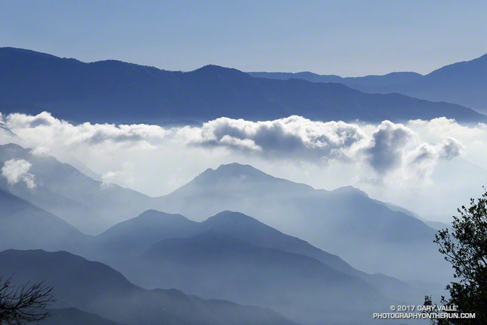
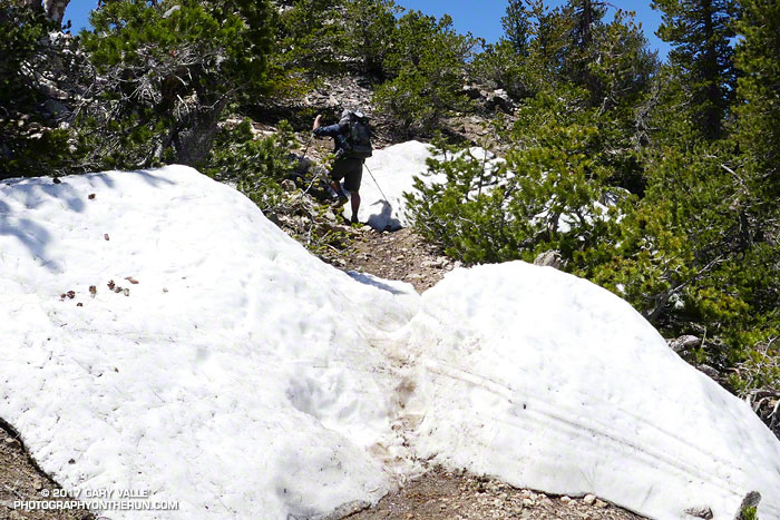
Each year around Memorial Day weekend I like to do a run that includes Mt. Baden-Powell (9399′). It’s a good time to check how much snow remains at the higher elevations of the San Gabriel Mountains. In a heavy snow season, such as 2004-2005, higher sections of trail may still be buried in snow and drifts can persist into July. In below average years, such as we experienced from 2013 to 2016, there may be little or no snow.

South Fork Trail below Islip Saddle

There are several good runs that summit Mt. Baden-Powell. If Hwy 2 is still closed between Islip Saddle and Vincent Gap, I’ll usually do an out and back from Islip Saddle to Mt. Baden-Powell. If Hwy 2 is open, then a point to point run from Inspiration Point to Islip Saddle or Eagles Roost is a good option. Today the choice was one of my favorite loops in the San Gabriels. It starts at Islip Saddle, descends to South Fork Campground, then climbs about 5000′ to the summit Mt. Baden-Powell. From Baden-Powell the route follows the Pacific Crest Trail back to Islip Saddle.

Pine Mountain, Dawson Peak and Mt. Baldy from the summit of Mt. Baden-Powell.

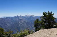
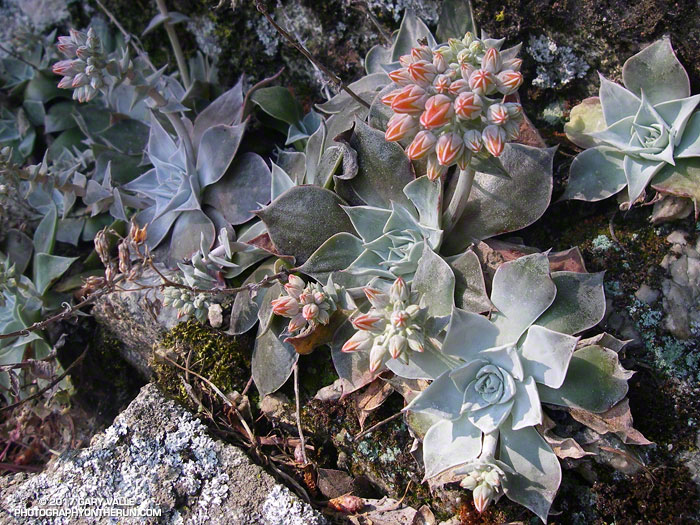
This was my third time on the PCT between Islip Saddle and Mt. Baden-Powell this Spring. The first was at the beginning of April and was more of a snow hike than a run. The micro spikes went on at 7000′, less than 0.7 mile from the Islip Saddle trailhead. The second trip was two weeks later, in mid-April. Micro spikes were still helpful in a couple of places and there was still plenty of snow on the north side of the crest. Based on other seasons with a similar amount of snow, I thought some patches of snow might last into June, or even early July. Today (May 27) only a few patches remain on Baden-Powell and along the crest, and these will soon be gone.

Manzanita Trail between South Fork Campground and Vincent Gap

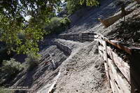
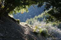
Except for being a little disappointed there wasn’t more snow, the run went well. The South Fork Trail was rocky and rough — as usual. The Manzanita Trail, which connects South Fork Campground to Vincent Gap, has seen a lot of work in recent years and is in relatively good shape. Even the gnats weren’t bad. I saw no one on the South Fork and Manzanita Trails. As might be expected on a Saturday on Memorial Day Weekend, there were “a few” hikers, thru-hikers and runners on the PCT.

The South Fork Trail is part of a long and little-used “official” PCT detour around the mountain yellow-legged frog closure at Eagles Roost. Based on the number of thru-hikers I see on Hwy 2, most opt to hike the 2.7 road miles between Eagles Roost and Buckhorn Campground and then descend the Burkhart Trail to the PCT. It’s been more than 11 years since the initial “temporary” closure of the Williamson Rock area in December 2005. Hopefully it won’t be too many more years before the proposed plan to reopen the PCT and partially reopen Williamson Rock is completed.

Sunny San Francisco

Land's End with Golden Gate Bridge and Marin Headlands in the distance.

It was a warm day by San Francisco standards — sunny and in the seventies. We’d planned to go “across the bridge” for today’s run, but with the great weather it seemed half the city’s residents and visitors were queued up on the streets leading to the Golden Gate Bridge. We opted for a run in the city instead.

This was not an inferior alternative. Running in the city is fun; there are many options and much to see. Today’s course took us from Industrial Light & Magic, to Mountain Lake, Land’s End, Sutro Heights, Ocean Beach and Golden Gate Park.

Some related posts: Crissy Field – Fort Point – Land’s End – Golden Gate Park Loop, San Francisco Sights Trail Run, Golden Gate Bridge Run

Misplaced on Mt. Wilson

View from the Rim Trail on Mt. Wilson

I’d just finished an 18 mile loop from the top of Mt. Wilson and was changing my shoes, when I noticed a group of six hikers walking down the Mt. Wilson loop road toward me. I’d started my run before the Mt. Wilson gate was open and was parked in a turnout near the top of the Kenyon Devore Trail.

Poodle-dog bush along the Rim Trail on Mt. Wilson.

The run over to Newcomb Pass, down to Chantry Flat, and then back up to Wilson had gone well. If you don’t mind a little Poodle-dog bush and a lot of poison oak, the Rim Trail is one of the hidden gems of the San Gabriels. And the Gabrielino Trail’s excursion through the forests and along the creeks of Big Santa Anita Canyon is a classic.

When the group reached me, one of them asked,”We’re looking for the Winter Trail, do you know where that is?” I did know where the Upper Winter Creek Trail was, because I’d just been at the top of it about 45 minutes earlier.

With its maze of antennae, telescopes and other facilities, it’s not uncommon for hikers and runners unfamiliar with the top of Wilson to become temporarily misplaced. The trails are, of course, on maps — including Google Maps — and described in various online and offline resources.

Bigleaf maple along the Gabrielino Trail in Big Santa Anita Canyon.

In this case the hikers didn’t know where they had parked and they didn’t know the route that had taken up the mountain. If you don’t have a clue where you need to go, a map isn’t very useful.

When I described where they needed to go, there were groans all around.

It was midday, the weather was good, it wasn’t hot, they had water and a phone, they would be hiking mostly downhill, and there were plenty of other hikers on the trail. Unless they did something really stoopid, it was just going to be a long day.

A Fashion Show on Lasky Mesa?

Lasky Mesa

From Gone with the Wind to the bridge scene of Mission Impossible III, there have been some big productions on Lasky Mesa. I’ve seen TV shows, commercials, music videos, photo shoots, and even an online game being filmed on Lasky Mesa. But as I ran past the complex of canopies and tents on the grassland site, I never would have guessed that this time the production was a fashion show.

It was not only a fashion show, but a runway show by the French fashion house Dior, introducing their “Cruise 2018” collection. Given the dry-golden-grass character of Lasky Mesa in May, I jokingly wondered if the designs were all going to be in tones of beige, tan and brown. Not quite, but from a photographer’s perspective of color and texture Lasky Mesa appears to have been a surprisingly complementary location for the event.