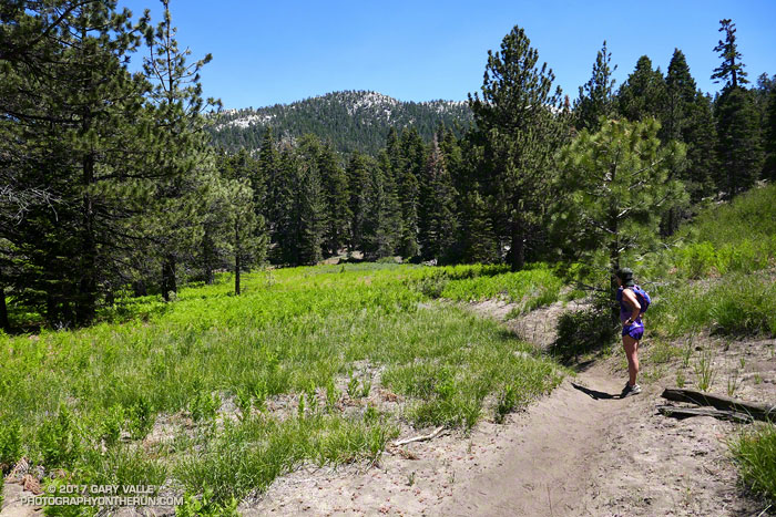
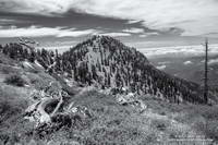
From Sunday’s run to San Jacinto Peak and Tahquitz Peak in the San Jacinto Mountains.

From Sunday’s run to San Jacinto Peak and Tahquitz Peak in the San Jacinto Mountains.
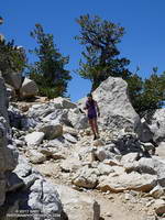
We were nearly to the junction of the Pacific Crest Trail and the South Ridge Trail and about a half-mile from Tahquitz Peak (8846′). It was hot. In the shade the temp was in the high 80s, but in direct sun the temperature was close to 100°F.
A few hours earlier Skye and I had grabbed the first car up on the Palm Springs Tram and done the 5 mile, 2435′ ascent of San Jacinto Peak. At 10,800’+ at 10:00 in the morning it had been 70°F — warm for one of the higher mountains of Southern California. Remarkably, a couple of small patches of snow remained on the south side of the summit.
Where we were now, 70 degrees would feel like a refrigerator. We’d given up that cooler clime and all the elevation we’d gained, and run five miles down the Wellman Divide Trail and PCT to Saddle Junction — a descent of about 2700′. The temperature had increased all the way down.
We might as well have been in a drying oven. The combination of the hot weather, a high sun, low humidity and higher altitude had desiccated me. At the turn-off off from the PCT to Tahquitz Peak I lifted my pack and squeezed the reservoir — again. In the few minutes since I last checked, no water had magically found its way into my pack. There was less than 20 ounces remaining and that wasn’t going to be enough.
After running over to Tahquitz Peak and visiting the lookout, there was still the minor detail of getting back to the Tram. The Mountain Fire closure was still in effect, which meant we could not use the Willow Springs Trail and would have to retrace our steps and climb all the way back up to Wellman Divide.
During the drought I would bring extra water when doing this route, and stash it along the trail. With this year’s good snowpack it seemed we should be able to find water if we needed it.
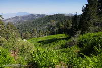
Prior to the Mountain Fire I’d used Willow Creek as a water source, but since the Willow Springs Trail was closed, that was out. The seep at Wellman Cienaga was too far up and the flow was low. Skunk Cabbage Meadow and Tahquitz Valley were a possibility. Originally included in the Mountain Fire closure area, they had reopened. I recalled a water source in Skunk Cabbage Meadow, but didn’t remember much about it.
When we got to Tahquitz Peak we asked Joe, the volunteer Ranger at the Tahquitz Peak Lookout, what he thought would be a good water source. He suggested Tahquitz Creek in Tahquitz Valley. I hadn’t been to Tahquitz Valley, so this was a great time to check it out.
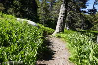
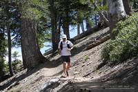
Although small in its upper reaches, Tahquitz Creek had plenty of water. Using a UV Pen, we refilled our packs and drank until we couldn’t drink any more. Continuing, we found there was also water available at Skunk Cabbage Meadow. At least for now. I wouldn’t hazard a guess how long these water sources will last.
Ah water, wonderful water. With water the hike and run back to Wellman Divide was just a sweaty, strenuous and scenic climb, and not the hellish ascent it might have been.
Some related posts: San Jacinto Peak and Tahquitz Peak Trail Run, Room With a View, Mountain Weather
I rounded the corner, driving from deep shade into the golden glare of the rising sun. There was almost no traffic on Angeles Crest Highway. Up ahead, in the shade of some trees, there was something in the road. Was it a rock or a pine cone? Driving into the sun it was hard to tell. At this time of the morning — before the CalTrans truck has swept the road — one small rock can ruin your whole day. Getting to the trailhead unscathed is always the first challenge of the day.
Today, Craig and I were planning to do a point to point run from Inspiration Point to Islip Saddle — one of the best stretches of trail in the San Gabriel Mountains.
PCTA volunteer Ray Drasher often takes care of clearing the trees from this section of the Pacific Crest Trail. It’s quite an undertaking to get the required stock and equipment to the trailhead and then cut trees spread over several miles of trail. Because of conflicting reports, Ray wasn’t sure whether there were trees still on the trail or not. We’d let him know after the run.
On the drive up you could see it was going to be a spectacular day in the Angeles high country. A low pressure trough moving through central California had pulled in the marine layer and a tumultuous ocean of cloud reached from the south-facing canyons far out over the Pacific.
I drove through the double tunnels at Mt. Williamson and then around a left-hand curve. Up ahead I could see the northwest ridge of Mt. Islip dropping down to Islip Saddle. What the heck? Orange cones? The gate is closed? The HIGHWAY is closed? That didn’t make sense; the Winter closure had ended weeks before.
After parking, I talked to a hiker who said it was closed for “road work.” I assumed there must have been a rock slide in one of the problematic areas between Islip Saddle and Vincent Gap. Later I learned the problem was a “sink hole” west of the Grassy Hollow Visitor Center.
After Craig arrived we discussed route options to Mt. Baden-Powell. Either we did the South Fork loop, which I’d done a couple weeks before, or we did an out and back on the PCT. We opted for the out and back.
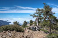
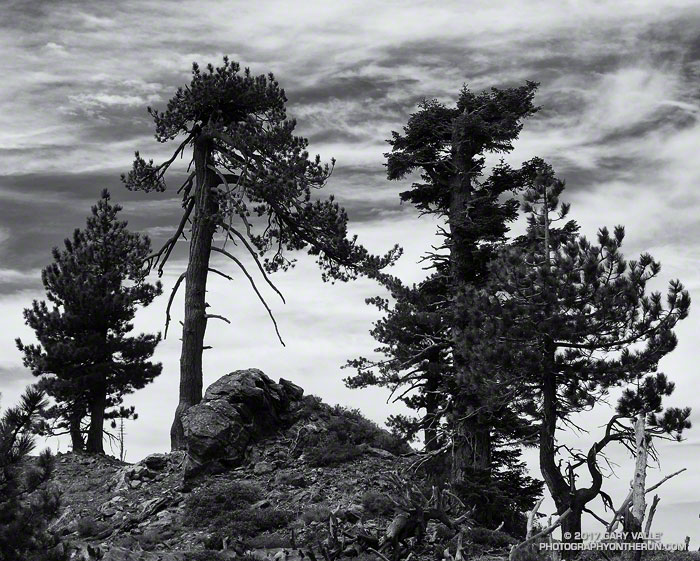
The run was as spectacular as expected. The visibility above the deck of stratus was at least 100 miles. San Bernardino Peak, San Gorgonio Mountain and San Jacinto were easy marks to the east and Owens Peak and the Southern Sierra could be seen to the north. Before it was immersed in a tide of cloud, the summit of Santiago Peak (Saddleback) had been visible to the south. High clouds and a gusty westerly wind kept the temperatures moderate. Only one very small patch of snow remained on the trail.
I’d hoped to be able to tell Ray the trees had been cleared from the trail, but no — they were still there. He said the next time I ran there, they would be gone. Thanks Ray!