
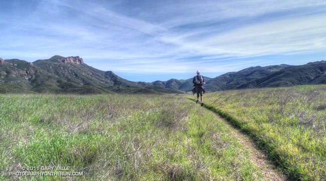
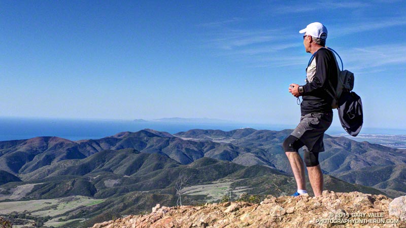
Craig had never done any rock climbing, but was doing a great job of scrambling up the steep gullies, and climbing the short sections of knobby, low angle volcanic rock. We were climbing up through a maze of brush and rock formations on the steep ridge that follows Boney Mountain’s western escarpment. The scramble up the western ridge would be well worth the effort. The route is a shortcut to the Backbone Trail and some of the most spectacular running in the Santa Monica Mountains.
Our run had started at Wendy Drive & Potrero Road in Newbury Park. We were doing a 20 mile loop that was about as varied as a trail run can be. In addition to the 1.5 mile ascent of Boney Mountain, there would be about 13 miles of single track trail, 4.3 miles of dirt road, and even 1.7 miles of paved road.
After getting through the maze to the Backbone Trail we would do the classic run down the Chamberlain Trail to the Old Boney Trail. From the bottom of the Chamberlain Trail there are four major variations. Three of these lead to Big Sycamore Canyon and one loops directly back to the start of the climb up Boney Mountain:
– Turn left (west) on the Old Boney Trail and at the junction of the Serrano Valley & Old Boney trails follow the Serrano Valley Trail and then the Serrano Canyon Trail to Big Sycamore Canyon. This was the route we were doing today.
– Turn left (west) on the Old Boney Trail and follow it all the way to Big Sycamore Canyon.
– Turn right (east) on the Old Boney Trail and at the junction of the Blue Canyon & Old Boney trails, continue down the Blue Canyon Trail to the Danielson Multi-use area in Big Sycamore Canyon.
– Turn right (east) on the Old Boney Trail and at the junction of the Blue Canyon & Old Boney trails, turn up the Old Boney trail and follow it over the shoulder of Boney Mountain and back to the point where the ascent of Boney Mountain began.
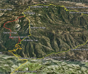
In Big Sycamore Canyon there are many options. Today we would run up Sycamore Canyon Rd to Wood Canyon Rd and pick up the Two Foxes Trail. This trail continues up-canyon and eventually rejoins Sycamore Canyon Rd, which would take us to the Upper Sycamore Trail, and from there to Danielson Road and Satwiwa. Here’s an interactive Cesium browser View of a GPS trace of our route. And here are archived maps of Rancho Sierra Vista/Satwiwa and Pt. Mugu State Park originally from the NPS Santa Monica Mountains web site. Also see the Pt. Mugu State Park maps on VenturaCountyTrails.org.
Note: There is an easier alternative to the western ridge route on the north side of Boney Mountain. The route starts near the Danielson Memorial, and ascends a use trail up the eastern ridge on the north side of the mountain. In places the (unmaintained) trail is very steep, eroded, and rubbly but it is more straightforward and less technical than the western ridge.
Some related posts: What a Great Day for a Trail Run, Sandstone Peak from Wendy Drive, Boney Mountain Views