Category Archives: drought

Thirsty Mt. Pinos

Towering pines on Mt. Pinos, near the Chula Vista parking area.

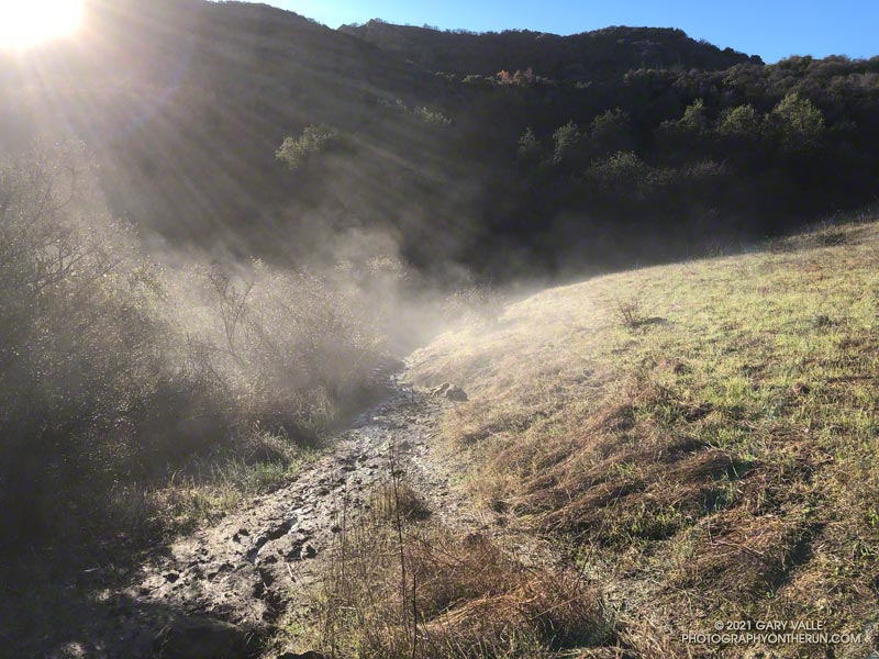
A couple leaving the camp saw that I was trying to collect drips of water from the nearly dry spring. I told them I was OK, and had water in my pack — I was just using a makeshift cup to get a couple of mouthfuls of cool water from the slowly dripping spring.

I had stopped at Sheep Camp (8300′) in the Chumash Wilderness, in Los Padres National Forest. The day was warm and the spring at the camp is usually a refreshing stop on the way back to Mt. Pinos and the trailhead at the Chula Vista parking area. Earlier, I’d talked to a runner training for the Kodiak 100, and he’d mentioned that the spring was a key source of water for his dog.

Trying to collect a mouthful of water from the spring at Sheep Camp. July 2022.
Trying to collect a mouthful of water from the spring at Sheep Camp

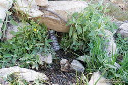
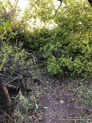
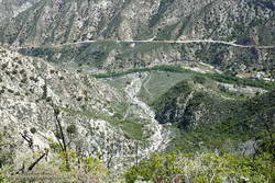
In recent years water has sometimes been an issue at the Sheep Camp spring. In July 2018, six out of the past seven Rain Years had been dry, and the flow of the spring was just a trickle. But it had been enough to slowly refill my Camelbak (TM) and get me down to Lily Camp (6600′) and back. Not so today.

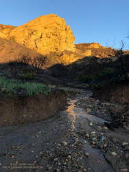
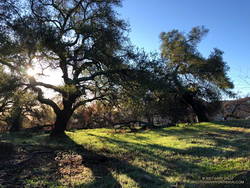
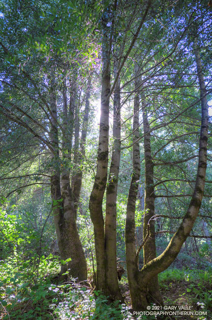
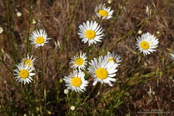
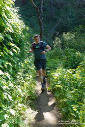
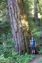
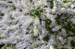
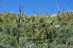
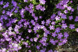
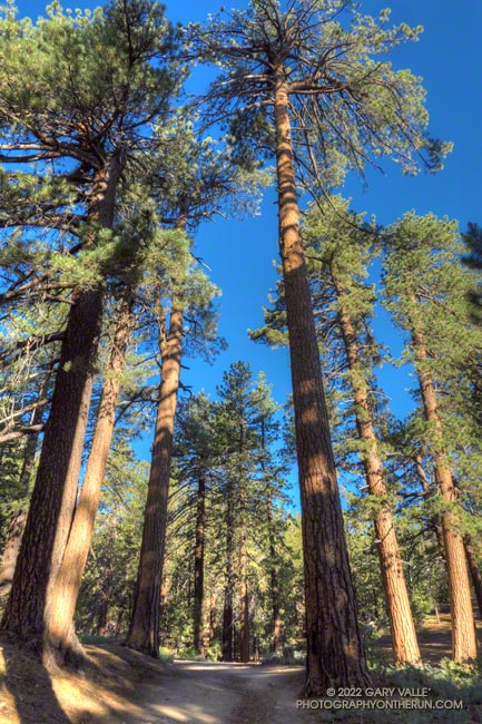
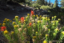
Even without the water, Sheep Camp is a pleasant and worthwhile detour. Old growth pines tower above and bright yellow sneezeweed and other flowers are sprinkled about the forest floor. In the Spring large patches of iris bloom in the damp areas.

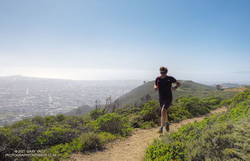
Today, I was returning from Mt. Abel, after having done Mt. Pinos, Sawmill Mountain, and Grouse Mountain on the way to Mt. Abel from the Chula Vista parking area. Here is an elevation profile of the run/hike. The cumulative elevation gain on the 15.5 mile run is about 3700′.

North summit of Grouse Mountain, west of Mt. Pinos.
North summit of Grouse Mountain.

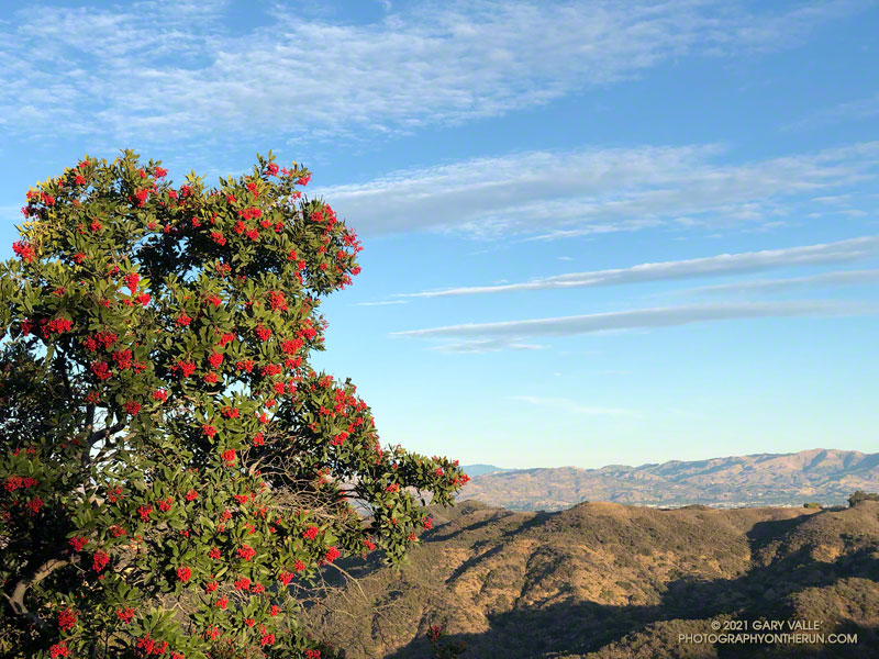
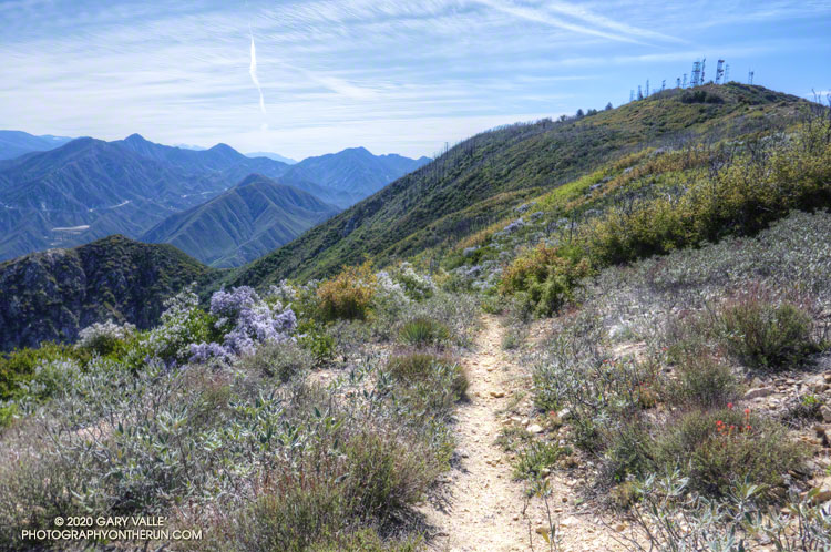
The short side trips to the summits of Mt. Pinos and Sawmill require almost no extra effort, and the view from Sawmill — if it’s not too smoky or hazy — is wide-ranging. Getting to the twin summits of Grouse takes a bit more work, but it’s fun to follow the short use trail up the south summit and then to wander through the pines to the slightly taller north summit.

The descent that follows — down the use trail from Grouse and then down the Vincent Tumamait Trail to Puerto del Suelo, drops about 1000′ in elevation over 1.6 miles. This, of course, must be repaid on the way back!

When you reach the road at the end of the Vincent Tumamait Trail, you might remark, “But there’s no trail to Abel!” And you would be correct. It’s fairly straightforward to trek up through the forest from the road, though care is required due to the debris from forestry work in the area.

Rabbitbrush and paintbrush along the Vincent Tumamait Trail, northwest of Mt. Pinos.

Here’s an interactive, 3D terrain view of the run/hike from Mt. Pinos to Mt. Abel, with side trips to Sawmill Mountain, Grouse Mountain and Sheep Camp. The map can be zoomed, tilted, rotated, and panned. To change the view, use the control on the upper right side of the screen. Track and placename locations are approximate and subject to errors. Poor weather, snow, ice, and other conditions may make this route unsuitable for this activity.

More photos and info can be found in the related posts and in this post from a 2019 run/hike of this route.

Some related posts: Mt. Pinos Adventure Run to Mesa Spring; Up, Down and Around on Mt. Pinos’ Tumamait and North Fork Trails; Thunderstorm

Running Between Storms on the Trippet Ranch Loop

Musch Trail steaming in the early morning sun.
A wet (and muddy) section of the Musch Trail.

Update January 4, 2022. Did the Garapito Trail again this weekend as part of a longer run through Santa Ynez Canyon. The debris from the fallen oak tree was much easier to get through this time. Some people coming down the trail after me had a small saw, and said they were planning to work on it.

Update December 31, 2021. It turns out that a lot more rain was on the way! Los Angeles recorded 9.46 inches of rain this month, making it the third wettest December on record, going back to 1877. This puts Los Angeles at 10.40 inches for the Rain Year to date, which is about 237% of the normal.

It had rained the past three days, including Christmas. Today was the 26th, and Downtown Los Angeles (USC) had recorded nearly 150% of the rainfall normally recorded in December. And more was on the way.

Early morning light on Eagle Rock
Early morning light on Eagle Rock.

I clicked START on my Garmin as I passed the gate at the Top of Reseda. It was about twenty minutes before sunrise. The temperature was around 40 and the eastern sky was brightening with the advancing sun. As I worked up the initial trail to dirt Mulholland, thousands of lights twinkled across the San Fernando Valley.

The chaparral was soaked with overnight rain; and befitting the Holiday season, was ornamented with thousands of silvery water drops.

I took my usual route, turning off Mulholland onto Fire Road #30, and then following it to the Hub. From the Hub, Eagle Springs Fire Road led down to Eagle Springs, then beneath the sunlit face of Eagle Rock to Eagle Rock Fire Road and the top of the Musch Trail. In the Palisades Fire burn area there was some significant erosion along the fire road where the runoff wasn’t controlled.

I’d be doing the Musch Trail later in the run, but for now continued down Eagle Springs Fire Road toward Trippet Ranch.

Erosion along Eagle Springs Fire Road. December 26, 2021.
Erosion along Eagle Springs Fire Road.

Mud — slippery, cake-on-your-shoes mud — isn’t normally much of an issue until past the Musch Trail and on the steeper downhill that leads to the top of the Santa Ynez Trail and Trippet Ranch. Today there were some slippery spots, but it wasn’t too bad. Remarkably, I didn’t see anyone until I reached the Trippet Ranch parking lot.

My return route from Trippet Ranch was mostly on trails, beginning with the Musch Trail. There are usually a few muddy sections on the Musch Trail after a good rainstorm. Today, one wet, muddy section of trail was steaming in the morning sun. Once I was on the steep climb up to Eagle Rock Fire Road, most of the significant mud was left behind.

Oaks along Eagle Springs Fire Road, above Trippet Ranch.

At the top of the Musch Trail, I turned left on Eagle Rock Fire Road and worked up past Eagle Rock and over to the top of the Garapito Trail. I run this trail often, and know it well. Winding down through decades-old chaparral, I became lost in thought, immersed in the outdoor experience, and enjoying every aspect of the trail.

That was why it was such a shock when, at the bottom of the mile and a half descent, the trail suddenly ended in a wall of brush.

That couldn’t be. Had I somehow turned onto a use trail? Nope, I was on the right trail.

Garapito Trail blocked by fallen oak. (12-26-2021)
Garapito Trail blocked by fallen oak.

That’s when I noticed the “brush” was the top branches of a large oak. The fallen tree had COMPLETELY blocked the trail. I took a quick look around for an alternate route and didn’t see anything obvious. Working through the mishmash of foliage and branches was a bit like bushwhacking through dense manzanita. With some effort, and some rock climbing moves, I eventually emerged on the other side of the mass. The fallen tree was part of an old, multi-trunked oak that has been collapsing over a period of weeks.

The remainder of the run was uneventful, but enjoyable. Continuing up the Garapito trail to Fire road #30, I crossed the fire road and picked up the Bent Arrow Trail. This connects to dirt Mulholland, which leads west to the Top of Reseda.

Some related posts: Trippet Ranch Loop After the Palisades Fire, Trippet Ranch Wildflower Run, The Heavenly Ranch in the Hills

Looking For Christmas Berries

Toyon heavily-laden with berries
Toyon along the Garapito Trail (Winter 2019-2020)

A week after doing the out and back run to the Ray Miller Trailhead, I was back in the Santa Monica Mountains and doing another popular trail run — the Trippet Ranch loop. Near the top of the Garapito Trail it dawned on me I’d seen no berries on the toyon shrubs and trees along the way. These red-orange berries usually add a bit of Holiday color to the chaparral, and at one time were so sought after that a law was passed to protect them.

Toyon usually blooms in the Summer, producing green berries that slowly turn red-orange by the holidays. The title photo — of a toyon heavily loaded with berries — is from last Winter.

For the remainder of the run I checked most of the toyon along the trails back to the Top of Reseda. Not a single toyon had any berries.

How widespread was this? The following two weekends, I did runs in other areas of the Santa Monica Mountains. One was an extended version of the Bulldog Loop, and the other an out and back run from the Top of Reseda to the Oak Tree on Rogers Road segment of the Backbone Trail.

On those three runs I must have passed hundreds (thousands?) of toyon along the trail. Out of all of those I checked, only one had berries. It was near the water tank on Mesa Peak Mtwy fire road, at the top of the climb up from Tapia.

As you might expect, the most likely explanation for the lack of berries is the drought. Precipitation records for Downtown Los Angeles (USC) show that in 2019-2020, the rain season lasted about 5 months — from about mid November to mid April. Leading up to the flowering period for toyon the accumulated rainfall was a little above normal. The result was what you see in the title photo.

On the other hand, in 2020-2021, the rain season effectively began at the end of 2020 and ended in mid March. Less than half of normal rainfall was recorded going into the flowering period of toyon.

The toyon on Mesa Peak fire road that managed to produce some berries is situated near the crest of east-west oriented ridge. It probably benefits from enhanced precipitation because of its location.

Some related posts: Christmas Berry on the Garapito Loop, Best Trailhead to Start the Bulldog Loop, Will Rogers – Rivas Canyon – Temescal Canyon Trail Run

San Bruno Mountain and Windy Hill Trail Runs

California bay trees in Windy Hill Open Space Preserve near the bottom of the Razorback Ridge Trail.
California bay – Windy Hill Open Space Preserve

With vaccinations on the increase and Covid on the decline, it was wonderful to once again be able to visit family.

As we always try to do, Brett and I got in a couple of runs. We usually do at least one run that is new to me, and there are certainly plenty from which to choose in the Bay Area.

Oxeye Daisy along the Old Ranch Trail in San Bruno Mountain Park
Oxeye Daisy along the Old Ranch Trail

Our first run was on San Bruno Mountain. We’d previously done the Ridge Trail, so this time opted to do a variation of the Summit Loop. The parking lot at the base was was closed, so we started the run using the Old Ranch Road Trail. This was a plus because it added a little mileage and there were a lot of wildflowers along the trail, including monkeyflower, iris, lupine, yellow paintbrush, daisy, and foxglove.

Brett running up the Summit Loop Trail on San Bruno Mountain
Summit Loop Trail, near the top.

It was an excellent run on single-track trail. As is the rule on San Bruno, it was a bit breezy, with hazy views of the surrounding communities and the Pacific. An island of open space in an urban sea, San Bruno Mountain is a miracle of land conservation, and an area to be relished. Here is a map of trails in the area.

The next day, after watching a spirited youth soccer match, we headed south on 280. On the way, Brett filled me in on the runs he likes to do in Windy Hill Open Space Preserve and Huddart Park. We couldn’t go wrong with either choice but finally decided to save Huddart Park for another day.

Brett running through thimbleberry on a lush section of the Razorback Ridge Trail
Razorback Ridge Trail

Windy Hill Open Space Preserve is on the northeast-facing slopes of the Santa Cruz Mountains above Portola Valley. We parked near the Alpine Trailhead and ran up the road to the Eagle Trail. Corte Madera Creek was running, but low. Although the grasses along the trail were green and the undergrowth was relatively lush, I suspect the conditions were more like July than May. Open hillsides looked mid-Summer dry and the lichen on the trees was drab and desiccated.

Like the rest of California, the Santa Cruz Mountains have seen well below average precipitation this rain season. One station near Windy Hill, Woodside 3.4 S, recorded only about 28% (12″) of normal precipitation from October 1 to May 19. Another station, Skyline Ridge Preserve, recorded about 41%  of normal (16.5″) from October 1 to May 3.

Western columbine along the Lost Trail in Windy Hill Open Space Preserve
Western columbine

From the Eagle Trail/Private Road we turned onto the Razorback Ridge Trail. According to my Garmin track, the Razorback Ridge Trail gains 1000′ or so over 2.4 miles to its junction with the Lost Trail. It’s all runnable, switch-backing up a thimbleberry and fern-lined trail, shaded by California bay trees.

While the Razorback Ridge Trail continues up another 0.4 miles to Skyline Blvd., we turned right onto the Lost Trail. This trail parallels Skyline as it works in and out of the tributary ravines of Jones Gulch, on its way over to the Hamms Gulch Trail. Along the way there were views across the valley to Mt. Diablo, some 40 miles distant. Western columbine was blooming along the trail, its bright red color complimenting the green theme.

Large Douglas-fir along the Lost Trail in Windy Hill Open Space Preserve
Large Douglas-fir along the Lost Trail

At the top of Jones Gulch, there is an impressive, old-growth Douglas-fir. At chest height, it is about as wide as Brett is tall. This would put its diameter at over 72″ and its circumference at over 220″, suggesting an age in the neighborhood of 350 years.

The run down the Hamms Gulch Trail was as good as the run up Razorback Ridge. Given the weather was nearly perfect for a hike or run, we were surprised to see only a dozen or so people on the trail.

From where we were parked the run worked out to about 8 miles, with about 1500′ of gain/loss. Here is a trail map of the area, and here is an interactive, 3D terrain view of my GPS track of the loop. The interactive map can be zoomed, tilted, rotated, and panned. To change the view, use the control on the upper right side of the screen.

Some related posts: Breezy San Bruno Mountain Ridge, San Francisco Sights Trail Run, Miwok Wanderings

A Dry and Dusty Start to the Los Angeles Rain Year

dry and dusty Upper Las Virgenes Canyon Open Space Preserve (Ahmanson Ranch)

Except for a teaser storm system in early November that brought a smattering of rain to the metro area and some snow to the mountains, the Los Angeles rain year is off to a parched start.

As of December 1, Downtown Los Angeles (USC) has recorded only 0.11 inch of rain since July 1. Along with 1995, this is the 7th driest start to the rain year over the 144 years weather records have been kept in L.A.

Update December 29, 2020. In the first significant storm of the rain year, Downtown Los Angeles recorded 1.82 inch of rain, bringing the rainfall total up to 1.95 inches. The storm total was more than generally forecast, but L.A. is still about 2 inches below normal for the date. The rain does move 2020 out of contention for the driest first six months of the rain year.

Update December 20, 2020. The period July 1 – December 20, 2020 is the driest on record (for that date range) for Los Angeles. As of December 20, the rainfall total for Downtown Los Angeles (USC) remains at 0.11 inch.

While “past performance may not be indicative of future results,” I was curious to see if, historically, a dry start to the rain year has generally resulted in below average annual rainfall.

There have been 16 years in which Los Angeles precipitation was 0.25 inch or less for the period July 1 to December 1. Rain year precipitation (July 1 – June 30) for those years varied from a low of 4.79 inches in 2017, to a high of 23.43 inches in 1937. Overall, these years averaged 11.34 inches of rain annually, which is 3.66 inches below the current normal of 14.93 inches.

Whether or not annual rainfall this rain year is below normal we’ll have to see. An important consideration is that La Nina conditions are present in the equatorial Pacific. This doesn’t necessarily mean less rainfall in the Los Angeles area, but taking into account a number of factors, the Climate Prediction Center is projecting below average precipitation this Winter in Southern California.

The title photo of silhouetted mountain bikers is from this afternoon’s run at Upper Las Virgenes Canyon Open Space Preserve (Ahmanson Ranch). The image is an example of a “silhouette illusion.” Are the riders going toward or away from the camera?

Back to the Stone Canyon Trail

Top of the Stone Canyon Trail on Mt. Lukens
Top of the Stone Canyon Trail and the summit of Mt. Lukens.

Update April 4, 2021. Wow! What a difference from last year! The Stone Canyon Trail was in great shape on this morning’s hike/run. All the dead limbs/small trees had been removed. All the washouts had been repaired. A ton of brush had been cleared. I didn’t even get my shoes wet crossing Big Tujunga Creek because there was a causeway of large rocks across the creek. Many thanks to whoever did the work on the trail!

At the deepest part of the creek, the cold water reached mid-thigh. I’d futzed around looking for a way to rock hop across slowly-flowing Big Tujunga Creek, but didn’t find one.

With squishy shoes, I followed the trail eastward along the creek. A little past Stone Canyon wash, the trail turned toward Mt. Lukens and started to climb.

Chaparral whitethorn along the Stone Canyon Trail
Chaparral whitethorn

The Stone Canyon Trail is one of the trails on my list of trails less-traveled. Today, the trail choice had been between the Stone Canyon Trail and Condor Peak Trail. Recalling the difficulty of the Condor Peak Trail, I thought it would be better to do Mt. Lukens first, and save Condor Peak for later.

As I worked up the trail, I marveled at its condition. It was in surprisingly good shape! It had been groomed relatively recently, and I mentally thanked the person or group that had taken care of the trail. With a clear trail and cool morning temperature, it felt good to push the pace up the steep trail.

Stone Canyon from the Stone Canyon Trail
Stone Canyon

The last time I’d done this route was in November 2016. That outing followed five years of drought. With growth suppressed, the upper half of the trail was only moderately overgrown, and I did not see any poison oak. Ever the optimist, I thought today’s conditions might be even better.

Remnants of scrub oak burned in the 2009 Station Fire

Not this time. I don’t know if Winter rains or the pandemic had intervened, but about halfway up the peak, the trailwork abruptly ended. The upper half of the trail was badly overgrown, and at inconvenient times Spring-green poison oak lined the trail. In a few places, fallen scrub oak trees — burned in the Station Fire — were mixed in with the brush. Where the 2016 ascent had been after a drought, today’s followed a wet period in which three out of the past four years have had normal or above-normal rainfall.

Prickly phlox along the Stone Canyon Trail
Prickly phlox

With care, patience, and a bit of bushwhacking, I eventually reached the top of the Stone Canyon Trail and the old dirt road on the west side of the peak. A few minutes later I stood alone on the summit of Mt. Lukens. I had not seen anyone on the ascent and would not encounter anyone on the way down.

Here’s a Google Earth image overview of the Stone Canyon Trail and a 3D Cesium interactive view that shows a GPS track of the route up and down the Stone Canyon Trail on Mt. Lukens. The view can be zoomed, tilted, rotated, and panned. Placemark and track locations are approximate and subject to errors.

Related post: Mt. Lukens, Then and Now