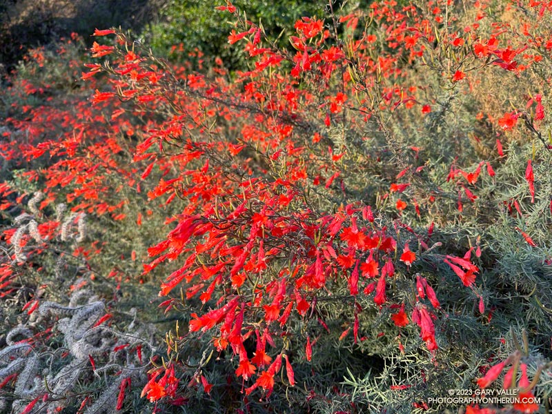
California fuchsia along Fire Road #30, near the Hub.
Downtown Los Angeles (USC) finished the 2022-2023 Water Year with 31.07 inches of rain, making it the seventh wettest on record in Los Angeles. The rainfall total includes about three inches of rain from former Hurricane Hilary as it moved through Southern California as a rare tropical storm and post-tropical cyclone.
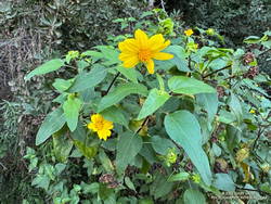
Canyon sunflower blooming out of season along Fire Road #30.
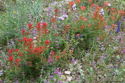
The effects of all that rain can be seen on just about any trail in Southern California. It has resulted in a false Spring in many areas, with greening hills, out-of-season wildflowers, flowing creeks, and profuse growth throughout the area.
This morning, I returned to the Top of Reseda and Topanga State Park to do a variation of the Trippet Ranch Loop and continue exploring and enjoying the unusual conditions.
After running up to the Hub, this variation does an out and back to Temescal Peak and Temescal Lookout. After returning to the Hub, the route continues on Eagle Springs Fire Road down to Trippet Ranch. From Trippet Ranch, it works back to the Top of Reseda using the Musch and Garapito Trails and connecting sections of fire road. This interactive, 3D terrain map shows a GPS track of the trail run.
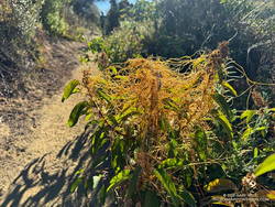
Dodder growing on laurel sumac on the Musch Trail.
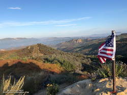
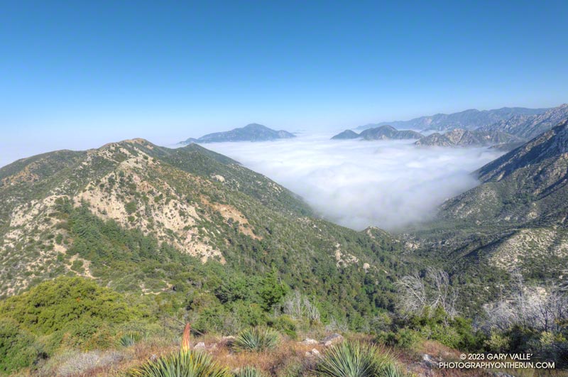
Visiting Temescal Peak and Temescal Lookout increases the run’s mileage from 12.5 miles to 16. On a clear day, the runner is rewarded with far-reaching views of the coast, West L.A., Downtown, and the surrounding mountains.
While most of the roads and trails on this route are frequently used and in decent condition, the Garapito Trail has been overgrown all Summer. As of October 8, it was still overgrown. Some people I’ve encountered on the trail were OK with this, but others haven’t been so happy. If desired, the trail can be bypassed by continuing to the Hub on Eagle Rock Fire Road and retracing your route back to the Top of Reseda.
The 17.5-mile Trailer Canyon – Santa Ynez Canyon Trail – Trippet Ranch Loop is a longer version of the venerable Trippet Ranch loop from the Top of Reseda. It might also be called the Three Vistas Loop because it visits three high points in Topanga State Park with 360-degree, panoramic views.
Eagle Rock from Temescal Peak.
The run starts and ends the same as the Trippet Ranch Loop. After running up to the Hub on Fire Road #30, instead of continuing straight on Eagle Springs Fire Road, this route turns left on Temescal Ridge Fire Road. The fire road is followed up to where the Backbone Trail single-track forks left off the road. The Backbone Trail is followed a tenth of a mile east, where a path leads up and left to the top of Temescal Peak.
The view from this little peak is superb. On a day with good visibility, the view can extend beyond Mt. Baldy to San Gorgonio Mountain and San Jacinto Peak. The next overlook on this route, Temescal Lookout, is about a half-mile (as the crow flies) to the south. The third overlook, Eagle Rock, is about a mile to the west.
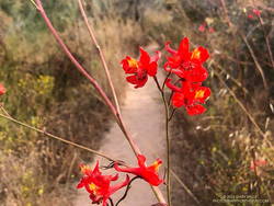
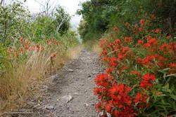
Scarlet larkspur.
From Temescal Peak, the route returns to Temescal Ridge Fire Road. I usually follow the use-trail back down and across the Backbone Trail and then continue on the use-trail to the fire road.
The next stop, Temescal Lookout, is about a mile from the top of Temescal Peak and just off Temescal Ridge Fire Road. When doing this loop, I run up a dirt access road on the north side of the lookout and then descend a use trail on the south side. Once the site of a fire lookout, it also has an excellent view. This photo of Downtown and San Jacinto Peak was taken from the viewpoint.
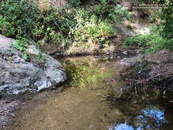
Pool on Santa Ynez Creek.
Once back on Temescal Ridge Fire Road and headed south, it’s less than a half-mile to the turn-off down Trailer Canyon Fire Road and then another 2.3 miles down to Michael Lane in Pacific Palisades. On the way down, there are good views of where the loop is headed next — Santa Ynez Canyon. A large part of Santa Ynez Canyon was burned in the May 2021 Palisades Fire.
After turning right (west) on Michael Lane, the street is followed around and down to Vereda de la Montura. A right turn here leads to the Santa Ynez Canyon Trailhead in about a quarter-mile. This is where some route-finding fun begins.
A bit more than a mile from the trailhead, the Santa Ynez Canyon Trail climbs out of the bottom of the canyon and up onto a broad ridge. Another mile of uphill, and it tops out at Eagle Springs Fire Road. After turning left, it’s less than a half-mile down to the Trippet Ranch parking lot.
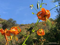
Humboldt lily.
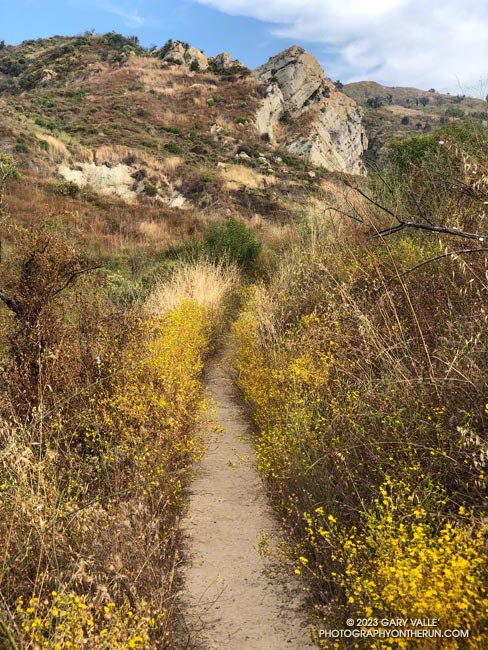
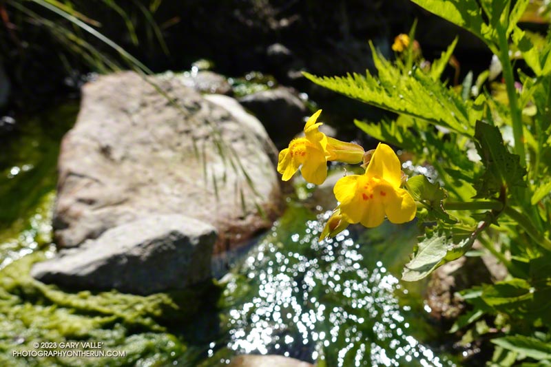
The previous weekend I’d done the Trippet Ranch Loop, so knew what the expect on the remainder of the run. Other than being a little overgrown, the Musch Trail was in reasonable shape. There were still some late-season blooms of showy penstemon, yellow monkeyflower, and white snapdragon along the trail. This time of year, the round pincushions of buckwheat are common. Water was available at the start of the Musch Trail and at Musch Camp.
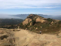
Eagle Rock is the third viewpoint on the loop, and the most popular. The massive rock formation overlooks Santa Ynez Canyon and has an airy, 360-degree view. On a clear day, Santa Monica Bay, Palos Verdes Peninsula, and Catalina can be seen to the south. On weekends, it’s rare to find the top empty. The summit had just been vacated as I climbed up and was reoccupied by another hiker as I walked down.
Returning to Eagle Rock Fire Road, I turned right and continued northeast a tenth of a mile to the top of the Garapito Trail.
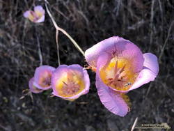
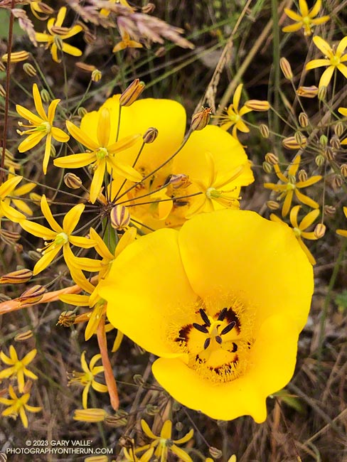
Plummer’s mariposa lily.
A little more than three miles long, the Garapito Trail is one of my favorite trails in the Santa Monica Mountains. Several sections of the trail are overgrown at the moment. At one point, not too far from Fire Road #30, it was necessary to bushwhack through a dense patch of six-foot-tall giant rye grass.
Two lilies listed on the CNPS Inventory of Rare and Endangered Plants of California were blooming along the Garapito Trail — Plummer’s mariposa lily and Humboldt lily. Both plants have a Rare Plant Rank of 4.2, which indicates they are of limited distribution and moderately threatened in California. Thanks to our very wet rain season, the eye-catching red of scarlet larkspur was unusually prevalent along the trail.
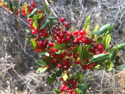
Redberry.
The Garapito Trail ends at Fire Road #30. Normally the route would cross the fire road and follow the Bent Arrow Trail to dirt Mulholland, but the trail was damaged by rainy season storms and is still closed.
Turning left onto Fire Road #30, I retraced my steps from earlier in the morning and in a few minutes was back to the trailhead at the Top of Reseda (Marvin Braude Mulholland Gateway Park).
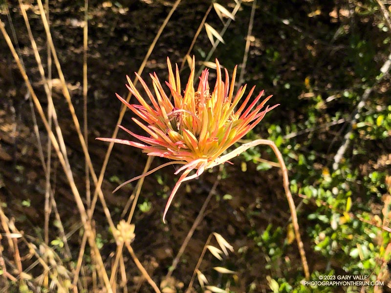
Recently, while doing the Bulldog Loop in Malibu Creek State Park, I noticed a peculiar plant about a half-mile up the Bulldog climb. The linear, red-tinged “petals” were unusual in the early morning light. I snapped a photo of it, planning to identify it later.
When I looked at the photo later that day, I couldn’t ID the plant. Hoping to get some hint about its identity, I tried various “AI-powered” searches and apps. This included Google Lens, Bing Visual Search, Pl@ntNet, iNaturalist Seek, PlantSnap, Flora Incognita, LeafSnap, and others. The most common matches were air plants such as Tillandsia ionantha and various species of paintbrush.
This wasn’t a huge surprise. The AI-based applications were having the same problems I was having — they were not “familiar” with this particular stage of the plant’s life cycle. They also were not keying on an important element of the image.
After a few days without any progress identifying the plant, I headed back to Malibu Creek State Park to take a closer look at the plant.
That turned out to be more challenging than expected. Even though I had the plant’s GPS coordinates, the time of day was different, with different lighting. The plant was also less colorful than before. I walked up and down a 30-yard stretch of Bulldog fire road several times before finally seeing it.
Once located, it didn’t take long to find examples of the plant at an earlier stage of development. In one case, with leaves on the stem and another with leaves and a flower. This helped solve the mystery.
It turned out the plant was one with which I was familiar — Purple Clarkia (Clarkia purpurea). The title photo is after the plant has flowered and all but a terminal cluster of leaves on the stem have wilted. The 8-grooved, elongated-football-shaped structures intermixed with the leaves are ovaries. These are distinctive. A human expert would have immediately zeroed in on these.
The flowers of Purple Clarkia are usually much larger than seen here. They are typically purple-pink with a wine-red spot on each of the four petals. However, the color of the flowers varies, and wine-colored flowers are not uncommon. The size of the flower also varies. Jepson mentions that the subspecies intergrade extensively.
Using the photo of the plant in flower, some of the AI-based apps identified the genus as Clarkia and/or the species as purpurea, or at least included Clarkia among their suggestions.
The Red Box – Bear Canyon – Switzer’s Loop trail run is a favorite I’ve enjoyed doing for many years. Part of its attraction is the isolated, backcountry feel of Bear Canyon, particularly between Tom Sloane Saddle and Bear Canyon Trail Camp. It’s worth spending a few minutes at the old cabin site in the upper canyon to contemplate a lifestyle from an earlier century.
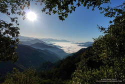
Early morning view from the Bill Riley Trail (aka Mt. Disappointment Trail).
The descent of Bear Canyon is always adventurous in some way. Based on what I’d been seeing on other trails this year, I’d expected upper Bear Canyon to be a mess. I had braced myself for downed trees, washouts, and overgrown, hard-to-follow sections of trail.
But just a few minutes below Tom Sloane Saddle, a tree blocking the trail had been cleared, and the saw cuts were fresh! As I worked down the trail, I was excited to find more trailwork had been done. Branches or trees that had fallen across the trail had been cut. Some overgrown sections of trail had been trimmed. One washed-out section of trail looked like it had just been repaired. Someone had even trimmed a little of the poison oak that is so common along the trail.
The last time I was in Bear Canyon (April 2021), the creek had been nearly dry. This year there was plenty of water and plenty of stream crossings. Unlike several recent runs, I had my poles and was able to keep my shoes and socks mostly dry.
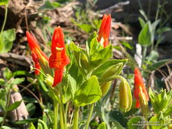
Trailside wildflower garden
I had debated whether to do this loop on Memorial Day Weekend. It passes through Switzer’s Picnic Area, one of the most popular day-use areas in Angeles National Forest. Many visiting Switzer’s do the hike down the Gabrielino Trail to see Switzer Falls, and many of those continue down the Bear Canyon Trail to the area below the falls.
Today, the two-mile stretch from below the falls to Switzer’s was as busy as expected. One issue I hadn’t anticipated was that some stream crossings were backed up like the Hillary Step on Everest. Other than wading, there was usually only one “dry” route across the stream. At one busy crossing, a hiker — clutching a dog under each arm — deftly balanced across a sequence of slippery rocks and branches, keeping his and his charge’s feet dry.
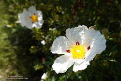
Crimson-spotted rock rose along the Gabrielino Trail
Once past Switzer’s, things returned to normal. From Switzer’s, it’s about 4.5 miles up to Red Box, with an elevation gain of about 1350′. I had been on this section of the Gabrielino Trail about a month before and was curious to see if a mass of fallen trees blocking the trail had been removed.
The trees still needed to be cleared — Forest Service rules require a qualified sawyer to do that kind of work — BUT the remaining 2.5 miles of trail to Red Box were being trimmed and cleared by several dozen members of the Mt. Wilson Bicycling Association. I wondered why I wasn’t seeing any mountain bikers on the trail — they were all working on it!
The seasonal bridge across Malibu Creek is back! No sketchy log to test your balance or thigh-deep water to wade through — just walk across.
This afternoon I’d returned to Malibu Creek State Park to check on the bridge, count the surviving coast redwoods on the Forest Trail, and see what was happening on the Lost Cabin Trail.
When running the Bulldog Loop a couple of weeks ago, I did a quick check of some of the redwoods on the Forest Trail but skipped the back half of the trail. Today, I crawled through the downed trees blocking the trail and checked the rest of the trees.
I counted seven surviving redwoods. Several of these are multi-tree groups consisting of two or more trees. These family groups were counted as one tree. One of the trees, and perhaps more, was naturally germinated. Most of the trees looked healthy, but appearances can be deceiving.
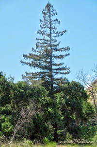
Coast redwood along the Crags Road Trail
One redwood is just a few feet from the Crags Road Trail. It’s on the right side of the trail, just past the seasonal bridge, when going west on Crags Road toward the M*A*S*H site. The unique conifer is easy to spot among the other trees.
The start of the Lost Cabin Trail is on the left as you enter the M*A*S*H site going west on Crags Road. Like the Forest Trail, it is less used and isolated but has a character all its own. Today, the Lost Cabin Trail was a trove of brightly colored wildflowers.