Category Archives: photography

South Fork Adventure

South Fork Trail, between Islip Saddle and South Fork Campground

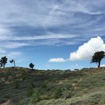
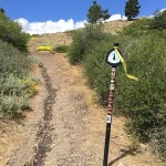
I asked Skye what her watch had for the mileage. Had we gone two miles yet? We were running down the South Fork Trail from Islip Saddle and hoping to do one of my favorite adventure runs in the San Gabriel Mountains. The 23.5 mile loop descends to South Fork Campground,  then climbs to the summit of Mt. Baden-Powell via the Manzanita Trail and PCT; and then continues on the PCT back to Islip Saddle.

Rock slides on the South Fork Trail between Islip Saddle and South Fork Campground.
Rock slides on the South Fork Trail

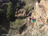
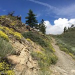
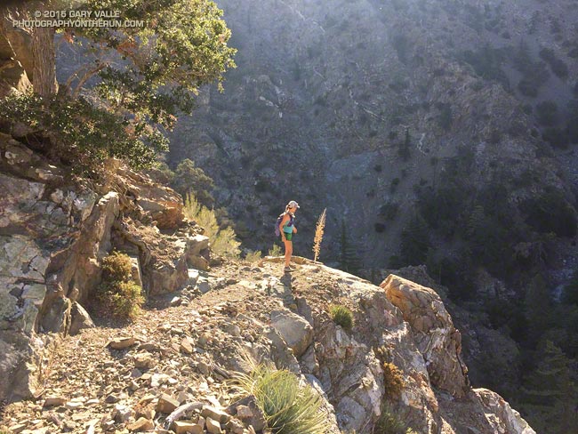
A few days before there had been a report on Facebook that the South Fork Trail “was gone” about two miles down from Islip. With the heavy rains we’d seen in July that was certainly a possibility. Even without the rain it was a possibility. The South Fork Trail is under constant bombardment and it is normal for some sections of the trail to be covered by rock slides. I can’t think of an “official” trail in the San Gabriel Mountains with a more primitive character.

The condition of the South Fork Trail wasn’t the only possible problem. Earlier in the week I’d run the Manzanita Trail most of the way to South Fork Campground to be sure that if the South Fork Trail was passable, we would be able to complete the loop. There were two things to check. Was the spring running 1.4 miles from Vincent Gap? It was. And had the heavy July rain washed out the trail in the landslide area above Paradise Springs? It hadn’t. So if we could get to South Fork Campground we were good to go.

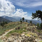
As things worked out the condition of South Fork Trail was about the same as it always is. I’ve seen it in better condition and I’ve seen it worse. With care it was passable — but that isn’t a recommendation. It’s the kind of trail some love and others hate.

Elevation profile of the Islip Saddle - South Fork - Vincent Gap - Mt. Baden-Powell Loop
Elevation Profile

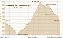
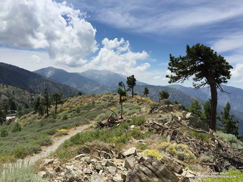
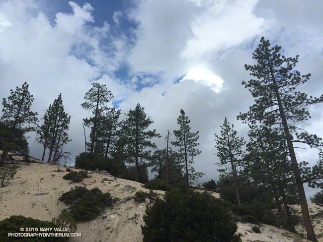
Once down at South Fork Campground the adventure isn’t over. There are some rock and boulder strewn washes to navigate and there’s the small matter of the nearly continuous 10 mile, 5000′ climb to the top of Mt. Baden-Powell. Having recently completed the Angeles Crest 100 and climbed Mt. Whitney, the tough climb from the South Fork was a piece of cake for Skye. On the other hand, I was very happy to round the final corner and see Baden-Powell’s busy summit come into view. On the way up  we ran into Mt. Disappointment race organizers Gary & Pam Hilliard, getting in a little work after doing the Julian Station Full Moon run the previous weekend. Next year will be Mt. Disappointments’ 10th running.

Regrowth of lodgepole pines along the PCT near peak 8426 following the 2002 Curve Fire.
Lodgepole pine saplings

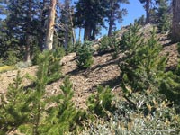
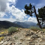
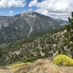
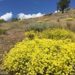
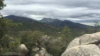
Between Baden-Powell and Windy Gap the weather was cool and the running comfortable on the PCT. Perhaps because of the heavy July rain the pines and firs seemed to be especially green. In several areas young, healthy trees grew in nursery-like stands amid the bleached trunks of trees burned in the 2002 Curve Fire.

I was just about out of water when we pulled into Little Jimmy Spring, and as always, the water was clear, cold and rejuvenating. Another 2.5 miles and the loop would be done. Although it’s difficult for its length, it’s also very enjoyable. If the weather holds I’ll probably do it again this Fall before Winter settles in.

Some related posts: Trail Running Weather, San Gabriel Mountains Running Adventure, Islip Saddle – Mt. Baden-Powell South Fork Loop

Inspiration

Pine Mountain and Mt. Baldy from Lightning Ridge

The day before the Angeles Crest 100, after checking in for the race in Wrightwood, I drove over to Inspiration Point to have lunch, go for a short hike, and enjoy being in the mountains. The day was exceptional.


Click an image for more info and to display the image full-size.

July Deluge a Preview of Southern California’s Upcoming Rain Season?

Pines and clouds in the San Gabriel Mountains

It wasn’t so much a surprise that there was thunder or that it was starting to shower again. It was that I was hearing thunder all around me — to the east toward Mt. Waterman and Twin Peaks, to the south toward Mt. Wilson and the San Gabriel Valley, and to the west toward Big Tujunga Canyon and the San Fernando Valley. This was clearly more than an isolated summer build-up. Pockets of showers, some light and some heavy, could be seen in the distance and I wondered just how wet I was going to get.

Mt. Waterman (left) and Twin Peaks from near Mt. Hillyer in the San Gabriel Mountains
Mt. Waterman (left) and Twin Peaks from near Mt. Hillyer

The answer was “pretty wet!” That was on a run in the San Gabriel Mountains on Saturday, and was the result of the first wave of moisture and instability associated with tropical system Dolores and a strong monsoonal flow from Baja. An even stronger surge of moisture followed Sunday afternoon with rain rates exceeding an inch an hour. From 5:15 p.m. to 5:25 p.m. a CBS Radio weather station on Mt. Wilson recorded a half-inch of rain in just 10 minutes!

NEXRAD regional composite radar image for Southern California at 5:00 p.m. Sunday, July 19, 2015.
Composite radar image for Southern California at 5:00 p.m. Sunday

Though the heavy rain created its own problems — including flash floods, debris flows and rock slides — the soaking rains helped quell the Pines Fire near Wrightwood and the North Fire near Cajon Pass. Over the three day period from Saturday to Monday the Big Pines Remote Automated Weather Station (RAWS), near the Pines Fire, recorded 3.12 inches of rain. Several stations in the San Gabriels recorded more than three inches of rain, including Clear Creek and Opids Camp.

Many locations set new records, not only for the date, but for any day in July. Downtown Los Angeles (USC) set rainfall records for the date on Saturday, Sunday and Monday. Downtown Los Angeles recorded 0.36 inch of rain Saturday. This is more rain than any day in any July since recordkeeping began in 1877. That one day of rainfall even broke the monthly record for July in Los Angeles! Prior to this event the wettest July on record was in 1886, when 0.24 inch was recorded.

Strengthening El Nino conditions and the active phase of the Madden-Julian Oscillation contributed to the development of Dolores in the Eastern Pacific, enhancing convection. Anomalously warm SSTs in the tropical and sub-tropical Eastern Pacific also played a role, helping to maintain the strength of Dolores and increasing the amount of water vapor entrained by the system.

This year’s El Nino is very different than last year’s on again, off again event. This year’s El Nino is already established, well-coupled with the atmosphere and growing in strength. It’s firing on all cylinders and at this point it appears the only question is, “How strong will it get?”