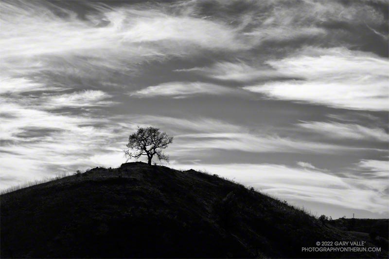
A conspicuous valley oak on a hill to the south of East Las Virgenes Canyon Road/Trail, about a mile from the Victory Trailhead of Upper Las Virgenes Canyon Open Space Preserve (Ahmanson Ranch).

A conspicuous valley oak on a hill to the south of East Las Virgenes Canyon Road/Trail, about a mile from the Victory Trailhead of Upper Las Virgenes Canyon Open Space Preserve (Ahmanson Ranch).
Another spectacular morning for a Southern California trail run.
The temperature on Saddle Peak was in the high-60s, with light winds out of the north.
The distance to Two Harbors from Saddle Peak is about 45 miles.
WARNING: The North and Northeast Ridges of Lone Pine Peak are long, complex, alpine climbing routes. Many people climb them without issue, but some are forced to retreat, bivi, or have other difficulties. Some have problems finding the descent routes. Depending on your mountaineering and rock climbing skills, the weather, and your judgement, these climbs can be a fantastic experience or an epic nightmare.
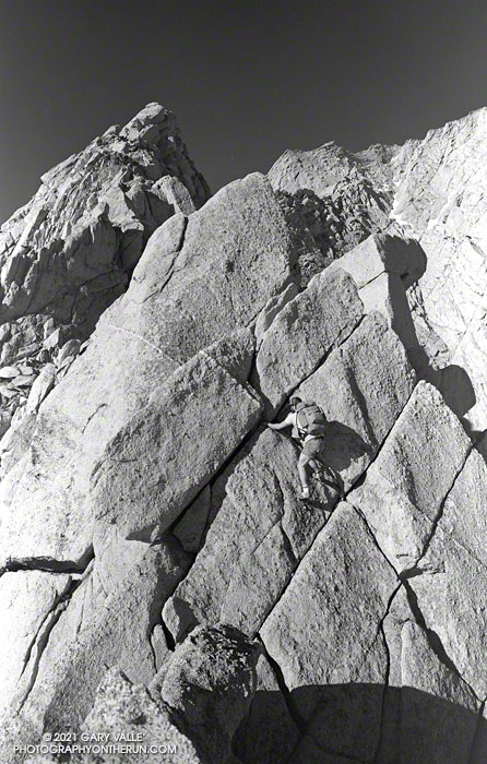
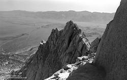
The soaring knife-edge ridges and sweeping granite faces of Lone Pine Peak are compelling features that mountaineers and rock climbers find irresistible. The North Ridge — the right skyline of the peak when viewed from the Owens Valley — is the most popular climbing route on the mountain. It was first climbed in September 1952 by A. C. Lembeck and Ray W. Van Aken. In the 1954 edition of the Climber’s Guide to the High Sierra, it was described as a long class 5 route requiring six pitons.
What’s old is new again, and with the rapid evolution of climbing in the ’70s, the North Ridge was rediscovered. I think I first heard about an “amazing ridge” on Lone Pine Peak out at Stoney Point. There was a group of us that bouldered at Stoney on Tuesday and Thursday and then climbed at Tahquitz, Suicide or JT on weekends. Periodic multi-day trips to the Needles, Yosemite, Tuolumne, and the Sierra rounded out our climbing routine.
Phil Warrender and I, along with other climbing partners, climbed the North Ridge many times. We’d drive up from L.A. after work, sleep at Whitney Portal, and would climb the ridge the following day. I don’t think I climbed the North Ridge by the same route twice. That was part of its attraction.
Because we were familiar with the approach and descent, climbed the ridge without a rope, usually didn’t have route-finding issues, and ran down most of the Meysan Lakes Trail, we were able to do the North Ridge comfortably in a day. Starting at the Portal 6:00 a.m., we typically made it back in the mid to late afternoon.
You can’t climb the North Ridge or look at Lone Pine Peak from the Owens Valley, and not think about climbing the Northeast Ridge. To our climbing eyes, the Northeast Ridge looked like it was going to be more difficult than the North Ridge. The Northeast Ridge looked sharper and the towers more dramatic. And, it looked like the ridge ended at a headwall.
Whether it was the perceived difficulty and the strenuous approach — or just random chance — nearly 30 years after the first ascent of the North Ridge, there was no record of the Northeast Ridge having been climbed.
Phil and I did a lot of rock climbing and mountaineering in 1982. That June, along with Rich Grigsby, we climbed Whitney Portal Buttress. Lone Pine Peak was across the canyon, and I think that’s when we decided we had to get on the Northeast Ridge as soon as possible. We scouted the approach and waited for the snow higher on the ridge to melt.
A month later (July 10) we parked in the pinon pines and sagebrush at the end of an obscure dirt road at the base of the peak, pulled out our packs, put on some sunscreen, and set off to climb the Northeast Ridge.
To give ourselves the most daylight for dealing with possible problems on the technical part of the ridge, we decided to hike the non-technical section in the afternoon, then bivi and start climbing early the next morning. One downside of this decision was that it was July, and we did the hike during the hottest part of the day.
To save weight we carried a minimum of “just in case” climbing gear. We took the good half of an 8 mm rope that had been damaged. We packed “swami belts” instead of climbing harnesses. The webbing was much lighter and more compact, and might come in handy if we had a problem. We took a few slings and maybe a nut or two. In a pinch we figured we could use natural protection or chock some appropriately shaped rocks. We hiked and climbed in approach shoes. Phil’s shoes were Nike Lava Domes. I don’t recall what shoes I used, but I do remember that the soles started to delaminate during the climb.
We each took a couple bottles of water. We thought there was a slight chance of finding an accessible patch of snow higher on the route, but that didn’t happen. There was a little snow in the gully between the Northeast and North Ridges.
We both carried (film) cameras. My camera (and maybe Phil’s) was a Pentax ME. At that time, I was shooting a lot of B/W film – rolling my own cartridges from a bulk roll of fine-grained 2415 Tech Pan film and developing it myself.
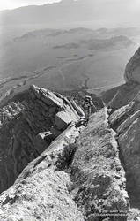
Our bivi spot was just below where the interesting climbing began, at an elevation of about 9400′. It had a great view of Bastille Buttress. We didn’t have sleeping bags, but with the warm weather slept well and started climbing shortly after sunrise.
The climb could not have gone more smoothly. It was a granite playground of ramps, towers, and feldspar dikes and crystals. Everything that looked like it might be a problem had a solution. My notes regarding the route were pretty sparse:
“Ramp on right of first major tower. Followed a dike on another. Traverse on shattered ledge/weakness on final headwall.”
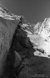
We never used the rope or any of the climbing gear. There were a few bouldering-type moves, but overall the climbing was surprisingly straightforward. The rock quality was generally good. The granite is peppered with large feldspar phenocrysts. These can make great holds, but can also pop unexpectedly.
Judging from the sun’s angle and shadows, it was around noon when I took this last photo high on the ridge. That would have put us on top about 1:00 p.m. It may have been earlier. Low on water, we briefly visited Lone Pine Peak’s summit, and then hiked south to the usual descent chute on the west side of the peak.
Hurrying down the scree, we thirstily drank from the first little stream we encountered. After rinsing off the granite grime at a nearby tarn, we found the Meysan Lakes Trail, and headed back to the Portal.
Once again Southern California is facing another very dry rain year. Since July 1, Downtown Los Angeles (USC) has recorded only 1.97 inches of rain. This is more than 8.5 inches below normal.
At this point it appears likely the rainfall recorded at Los Angeles from July 1 – February 28 will be the second driest for that period on record. If we don’t see some significant rain in March, we could be contending with 2006-2007 for the driest rain year on record.
Several weather models have been advertising a change to a wetter weather pattern for the West Coast and Southern California. At one point the ECMWF was forecasting several inches of rain in the Los Angeles area around March 1-2. This morning’s ECMWF run was far more stingy with the wet stuff, and precipitation completely disappeared from the GFS forecast for that period.
Never fear, these forecasts will likely change again. Model skill more than a few days out is very poor. Next week we should have a better idea if the pattern change is real, or just more model hype.
Update March 1, 2018. With only 1.99 inch of rain from July 1 to February 28, Downtown Los Angeles (USC) did end February with the second driest rain year to date. Depending on whether 1911-1912 is included in the ranking, the water year to-date, beginning October 1, is either the second or third most dry on record. Now all eyes turn to the storm that is forecast to move into the Los Angeles area this evening. This morning the CNRFC 72 hr. QPF for the Los Angeles area ranges from around 0.75 – 1.0 inch in the basin and valleys to around 1.5 – 1.75 inches in the mountains. Higher totals are forecast in the Ventura and Santa Barbara areas. Check with the NWS Forecast Office Los Angeles for the latest weather forecasts, advisories and warnings.
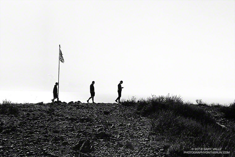
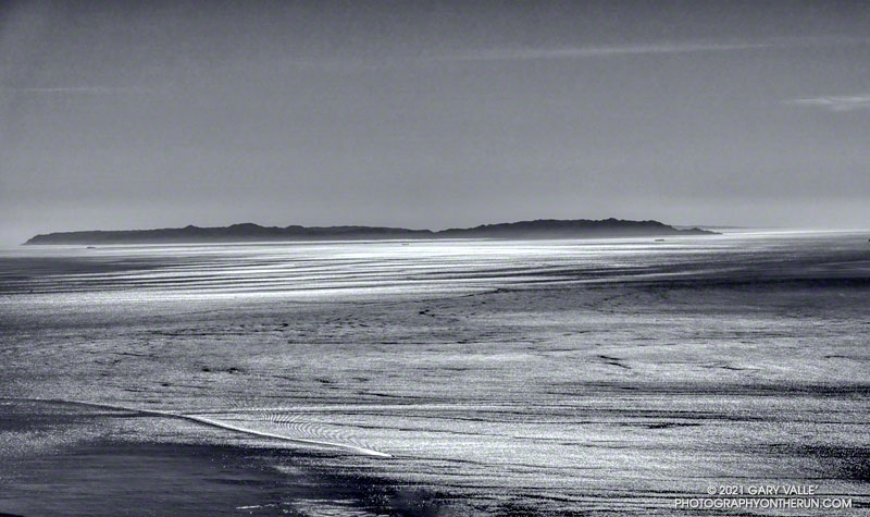
From Saturday’s out and back run to Mugu Peak.
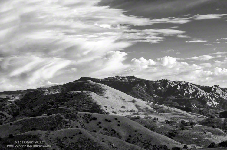
The sunlit hills are on the west side of the New Millennium Loop in Calabasas. The rocky peak in the background is Saddle Peak. The 68 mile Backbone Trail, which traverses the length of the Santa Monica Mountains, passes near the summit of Saddle Peak.
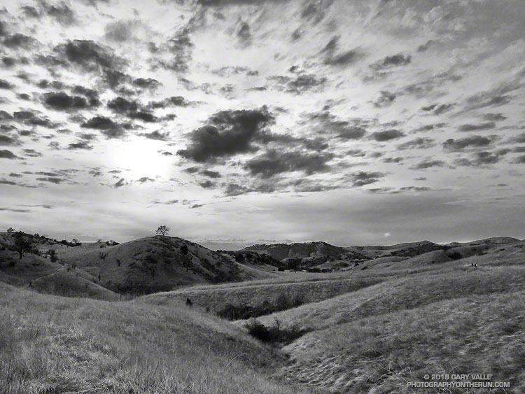
From a recent run on Cheeseboro Ridge.