Category Archives: running

Rivas Canyon Eucalyptus

What is it? Photography by Gary Valle'.

These shallow channels looked like they might have been cut by a woodworker’s router. But they were cut — or I should say chewed — by Longhorned Borer beetle larvae, feeding on the cambium of a eucalyptus tree.

Fallen eucalyptus in Rivas Canyon. The grooves are from beetle larvae feeding on the cambium of the tree.

The tree was across the trail in Rivas Canyon. Not unlike the fallen oak on Rocky Peak, Southern California’s multi-year drought likely weakened the eucalyptus, making it susceptible to other pests.

The Rivas Canyon Trail connects Will Rogers State Park to Temescal Canyon. Today (and last weekend) I ran it as part of a long loop from the “End of Reseda” at Marvin Braude Mulholland Gateway Park.

Some related posts: Will Rogers – Temescal Loop, Will Rogers Western Ranch House, Downtown Los Angeles and San Jacinto Peak

Bizarro Bulldog Loop

Bizarro Bulldog Loop

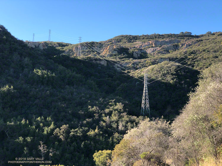
The rock and brush-choked gully was going to have to do. There was no “use trail” or other path that I could find. Just to be sure I wasn’t missing another route, I followed the overgrown dirt road past the power transmission tower to where it dead-ended at a wall of chaparral.

Returning to the gully, I looked up. A large boulder and some other debris were wedged against a tree, blocking its entrance. Knowing well the pitfalls, I carefully clambered over the aggregation and started up the congested channel.

Curiosity is an irresistible force for most that love the outdoors. It propels us to explore near and far, experiencing what we have not experienced before. It knows no geographic bounds, and can be equally strong a mile, or a hemisphere, from home.

In a sense this adventure began years ago, when I first noticed the power line service roads paralleling the Bulldog Mtwy fire road. Since then I’ve done the Bulldog loop many times. Each time I’ve looked over at those roads and wondered why they didn’t connect — and how difficult it would be to link the two.

That question might finally be answered today. The plan was to do a variation of the Bulldog Loop, finishing the climb to the crest using the power line service roads, rather than Bulldog Mtwy.

When I’d parked at the the Cistern trailhead on Mulholland the temperature had been a chilly 28 degF. A mile and a half into the run, down in the canyon along Malibu Creek, the Tempe sensor attached to my pack read 24 degF!

It was cold enough that the wind chill from running 4-5 mph was significant. I could feel the cold through my gloves and arm sleeves and my hands were getting cold. I flexed my hands as I ran, and from time to time would briefly walk to reduce the chill. Relief was only a couple of miles away — at the start of the Bulldog climb I would break into the sun.

Ah sun, glorious sun! There is nothing quite like the warmth of the morning sun following a cold dawn. It warms the body and imbibes the soul. It is something to relish and celebrate.

I’d reached that sun about 30 minutes ago. Now I was immersed in cool shade and working my way up the steep drainage through thick chaparral. The puzzle was not an easy one, and I’d almost turned around several times. To not make a foolish decision, it is necessary to be willing to turn around.

At one point the route up the gully appeared to be blocked. Looking for an alternative, I worked up a steep slope on the left, concentrating on the route-finding. It wasn’t going to go either. When I stopped to re-evaluate the route, I realized I was surrounded by a tangled thicket of just-sprouted poison oak.

Resigned that it was just going to be too ugly to continue, I returned to the gully, intending to follow it down. But then I muttered to myself, “I wonder…” and took a couple steps up the gully, and then a couple more. A route through the impasse revealed itself. Many times that’s all it takes — a step or two — to see a solution not seen before. I could continue.

Eventually the terrain forced me to the right of the gully, up along a sandstone rib, and toward a little outcrop. The rock quality was very poor. Fist-sized pieces of cobble embedded in the sandstone could be pulled out by hand and sound-appearing holds were easily broken.

With some careful route-finding I was soon on top of the sunlit rock. An island in a tumultuous ocean of chaparral, it gave me the first good view of my surroundings since I’d started up the gully. From the outcrop I could see why the roads didn’t connect. Partially hidden from view, a 50′ tall headwall completely blocked the drainage.

There was no way I was going to try and climb the headwall directly. Trying to force a line here would be a very bad idea. But there was a weakness on its right side that — if it wasn’t too steep and loose — might go.

And it did! Once on top of the headwall, only a bit of bush-whacking was necessary to get to the first tower on the upper service road. Freed from the tangle of chaparral, it didn’t take long to get up to Castro Peak Mtwy, and back onto the Bulldog loop.

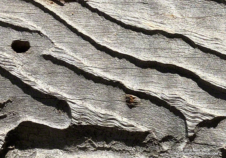
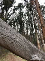
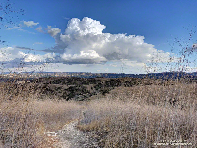
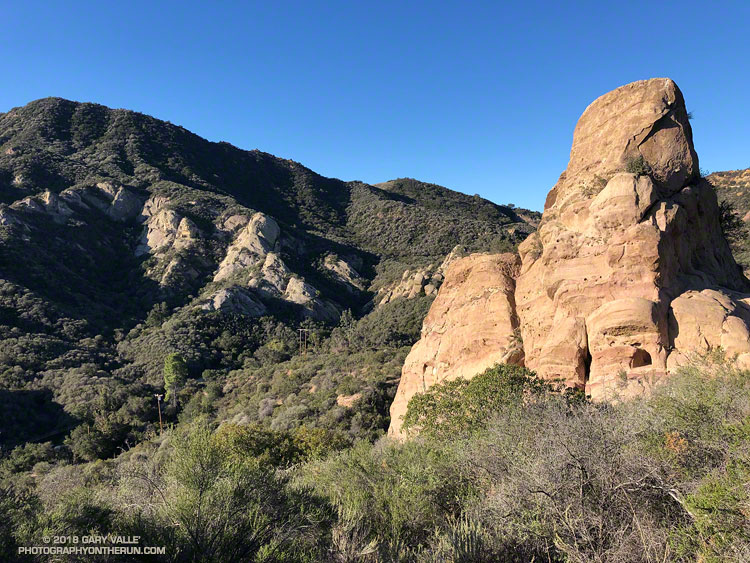
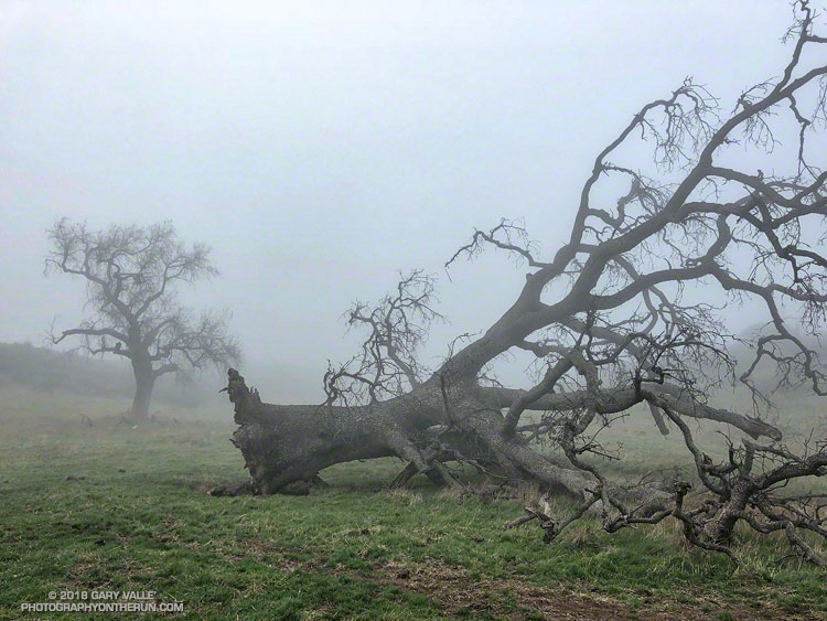
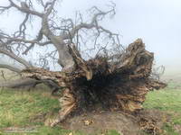
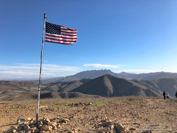
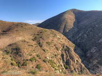
I won’t be doing THAT route again, but did enjoy solving the puzzle — even if it was a bit bizarre. Here are a few photos taken along the way.

Red Rock Canyon from the Red Rock Trail

Red Rock Canyon from the Red Rock Trail

Nope, I wasn’t running near Las Vegas or north of Mojave, this Red Rock Canyon is in Old Topanga Canyon, southeast of Calabasas Peak.

Although there’s a trailhead off of Old Topanga Canyon Road, I usually access Red Rock Canyon from the top, using Calabasas Peak Mtwy and Red Rock Road.

Fallen Oak

A large valley oak along Rocky Peak fire road that toppled following five years of drought.

The fallen oak pictured above — one of the larger valley oaks along Rocky Peak fire road — toppled over in the summer of 2016 following five years of drought. Fire and drought are a natural part of the valley oak’s habitat and the trees have evolved to withstand ordinary variations in their environment. However, severe fires or extended droughts, or fire in combination with drought can overcome the tree’s defenses. The drought may have been the culminating factor in the felling of this oak, but fire and other factors may have also played a role.

Base of large valley oak along Rocky Peak fire road that toppled following five years of drought.
Base of large valley oak that toppled following five years of drought. Click for larger image.

According to the Fire Effects Information System (FEIS), the heart-rot fungus Armillaria mellea is usually present in valley oaks and larger oaks tend to be hollow or rotten in the center. The toppled oak was hollow near its base and its interior appears to have been blackened by fire. The FEIS describes instances where the decaying wood in the interior of older valley oaks could ignite in a fire, but leave the exterior bark uncharred.

What fire might have burned the tree? There are two possibilities: the 2008 Sesnon Fire and the 2003 Simi Fire. It probably wasn’t the Sesnon Fire — this photo of the tree, taken about a month after the Sesnon fire, shows little impact. I couldn’t find a photo of the tree following the Simi Fire, but photos taken nearby show a severely burned landscape. Ultimately, it appears fire and drought weakened the tree, accelerating its heart rot and weakening its roots to the point it could no longer support itself.

Photos of the fallen oak are from this morning’s foggy run along Rocky Peak fire road.

Related post: Ahmanson Blue Oak Succumbs to Climate ChangeChumash Trail – Sesnon & Simi Fires

Breakaway

Summit of Mugu Peak in Pt. Mugu State Park. Boney Mountain in the distance.

My legs hadn’t fully recovered from a bit-too-long training run a couple of weeks ago and I’d been looking to do a 4 to 5 hour trail run that didn’t involve a huge amount of elevation gain. In the areas of Southern California where I run, it’s tough to find a 20 mile trail run that isn’t hilly. With “only” about 3000′ of gain, I’d opted to do an out and back to Mugu Peak from from the Wendy Drive trailhead in Newbury Park.

La Jolla Valley Loop Trail and La Jolla Canyon, Pt. Mugu State Park.
La Jolla Valley Loop Trail and La Jolla Canyon. Click for larger image.

Mugu Peak is a very popular summit. With the La Jolla Canyon Trail still closed, most of the hikers doing the peak are now using the Chumash Trail as an alternate. Runners have more options and can reach the peak from the Ray Miller, Sycamore Canyon, and Wendy Drive trailheads.

At the moment I was about a mile north the Danielson Multi Use Area, running on a paved section of road in Big Sycamore Canyon. The Sin Nombre and Hidden Pond trails can be used to avoid this stretch of pavement, but at this point in a long run I usually just want to get to the Upper Sycamore Trail as quickly and easily as possible.

Pt. Mugu from Mugu Peak with Anacapa and Santa Cruz Islands in the distance.
Pt. Mugu from Mugu Peak. Anacapa and Santa Cruz Islands are in the distance. Click for larger image.

Running a couple of miles on pavement isn’t necessarily a bad thing. Especially in Sycamore Canyon. The road is lined with sycamores and oaks and there is plenty of shade. The uniformity of the road is both good and bad. It’s good because the running is more automatic and bad for the same reason. It can be tedious — especially on tired legs at the tail end of a long run.

The traffic along the road is usually not an issue. Today, I had passed a couple of groups of hikers and been passed by a few mountain bikers. Most of the time the road was empty.

California bay along the Upper Sycamore Trail in Pt. Mugu State Park
California bay along the Upper Sycamore Trail. Click for larger image.

I first heard the sound some distance behind me. Hissing isn’t quite the right word. It was a synchronized blend of aerodynamic, mechanical and road noises and it was getting closer. At first I thought it might be a ranger’s truck, but it didn’t sound like a vehicle. I glanced behind me to see a mass of approaching cyclists, and wondered how many bikes there would be.

I heard a shout of “Right!” as the lead cyclist alerted the group, and in an instant the peloton began to sweep past. I felt a little like the breakaway racer that is inevitably consumed by the unrelenting pack. For a few moments I could feel the push of the peloton and then they were gone.

The lead group was followed by a second group, nearly as large, and then an assortment of riders that had been left behind. After they were past, I settled back into the run and soon saw the yellow “narrow bridge” sign near the start of the Upper Sycamore Trail. Turning onto the rocky, narrow trail, I switched back into trail mode. A little less than three miles to go…

Related posts: Busy Mugu Peak, Wendy Drive – Mugu Peak Challenge