
Category Archives: running
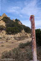
Sean O’Brien 50K Training Run
I looked at the mileage on my Garmin watch — 11.93 miles. I was at Kanan Dume Road and debating whether to make Kanan my turnaround point. My run had started at Malibu Canyon Rd. & Piuma Rd., where I’d picked up the Sean O’Brien Trail Runs course at around mile 2. After crossing Malibu Creek, the 100K, 50M, 50K and Marathon courses all follow the Backbone Trail westbound from Malibu Canyon.
The ground had been spotted with raindrops as I started the nearly 3 mile, 1500′ climb out of Malibu canyon. Subtropical moisture was streaming in from the southwest and there was a broad swath of clouds over Southern California. There were scattered showers, but most of the rain was evaporating before it reached the ground. The last time it had rained was more than a month ago, and the smell of rain was intoxicating.
Two weeks ago I’d done this climb as part of a “reverse” Bulldog loop. It hadn’t become any less steep. Most of the climb is on a fire road and some of it is runnable — just how runnable depends on your VO2max, determination and inclination. It was a relief to reach the top and start running downhill, even if another climb loomed just ahead.
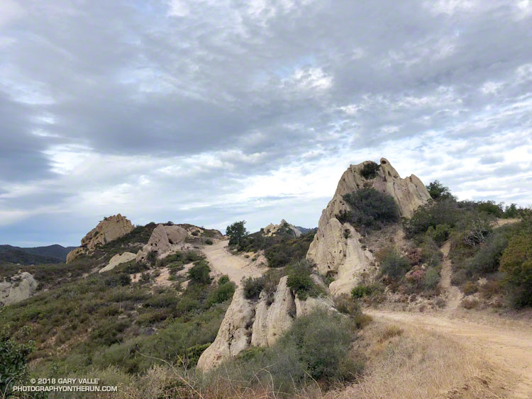
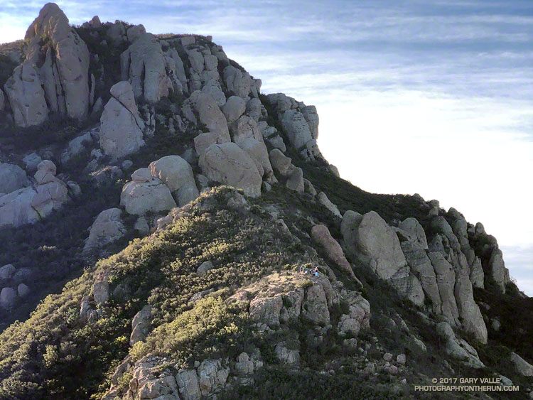
Once to the top of this next climb, it is about a mile and a half to Corral Canyon. There are a couple of short ups and downs along the way and the rock formations become increasingly dramatic. Just east of Corral Canyon the Backbone Trail winds through a wonderland of rocks and pinnacles, climbing a steep sandstone ramp and passing through a rock gateway.
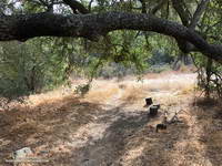
From Corral Canyon the Backbone Trail drops into Upper Solstice Canyon. Today, the 16 crossings of the small creek in the canyon were all dry. Someone had provided log seats under a sprawling oak at “heart” meadow. I had to stop for a moment just to enjoy its tranquility. On a run here in January several years ago, the area was covered in ladybugs.
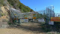
The high point of the 50K course follows the climb out of Upper Solstice Canyon and is near the saddle at Newton Mtwy. Back in the day the Bulldog 50K used to climb up and over the shoulder of Castro Peak from the top of Bulldog; then descend to this saddle and continue to Corral Canyon on the Upper Solstice Canyon Trail. This 2004 Los Angeles times article describes why the road is now gated and private.
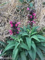
The day was a little warmer than expected and the shaded sections of trail in Newton Canyon were refreshingly cool. The dried out stalks of last year’s hummingbird sage were common along the trail and given the lack of rain, I was very surprised to find a plant that was blooming.
The Sean O’Brien Marathon turns around at Kanan Dume Road, which is what I should have done. That would have resulted in a pleasant 24 mile training run with a bit over 5000′ of gain. Instead I decided to continue west on the Backbone Trail and “just run down to the bridge” to see if there was any water in Zuma Creek. There wasn’t. The bridge also would have been a perfectly good turnaround point that would have netted a 26 mile run.
But it was one of those rare, long run kind of days where the mind and legs are in sync and the miles almost didn’t matter. I reasoned that the Sean O’Brien 50K turnaround was “only” another mile and a half away, so why not continue. That way I’d have an even better idea of what to expect on race day.
I did continue, and with the exception of running low on water, everything went well. At Latigo Canyon several runners had just returned to their cars and I was able to fill up my Camelbak(R). Thanks Lou! And thanks to the other runners at the trailhead for their offers of gels, beer and salt!
I’ve run that section of the Backbone Trail several times, but never as an out and back. I now understand why the times for the Sean O’ Brien 50K are a little longer than the typical 50K. For one thing the course is about 1.5 mile longer than a 50K. For another, it has a TON of elevation gain. Using the elevation profile from my fenix 3 and a 1/3 arc-sec DEM from the USGS, the hand-calculated elevation gain worked out to be around 6000′. Tack on another 500′ of gain to account for the Tapia Spur Trail and the total gain for the Sean O’Brien 50K works out to a stout 6500′, give or take.
An End of Year Boney Mountain Adventure
The last day of 2017 had been a near perfect day for a trail run. I’d started my adventure with an ascent of Boney Mountain’s western ridge, joining the Trail Runners Club for part of the climb. After reaching the top of Boney Mountain’s western ridge, I continued to Tri Peaks and Sandstone Peak, the highest peak in the Santa Monica Mountains. From Sandstone Peak, a few scenic miles were added by completing the Mishe Mokwa loop. This brought me back to the Chamberlain segment of the Backbone Trail, headed west.
About a half-mile past the Backbone Trail’s western junction with the Tri Peaks Trail, the Backbone Trail begins a 4.7 mile, 2400′ descent to Sycamore Canyon. I had started this descent and was nearly down to Chamberlain Rock, when I heard voices on the trail ahead. They sounded like they were just around the next switchback. Slowing to a walk, I rounded the sharp corner. Three smiling hikers said hello, and I wished them a Happy New Year.
It’s a little unusual to see a group of hikers on this section and for a moment I wondered if they might be doing the full length of the 68 mile Backbone Trail. I asked how they were doing and one of them casually replied, “Doing great — we’re just headed down to the Sandstone Peak parking lot…”
Surprised by the answer, I asked, “The trailhead on Yerba Buena?” They were miles from where they thought they were and headed in the opposite direction they should be. Every step down the trail was taking them farther and farther away from their intended destination. They looked fit, experienced and well-prepared, but somewhere along the way, they had taken a very wrong turn.
From what I could determine they had intended to do the Mishe Mokwa – Sandstone Peak loop counterclockwise, or a variation that involved Tri Peaks. Apparently, at the top of the Mishe Mokwa Trail instead of continuing toward Sandstone Peak on the Backbone Trail, the hikers decided to take the Tri Peaks Trail. They followed the Tri Peaks Trail until it ended at the Chamberlain/Backbone Trail, about two miles west of Sandstone Peak.
At this point, to get back to Sandstone Peak (and their car), they needed to turn left (east). Instead, they turned right and headed down the Chamberlain Trail. One of the three hikers suspected they had gone in the wrong direction, but wasn’t able to convince the others.
The good news is they only had gone about a mile down Chamberlain from the Tri Peaks Trail junction. This put them about 2.5 miles from Sandstone Peak and about 4 miles from their car. It was around noon and the weather was good. If they had no route-finding issues on the way back they would probably still have time to do Sandstone Peak. They just would be doing more of an End of the Year adventure than they planned.
Here are a few photos taken along the way.
Some related posts: Boney Mountain Western Ridge & Loop, Balance Rock, Misplaced on Mt. Wilson
Some Fall Color to Bring in the New Year
While much of the country shivers in the cold climes of Winter, the muted colors of the changing season have finally reached the lower elevation areas of Southern California.
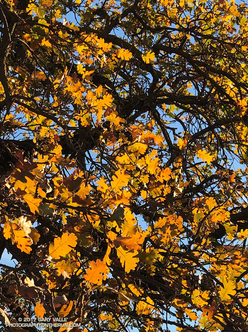
In this area, the leaves of Valley Oaks usually begin to turn around mid-December and the trees lose their leaves around the beginning of the new year. About a month and a half later trees begin to sprout new leaves, usually in mid to late February. From year to year, the time frame can vary by as much as 2-3 weeks.
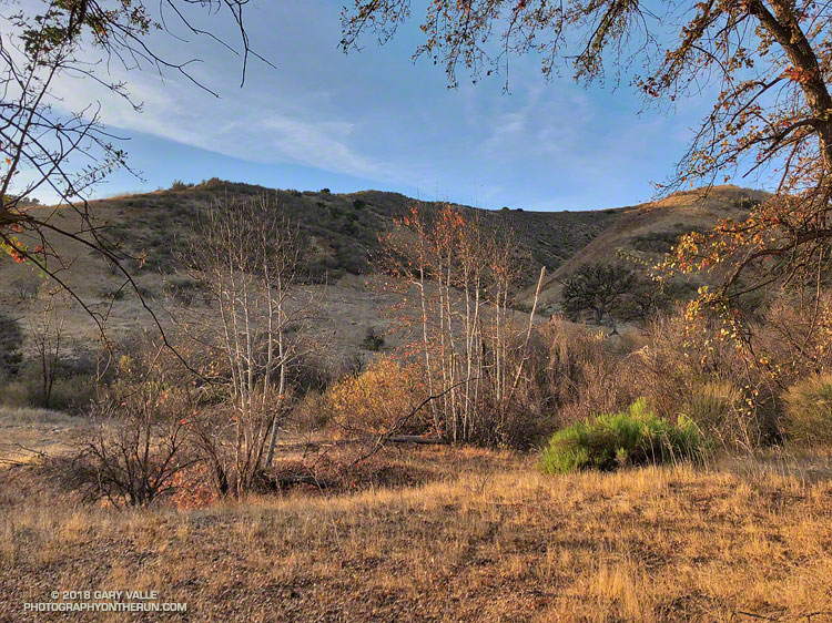
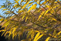
The photo of Valley Oak leaves was taken December 28, 2017, in Upper Las Virgenes Canyon Open Space Preserve (formerly Ahmanson Ranch). This willow in East Las Virgenes Canyon was also showing some nice color.
Bulldog Loop Near Corral Canyon
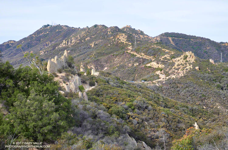
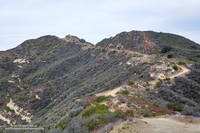
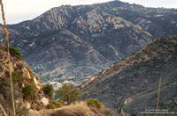
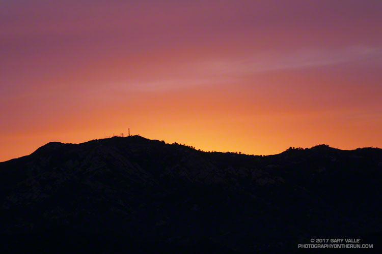
The high point of the 14+ mile Bulldog Loop in Malibu Creek State Park is near the center of the skyline in the photo above. The Bulldog fire road can be seen cutting across the peaks on the right. Bulldog tops out at the Castro Peak fire road, which is the fire road leading up from the Corral Canyon Road parking area. Castro Peak (privately owned) is the peak on the left with the antennae.
From Crags Road to Castro Peak fire road, the Bulldog fire road gains about 1727 feet in 3.4 miles. The steepest mile starts at mile 2.0 of the climb and gains about 732 feet.
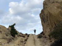
Today I was running the loop clockwise, so got to run down Bulldog for a change!
Some related posts: Best Trailhead to Start the Bulldog Loop?, Malibu Creek State Park Scenic Loop, Vertical Relief, M*A*S*H Sunrise
Saddle Peak Sunrise
Sun rising behind Saddle Peak. From the Mesa Peak Mtwy segment of the Backbone Trail in the Santa Monica Mountains, near Los Angeles.