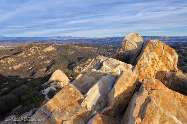
A run doesn’t have to be long or difficult to be interesting. I’d done the Ray Miller 50K the week before, so was looking to do something not too long or strenuous. That didn’t mean it couldn’t be a run with an adventurous edge. After considering several options, I finally settled on the Topanga Lookout Ridge Loop, plus a short side trip to the summit of Saddle Peak.
This 8.5 mile route combines a fun run, hike and scramble up a mile and a half long ridge to the Topanga Lookout with a scenic run on a segment of the Backbone Trail. The return to the Cold Canyon trailhead on Stunt Road is accomplished by descending the Stunt High Trail from its junction with the Backbone Trail.
The Backbone Trail climbs to its second highest point near Saddle Peak and it takes only a few minutes to run over to the summit of the peak. Despite rumors to the contrary the West peak (with all the antennae) is the higher peak. That’s where the benchmark is, and 1/9th arc-sec DEM data puts its elevation about 18′ higher than the East peak.
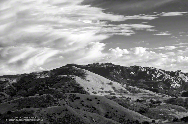
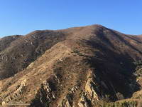
The sunlit hills are on the west side of the New Millennium Loop in Calabasas. The rocky peak in the background is Saddle Peak. The 68 mile Backbone Trail, which traverses the length of the Santa Monica Mountains, passes near the summit of Saddle Peak.
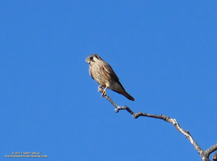
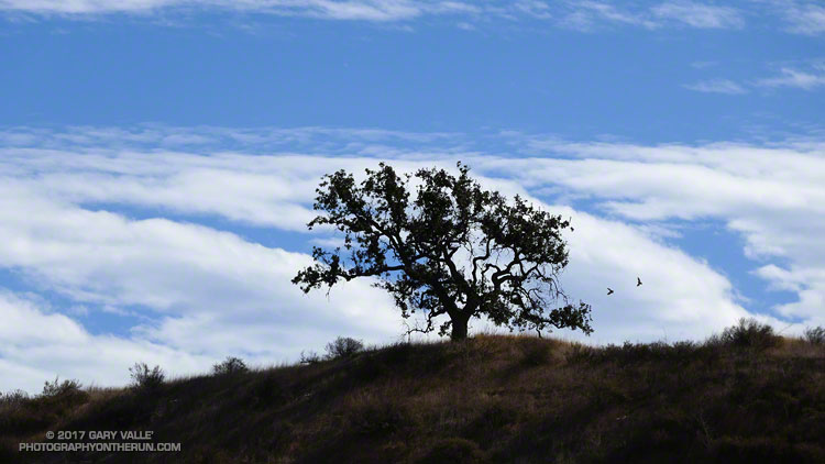
I was in that other-world you can reach when running, lost in thought and dreaming of dreams. As I approached the valley oak on the western edge of Lasky Mesa, I wondered if the tree was going to survive. Even though last Winter had been wet, it had been a hot summer, and this once-elegant star of TV and film was still struggling with the deleterious effects of five years of drought. Leaves grew in clusters along its spindly limbs as if it had been burned in a wildfire.
Nearly under the scraggly valley oak, I slowed to a walk to look at it more closely. Glancing upward I did a double-take… Perched on a bare limb at the top of the tree was a small raptor. So small, that it had to be an American kestrel.
Kestrels are extremely wary birds with acute vision, and I was surprised it had not flown as I had run toward the tree. I’ve seen and heard kestrels many times at Ahmanson Ranch, but never this closely. The diminutive falcon was only about 15′ above me. My camera was in my pack and just about any movement was going to spook the bird.
Ever so slowly, I turned my back to the bird and walked a few steps away from the tree. Wishing I had eyes in the back of my head, I carefully removed my camera from my waist pack, turned it on, made sure it was set correctly, and partially extended the zoom lens. Turning back toward the tree, I expected the falcon to be gone, but it had not flown.
I took a set of bracketed photos and then another. I needed to be a little closer. I took two or three slow steps toward the tree. As I raised the camera, the female kestrel — burnt orange across the back and upper wings — had had enough. With a powerful stroke of her wings she turned and leapt to flight, once again leaving me to my thoughts.
There’s magic in the morning, when the owls hoot softly and there is a chill in the air.
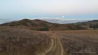
I’d started my run from the Wendy Dr. trailhead when there was just enough light to see the trail. The moon was poised low in the western sky, full and bright. As I passed the frame of the Chumash ‘Ap at the Satwiwa Native American Indian Culture Center I’d thought about the Chumash, and how well they must have known this land. It is one thing to visit a place, and quite another to live there.
Moon setting over Rancho Sierra Vista/ Satwiwa.
Today the plan had been to run to the Ray Miller Trailhead and do a little of the Ray Miller 50K course along the way. At the start of the run I hadn’t decided which route I was going to take to Ray Miller — Hell Hill or Fireline. I’d finally opted for Fireline, since that route would follow the last 5 miles of the 50M/50K course and is much more runnable.
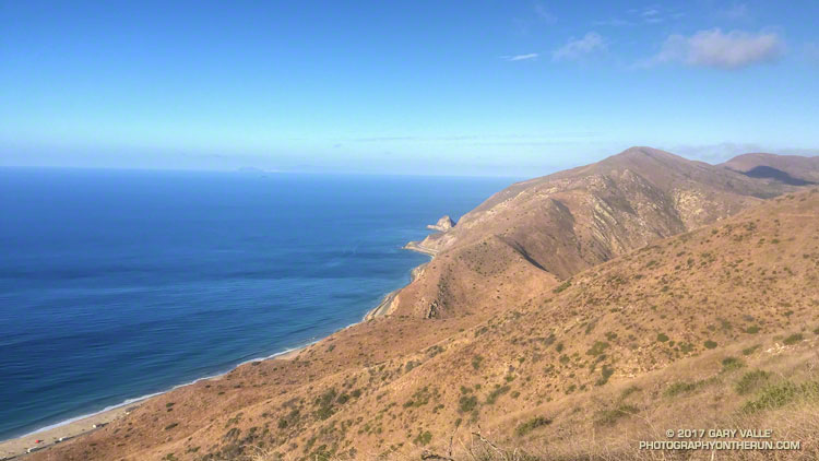
I hadn’t run Fireline since the 2013 Ray Miller 50K. With only 7 miles on my legs (instead of 26) it didn’t seem nearly as steep. Once at the top of Fireline, and after doing a bit more uphill on Overlook fire road, I eventually got to the best part of today’s run — the 2.5 miles of scenic downhill on the Backbone Trail to the Ray Miller trailhead on PCH.
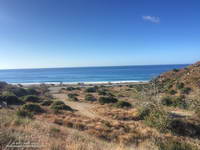
PCH at the Ray Miller Trailhead.
The Pacific was painted in a palette of wide-gamut blues and although it was hazy offshore, there were excellent views along the coast. To the west Anacapa and Santa Cruz Islands could just be seen in the ocean haze and Mugu Peak loomed golden in the morning sun. The Ray Miller Trail is very popular and on the way down I passed several runners in the first miles of their morning run.
At the Ray Miller parking lot my Garmin fenix read 12 miles. Just like climbing a mountain, getting to the turnaround point of a long self-supported run is only part of the adventure. I gulped down some water at the water fountain; checked how much water I had left in my pack; ate a Snickers left over from Halloween; and then started the 1000′ climb back up the Ray Miller Trail to the Overlook fire road.
The Mugu Peak Trail starts in upper La Jolla Canyon and climbs up and around Mugu Peak.
The run was going well and at the start of the climb I was thinking about following the 50M/50K course up and around Mugu Peak before starting the trek back to Wendy Drive. By the time I’d reached the top of Ray Miller and had climbed up to the high point of Overlook fire road my mileage appetite wasn’t so big. Following a short side trip into La Jolla Valley, I returned to the Overlook fire road, descended Hell Hill and Wood Canyon, and started working my way back up Sycamore Canyon on the Two Foxes Trail.
At the Danielson Multi-use area there was a large group participating in a guided hike. A familiar runner with a distinctive hat was making his way around the group. It was photographer and ultrarunner Larry Gassan. Larry joined me for the remainder of the run and his stories made the run back up Sycamore Canyon and Upper Sycamore much more interesting.