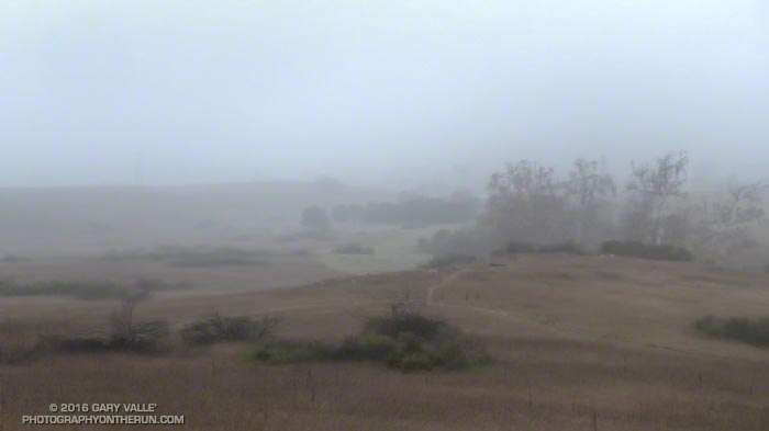
From this morning’s out and back run from Satwiwa (Wendy Drive) to Mugu Peak.

From this morning’s out and back run from Satwiwa (Wendy Drive) to Mugu Peak.
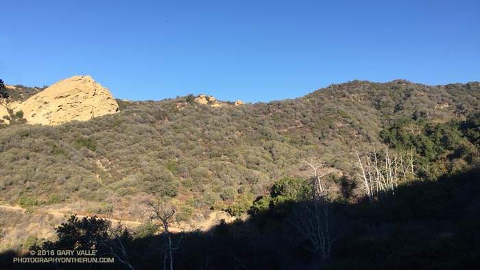
From Sunday’s run in Topanga State Park.
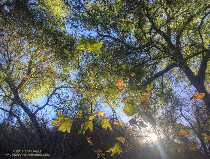
From this morning’s run to Temescal Peak, Eagle Springs, Trippet Ranch, Eagle Rock and Garapito Canyon.
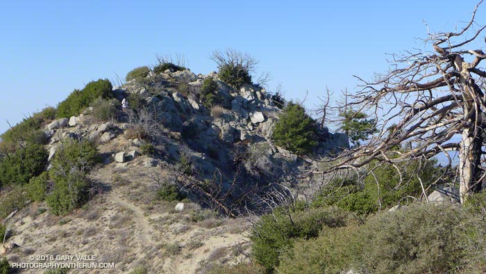
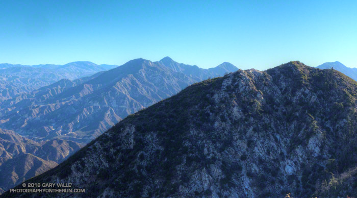
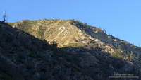
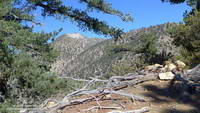
Did the Colby Canyon – Strawberry Peak – Red Box loop again over the Thanksgiving holidays. While taking some photos near Strawberry’s summit I was struck by the regrowth that has occurred since the 2009 Station Fire. What caught my eye were the bare limbs of the old growth, burned in the fire, projecting from the new, dense, green growth.
The growth of the chaparral over the seven years since the fire does not appear to have been noticeably impaired by the 2011-2015 drought in Southern California. (In the photograph above note the height of the regrowth compared to my friend near the summit.)
This conclusion is based in part on the observation of chaparral regrowth following other fires, such as the 2005 Topanga Fire, but is also supported by comparing the amount of new growth to the pre-Station Fire growth. This can be inferred by the length of the burned limbs and the approximate age of the chaparral when burned by the Station Fire.
According to the FRAP California geodatabase of fire perimeters, the last fire to burn the summit of Strawberry Peak was the 1979 Sage Fire, which burned approximately 30,000 acres. Before that you have to go back to 1896 to find another fire in the database that burned Strawberry’s summit.
In the absence of fire, it appears that in another 23 years the chaparral in the title photo could reach a similar height and extent to the old growth.
Note: This ascent of the Stone Canyon Trail was in the Fall, following five years of drought. On a Spring 2020 ascent, following a relatively wet period, there was a moderate amount of poison oak and some sections of the upper half of the trail were badly overgrown. In Spring 2021, a lot of work had been done on the trail and it was in excellent condition.
The last time I climbed Mt. Lukens was in the 70s. Drawn by its classic line, Phil Warrender and I climbed Lukens’ west ridge — a long, trailless ascent that started near the probation camp on Big Tujunga Canyon Road. Many years and many adventures later I was back on Lukens — this time on the Stone Canyon Trail.
Curious about the current condition of the trail, last night I read a few recent trip reports. It was a bit like reading tabloid news. If the reports were to be taken at face value, it would be a hellish, impossible to find, unmaintained, horribly overgrown, washed out trail that was lined with poison oak and poodle dog bush, and writhing with rattlesnakes.
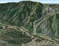
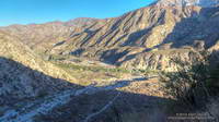
It was evident in the first mile that the Stone Canyon Trail is a classic, no nonsense, ear-popping trail. First shown on the 1933 La Crescenta Quadrangle Advance Sheet, the route of the trail is pretty much the same now as it was then, starting near Wildwood in Big Tujunga Canyon and zig-zagging up the ridge just east of Stone Canyon to the summit of the peak.(The 1933 topo also shows a trail along the route Phil and I climbed.)
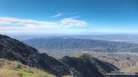
The Stone Canyon Trail tops out about a half-mile northwest of Mt. Lukins’ summit. Like many urban peaks, the summit is cluttered with electronics, but there are still worthwhile views on and near the top of the peak.
While on the summit, a LASD’s Air Rescue 5 helicopter flew by to the east — I guessed on the way to the Barley Flats staging area. But part way down the peak I heard the airship to the northeast and noticed a cloud of dust being stirred up from a turnout on Angeles Forest Highway. Once again Air Rescue 5 was at work. It’s astonishing how many calls they get.
Continuing to run down the trail I thought about some of the online comments I’d read the night before.
Hellish? Well, sure, on a hot day. Unless you’re looking to get in some heat training, don’t climb it on a hot day. Climb it when the weather is clear and cool!
Impossible to find the trail? Except for the big sign at the trailhead parking lot, I didn’t see any trail markers. But if you have a “big picture” view of where the trail is in relation to the parking lot, it’s not too hard to find.
Unmaintained? These days most trail maintenance is done by volunteers. A trail like the Stone Canyon Trail is kept alive through use, sporadic organized trailwork, and an occasional snip here and snip there.
Horribly overgrown? The higher you go the more overgrown it is, but today it was not yet to the point that serious bushwhacking was required. I wore running shorts. (But I almost always wear running shorts.)
Washed out? Yes, there were a few small washouts, and the margin of the trail has collapsed in a number of places. With care, all were passable. One of the washouts was a little larger, and required a bit more care than the others.
Poison oak and poodle dog bush? Maybe I missed it, but I didn’t see any poison oak. There was a minuscule amount of dried up PDB. (Ask me about the PO later in the week.)
Rattlesnakes? Always a possibility, even in Winter. But this is true in most areas of Southern California. In my experience the chance of encountering a rattlesnake is less from November through February, but there’s still a chance.
Ear-popping? The trail gains about 3,270 feet in 3.8 miles. My ears “popped” a couple of times on the way up.
Theoretically the gate on Doske Road is open from 8:00 a.m. to 8:00 p.m. The Angeles National Forest web site showed the status of the Wildwood Picnic Site to be open, but the gate was not open today. I parked in the large turnout on Big Tujunga Canyon just west of the gate and ran about a half-mile on Doske and Stonyvale Roads to the parking lot and trailhead.
Nearly every time I’ve climbed Mt. Baden-Powell I’ve wondered about the long ridge extending south from its summit. And nearly every time I’ve summited Baden-Powell I’ve been in the middle of another running adventure, and unable to explore more than a few hundred yards down the ridge. But today I wasn’t running to Eagles Roost or doing a long loop from Islip Saddle. Today the plan was to climb Ross Mountain, a peak far down on Mt. Baden Powell’s south ridge.
Major mountain ridges are often isolated, aesthetic and adventurous — characteristics that are magnets to mountaineers. While not technically difficult, the excursion to Ross Mountain is demanding. The first step is to climb Baden-Powell — a four mile trek with 2800′ of gain, that tops out at an elevation of about 9400′. From the top of Baden-Powell a use trail then leads down the south ridge three miles over varied terrain to Ross Mountain.
For the most part the use trail is relatively distinct and follows the anticipated route down the ridge. Even so, it is usually not as easy to follow a use trail as it is a conventional trail. It had rained a few days before, and the tracks of the last group to do Ross were vague. The most distinct tracks on the trail were from the recent passage of a bighorn sheep.
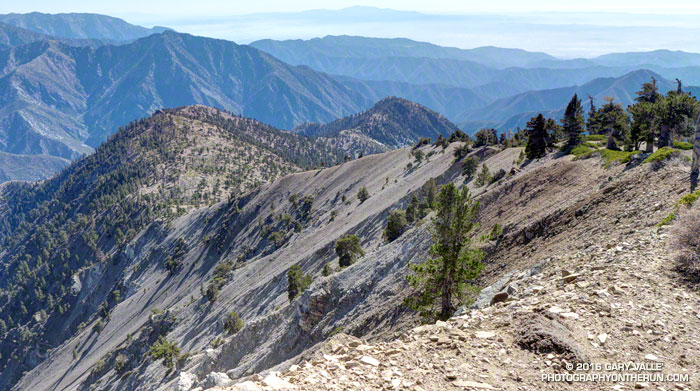
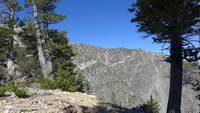
The route to Ross drops 2100′ in 2.5 miles, then ascends 200′ over the remaining half-mile to the peak. The descent is not continuous. About a mile from Baden-Powell the ridge is interrupted by a large bench, and there are other ups and downs along the way. The ridge can be seen in profile in this image or the PhotographyontheRun masthead.
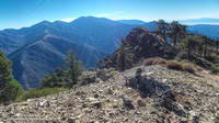
The ridge projects into one of the more rugged areas of the San Gabriel Mountains — the Sheep Mountain Wilderness. To the west is the deep canyon of the East Fork, with Pine Mountain, Dawson Peak, Mt. Baldy and Iron Mountain towering above. To the west is the very remote canyon of the Iron Fork, sweeping up to form the 9000′ crest between Throop Peak and Mt. Burnham.
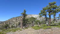
The ridge hosts a wide variety of conifers — limber pine, lodgepole pine, white fir, sugar pine, Jeffrey pine and even a few incense cedars. Life on the ridge is tough, and many of the trees are contorted, broken or stunted. It appears to have been a good year for the sugar pines, and some were heavily laden with cones. Overall the health of the trees on the ridge appeared to be good, with surprisingly few trees in obvious distress from the drought.
A little more than three hours after leaving Vincent Gap I zig-zagged up the final few steep steps to the 7402′ summit of Ross Mountain. Not unlike other vantage points along the ridge, the summit was a pretty spot under a sugar pine tree, but in this case with a small cairn and rain-soaked summit register.
After procrastinating a bit and checking out the south side of Ross Mountain’s elongated summit, I began the journey back to Baden-Powell.
Surprisingly, considering my plodding pace coming back up the ridge, it took almost exactly the same amount of time to get back to Vincent Gap as it had to go to Ross Mountain. As it worked out, the time lost on the climb back up the ridge was offset by the superb run down the Baden-Powell Trail.
According to my Garmin fenix 3’s barometric altimeter the total gain/loss on this adventure was about 5100′. If the gain/loss is calculated from the GPS track using 1/3 arc-sec DEMs it works out to about 5400′. The round trip distance was 14 miles.
Related post: Return to Ross Mountain