Category Archives: trails|malibu creek state park

Spring Fever Running the Phantom Loop in Malibu Creek State Park

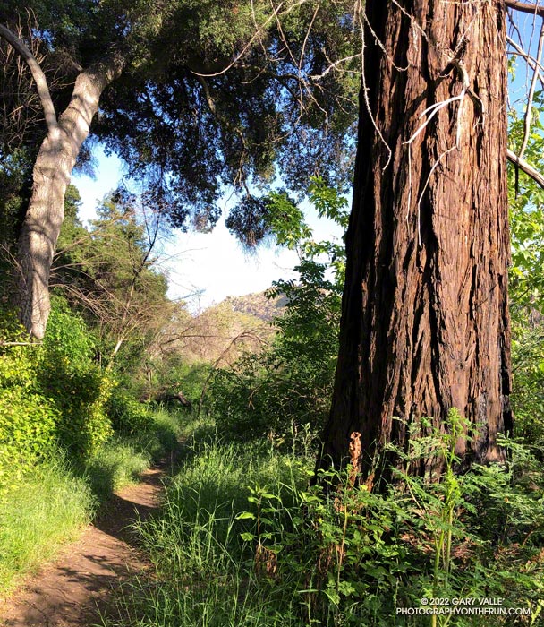
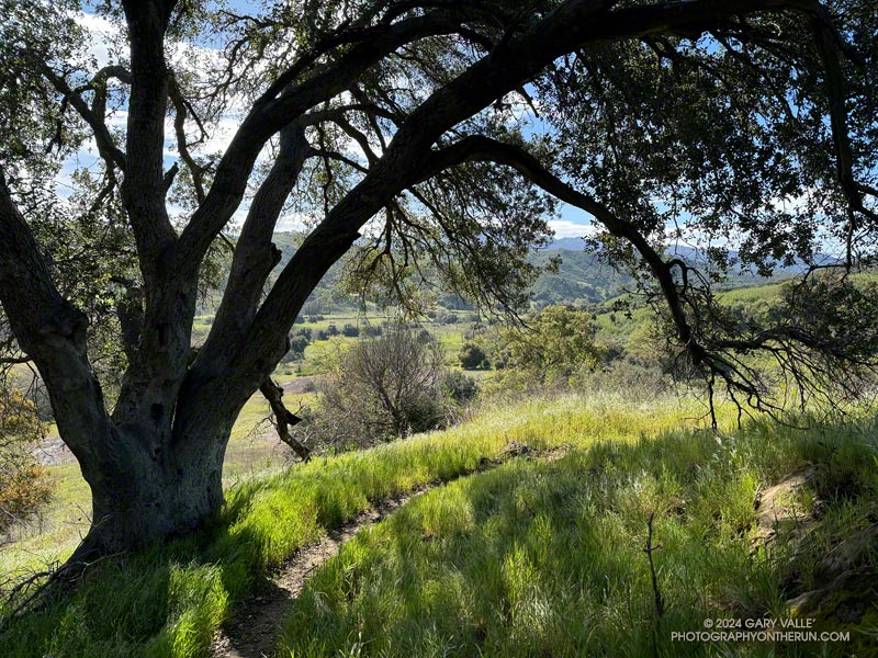
Coast live oak along the Talepop Trail. Photography by Gary Valle'

One of the e-mountain bikers commented, “That’s a lot of water!”

The three of us had arrived at the bank of Malibu Creek at the same time. There was a lot of water. The crossing must have been a real monster during some of this year’s storms, but this morning the creek was slow-moving and maybe 30-40 yards across. The main concern getting across would be slipping on the algae-covered rocks along the bottom and taking an unintended bath. I waded in.
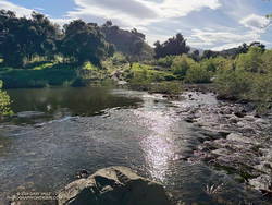
Crags Road Trail crossing of Malibu Creek - March 2024 (thumbnail)
Malibu Creek – the trail continues on the other side.

How did I find myself wading across Malibu Creek on this brisk March morning? I was doing a convoluted variation of the Phantom Loop, enjoying the Spring scenery, and going where the trails and terrain took me.

What is the Phantom loop? For me, it’s any loop that starts at the Cistern Trailhead on Mulholland Highway and ends at the Phantom Trailhead on the other side of the highway. Or vice versa. And since it’s a loop, it could start/end at any trailhead on or near the loop.

There are many ways to complete this loop. Here’s an interactive 3D-terrain view of the shortest version I’ve done (7.3 miles), and here is a longer variation (24 miles).
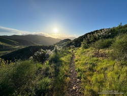
Rising sun on the Lake Vista Trail in Malibu Creek State Park. (thumbnail)
Lake Vista Trail

My run started on the Cistern Trail shortly after dawn. I’d run through Reagan Ranch and then up the Lake Vista Trail to the overlook for an early morning view of Malibou Lake. From the overlook, I’d continued east on the Lake Vista and Deer Leg Trails, enjoying the blooms of the Ceanothus, Hummingbird Sage, and bush poppy along the way.

Just before the Deer Leg Trail descends from the crest, I stopped at another overlook to take in Malibu Creek’s stunning terrain. From the viewpoint, I could see the coast redwoods along Century Lake. A few of the tall trees survived the 2011-205 drought and the 2018 Woolsey Fire, including one young naturally germinated tree. Now we’re in a rare wet cycle. The past two years are among the wettest on record for Los Angeles — good news for the remaining trees!

From the overlook of Malibu Creek, I ran down to the Yearling Trail, turned right (east), and in about a hundred yards was at the top of the Cage Creek Trail. I followed this short trail down to Crags Road and Malibu Creek.
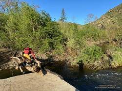
Improvised bridge across Malibu Creek. (thumbnail)
Runner crossing a makeshift bridge across Malibu Creek.

I thought there was a chance the seasonal bridge on the way to the M*A*S*H site might have already been reinstalled. It hadn’t, but a pile of limbs and logs spanned the gap across the creek.

From the matchstick bridge, I turned around and ran east on Crags Road, past the Cage Creek Trail and Century Lake, and then down the road to the junction of High Road and Crags Road.

When doing the Phantom Loop, I usually continue east under the oaks on High Road to the Grassland Trail. But this morning, in keeping with today’s theme, I headed across the bridge — in the direction of the Visitor Center — and looked for a sign marking the start of the Chaparral Trail.
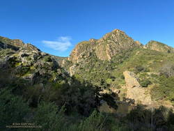
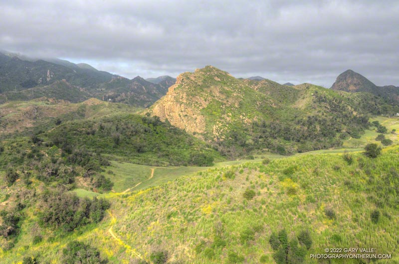
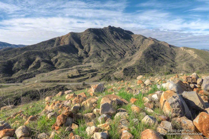
Goat Buttes and Planet of the Apes Wall from the Chaparral Trail. (thumbnail)
Goat Buttes and Planet of the Apes Wall from the Chaparral Trail.

Only about a half-mile long, this obscure trail starts about 60-70 yards northeast of the Visitor Center and links to Mott Road/Century Mtwy, near Crags Road. It has unique views of Planet of the Apes Wall, Malibu Creek, and Goat Buttes. When I reached the trail’s end, I turned left on the road and followed it to the flooded crossing on Crags Road.

Wading into a stream is always a bit awkward. I decided to follow a rocky shoal where the water was about calf deep. As expected, the rocks were rounded and slimy. I didn’t have poles and the footing wasn’t the best, but I managed to get across without incident.

In a few steps, I was headed east and back on the route of the “standard” Phantom Loop. In about a tenth of a mile, I forked left off the main road and onto the Grasslands Trail.

I’m always surprised how quickly the squishiness of wet running shoes and socks goes away. (Today, I was running in Hoka Challenger ATR 7s with Injinji socks.) By the time I reached Mulholland Highway, my shoes and socks had air-dried and felt more or less normal. Crossing Mulholland Highway, I walked east a few yards and continued north on the North Grasslands Trail to the Liberty Canyon Trail.

I hadn’t run far in Liberty Canyon when I came to the Talepop Trail. It had been a long time since I had done the Talepop – Grasslands (Las Virgenes Fire Road) Loop. The hills were green, the sun shining, and the temperature perfect for running. What better time than now to get on it again? With the cool conditions, I had plenty of water to do the extra three to four miles and wouldn’t have to make a side trip to De Anza Park.
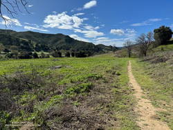
Las Virgenes Fire Road Trail (thumbnail)
Las Virgenes Trai/Fire Road

The loop was as pretty as I remembered it. Initially following an undulating ridge, the Talepop Trail eventually winds down to the grassy valley to the east and intersects Las Virgenes Fire Road. A left (north) turn here goes to De Anza Park; a right turn traverses classic oak grassland and leads back to the southern end of the Liberty Canyon Trail.

After completing the Talepop Grasslands loop, the remainder of the run followed the usual route of the Phantom Loop. It continues about 1.5 miles north on the Liberty Canyon Trail, but before reaching the trailhead, it jogs left (west), goes over Liberty Creek, and around to a short trail that connects to the Phantom Trail at a group of eucalyptus trees. My route in this area can be viewed by using our high-resolution, interactive 3D viewer and zooming in on the area near the Liberty Canyon Trailhead.
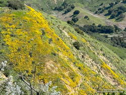
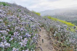
Hillside covered in wildflowers in Malibu Creek State Park
Hillside covered in wildflowers

The Phantom Trail goes west up a canyon and then turns south, eventually reaching Mulholland Highway near the Cistern Trailhead. Once out of the canyon, the main trail crosses a use trail several times, so care must be taken to stay on route. The use trail more or less follows the ups and downs on the crest of the ridge, while the main trail switches from one side of the ridge to the other, avoiding unnecessary elevation gains.

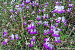
The last time I ran this segment of trail — October 2023 — it was VERY overgrown (video). This time, thanks to the work of SMMTC volunteers, nearly all of the trail had been cleared. Many colorful wildflowers were in bloom on this stretch, including Ceanothus, Encelia, Wishbone bush, California poppy, owl’s clover, and paintbrush.

Here are a few photos (and notes) from the trail run, including some of the wildflowers seen along the trail.

Some related posts:
Bulldog Loop Plus the Phantom Loop
Redwoods, Raptors, and the Phantom Loop
Malibu Creek State Park Scenic Loop

A Displaced Bridge, Exceptional Backbone Trail Views, and a Card Table Along the Bulldog Loop

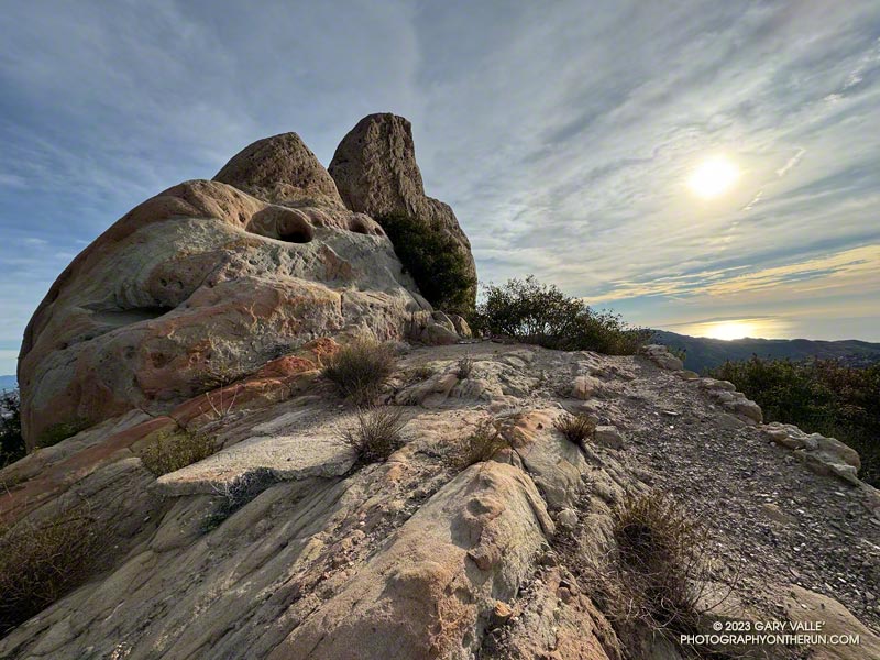
Rock formation along the Backbone Trail. Photography by Gary Valle'

The photograph above was taken a few steps off the Backbone Trail, between the Corral Canyon Trailhead and Mesa Peak Motorway fire road. Also in the area was a set of table and chairs that might be used for an ocean-view card game or a lunch break.

These scenes were about halfway through a variation of the Bulldog Loop that starts/ends at the Cistern Trailhead on Mulholland Highway. The route follows the Cistern, Lookout, and Cage Creek Trails down to the Crags Road Trail, just east of where it crosses Malibu Creek.

A permanent bridge used to span the creek, but after being washed out several times in Winter floods, a “seasonal” bridge was put in place. The seasonal bridge is removed when there is a threat of flooding, such as during the rainy season.

This morning, the temperature in the canyon was in the mid-thirties. That was cool enough that I didn’t want to get wet, and I hoped the removal of the bridge had been delayed. But several days of rain were in the forecast, and as I neared the creek, I could see the bridge now lay alongside trail.

A log spanned the creek where the bridge once stood. Using a suitable stick as a hiking pole, it was easy to cross the log, stay dry, and continue the loop.

Some related posts:
Best Trailhead to Start the Bulldog Loop?
Bulldog Loop Plus the Phantom Loop
After the Woolsey Fire: Bulldog Loop

Forest Run

Coast redwood along the Forest Trail in Malibu Creek State Park

The nasal bellowing of a bullfrog shook the morning, but didn’t disturb the mirror-like surface of Century Lake. I had paused along the Forest Trail in Malibu Creek State Park to take in my surroundings. Here and there glimmers of sunlight reflected from the base of the reeds along the opposite shore. Birds called, flowers bloomed and Nature continued to work in its wonderous way.

Canyon sunflower along the Lookout Trail in Malibu Creek State Park.
Canyon sunflower along the Lookout Trail.

My run had started at the Cistern Trailhead on Mulholland Highway and then wandered about the Reagan Ranch area. The Lookout and Yearling Trails had been thick with mustard and badly overgrown. The plants had been wet with dew, and my black sleeves and shorts had been liberally sprinkled with the bright yellow flowers. A few ticks had also hitched a ride, but were removed before they could bite.

It had been a relief to get back to the Cage Creek Trail and descend to the Crags Road Trail and Malibu Creek. The logs extending across the creek from the washed out bridge had been rearranged, making it easier to cross.

Log crossing across Malibu Creek on the Crags Road Trail, near the Forest Trail junction.

No other trail in the Park is quite like the Forest Trail. The trail isn’t part of a loop, doesn’t connect to other trails, and is only a half-mile long; but it feels like a trail you might find in Big Sur, Santa Cruz or the Bay Area. The forest is comprised primarily of coast live oak, California bay, and sycamore, but at several spots along the trail you’ll find coast redwoods.

Coast redwoods are not endemic to Southern California. All but one of the Forest Trail redwoods were planted over 100 years ago. The trees were severely impacted by the 2011-2015 drought, and only a few have survived. Even so, they are easy to spot — the large, deeply-furrowed, copper-brown trunk of a coast redwood is unmistakable.

Note: There is some poison oak along the Forest Trail, and this year some was protruding onto the trail.

Some related posts: The Malibu Creek State Park Redwoods Are Dying; Malibu Creek State Park Redwoods: Fighting the Drought; After the Woolsey Fire: Malibu Creek State Park Redwoods, M*A*S*H Site and Bulldog Climb

Dawn Songs, Wildflowers, and a Rocket Launch from the Phantom Trail

Sun and clouds in Malibu Creek State Park
Clouds & sun at Malibu Creek State Park, near the end of the Phantom Loop

I checked my watch — it was 6:13 a.m. I was part way up the Phantom Trail in Malibu Creek State Park, and had stopped to see if I could hear the launch of the Falcon 9 at Vandenberg Space Force Base.

I’d hoped to see the launch, but low clouds obscured the view skyward. Even so, there was a chance that a thin spot in the cloud deck might reveal the ship, as it propelled its classified payload into orbit.

All was quiet, except for the dawn songs of waking birds and the occasional car or motorcycle on Mulholland Highway. But then, just above the ambient sounds, I heard it — a constant dull roar somewhere to the west. I scanned the sky for any hint of an exhaust plume.

None was evident, but I suspect that if I had looked at the right spot at the right time, I might have glimpsed the rocket’s sun-bright flame. After searching and listening for a couple of minutes, I resumed working up the trail.

Phacelia along the Phantom Trail in Malibu Creek State Park
A sea of Phacelia along the Phantom Trail

Ka-boom! Even though my attention had turned to the trail, the distinctive, two-syllable report of a sonic boom broke my reverie. It had to be the Falcon 9 booster returning to the launch site. The boom wasn’t very loud at my location, but some living closer to Vandenberg apparently mistook the launch and sonic boom as an earthquake.

The remainder of the run went well. I’d run the Ahmanson 12K the day before, and the Phantom Loop (clockwise) was a good follow-up to that run.

I was a bit surprised just how overgrown some sections of the trail were. Mustard wasn’t the only plant crowding the trail, phacelia was as thick along the Phantom Trail as I’ve seen.

A showy patch of Chinese houses wildflowers along the Phantom Trail
Chinese houses along the Phantom Trail

With the cloudy, cool start to the day, the poppies were mostly closed, but several other species of wildflowers added color along the trail. Among them were Elegant Clarkia, Owl’s Clover and Chinese Houses.

Note: A little higher in the Santa Monica Mountains and farther to the west, Jonathan Stewart captured this video of the NROL-85 launch from Boney Mountain.

Some related posts: Phantom Trail: Trade-offs of a Wet Rainy Season; Redwoods, Raptors, and the Phantom Loop; Ladyface Via the Phantom Trail and Heartbreak Ridge

Ladyface Via the Phantom Trail and Heartbreak Ridge

Ladyface from Heartbreak Ridge, January 2022

The run up the Phantom Trail from Mulholland Highway and out Heartbreak Ridge is a fun adventure all on its own. When you first see Ladyface from the Phantom Trail, it seems like the trail isn’t going to go anywhere near the peak. But a series of ups, downs, and arounds does eventually get you to an overlook above the junction of Kanan & Cornell Roads. If you were to turn around at this point, the out and back would total a little over 8 miles.

Continuing down to Kanan Road and doing a counterclockwise loop on Ladyface — ascending the East/Northeast Ridge and descending the East/Southeast Ridge — adds another 3.5 miles to the route, and ups the adventure quotient a notch.

I first climbed Ladyface by this route in 2010 and have done Ladyface many times since. It’s a “real” peak with all the pros and cons that come with such a peak. The route isn’t always obvious, and some scrambling using the hands is required. Some sections of trail are steep, gritty and slippery. The quality of the volcanic rock varies. The knobby rock is fun to climb, but can break unexpectedly.

Even with the Ventura Freeway buzzing below the peak, the views from Ladyface are spectacular. A panorama of the Santa Monica Mountains extends from Saddle Peak in the east to Boney Mountain in the west. On the opposite side of the mountain, Hines Peak, Simi Peak and the San Gabriel Mountains fill the scene. On a day with good visibility, San Jacinto Peak can be spotted, far to the east.

Here are a few photos taken along the way, and an interactive, 3D terrain view of the GPS track of my route. The map can be zoomed, tilted, rotated, and panned. To change the view, use the control on the upper right side of the screen. Track and placename locations are approximate and subject to errors. Poor weather, and other conditions may make this route unsuitable for this activity.

Some related posts: Ladyface the Long Way, Ladyface After the Woolsey Fire, Ladyface Loop

Exploring the Lake Vista Trail and Ridge

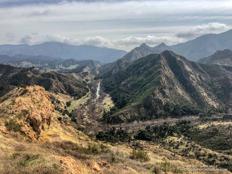
Malibu Creek, Goat Buttes and Century Lake from Lake Vista Butte

This morning’s running plan morphed from doing a loop I’ve done many times, to exploring a trail I hadn’t done, and hiking along a ridge to the top of a butte with a sweeping view of Malibu Creek State Park.

Lake Vista Ridge and Butte in Malibu Creek State Park

My run started at the Cistern Trailhead on Mulholland Highway. After descending the Cistern Trail, I picked up the Lookout Trail and headed west to the top of the Cage Creek Trail and the start of the Yearling Trail. Continuing on the Yearling Trail, I turned left (south) up the Deer Leg Trail, and continued west on the enjoyable, up-and-down single track.

I usually run the Deer Leg trail in the opposite direction and was a little surprised when I happened upon the Lake Vista Trail. How had I managed to run past this trail junction so many times and not notice it? Any trail with “Vista” in the name is worth exploring, so there was little choice but to turn onto the trail and see where it led.

Malibou Lake and Sugarloaf from Lake Vista Ridge

As it climbed toward an obvious ridgeline, the enjoyable single-track trail wound in and out of several small canyons. About 0.7 mile from the Deer Leg Trail junction, the Lake Vista Trail topped out at a very pretty overlook of Malibou Lake (not a typo). My watch showed the mileage to the overlook from the Cistern Trailhead was about 2 miles.

From the overlook an unofficial “use” trail worked back east along a broad ridge to the top of a prominent butte that has an unique exceptional of Malibu Creek, Century Lake and Goat Buttes. Because of the area’s volcanic origins, the use trail is rough and rocky in places, and the trail is not always obvious. It’s a little under a half-mile from the overlook to the summit of the butte. Even though it was Winter, I kept a wary eye and ear out for rattlesnakes.

Once back at the overlook, I made a loop of it by descending the Lake Vista Trail to the Reagan Ranch parking area, and then working back east on the Yearling and Lookout Trails to the Cistern Trail. Here’s an interactive, 3D terrain view of my GPS track of the run and hike.