Category Archives: trails|san gabriels

Mt. Wilson Trail Plus

Sunrise behind San Jacinto Peak from the Mt. Wilson Trail.

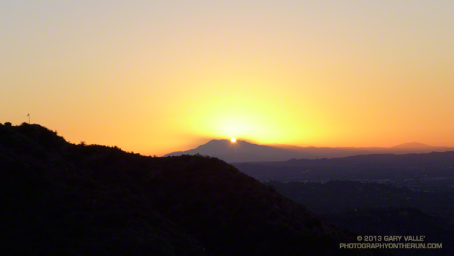
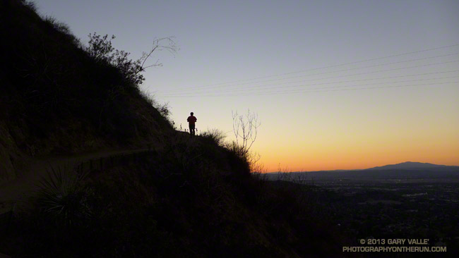
As I worked up the Mt. Wilson Trail the first flare of sunlight gleamed from behind Mt. San Jacinto. The entire mountain was backlit by the sun, an aura of sunbeams radiating from its ridges. It was about 7:15 and along with a few other hikers and runners, I was chugging up the well-used trail from its Mira Monte Avenue trailhead.

Other than going to the top of Mt. Wilson, I had no specific plan in mind. I’d see how I felt on top and then decide whether to run back down the Mt. Wilson Trail or do something longer.


The run/hike to the top is a little over 7 miles one way with an elevation gain of about 4700′. It’s a spectacular trail that works up rugged Little Santa Anita Canyon to historic Orchard Camp (about mile 3.5), and then climbs up to Manzanita Ridge and the Winter Creek Trail junction (about mile 5.4). Around mile 6 the trail joins the Mt. Wilson Toll Road for about a half-mile, then forks from it on the right, leading in another half-mile to the main parking lot at Skyline Park.

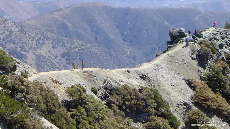
In addition to the original Mt. Wilson Trail there are four other trails that start/end at the top of Mt. Wilson: the Kenyon Devore Trail, Rim Trail, Sturtevant Trail and the Mt. Wilson Toll Road. Using these trails and interconnecting trails and roads a multitude of Mt. Wilson runs and hikes are possible.


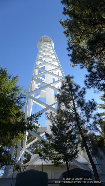
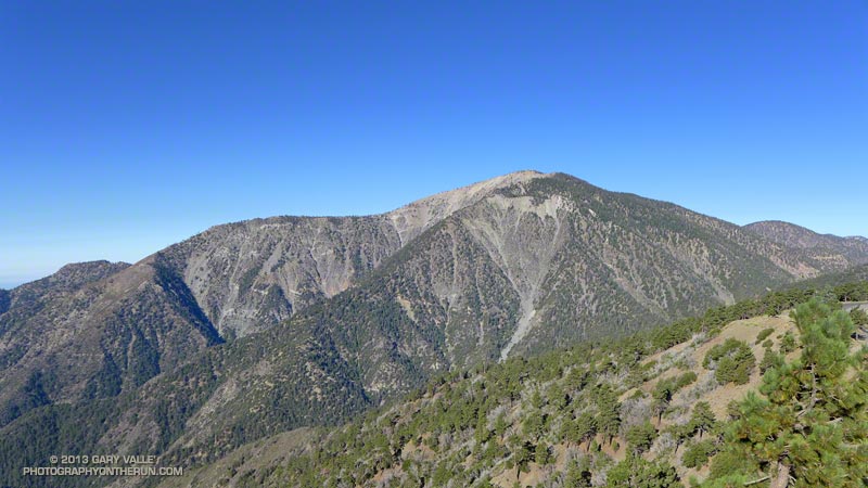
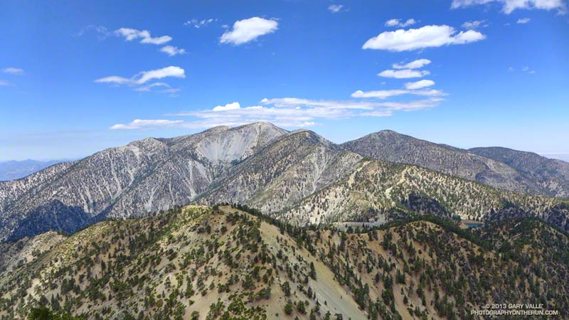
At around 9:30 I topped out at the Skyline parking lot and while filling my Camelbak at a water faucet pondered some options. I could just retrace my steps and run back down the Mt. Wilson Trail. That would be the simplest and would be nearly all downhill. Tempting. But the weather was Autumn perfect and the visibility at least 100 miles. It was early and there was plenty of time to do a longer outing.

I’d been toying with the idea of descending the Sturtevant Trail to the Mt. Zion Trail, taking that trail to Hoegees Camp, and then ascending the Winter Creek Trail back up to the Mt. Wilson Trail at Manzanita Ridge. Variations of this loop are popular and most often done from Chantry Flats.


I didn’t know what it would be like to do the loop from the Mt. Wilson Trail, but I had a pretty good idea. On the way up Wilson I’d peered down, down, down into the canyon ascended by the Winter Creek Trail. It looked like the climb out would add another couple thousand feet to an already stout tally.

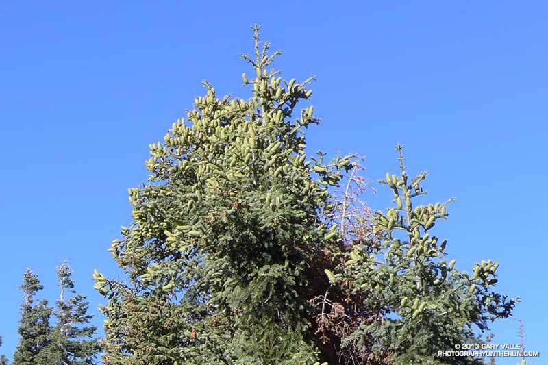
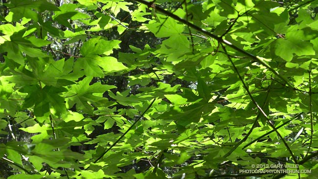
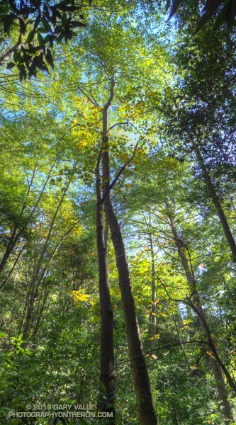
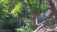
And it did! Overall the trails were in great shape and there were many miles of superb running. Near Sturtevant Camp at the Mt. Zion Trail junction (about mile 10.3) and continuing above Spruce Grove on the Mt. Zion Trail the forests of bigcone Douglas-fir, oak, alder and bay were so dense and shady I had to check if my sunglasses were still on.

The difficulty of the ascent of the Winter Creek Trail from Hoegees Camp (about mile 13) on tired legs was offset by the beauty of the canyon. At the top of the Winter Creek Trail, I jumped onto the Manzanita Ridge Trail, so that added a little extra gain. I was happy to finally see the bench at the Mt. Wilson Trail & Manzanita Ridge junction (about mile 15.4).


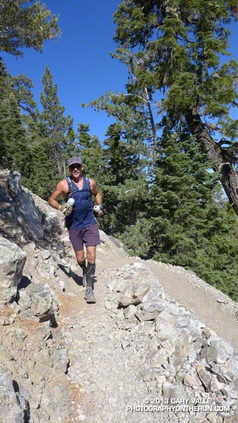
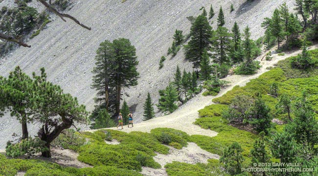
Although there are several places that a fall could “ruin your whole day,” the run down on the Mt. Wilson Trail is one of my favorite descents in Southern California. It’s generally not super steep and there are long stretches of relatively straightforward trail.

The run worked out to 20+ miles with an elevation gain/loss of about 7200′. Although a bit strenuous, it visited some of the most scenic areas found on Mt. Wilson.

More Highs and Lows on the PCT Between Inspiration Point & Islip Saddle

Young deer on the PCT on Blue Ridge in the San Gabriel Mountains

The trail run from Inspiration Point to Islip Saddle traverses a rolling section of the PCT along Blue Ridge, descends to Vincent Gap (6565′) and then climbs a switchbacking trail to the summit of Mt. Baden-Powell (9399′). The run continues along the crest of the San Gabriels on the PCT past several 9000′ peaks to Little Jimmy Spring and campground. From there it is a couple of miles to the parking lot in the saddle between Mt. Islip and Mt. Williamson.


A longer version of the run continues over the shoulder of Mt. Williamson to Eagles Roost. Many runners stop at Eagles Roost because of the now seven year (!) closure of the 3.5 mile segment of the PCT between Eagles Roost and Cooper Canyon. Continuing past Eagles Roost requires running 2.7 miles on Highway 2 to Buckhorn Campground, picking up the Burkhart Trail and following it down to the PCT in Cooper Canyon.


Today we were looking to do under 20 miles and keep the elevation gain to something sensible. Tim had run this stretch just a couple weeks before while doing the Angeles Crest 100 — his first 100 miler. Craig had crewed and paced a friend in the AC100 and was training for an upcoming 50 miler. Over the past several weeks I’d been doing a series of higher altitude runs and was also training for a 50 miler.

So far the run had been really relaxed and low key. We’d encountered a pair of young deer near Jackson Flat. They’d eyed us curiously before bounding off into the trees and the encounter seemed to have set the tone for the run. From time to time we stopped to enjoy a view point, look at the geology, or take a picture of a big ol’ tree. Rabbitbrush was blooming everywhere, adding a bright yellow accent to the rocks and ridges.


Earlier this year I photographed a bumper crop of cones on bigcone Douglas-fir in the Mt. Wilson area and here on Blue Ridge white firs had produced a huge number of cones. Other plants, such as bush chinquapin, had also produced large crops this year. Currant bushes along the trail had been productive, but because it has been so dry the fruit was smaller than normal.


The demeanor of the run changed part way up Baden-Powell. Mt. Baden-Powell is an immensely popular peak, and on a Summer weekend you’ll find an assortment of youth groups, fitness groups, hikers, runners and on rare occasions even an equestrian or two.

I stuffed another just-discarded nut bar wrapper into the back of my pack. That was a bad sign, and about two-thirds of the way up the peak things got a little crazy. The switchbacks above looked like escalators in a mall during the Holidays. People going up; people going down; people cutting switchbacks. A lot of people cutting switchbacks. At one point it seemed more people were short-cutting the trail than were on the trail.

Request: “Please don’t cut the trail…”

Response: “I figure Indians hiked all over this mountain; it’s my choice where I hike…”


0
The mindset of the people that throw trash on the trail and shortcut the trail is much the same. They just don’t care. They don’t consider that someone else is going to have to clean up their mess. A person that shortcuts a trail doesn’t realize several other people — usually volunteers — are going to have to repair the damage. Cutting switchbacks causes erosion, tramples plants and looks ugly. It tells others that you are unfit and inexperienced.

A couple of switchbacks above the chaos settled, and when two young boys cut a switchback just ahead of me it was heartening to hear their father explain why that was a bad idea.


The summit of the Baden-Powell was not nearly as busy as I thought it might be. Just a few people were enjoying the great view from the summit. We took a short side trip down the south ridge to look at a lodgepole pine whose limbs and bark had been torn off in an ice storm during the Winter of 2010-11. In the same area was a stout limber pine that has a scar from a lightning strike. Later in the run we would pass another lightning tree near Mt. Hawkins.

The last several miles of the run were as relaxed and low key as the first few miles. Recovery continues among the ghost trees in the area burned in the 2002 Curve Fire, and the water and wildflowers at Little Jimmy Spring were as refreshing as ever!

Some related posts: Highs and Lows on the PCT, Inspiration Point to Islip Saddle Trail Run, PCT from Inspiration Point to Islip Saddle

Mt. Baldy Take Two

Runners on the trail to Telegraph Peak

What better place to be running on a hot July day in LA than the highest point in Los Angeles County — Mt. Baldy! Last Saturday I’d done the Ski Hut loop on Mt. Baldy (officially Mt. San Antonio), and today I was doing another variation of the loop, this time with Skye and Ann.

Note that I use the term “with” here somewhat loosely. They’ve been training for the TransRockies Run this August, and putting in a lot of time and miles on the trails. How much? Today’s run was just part of a 90+ mile, 22,000′ gain week for Ann.

Even though both of them had done hilly 23-24 mile runs the day before, I still had to try and find ways to slow them down:

“You know the route-finding on the next section of trail is a little tricky…”

or

“Let me get a little ahead so I can get a photo of you guys coming up the trail…”

or

“I’m not sure I got that rock out of my shoe. Can you guys hang on for a second…”

or

“Pleaseee slooow dooownn…”


On the way up we did a variation of the Ski Hut/Baldy Bowl Trail that goes to the site where two Grumman F6F-5N Hellcat fighters crashed in a snowstorm March 21, 1949. Seeing the wreckage was a somber reminder of just how unforgiving mountain weather can be. It also brought to mind the image of a similar big-engined, vintage, single-prop fighter doing a spectacular, banked, high speed pass (just) over the summit of Mt. Baldy not long after I’d crossed the Run-to-the-Top finish line a few years ago. Today there wasn’t going to be a problem with the weather, or for that matter, anything else.

After topping out on Baldy we ran over to West Baldy and back, and then continued down the Devil’s Backbone Trail to the Notch. The running from the Baldy-Harwood saddle down to and along the Devil’s Backbone is scenic and technical, and just about as good as mountain trail running gets.

We refilled our hydration packs at the Notch restaurant and then continued on to Thunder Mountain and Telegraph Mountain. The view of Baldy from Telegraph was excellent and it was easy to see Baldy Bowl and the route of the Ski Hut/Baldy Bowl Trail. We’d already done most of the 6000′ of elevation gain we would do today, and about 3000′ of the loss. Now on the 6.5 mile descent from Telegraph to Manker Flat we’d get to do the other 3000′.

Here are few additional photos from the run. Click the image for more info and a larger image.


Near the Top


Descending Baldy


Above Harwood Saddle


Devil’s Backbone


Devil’s Backbone


Baldy Peaks

Mt. Baldy Ski Hut Loop

Hikers on the summit of Mt. Baldy

As might be expected on a holiday weekend, it was busy on Mt. Baldy. Hikers and runners were doing the peak by all the regular routes — the Ski Hut/Baldy Bowl, Devil’s Backbone, Bear Canyon/South Ridge and North Backbone trails.


I did a variation of the Ski Hut loop. This loop starts at Manker Flat (about 6160′) and ascends Mt. Baldy (10,064′) via the Ski Hut/Baldy Bowl Trail and then descends the peak using the Devil’s Backbone Trail and ski area service road. Along the way I also ran over to West Baldy (9988′) and Thunder Mountain (8587′). This variation is about 14.5 miles with 5000′ gain/loss vs 10.5 miles and 3900′ gain/loss for the basic loop. If you throw in Telegraph Peak, it adds another 3.5 miles and 1000′ of gain/loss.

The weather was spectacular with just enough clouds to make the sky interesting. Temps were comfortably cool on top, and although warmer down at the Notch, OK for running over to Thunder.

Some related posts: Back to Baldy, Mt. Baldy Run Over the Top, South Ridge Relic, Up & Down Mt. Baldy’s South Ridge

Three Points Loop Twice

Ann and Skye on trail 10W04, between Mt. Waterman and Three Points

Did the 20 mile Three Points – Mt. Waterman Loop a couple of times this month. The first time was during a heat wave similar to what we’re going through now. It was one of those days when you drive to the trailhead early in the morning, open the car door, and the “brisk” mountain air is a surprising 75 or 80 degrees. After doing the run I checked the temperatures recorded at nearby Chilao, and by 9:00 a.m. the temperature was already at 90°F.


The title photo is of Ann and Skye on trail 10W04, between Mt. Waterman and Three Points. Here’s another photo of them in an area covered with bracken fern on a section of the trail that burned in the 2009 Station Fire. It doesn’t look like it, but they are on a trail!

Last weekend I did the loop again, and the temperature was about 15 degrees cooler. What a difference!

Some related posts: Three Points – Mt. Waterman Loop, Southern Pacific Rattlesnake on the Burkhart Trail, Three Points Loop Plus Mt. Waterman

Gabrielino Green

Big leaf maple leaves along the Gabrielino Trail

A soothing panoply of big leaf maple leaves along the Gabrielino Trail between Devore Camp and West Fork.

From last weekend’s Mt. Wilson – Devore Camp – West Fork trail run.

Some related posts: Mill Creek Canyon Maple Leaves, Maple Leaves Along the Ritchey Canyon Trail, Big Leaf Maple Leaves