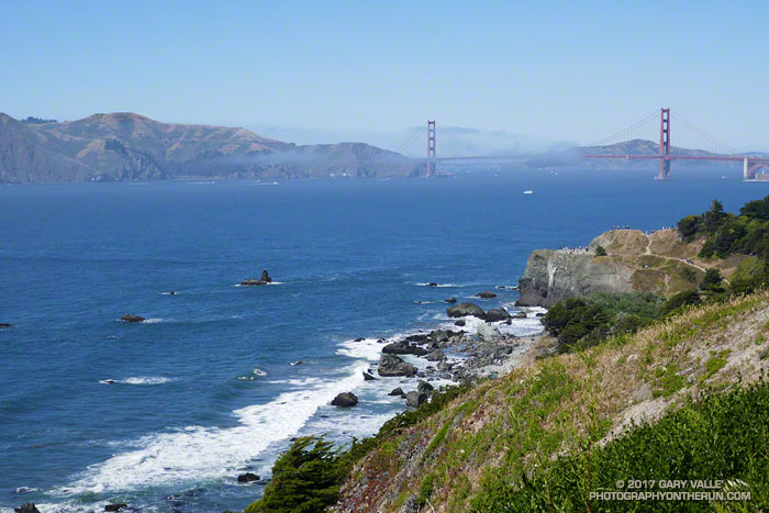
It was a warm day by San Francisco standards — sunny and in the seventies. We’d planned to go “across the bridge” for today’s run, but with the great weather it seemed half the city’s residents and visitors were queued up on the streets leading to the Golden Gate Bridge. We opted for a run in the city instead.
This was not an inferior alternative. Running in the city is fun; there are many options and much to see. Today’s course took us from Industrial Light & Magic, to Mountain Lake, Land’s End, Sutro Heights, Ocean Beach and Golden Gate Park.
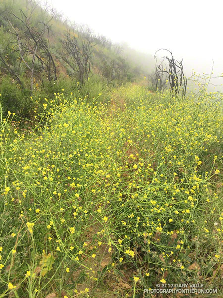
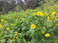
I was covered with bright yellow mustard petals and soaked from head to toe. It had been raining, and I’d just wrestled my way through another tangle of 10 foot high mustard plants. On some parts of the Old Boney Trail the mustard was so thick it was almost impenetrable. The pestilent species becomes especially prolific in wet years, growing rapidly and overwhelming native species and habitats.
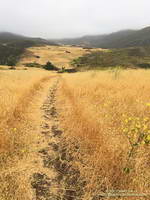
After turning onto the Serrano Valley Trail and climbing up to the overlook of Serrano Valley the trail wasn’t quite so overgrown — at least I could run. In the grasslands below the greens of the rainy season were gone, replaced with the straw-colored hues of dried grass gone to seed.
Serrano Valley
Like mustard, foxtails are bad this year. In recent weeks I’ve picked a multitude of the barbed grass seeds from my socks and shoes. Today, I’d worn ankle gaiters hoping to ward off the expected seed-storm in Serrano Valley. The seed-storm turned out to be more of a seed-shower, but the gaiters did help.
Part way through Serrano Valley I happened on a hiker, coming up from Serrano Canyon. We said hi to each other and then after he passed, he turned around and dramatically exclaimed “Don’t go down Serrano Canyon!!”
What?? Were there ogres down there? He’d obviously made it through the canyon OK. All limbs were intact and I didn’t see any cuts or bruises. I quickly ran through the possibilities and rejected most of them. One possibility that seemed plausible was that the trail had been washed out.
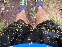
Covered in mustard petals.
One of the reasons I was doing this run was to see how Serrano Canyon had fared during the February 17 atmospheric river event. I’d seen the damage caused by high flows in Blue Canyon and Upper Sycamore Canyon. This was the first chance I’d had to investigate Serrano Canyon since the flooding, so the hiker’s warning had the opposite of its intended effect — it just made me more curious about what was going on in the canyon.
All the way down the canyon I kept an eye out for X-Files monstrosities, but saw none. Serrano Canyon did not appear to have had as severe flooding as Blue Canyon and Upper Sycamore Canyon. Some sections of the trail were very overgrown and a short section of the trail was partially washed away, but with care and a bit of mustard-whacking the trail was passable.
Canyon Sunflowers
I’d had my fill of mustard and was happy to reach the dirt road in Big Sycamore Canyon. I returned up canyon using a combination of Big Sycamore Canyon Road and the Two Foxes Trail. This was much more straightforward than Old Boney and it took only about an hour to reach the Upper Sycamore Trail.
The two hikers stopped on one side of the broad chute and I stopped on the other. We were on the Pacific Crest Trail about a half-mile from Little Jimmy Campground and had paused to put on micro spikes before crossing the icy slope. It was the same chute that had been so unnerving for a couple hiking down from Little Jimmy on a chilly morning two weeks before.
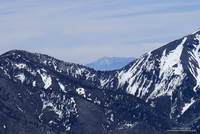
Mt. San Jacinto from Mt. Baden-Powell. Click for a larger image.
After the hikers crossed we chatted for a moment about the snow. They were doing the PCT and I asked them what gear they used on Fuller Ridge — an infamous section of the trail on Mt. San Jacinto. They said they’d used micro spikes and ice axes. The segment had gone well, but at one point it had taken them four hours to do two miles!
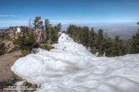
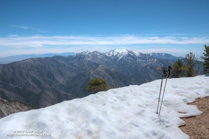
It’s not often there’s this much snow in April in the mountains of Southern California. After venturing to Mt. Hawkins a couple of weeks ago, I had wanted to get back to the San Gabriels and check out the snow on the higher part of the crest between Mt. Burnham (8997′) and Mt. Baden-Powell (9399′).
Mt. Burnham (near) and Throop Peak (behind) from just west of Mt. Baden-Powell.
The photo on the left is a view west along the crest from the shoulder of Mt. Baden-Powell to Mt. Burnham and Throop Peak. Strong, southerly winds that accompany Winter storms blow from left to right across the crest, depositing extra snow in the wind-shadowed lee of the ridge. Snow accumulates along the ridge in dense, deep drifts, which in a big snow year can persist well into Summer.
Snow at 9100′ along the crest just west of Mt. Baden-Powell.
The PCT between Mt. Baden-Powell and Throop Peak generally follows along the crest, tending to the north (right) side of the ridge and detouring around Mt. Baden-Powell and Mt. Burnham on their north slopes, and around Throop Peak on its southeast side.
Today, I stayed more or less on the crest between the summit of Baden-Powell and the PCT’s junction with the Dawson Saddle Trail, using the trail and snow where possible, but avoiding big drifts and steeper snow slopes. Between Throop Peak and Islip Saddle I stayed on the trail, and used micro spikes in a couple of places.
Lower elevation snow is melting relatively rapidly, but snow on the north-facing slopes at higher elevation could be around for weeks. Some patches and drifts may last into June or July. We’ll see!
On the summit of Baden-Powell I pondered Mt. Baldy and thought about Sam and his love of the outdoors and Mt. Baldy. His effusive spirit will linger there always, and we’ll smile when we encounter it.
When I emerged from Garapito Canyon my shoes, socks, shorts and shirt were soaking wet. A group of hikers were nearby and one asked if it rained while I was down in the canyon. It hadn’t, but it might as well have.
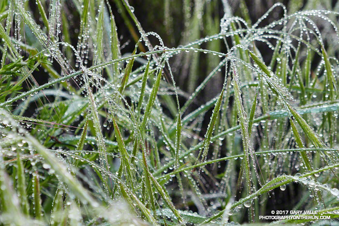
Our wetter than normal rain season has produced a lush crop of annual grasses — some as tall as waist high — that have overgrown sections of many local trails.
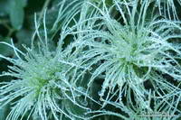
Water droplets on the feathery styles of Chaparral Clematis.
Overnight, light rain had coated every blade of grass and every leaf and limb of brush along the Garapito Trail with water droplets. Running through the wet grass was like passing through the wet brushes of a refrigerated car wash.
I happened to be wearing Gortex-lined running shoes, which was laughable considering the amount of water that had run down my legs and into the shoes. They were just as wet as if I had waded through a creek. Well-fitting gaiters might have helped, and at least would have kept the foxtails out of my saturated socks.
Seasonal snowfall in the mountains of Southern California is inconsistent at best. According to Tony Crocker’s Your Guide to Snowfall, in the past 20 years SoCal snowfall has ranged from a record high of 267 inches during the strong El Nino of 1997-98, to a low of 29 inches in 2013-14 during our prolonged drought.
Snow-covered slopes from the PCT near Little Jimmy Spring.
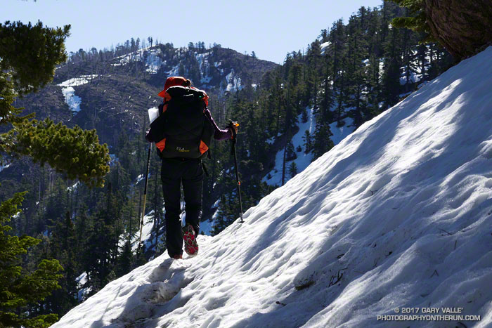
So far this season, Your Guide to Snowfall’s total for SoCal is 143 inches, which is a bit above average and far more than we’ve had in recent years. After seeing the amount of snow on the higher peaks of the San Gabriels from Mt. Waterman a couple weeks ago, I was curious to see what the conditions were on the PCT between Islip Saddle (6650′) and Mt. Baden-Powell (9399′).
Joining me on today’s adventure was Patty Duffy. An avid outdoorsperson and ultrarunner, Patty did the JMT last year, and will soon be embarking on an epic border-to-border journey on the Pacific Crest Trail. Epitomizing the “hope is not a strategy” approach to challenges, today she was using much of the gear she would be using on the PCT — and in addition — carrying a sleeping bag, tent, stove and two days food!
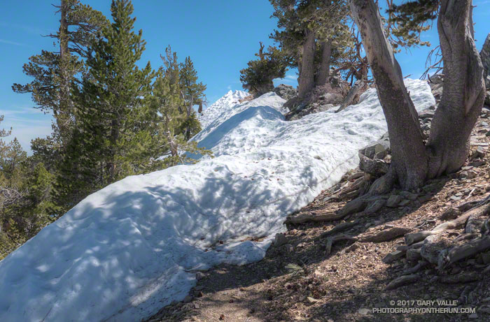
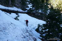
Icy stretch of snow on the PCT at 7100′, about 0.7 mile from Islip Saddle.
Even though we started an hour later than normal, and temperatures had warmed the past couple of days, the snow on the shaded, north-facing slopes was still icy. Two hikers on their way down from Little Jimmy had trouble crossing one slippery slope. They had no crampons or micro-spikes and threw dirt on the snow to get by. It was obvious when we reached the area they described – a northeast facing gully. The slope was steep enough that a fall would have been very serious. Steep slopes, chutes and gullies are common along the trail between Islip Saddle and Baden-Powell.
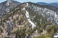
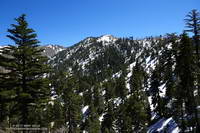
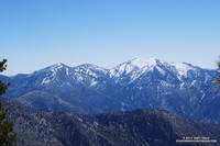
Pine Mountain, Dawson Peak and Mt. Baldy from near Mt. Hawkins.
The question of what is appropriate gear for hiking an icy trail in this kind of terrain doesn’t have a simple answer. Boots, “real” crampons, and an ice axe provide a lot of security when crossing a steep, icy slope; but many other combinations of footwear, traction devices, poles, and self-arrest tools are commonly used. Conditions can rapidly improve or deteriorate and equipment can fail. Whatever combination of equipment is selected it’s important to understand its use and limitations.
After reaching an elevation of about 8000′, we stayed on the crest all the way to Mt. Hawkins (8850′) and the Mt. Hawkins lightning tree. The ridge route had the advantage of being mostly snow-free, but in places is quite rocky and steep. There are also a number of downed trees scattered across the ridge — vestiges of the 2002 Curve Fire.
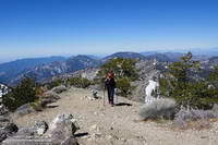
Patty on the summit of Mt. Hawkins (8850′).
In middle of Winter in 2014 there was so little snow on the PCT between Islip Saddle and Mt. Baden-Powell it was possible to run to Baden-Powell and back, do Mt. Hawkins, Throop Peak and Mt. Burnham along the way, and be back to Islip Saddle in the early afternoon. Not today. Winter’s storms had left more of the trail snow-covered than snow-free — and not with just a little snow.
A little beyond the Hawkins – Throop Peak saddle we stopped at a sunny, wind-protected spot with a nice view of Mt. Baldy for a few minutes, and then headed down. The snow conditions had improved considerably, and at one point we glissaded down a short slope.
It had been another outstanding day in the mountains, and I could only sigh, thinking of the many great days and experiences that Patty would have on the Pacific Crest Trail.