Category Archives: weather|southern california

Backbone Trail Training 2014 – Kanan to Mishe Mokwa to Wendy Drive

Backbone Trail Ultra Training Run #2 2014

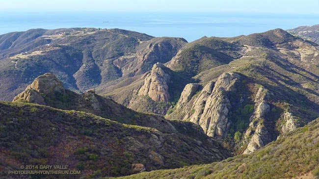
Rock Formations Along Wet Fork Arroyo Sequit from the Backbone Trail

The Coyote Backbone Trail Ultra was one of the most enjoyable runs I did last year. The low key approach with the emphasis on the experience rather than the clock was the perfect fit for my first 100K+ run. To be able to run the entire Backbone Trail with great support, company and entertainment was fantastic.

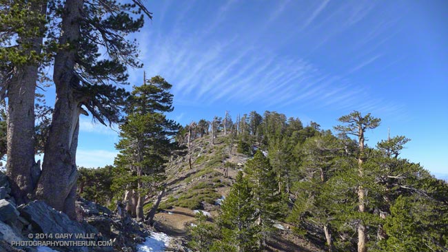
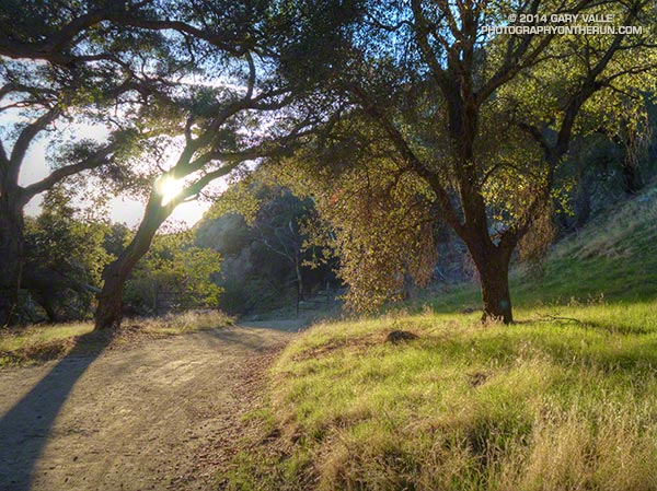
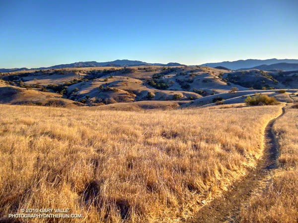
Today’s run — the second of four 2014 Backbone Ultra training runs — was from Kanan Road to the Mishe Mokwa trailhead near Circle X. This approximately 15 mile segment is one of the most scenic on the Backbone Trail with expansive views and superlative sections of single track trail. The 850′ climb from Encinal Canyon to Etz Meloy Motorway is so well-graded you (almost) don’t realize you’re gaining elevation.

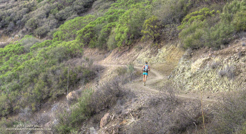
I was looking to get in some extra mileage and it turned out running cohort Ann Ongena was as well. Ann was marking the course for the training run, so the plan was to do the Kanan to Mishe Mokwa segment and then continue from Mishe Mokwa another 13 miles or so to the Wendy Drive trailhead in Newbury Park.


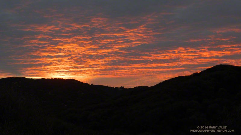
A little before dawn Backbone Ultra RD Howard Cohen dropped us off at the Kanan Road trailhead and then headed back to Mishe Mokwa to coordinate the training run. The temp at the trailhead was around 60 degrees, which is about 30 degrees warmer than last year’s frosty training run on this segment.

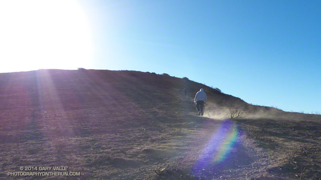
For some reason my GPS watch was a little slow to sync with the satellites, and while I waited Ann was already busy on the trail. Course markings don’t have to be numerous or obtrusive to be effective. The few markers she would place would be removed by Tres when he swept the course.


The run from Kanan to Mishe Mokwa went well. As has been the case too often this Winter, the weather was nearly ideal for running. Last year at this time Downtown Los Angeles had recorded 4.35 inches of rain for the water year (since July 1). That was well below average. This water year to date we’ve only recorded 0.97 inch of rain — a meager amount and less than in the record driest water year of 2006-2007.

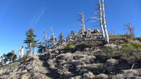
On this run and all the runs I’ve been doing this Winter I’ve been looking at how the chaparral plants deal with drought. Generally, they reduce their water needs by not flowering, remaining dormant, dropping leaves, producing much smaller leaves, folding or rolling their leaves and in other ways. Some annuals simply don’t germinate. Some plants such as chamise, with its needle-like leaves, deal with drought well; others such as bush monkeyflower are barely recognizable.


As I reached the high point of the Yerba Buena segment of the BBT above Mishe Mokwa and Circle X I vividly recalled being there during last year’s Backbone Ultra. It was about 9:30 at night and I had been running for 15 hours. I could see the lights of the aid station in the valley below and then heard — or thought I heard — cheers for a runner reaching the aid station. Although barely audible, those cheers picked up my spirits as much as they did the runner reaching the aid station!

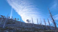
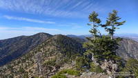
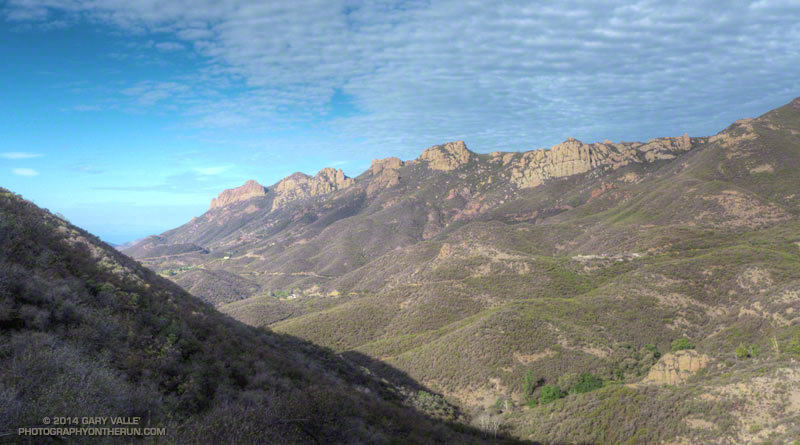
I didn’t hear any shouts from Mishe Mokwa this morning, but the thought made me smile. Overhead the layer of clouds which had been with us most of the morning was beginning to dissipate, and the temperature was beginning to climb. Across the valley Boney Mountain’s iconic rock formations stood in relief against a mackerel sky and I stopped a couple of times to photograph the scene.


At Mishe Mokwa we enjoyed the fare at Howard’s & Victoria’s rolling aid station and relaxed for a few minutes as a large group of hikers assembled and then started up the trail.

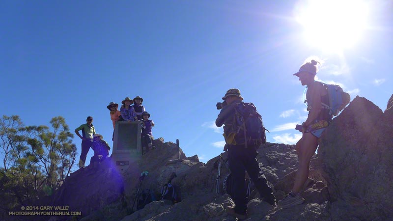
When marking a course it’s preferable that when the main group finishes the run the course-markers be comfortably ensconced in folding lounge chairs, an IPA in hand, sweat-free and looking as they have been there for hours. With more miles to cover I substituted a soda for the IPA and after about 10 leisurely minutes we followed in the hiker’s footsteps and continued up the Backbone Trail to a busy Sandstone Peak — the highest peak in the Santa Monica Mountains.

After spending a few minutes on the summit of the popular peak we worked over to the west junction of the Tri Peaks Trail, then down the Chamberlain, Old Boney and Blue Canyon trails to Sycamore Canyon. Here we left the Backbone Trail and enjoyed a little easy running up Sycamore Canyon to the Upper Sycamore Trail. Upper Sycamore ends at Danielson Road, which we followed to Satwiwa and trails that connect to Wendy Drive.

Some related posts: Backbone Trail Training 2014 – Stunt to Kanan, Backbone Ultra – Training Run #2 (2013), Backbone Ultra 2013

Mid January Trail Run from Islip Saddle to Mt. Baden-Powell

Mt. Burnham from the PCT in the San Gabriel Mountains, near Los Angeles
Mt. Burnham from the PCT
It’s been warm in Southern California. Thursday Bob Hope Airport reached a high of 90 degrees and it seems every couple of days another high temperature record is broken or one SoCal city or another is the hottest spot in the nation.
Not only has it been really warm, it’s been really dry. Downtown Los Angeles recorded only 0.2 inch of rain in December and not a measurable drop of rain has fallen so far this January. We already set the record for the driest calendar year, and at the moment we’re vying for the driest water year on record.
The PCT just west of Mt. Hawkins during the unusually warm and dry Winter of 2013-2014.

The PCT just west of Mt. Hawkins. January 18, 2014.

The unusually warm and dry weather made me wonder what the conditions were like in the Angeles high country. Might the PCT be runnable between Islip Saddle (6650′) and Mt. Baden-Powell (9399′)? As warm and as dry as its been, how much snow could there be?

At Islip Saddle there was very little snow. Here and there tiny remnants hid under the snowbush, but for the most part the north slopes of Mt. Islip looked more like July than January.


I encountered the first larger patches of snow and ice in the deeply shaded corners of trail before Little Jimmy Campground and Spring. It was easily traversed, but reminded me of November runs on San Jacinto Peak and San Gorgonio Mountain, when early season snow had melted and refrozen, turning sections of trail into a skating rink.
The thing is, it doesn’t take a lot of snow to transform a straightforward trail run into a slip and slide adventure, especially when the snow is icy. As warm as it was in the sun, several sections of the PCT between Islip and Baden-Powell never see the sun in Winter and were surprisingly cold. Even if it was 80-something degrees in the lowlands.


In this case if you wanted to bypass most of the snow patches you could do that by following the crest. On the way to Baden-Powell I tried to stay on the trail to see what sections were clear.  On the way back I climbed Mt. Burnham, Throop Peak, Mt. Hawkins and a couple other peaklets, so stayed on the crest.
Here’s a very short video (under 2 minutes) that will give you an idea what the conditions were like.

You Can Run From the Wind, But You Can’t…

Strong winds on Mugu Peak

Offshore wind events have been frequent this rain season. They often follow “inside slider” systems that miss Southern California and take a more inland track over the West. The result is more wind and less rain.

Los Angeles wrapped up calendar year 2013 with the least amount of rainfall on record. When talking about rainfall in Southern California it is more common to refer to the “rain year” which runs from July 1 to June 30.  (The water year was changed to October 1 to September 30,)

So when was the driest rain year in Los Angeles? It was just a few years ago, in 2006-2007 when only 3.21 inches of rain was recorded. It was also driest water year on record with only 3.73 inches of rain.

There were also many wind events in that dry rain season, and like this January not a lot of green in the hills. To date we have had less rainfall this water year than in 2006-2007!

For the most part this Fall and Winter I’ve been able to work around the wind events and do runs that more or less escaped the wind. I thought that was going to be the case again today. The predicted offshore event seemed to be behind schedule and when I left for the Wendy Drive trailhead there wasn’t much wind.

There were stirrings of an offshore breeze at the trailhead and I commented to a hiker that I hoped the winds would hold off until later in the day. The plan was to do the out and back run from Wendy Drive to Mugu Peak. Because of the myriad of route choices, this is a fun run to do as a time challenge. What is the fastest route? Try it and see.

Things looked good all the way down Sycamore Canyon and into La Jolla Valley, but the wind started to pick up as I worked toward Mugu Peak.

Once on the peak it was like flipping a switch on a wind tunnel! I was ahead of my PR to the peak by several minutes and I was trying to push the pace. That was not happening and several times I had to pause and put a hand down as I staggered in the middle of a big step.

I caught up to a couple of people just before the final steep push to the summit. The wind flow was not as turbulent and gusty here and one of them started to run. With each stride the dust streaked from his shoes. I stopped to take some photos and this short video clip.  The smoother winds didn’t last for long, and neither did the running.

Mugu Peak’s next door neighbor to the west, Laguna Peak, has recorded a wind gust of 125 mph. In this photo from Boney Mountain Mugu Peak is on the far left and Laguna Peak has the communications equipment on the summit. Today I’d estimate the strongest gusts on Mugu Peak were in the range of 50-60 mph. The winds were strong enough that the sewn end of a fluttering strap was like a whip and just as capable of raising a welt.

I spent zero time on the summit and was very happy to get back down to La Jolla Valley.

Some related posts: Wendy Drive – Mugu Peak Challenge, La Jolla Valley & Mugu Peak from Wendy Drive

When It Used to Rain in Southern California

Remember when it used to rain in Southern California? This is from a run at Ahmanson Ranch on January 6, 2005.

The 15 days from December 27, 2004 through January 10, 2005 were the wettest 15 consecutive days in downtown Los Angeles since record keeping began in 1877. Los Angeles would go on to have the second wettest water year on record, with 37.25 inches of rain for the period July 1, 2004 through June 30, 2005.

So far this water year — since July 1, 2013 — Downtown Los Angeles (USC) has recorded only 0.97 inch of rain!

A Little Green in Las Llajas Canyon

Las Llajas Canyon, in the eastern Simi Valley

Not everywhere is parched and brown in moisture-starved Southern California. There are a few places that have slurped up a few extra raindrops and are turning green.

This patch of green is in Las Llajas Canyon, in the eastern Simi Valley. Judging from the green growth and dried mud on the road in the upper part of the canyon, there must have been some extra rainfall here. There was even some water in one section of the creek.

Las Llajas Canyon is part of the 50K & 30K courses in the Bandit Trail Runs coming up February 16, 2014 at Corriganville Park in Simi Valley, CA.

Note: The Bandit Trail Runs event is now Rocky Peak Trails.

Some related posts: Bandit 50K 2013 Notes, Las Llajas Longhorns, Chumash-Las Llajas Loop

Driest Year on Record in Los Angeles

Driest Year on Record in Los Angeles

2013 will go on record as the driest calendar year in Los Angeles since recordkeeping began in July 1877.

Downtown Los Angeles (USC) has recorded only 3.60 inches of rain since January 1, breaking the record of 4.08 inches set in 1953 and 1947. Downtown Los Angeles averages about 15 inches of rain in a calendar year.

For more info see my post on Southern California Weather Notes.