Tag Archives: boney mountain

Which Stretch of the Backbone Trail Has the Longest Uninterrupted Descent and Most Elevation Loss?

Runners descending the Backbone Trail pass Chamberlain Rock.

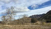
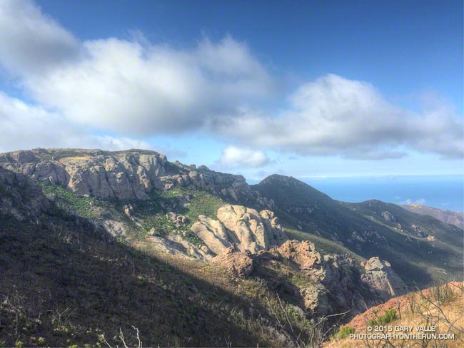
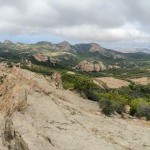
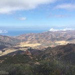
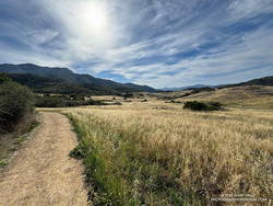
It’s a section of the westbound Backbone Trail that starts two miles west of Sandstone Peak and continues down the Chamberlain, Old Boney, and Blue Canyon Trails to the Danielson Multi-Use Area and Big Sycamore Canyon Fire Road. At the point where the trail turns south on the fire road, it has dropped about 2400 feet in 4.8 miles. Continuing south on the fire road, the Backbone Trail gradually descends another 100 feet over a mile and a half until it starts up the Wood Canyon Vista Trail.

What about the long downhill between Saddle Peak and Malibu Canyon? That would be a contender if it weren’t for a gradual uphill that starts a little east of the Piuma Road crossing. It gains about 180 feet over 0.8 mile. If that break in the downhill is ignored, then the stats for the two descents are similar.

Boney Mountain from Satwiwa.

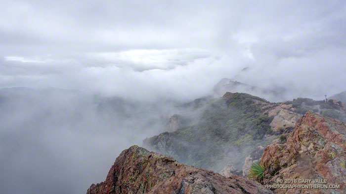
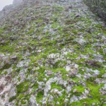
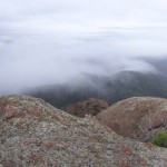
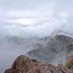
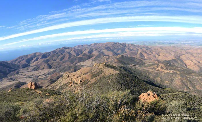
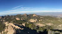
This morning, I did the Backbone Trail segment from Sandstone Peak to the Danielson Multi-Use Area as part of a loop from the Wendy Drive Trailhead on Potrero Road in Newbury Park. Including the optional side trip to Sandstone Peak, the loop totals about 18 miles with around 4000′ gain/loss.

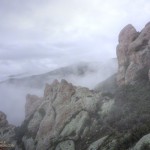
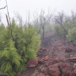
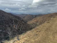
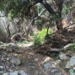
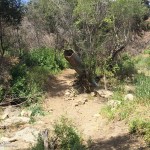
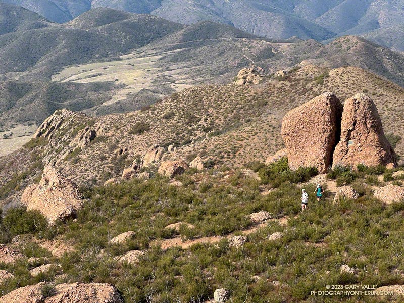
Fires and heavy rain the past decade have taken their toll on the Backbone Trail and other trails in the Santa Monica Mountains. Today, except for a short stretch near Chamberlain Rock, most of the long downhill was in decent shape and enjoyable to run.

Here’s an interactive, 3D terrain view of a GPS trace of my route. The eastern ridge route is also shown. The map can be zoomed, tilted, rotated, and panned using the navigation control on the right. Track and placename locations are approximate and subject to errors. Poor weather and other conditions may make this route unsuitable for this activity.

Some related posts:
Not So Busy Sandstone Peak
Looking for Boney Mountain
Backbone Trail Mystery

You Can’t See Far in a Cloud

Clouds along the crest of the Santa Monica Mountains near Sandstone Peak

For the most part the upper layer of clouds had been above Boney Mountain. Thin wisps of cloud had clung to the ridges in a couple of places, but the ceiling looked like it was going to remain above the peak.

But then something unusual happened. A lower deck of clouds formed in the Conejo Valley, and then expanded upward, enveloping me as I worked up Boney’s Western Ridge. It wasn’t a whiteout, but in places the visibility was reduced to about twenty feet.

Fog changes the mood and character of a place, particularly a place where airy views and an expansive mindset are the norm. Thoughts turn inward and perceptions more narrowly focused. The big picture becomes entirely virtual.

Earlier in the week the area had been drenched by more than two inches of rain. It had been damp overnight and water filled the profusion of irregular pockets covering the volcanic rock. The rock was plastered with a patchwork of bright green moss and gray-green lichen. Saturated with water, the moss was slippery as ice. I climbed with extra care, especially on the steeper sections.

Where soil collected on tiered steps, obovate leaves of shooting-star and other annuals sprouted, presaging a show of the purple and yellow wildflowers. Chalk liveforever relished the moisture, its drought-scarred leaves rehydrating and recovering.

Higher on the ridge the intricate green foliage of red shanks, still recovering from the 2013 Springs Fire, was heavily-beaded with water. Brushing against it was like being sprayed with ice-cold water.

I remained immersed in cloud all the way up the Western Ridge, past Tri Peaks and over to Sandstone Peak, and didn’t climb above them until near the summit of Sandstone Peak.

A few photos from the climb and run are below. Click an image for more info and to display the image full-size.

Related post: Increasing Clouds

Increasing Clouds

Pt. Mugu State Park from the Chamberlain segment of the Backbone Trail

The last couple of days I’d been checking the weather models to try and get an idea of when the cold front might reach Pt. Mugu State Park. Projections ranged from around 10:00 AM to about 1:00 PM.

A group of us were doing an annual end of the year trail run and scramble over Boney Mountain to the Backbone Trail, and then returning by various routes to the Wendy Drive trailhead. Along the way there are great views of the Boney Mountain Wilderness, Channel Islands, Conejo Valley and Ventura Mountains, but you can’t see very far from inside of a cloud.

Runners on the crest of the western ridge of Boney Mountain.
Boney Mountain’s Western Ridge

It turned out clouds would not be a problem. At least not the first half of the day. When I pulled into the parking area at Wendy Drive the front was little more than a white smudge on the western horizon. The sky was clear and it remained clear the entire time we worked up Boney’s Western Ridge. Everyone enjoyed scrambling up the gullies and rocks to the top of the mountain and then over to Tri Peaks.

View west from Sandstone Peak, the highest peak in the Santa Monica Mountains
Approaching cold front from Sandstone Peak

We’d reached Tri Peaks about 40 minutes ago. From there I’d run over to Sandstone Peak, the highest peak in the Santa Monica Mountains. From this panoramic vantage point I could see the front was still well to the west, near Santa Barbara. This gave me some time. I was prepared for rain, but didn’t want to miss the wonderful scenery running down the Chamberlain Trail, over to Serrano Valley, and through Serrano Canyon.

Sycamore Canyon near the Danielson Multi-Use Area.
Increasing clouds near Danielson Ranch

Over the remainder of the run I watched as cirrus clouds ahead of the front gradually muted the sun, mid-level clouds began to develop over the peaks, and the wind became more gusty and fitful. Later in the run the clouds started to lower and thicken and the temperature dropped. Eventually it began to smell like rain.

Cold front moving into Pt. Mugu State Park
Here comes the rain!

As I crested the hill on Danielson Road I felt a cold drop of rain on my arm and then another on the back of a leg. Clouds covered the sky, and to the west showers draped the ridges and filled the canyons. The front and I were racing the last mile to the trailhead, and I knew who had won.

Boney Mountain’s Western Ridge

Boney Mountain's Western Ridge

From today’s run, hike, scramble and climb of Boney Mountain’s Western Ridge. The rounded pinnacle at the  top of the formation is this one.

Some related posts: Boney Mountain Western Ridge & Loop, Over Boney Mountain to Sandstone Peak and Serrano Valley, Boney Mountain Eclipse Run, Boney Mountain – Serrano Valley Adventure Run, Boney Mountain Views

Over Boney Mountain to Sandstone Peak and Serrano Valley

Volcanic rocks along the western escarpment of Boney MOuntain

While running in the Marin Headlands last weekend it occurred to me that it had been at least a couple of months since I’d done a a run in Pt. Mugu State Park. In addition to following the recovery of the area since the May 2013 Springs Fire, I’ve been surveying the effects of the December 2014 flash floods in Sycamore Canyon and its tributaries and hadn’t yet looked to see what happened in Serrano Canyon.

When doing a run in Pt. Mugu State Park I almost always start at the Wendy Drive trailhead. I’ve run from that trailhead to Serrano Valley and Canyon a couple of ways. Both routes connect by way of Satwiwa and Danielson Road to the Old Boney Trail. One follows the Old Boney Trail all the way to the Serrano Valley/Canyon Trail. The other climbs up and over Boney Mountain, eventually connecting to the Backbone Trail, and then descends the Chamberlain Trail and rejoins the Old Boney Trail about a mile east of the Serrano Valley/Canyon Trail.

Today’s run was a variation of option B. After climbing Boney Mountain to Tri Peaks, I ran over to Sandstone Peak using the Tri Peaks and Backbone Trails. Sycamore Canyon Fire Road, Two Foxes Trail and Upper Sycamore Trail were used to get back to Satwiwa and the Wendy Drive trailhead from Serrano Canyon.

Some related posts: Pt. Mugu State Park Debris Flows and Flash Floods, Just Me and the Meadowlarks, After the Springs Fire: A Run Through Pt. Mugu State Park