Tag Archives: weather

It’s Mid-July And There Is Still Snow in Los Angeles County!

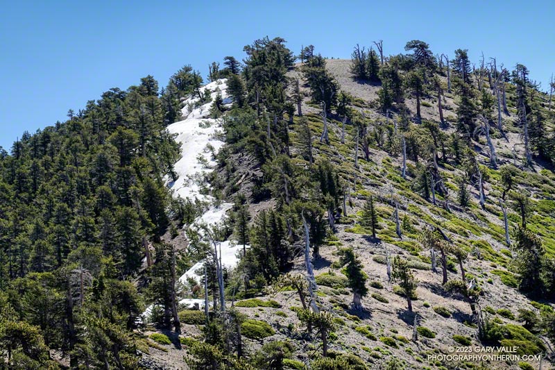
Snow in the lee of the West Ridge of Mt. Baden-Powell.

You might not see it from the Los Angeles side of the mountains, but there is still some snow on the higher, north-facing slopes of the San Gabriel Mountains.

During and after storms, snow-laden southerly winds dump their load on the backside of the crest, creating deep drifts, cornices, and compacted slabs of snow. This snow is often the last to melt, not only because it doesn’t face the sun, but because there is more of it.
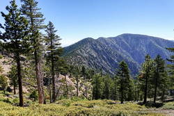
Mt. Burnham, Peak 9086, and Mt. Baden-Powell from near Throop Peak.

This morning, I was doing an out-and-back from the Windy Gap Trailhead in the Crystal Lake Recreation Area to Mt. Baden-Powell. The Windy Gap Trail climbs 1730′ in 2.6 miles, joining the PCT at Windy Gap. From there the trail follows the spine of the San Gabriels past Mt. Hawkins, Throop Peak, and Mt. Burnham to Mt. Baden-Powell.

I usually do this run from Islip Saddle, but with Angeles Crest Highway (Highway 2) closed between Red Box and Vincent Gap, the Islip Saddle trailhead isn’t accessible.
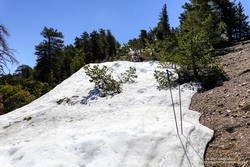
Snow on the west ridge of Mt. Baden-Powell. July 9, 2023.
Snow at about 9100′ on the west side of Mt. Baden-Powell.

Whether you start at Crystal Lake or Islip Saddle, the length of the run is about the same — a bit over 16 miles. The main difference is that the Windy Gap Trailhead is about 800′ lower in elevation. On the plus side, the Windy Gap Trail is very scenic; on the minus side, it faces south and can bake in the midday sun.

On today’s run, I encountered the first snowbanks at an elevation of 8870′, near the Dawson Saddle Trail junction. Out of curiosity, I tried to follow the trail and soon realized that was a mistake. I was more or less forced to skirt the downhill side of a lengthy and deep drift — it being too steep and icy to cross directly.
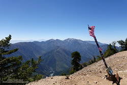
Mt. Baldy from the summit of Mt. Baden-Powell. July 9, 2023.

For the remainder of the run, I switched to the early season tactic of staying on the crest when the trail deviated onto shaded, north-facing slopes. These areas might have significant snow on the trail. This only happens in a few places, such as when the PCT works around Mt. Burnham. There is a use trail that ascends the west ridge of Mt. Burnham, and then returns to the PCT.

The conditions today are reminiscent of those found here in early July 2005. July 3rd of that year there was still snow on the summit of Baden-Powell, and there was deeper snow in the areas where there was snow today. We had a lot of storms this rain season, but in Rain Year 2004-2005 Downtown Los Angeles (USC) recorded about 9 inches more rain than during the 2022-2023 rain year!

Here is a short slideshow of some photos taken on the run. I’ve also included a few photos from the run to Baden-Powell in 2005 for comparison.

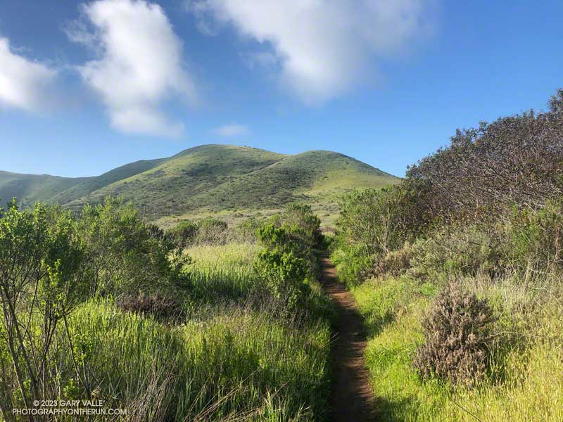
Soggy Shoes, Soppy La Jolla Valley, and Sensational Wildflowers

Approaching Mugu Peak from La Jolla Valley
Approaching Mugu Peak.

After doing a climbing /trail running combo in Pt. Mugu State Park last Sunday, I headed back to Wendy Drive this morning to do a trail run to Mugu Peak and back.

The plan was to get in a long run (20 miles) with fewer “get your feet wet” stream crossings, and also check out the conditions on several trails I hadn’t done this year.

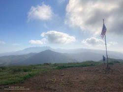
Boney Mountain (left skyline) from Mugu Peak

So much for keeping the feet dry! The temp was in the mid-30s when I turned off Big Sycamore Canyon fire road and onto Wood Canyon fire road. The main creek draining Sycamore Canyon cuts across the fire road here, and there was no way I was going to get across it without wading. Some smaller stream crossings followed, ending with Wood Canyon Creek.

My shoes were squish-squashing loudly as I started up Hell Hill. The 600′ climb was almost enjoyable with the cool temperatures. Partway up, a slurry of rock and mud had flowed from the hillside onto the road — the soil saturated from storm after storm.

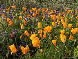
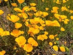
California poppies mixed with lupine along the Mugu Peak Trail

Several trails/roads converge at the top of Hell Hill, and I turned right onto the fire road that leads to the La Jolla Valley Loop Trail. I like to do Mugu Peak as part of a counterclockwise loop that combines segments of the La Jolla Valley Loop Trail and Mugu Peak Trails.

Long stretches of the La Jolla Valley Loop Trail between the walk-in camp and Mugu Peak were sopping wet. I’ll be curious to see how quickly it dries out, but today (April 2) it was really, really wet.

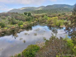
La Jolla Loop pond in La Jolla Valley in Pt. Mugu State Park.
La Jolla Loop pond is rarely this large — or even a pond.

Mugu Peak was pretty much as it always is on this side — busy and steep. The steepness of the “Direct” trail helped wring the water from my Ultraglides and Injinji socks. By the time I reached the top, my feet were only damp.

Mugu Peak is VERY popular, and there are almost always a few people taking in the wide-ranging views from the summit. Most do the short, steep hike from PCH on the Chumash Trail. A few start at the Ray Miller Trailhead — or like I was doing today — the long route from Wendy Drive.

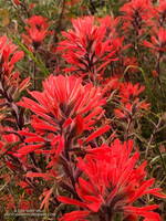
Vivid red paintbrush along the La Jolla Loop Trail in Pt. Mugu State Park.
Vivid red paintbrush along the La Jolla Loop Trail

Although I usually climb the peak, two other options are worthwhile: the loop around the ocean-facing side of Mugu Peak and
the loop around La Jolla Valley.

The wildflowers along the Mugu Peak Trail and La Jolla Loop Trail were fantastic. California poppies were plentiful on the south-facing slopes. The vibrance of the bright orange poppies could not have been better accentuated than by purple lupine. Yellow bush sunflower, royal blue phacelia, and rich red paintbrush also decorated the trail.

Bright yellow collarless poppies along Danielson Road.

I followed my usual route on the way back to Wendy — returning to the Hub, descending Hell Hill, retracing my steps in Wood Canyon, then following the Two Foxes single-track trail north to a short connector to Sycamore Canyon Road. This is near the Danielson Multi-Use Area. Once on Sycamore Canyon Road, the route back was the same as last week — up 1.8 miles of paved road and then onto the Upper Sycamore Trail. After that, up Danielson Road and across Satwiwa to the Wendy Drive trailhead.

Here is an interactive, 3D terrain map of my GPS track to Mugu Peak and back from Wendy Drive. To change the view, use the control on the upper right side of the screen. Track and placename locations are approximate and subject to errors. Poor weather and other conditions may make this route unsuitable for this activity.

Also, see the archived maps of Rancho Sierra Vista/Satwiwa and Pt. Mugu State Park from the NPS website, and the maps of Pt. Mugu State Park on VenturaCountyTrails.org.

Some related posts: Out and Back Trail Run to Mugu Peak, Running to Serrano and La Jolla Valleys from Wendy Drive, Busy Mugu Peak

The Rattlesnakes Are Blooming

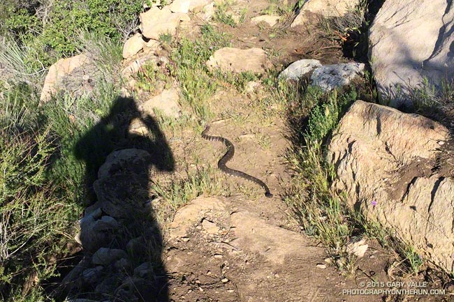
Rattlesnake on the PCT east of San Francisquito Canyon.

Although we are still experiencing a record-breaking drought, this rain season did provide a little short term relief to plants and wildlife. Compared to last year rainfall is up 27% at Los Angeles, 39% at Santa Barbara, 57% at LAX and 63% at Camarillo/Oxnard according to NWS data.

The increase in rainy season precipitation dramatically increased plant growth, the abundance of wildflowers, and temporarily increased the availability of key resources to wildlife.

Another thing it seems to have increased is the number of rattlesnakes. Over the past two years I have seen maybe two rattlesnakes total on my runs in the Santa Monica Mountains, San Gabriel Mountains, and in the Big Bear area and on San Gorgonio Mountain. In the Ahmanson Ranch – Cheeseboro area I’ve seen none.

With the increase in rainfall this season that has changed. The title photo was taken on the Leona Divide 50/50 course March 28. That day I encountered two rattlesnakes and talked to a runner that had seen three on the course the previous weekend. From March 26 to April 2 I encountered rattlesnakes on three out of four runs. Two of those were at Ahmanson and it seemed everyone I talked to on the trail was seeing rattlesnakes.

Hard to see rattlesnake on the PCT a few miles west of Bouquet Canyon.
See the rattlesnake? Click for larger view.

There has also been an increase in the number of encounters with non-venomous snakes as well. I’ve seen a number of gopher snakes and a California striped racer. Friends have mentioned seeing a ring-necked snake and California kingsnake.

Since the weather has cooled I haven’t encountered any rattlesnakes, but have seen their tracks. When I run, especially on single-track trails, my snake radar is on and I’m definitely on the lookout for the hard-to-see beasts.

Some related posts: Southern Pacific Rattlesnake on the Burkhart Trail, Southern Pacific Rattlesnake, Big Southern Pacific Rattlesnake at Ahmanson Ranch