Woolsey Fire perimeter downloaded from GEOMAC and timestamped November 18, 2018 at 5:59 a.m.
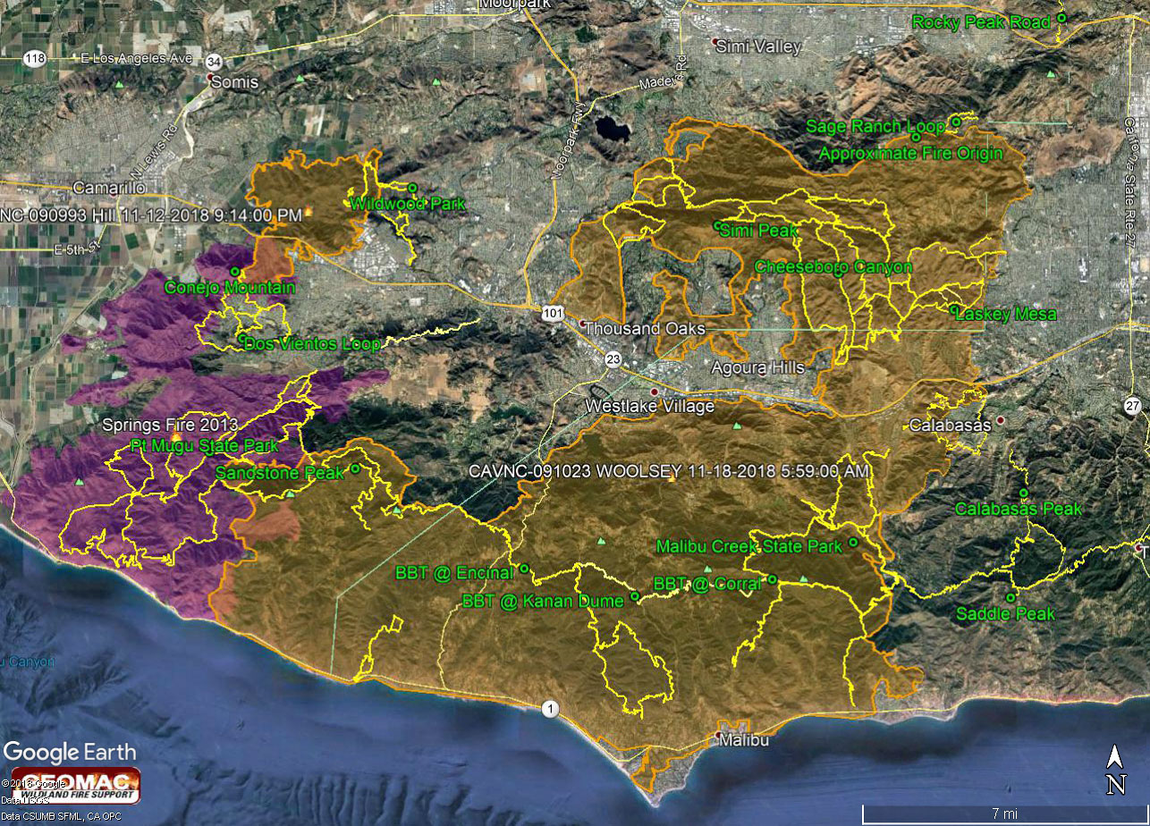 alt="Google Earth image with a recent perimeter for the 2018 Woolsey Fire along with GPS tracks of the Backbone Trail and some other trails in the region. The perimeter was was downloaded from GEOMAC and timestamped November 18, 2018 at 5:59 a.m." border="0">
Google Earth image with a recent perimeter for the 2018 Woolsey Fire along with GPS tracks of the Backbone Trail and some other trails in the region. The perimeter was was downloaded from GEOMAC and timestamped November 18, 2018 at 5:59 a.m.
Click this link to read more about this photograph.
Click on any of the following categories to see additional photography:
ABSTRACT - QUIRKY - LANDSCAPE - WILDLIFE - INSECTS - WILDFLOWERS - ADVENTURES
PHOTOGRAPHY
ON THE RUN
Copyright © 1995-2024 Gary Valle'. All Rights Reserved.
![]()