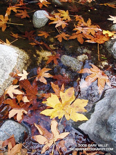
Bear Creek is an isolated tributary of Arroyo Seco Creek, north of Pasadena, in the San Gabriel Mountains. This photo was taken on a spectacular Fall day in upper Bear Canyon on a long trail run that started at Clear Creek Station. The route worked around the north side of Strawberry Peak to Red Box, down to the West Fork, up the Valley Forge trail on Mt. Wilson to Eaton Saddle, then through the Mueller Tunnel and past San Gabriel Peak and Mt. Lowe to Tom Sloan Saddle. From here it continued down into Bear Canyon, up the Gabrielino Trail to Switzers, and then back to Clear Creek using the Nature’s Canteen trail. (Photo from November 11, 2005.)
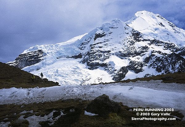
A runner descends the trail below Palomani Pass (16,600 ft.) on a Circuit of Mt. Ausangate (20,905 ft.) in the Peruvian Andes. Once acclimated, running at that altitude wasn’t as bad as I thought it might be, and when you return home, those 10,000 ft. trails feel like you’re running at sea level. The trip was arranged by my good friend Devy Reinstein of Andes Adventures and was unforgettable. (Photo taken July 23, 2003.)
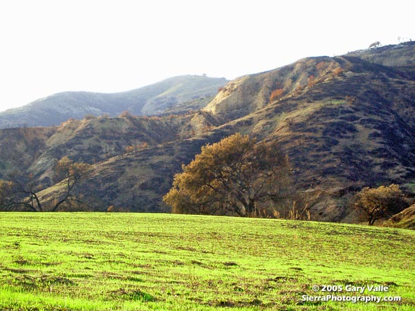
New sprouts of grass at Ahmanson Ranch less than a month after the Topanga wildfire burned 24,175 acres in the Simi Hills, northwest of Los Angeles. More photos and information regarding the Topanga Fire can be found in my Coyote Oak Journal article The Topanga Fire, Part I: Rain, Wind and Fire. (Photo from October 25, 2005.)
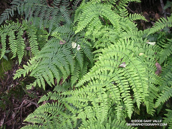
Ferns along the Garapito Trail, Topanga State Park.
Chaparral has been described as an elfin forest, and there is probably no better trail in the Santa Monica Mountains to see why, than the Garapito Trail. From the fire road near Eagle Rock, the trail seemingly dives into a tunnel of chaparral, and doesn’t emerge until it ends at Temescal Fire Road, some 2.5 miles away.
This day I ran a 12 mile figure-eight course from the end of Reseda to Trippet Ranch via the Hub, and then returned via the Musch, Garapito, and Bent Arrow trails. Fire roads out– trails back. A shorter option goes directly to the Garapito Trail via the Hub, and then returns via the Bent Arrow trail. This is about 7.5 miles. A longer option tacks on an out and back to Parker Mesa at Trippet Ranch.