Cool Weather, Old Trees, Grape Soda Lupine and a Restored Trail

Section of Three Points - Mt. Waterman Trail cleared of trees killed in the 2009 Station Fire.

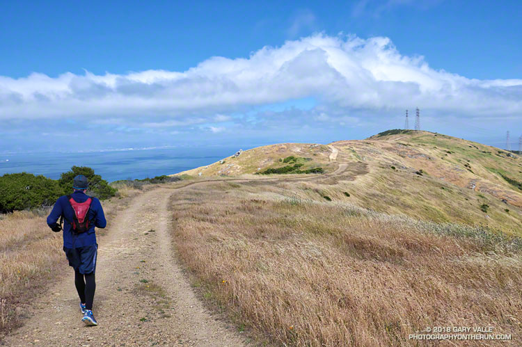
The weather was surprisingly cool for a Memorial Day weekend in the San Gabriel Mountains. At Three Points (5925′) the temperature was a brisk 43°F when I started my run, and it remained in the 40s as I worked up the Three Points – Mt. Waterman Trail toward Twin Peaks and Mt. Waterman. The trail from Three Points is a long-time favorite and part of an adventurous — and scenic — 20 mile loop around Waterman Mountain.

In 2009 the Station Fire ran up the ribs and gullies of the south face of Mt. Waterman, ravaging some slopes, but leaving others untouched. Many trees were killed, including some old growth incense cedars and Jeffrey pines. On a run in March 2017 I counted more than 40 dead trees down on the trail. At that time a few trees had already been cleared from the trail and in the following months many more would be.

Grape soda lupine along the PCT in Cooper Canyon.
Grape soda lupine along the PCT in Cooper Canyon. Click for larger image.

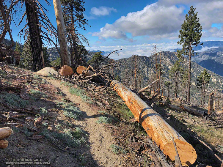
One particularly hard hit area is about a half-mile west of the Twin Peaks Trail junction. Last Summer dead trees blocked the trail in this area and in places were stacked one on top of another. The title photo is of the same area after the trail was cleared.

On a previous run I’d photographed the growth rings of a burned Jeffrey pine above the Twin Peaks Trail junction and estimated the total at about 325. Today, a recently cut Jeffrey pine just west of the Twin Peaks Trail looked like it might be considerably older. A very rough count of its rings totaled 475.

On this run the Three Points – Mt. Waterman Trail was almost entirely clear of trees and in the best condition I’ve seen since the Station Fire. Many thanks to Alan and the SoCal Hikers & Trail Builders for restoring this trail!

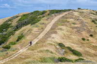
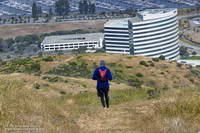
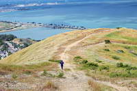
Here are a few photos from the run.

Some related posts: Downed Trees, Melting Snow, and a Waterfall; Three Points Loop Plus Mt. Waterman; After the Station Fire: Pine Seedling Along the Mt. Waterman Trail

Breezy San Bruno Mountain Ridge

Running along the San Bruno Mountain Ridge Trail

I staggered in the wind gust. It had to have been at least 45 mph. The views along the undulating ridge to the Bay were spectacular, but the wind was ferocious.

Hill on the San Bruno Mountain Ridge Trail.

Brett and I were running on the San Bruno Mountain Ridge Trail. We’d started at the summit parking lot and weren’t exactly sure where we were going to turn around. We’d know when we got to it.

The NWS forecast for San Francisco had called for “breezy” conditions:

.TODAY…Mostly cloudy in the morning then becoming partly
cloudy. Breezy. Patchy drizzle in the morning. Highs in the mid
50s to lower 60s. West winds 20 to 30 mph.

San Bruno Mountain Ridge above Sierra Point
Continuing down, down, down the ridge.

That forecast was for the city — and of course up on the peak the wind was even “breezier.” The SF Giants beanie I borrowed was the right call. So were the gloves, extra shirt and wind shell.

We continued along the ridge past the second set of loudly singing power lines and continued downhill. It became one of those, “let’s just go down to that next overlook,” and then the next one, and the next one. Not only were we losing a lot of elevation, but we’d be running into the wind on the way back.

San Bruno Mountain Ridge above the 101 and Sierra Point

We eventually turned around a little above Bayshore Blvd., at the “Sierra Point Reset” benchmark marked “487” on the topo map. As is often the case, the return wasn’t nearly as torturous as envisioned, but I was glad to get back to the car!

San Bruno Mountain is an invaluable island of open space, about 20 minutes from downtown San Francisco. For more information see the San Bruno Mountain Watch website.

Finally — a Few Wildflowers!

Bush sunflower

As of March 1, Downtown Los Angeles had recorded only 1.99 inches rain over the past eight months. Most of that was recorded in one storm in early January. It was the second driest July 1 – February 28 on record.

Following the January storm, temperatures warmed up and stayed relatively warm for much of the next 30 days. In the West San Fernando Valley the high temperature hit 89 °F at Pierce College on February 4, and was over 80 °F for 12 consecutive days. Some plants (and some rattlesnakes) responded as if it was Spring.

In mid February Winter returned, with cool daytime temperatures and cold nights. There were Frost and Freeze Warnings on several nights.

In March the ridiculously resilient ridge of high pressure over the West Coast finally relented, resulting in above normal rainfall. It took awhile, but the March rain and April sun eventually produced an assortment of wildflowers.

Here are some wildflower photos from recent runs at Ahmanson Ranch, Malibu Creek State Park and Topanga State Park.