After the Woolsey Fire: Trail Work with the SMMTC on the Chamberlain Trail

Trail runners assisting the SMMTC in trail work on the Chamberlain Trail segment of the Backbone Trail.

The trail work schedule of the Santa Monica Mountains Trail Council (SMMTC) is impressive to say the least. According to their Trail Work Statistics page, in 2018 the SMMTC was responsible for over 4,300 person-hours of work related to “establishing, preserving and maintaining the public trail system throughout the Santa Monica Mountains and adjacent areas.”

Members of the Santa Monica Mountains Trail Council (SMMTC) approaching the junction of the Old Boney and Chamberlain Trails.
Some of the SMMTC crew approaching the junction of the Old Boney and Chamberlain Trails.

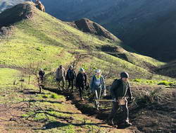
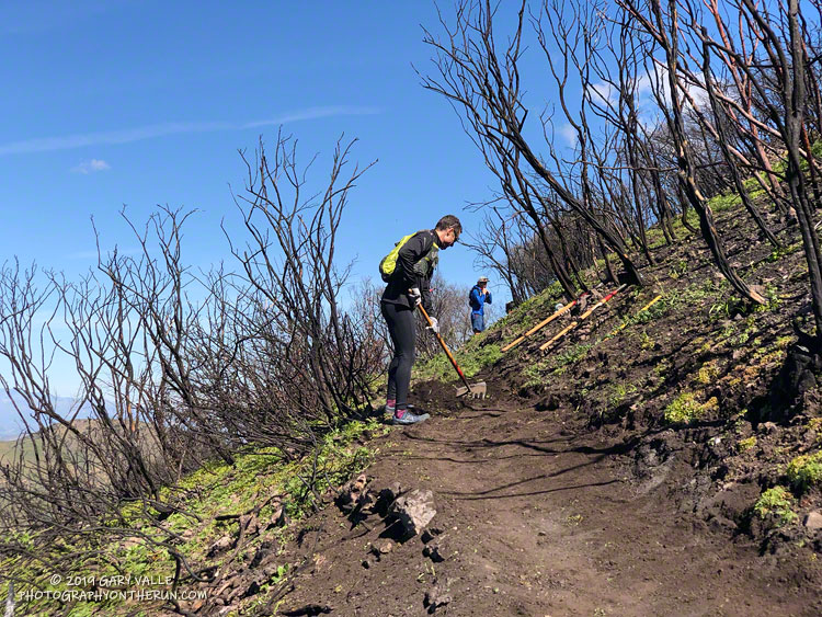
Saturday, 27 trail runners assisted the SMMTC in trail work on the Chamberlain Trail segment of the Backbone Trail. The trail runners were organized by Backbone Trail Utra race director Mike Epler, who recently joined the board of the SMMTC. Ultra race director Keira Henninger volunteered and also encouraged runners to participate.

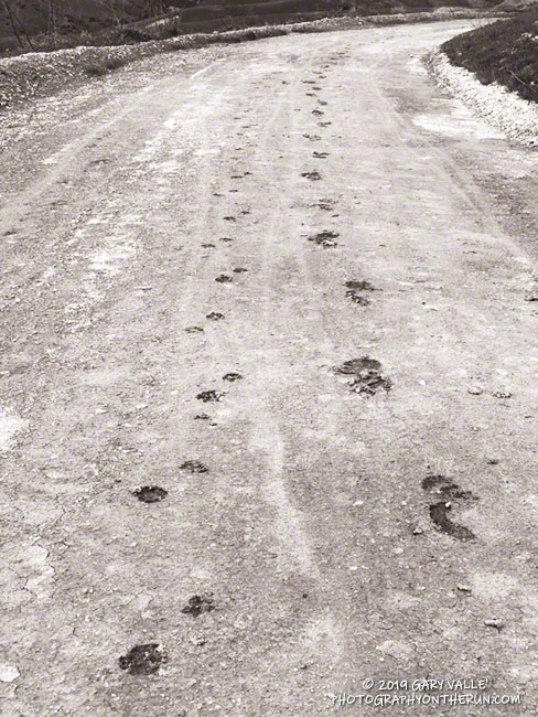
The Chamberlain Trail took a hard hit from the Woolsey Fire and subsequent rains. Under the direction of SMMTC crew members, runners restored washed out and rutted sections of trail and removed burned limbs, rocks and other debris. The trail was restored from its junction with the Old Boney Trail up to Chamberlain Rock. In preparation for future trail work, hundreds of limbs were removed from the trail up to its junction with the Tri Peaks Trail.

Many runners ran to the Chamberlain Trail, did the trail work, and then ran back. This was a good way to get in a good long run and contribute to the restoration of the trails damaged in the Woolsey Fire.

Additional photos and info are available on the SMMTC Facebook Page and web site.

Simi Valley Snow Shower

Simi Valley Snow Shower

There were many reports of snow, sleet, hail, and graupel around the area yesterday.

It was definitely cold! The afternoon temperature at 1700′ at the Cheeseboro RAWS was around 42°F. And the temperature was probably cooler in the vicinity of convective showers, such as the one above.

The photograph is from Sage Ranch, at an elevation of about 2000′. I was hoping to see some snow on the ground — but no cloud buildups cooperated.

Related post: Snow on Oat Mountain (December 2008)

Run to the Cheeseboro Remote Automated Weather Station

Cheeseboro Remote Automated Weather Station (RAWS)

This afternoon’s run was to the Cheeseboro Remote Automated Weather Station (RAWS). The station is perched on the ridge between Las Virgenes Canyon and Cheeseboro Canyon, along the Cheeseboro Ridge power line service road.

It is about 5 miles from the Victory Trailhead of Upper Las Virgenes Canyon Open Space Preserve (formerly Ahmanson Ranch) and one of many good runs from that trailhead into the Cheeseboro – Palo Comado Canyon area.

California poppies in Las Virgenes Canyon

Runs in the Ahmanson Ranch area are especially scenic at the moment. Above average rainfall has produced lush green growth in the oak grasslands following the Woolsey Fire. Many of the oaks are beginning to sprout new leaves and poppies and other wildflowers are beginning to bloom. Today there was a nice show of poppies in Las Virgenes Canyon at the connector leading to Cheeseboro Ridge and Cheeseboro Canyon.

Operated by the BLM and NPS the Cheeseboro RAWS (CEEC1) has been in service since September 1995. The station was in the area burned by the 2005 Topanga and 2018 Woolsey Fires and was active throughout each event.

Following are some of the extremes recorded by the station:

• Highest hourly temperature was 115 °F on July 7, 2018.
• Lowest hourly temperature was 32 °F on December 12, 1998.
• Maximum hourly wind speed was 37 mph on October 22, 2007.
• Maximum wind gust was 92 mph on January 6, 2003.
• Maximum daily precipitation was 5.01 inches on February 12, 2003.

So far this rain year (July 1 to June 30), 15.67 inches of rain has been recorded by the station.

Related post: Southern California Trail Running Temps

California Poppies Along the Lower Stagecoach Trail

California Poppies Along the Lower Stagecoach Trail above Corriganville in Simi Valley

Rounded a corner running down the Lower Stagecoach Trail, above Corriganville, and was suddenly immersed in a sea of orange.

The area was burned in a potentially dangerous fire, the Peak Fire, that started along the 118 Frwy on November 12, 2018, while the Woolsey Fire was still being fought. The fire threatened homes in the eastern Simi Valley and Box Canyon, but was aggressively attacked by firefighters and quickly knocked down.

Downtown Los Angeles Rainfall Surpasses Normal Rain Year Total

Rainbow at Ahmanson Ranch a few months after the Woolsey Fire.

Yesterday’s atmospheric river event increased the rainfall total for Downtown Los Angeles (USC) since July 1 to 15.50 inches, surpassing the normal annual Rain Year total of 14.93 inches. Last year, as of February 14, Los Angeles had only recorded 1.97 inches of rain.

As a result of all the wet weather, we’ve also been much cooler this December – February than last year. Since December 1 the average high at Downtown Los Angeles has been more than 7 degrees cooler than last year.

The Climate Prediction Center has just issued an El Nino Advisory for the presence of weak El Nino conditions in the equatorial Pacific. However, it is the interaction of the ocean and atmosphere that matters, and the atmosphere is behaving as if stronger El Nino conditions are present.

For the date, Los Angeles rainfall is at about 165% of normal and there’s still more than two months left in the rain season. We’ll see if the wet trend continues!

The title photo is from a  recent run at Ahmanson Ranch. This open space area was burned in the November 2018 Woolsey Fire.