As is usual, it’s been hot and dry in the Los Angeles area this summer. Most of the low elevation wildflowers have come and gone, and the last measurable rain at Downtown Los Angeles (USC) was more than 90 days ago.
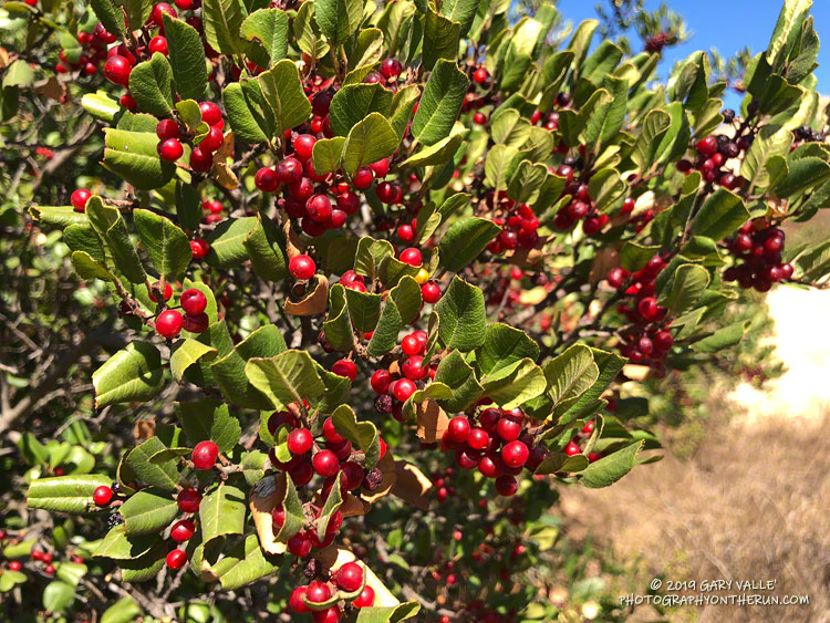
Holly-leaved cherry along the Backbone Trail.
Even so, there are still some colorful reminders of our wet 2018-19 rain season sprinkled along the trails of the Santa Monica Mountains and Simi Hills.
In the wake of all that rain, and the blooms that followed, several chaparral shrubs have had large crops of berries and fruit, among them hollyleaf redberry (Rhamnus ilicifolia), holly-leaved cherry (Prunus ilicifolia), and toyon (Heteromeles arbutifolia).
Are they edible? While all three plants were used as food sources by indigenous populations, knowledge of appropriate use and preparation is essential for safe consumption.
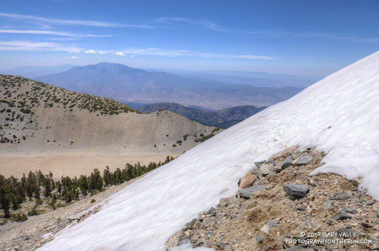
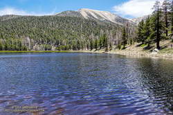
Working up the rocky trail, I looked to my left across the broad valley to San Gorgonio Mountain. There was still a narrow strip of snow near its summit, bright white in the morning sun.
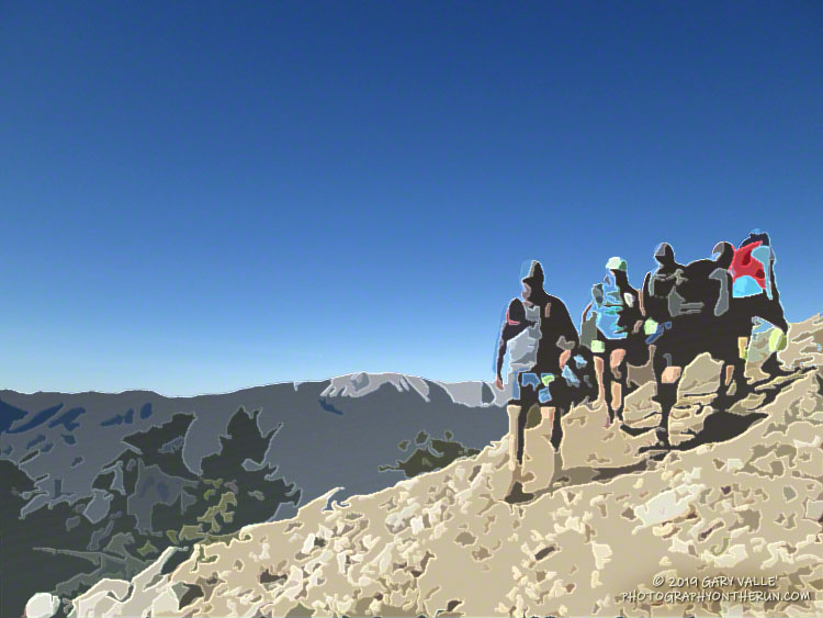
I was about 5.5 miles into the Kodiak 50K and nearing the top of 9952′ Sugarloaf Mountain. There wasn’t any snow here, but the morning had been cool — at least by Southern California summer standards.
San Gorgonio Mountain from the Sugarloaf Trail.
This was my sixth time running Kodiak. The first four times were at the 50M distance, and this year and last, I’d opted for the 50K. There have been a lot of changes in the Kodiak Ultra Marathons since the first 100M & 50M were run in 2013.
Initially held in late September, the event moved to an August date in 2017. 50K options were added in 2015. For the first three years the Kodiak courses were run in the counterclockwise direction. In 2016 the direction switched to clockwise and then alternated direction each year through 2018. This year the direction was the same as in 2018 — clockwise.
The general idea has remained the same. The 100 milers run a loop around Big Bear Lake. On the way, they ascend Sugarloaf Mountain, and also descend thousands of feet into the dank depths of Bear Canyon. The 50 milers run from the north side of the lake to the Finish, climbing either the Siberia Creek Trail if the course direction is counterclockwise, or Sugarloaf Mountain if the course is run clockwise. The options for 50Kers have varied from year to year.
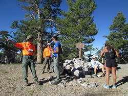
Big Bear SAR volunteers helped out on the top of Sugarloaf Mountain.
This year the 100M start time was moved to 6:00 p.m. This put 100M runners beginning the descent into Bear Canyon between about 8:00 p.m. and 10:30 p.m. — a much cooler time of day. The trade-off was that they would be doing the 3000′ climb up Sugarloaf Mountain with about 67 miles on their legs, and many of the runners would run into a second night.
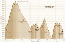
There were two notable changes in the Kodiak 50K this year. One adjustment is that it started two hours earlier — at 6:00 a.m. The other is that it was a couple of rocky miles longer than last year. The mileage was added on the descent of Sugarloaf — with runners looping down Wildhorse Meadow Road instead of retracing their route on the Sugarloaf Trail. My watch recorded a distance of about 34.5 miles and corrected elevation gain of about 6800′.
Because of the change in the 100M and 50K start time, we were ahead of many of the 100M and 50M runners, but we did get to see the 100M leaders flying down Sugarloaf.
2019 Kodiak 50K Elevation Profile
The weather was cool in the morning and warm in the afternoon. At Big Bear Airport the overnight low Friday night was 37°F and the high on Saturday was 77°F. With the clear skies, it was hot on exposed, south-facing trails. The Converse RAWS (5618′) recorded a high (inside a ventilated instrument housing) of 84°F; however the “fuel temperature” of a pine dowel in direct sun hit 106°F. In my experience, the fuel temperature is a better indicator of the temperature runners might encounter on sun-baked sections of trail.
My run went well. There was no repeat of the leg cramps I experienced near the end of this year’s ANFTR/Mt. Disappointment 50K. This 50K was longer, had more elevation gain, was at higher elevation, and was generally more technical, but my legs behaved the entire time. That’s the riddle of Exercise-Associated Muscle Cramps (EAMC). Sometimes you get leg cramps and sometimes you don’t. In this race I made sure that I stayed well-hydrated and fueled. I also used poles on the steeper climbs.
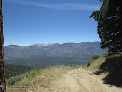
Near the top of the four mile Radford Road descent, with San Gorgonio in the background.
This was one of those races that I could just run and enjoy. It was great to talk with Diana, Gloria and Greg along the way. The runners you meet during races are often very accomplished and usually have some unique stories to share!
Many thanks to Kodiak Race Director Susie Schmelzer, Course Director Harald Zundel, and Communications Director John Emig and to Team Kodiak, all the volunteers, sponsors, Bear Valley SAR, HAM operators, medical personnel, City of Big Bear Lake, US Forest Service, Big Bear Trails Foundation, RIM Nordic and Open Air Big Bear, and everyone that helped put on the event.
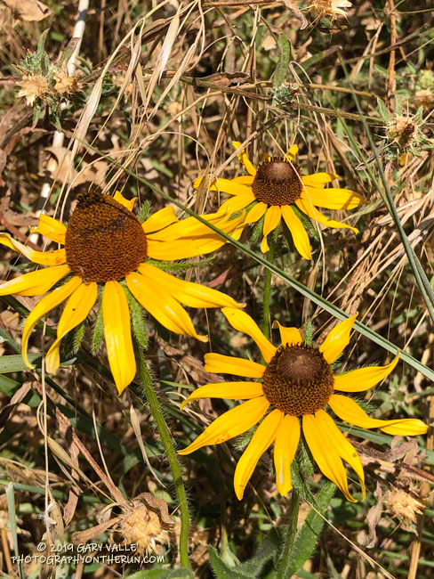
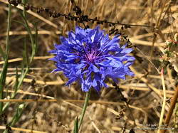
The most recent additions to my Weekday Wildflowers photo album include two non-native wildflowers seldom seen at Ahmanson Ranch — black-eyed Susan (Rudbeckia hirta) and bachelor’s button (Centaurea cyanus).
Bachelor’s button
Both were found along the Lasky Mesa Trail near the dry streambed of East Las Virgenes Creek. They likely escaped cultivation or were part of a seed mix scattered in the area.
Weekday wildflowers are flowers I’ve encountered during 2019 on weekday runs from the Victory Trailhead of Upper Las Virgenes Canyon Open Space Preserve (formerly Ahmanson Ranch).
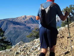
The weather was Southern California perfect. Shorts and short-sleeves were the dress of the day. Winds were light, no thunderstorms were in the forecast and no large wildfires polluted the air. Although temps in the valleys were nearing 100 degrees, the weather on the summit of 11,499′ San Gorgonio Mountain was altitude-conditioned bliss.
I’d spent about 15 minutes enjoying the summit, then run back down the Summit Trail. Turning left onto the Sky High Trail, I continued a keyhole loop that had ascended the South Fork Trail, Dollar Lake, and San Bernardino Divide Trails. Altogether, the route was about 21 miles long and the approximate elevation gain/loss was 4700′.
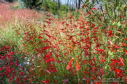
Penstemon along the South Fork Trail.
From the start of the run, the effects of the wet 2018-19 Winter and big snowpack were everywhere. Wildflowers bloomed in profusion, seeps and small streams greened the landscape, and grasses and ferns grew thick beneath the trees. The roar of the streams at South Fork Meadows left little doubt as to what kind of Winter it had been.
On the way up the Dollar Lake Trail, I’d seen elongated patches of snow in the chutes along the crest. While there was no snow directly on the trail between Dollar Lake Saddle and the summit, there was more snow than usual on the north side of the peaks.
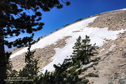
But there was snow on the Sky High Trail. Topping out at over 11,300′, the Sky High Trail is one of the most spectacular trails in Southern California. I marvel at its airy location every time I run it. Near the top of the trail, I’d crossed a small patch of snow and thought, “Well, at least there was a little snow on the trail.”
Large patch of snow on the Sky High Trail at an elevation of about 11,100′ on July 27, 2019.
A little disappointed, I’d put my poles away and continued running down the trail. At around 11,100′ I rounded a corner and surprise, surprise — there was a much larger patch of snow on a southeast-facing section of trail. It was about 100 yards across and steep enough that a fall would be a bad idea. Fortunately, the snow conditions were perfect. A few hikers had recently traversed the snowfield, and I followed in their footsteps.
However, that wasn’t the last of the snow. At an elevation of about 10,200′, not far past the C-47 crash site, the trail crosses a long chute that extends nearly to the top of Gorgonio. The snow in that chute had melted just enough that a thin strip of trail was exposed.
Thinking that had to be the last of the snow, I continued the traverse to Mineshaft Saddle (9936′) and began the descent of the Dry Lake Trail. Once past a rocky section of the trail, I picked up the pace, energized by the increased oxygen at lower elevation. Enjoying the downhill, I descended into an area of converging chutes and gullies, when the path through the lodgepole forest abruptly ended.
Avalanche debris on the Dry Lake Trail above Dry Lake.
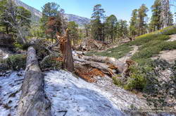
The trail was obliterated. Large trees were ripped from the ground, broken, tossed, and piled up as if they were matchsticks. Underneath the debris were mounds of dense, icy snow — the remnants of an avalanche. This report on SoCalSnow.org includes photos of an avalanche in February 2019 on the north face of San Gorgonio and mentions previous avalanches.
That snow, at an elevation of about 9400′, had finally been the last on the trail. Because the compressed snow is effectively a big block of ice, it could be around for a while.
In the area of the avalanche, the Dry lake Trail enters a large area of rocky rubble that extends into the Big Draw. According to the Dibblee Geologic Map for San Gorgonio Mountain, this rubble is glacial till, produced by the largest of several pocket glaciers that existed on San Gorgonio Mountain, Shields Peak, and San Bernardino Peak.
This is the first time Dry Lake has been full this time of year since 2011.
Continuing down the trail to Dry Lake I saw where some of this season’s meltwater had gone — for the first time since 2011, Dry Lake was full in late July.
Last Saturday’s run was so enjoyable that yesterday I went back to Gorgonio and did it again. As might be expected during a Southern California Summer heatwave, the snow on the Sky High Trail, and elsewhere, is melting fast and won’t be around for long.
Here are a few photos taken along the way. The album includes photos from both the July 27 and August 3 runs. A couple of photos from a run on September 7 were also added.