
For official information see the El Dorado Fire incident page and Apple Fire incident page on Inciweb, and the San Bernardino National Forest website. National Forests in California have reopened to varying degrees. For more information, contact the National Forest.
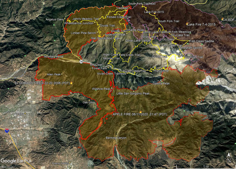
Here’s a Google Earth image of El Dorado and Apple Fire perimeters from the National Interagency Fire Center (NIFC) . The image acquisition timestamp of the perimeter is 9/22/2020 2008 (PDT) .
The 2015 Lake Fire perimeter is also shown. Some trails in the San Gorgonio Wilderness are also shown as yellow tracks. All map data are approximate.
Here’s a 3D interactive Cesium view of the same perimeter and trails.