For the second time this month, I was crossing San Gorgonio’s summit plateau and relieved to be nearing the summit. Most of the uphill was done! My route was the same both times — South Fork, Dollar Lake, Divide, and Summit Trails up; then the Summit Trail, Sky High, Dry Lake, and South Fork Trails down. Here is an interactive, 3D terrain view of the route.
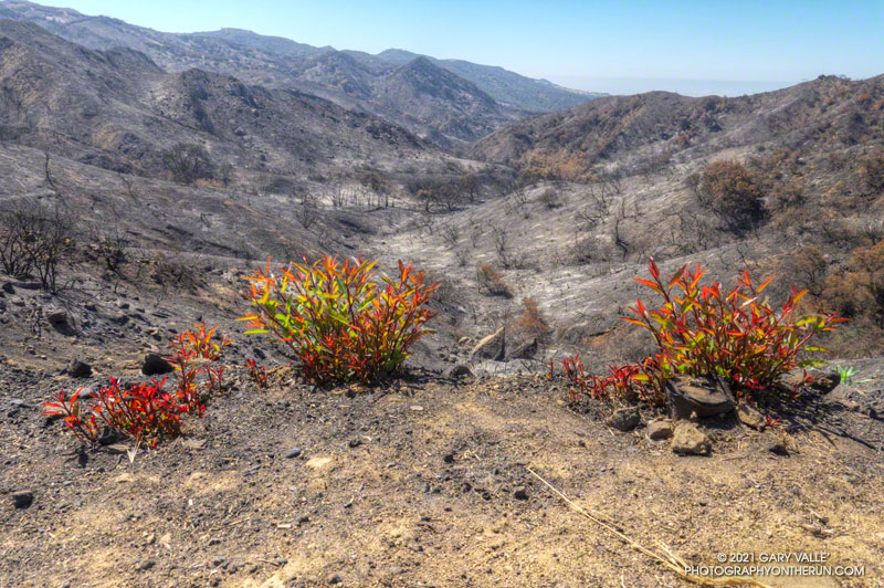
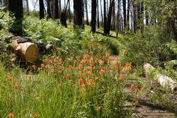
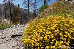
The changes along the South Fork Trail in just two weeks were remarkable to see. It may be Summer in the lowlands, but Spring was still in progress on the mountain. Withered-looking black oaks were now flush with leaves; newly sprouted ferns had unfurled, filling areas of the understory with bright green fronds; colorful wildflowers seemed to have appeared overnight.
Over the past two weeks, trailwork continued in the area. The start of South Fork Trail was rerouted for a second time since the 2015 Lake Fire, avoiding a very steep, root-filled section. In a continuing battle, some of the dead trees that had fallen on the trail had been cleared.
Earlier in the month a few small patches of snow could still be seen on the mountain, but today it was nearly gone. Only one tiny, stubborn patch of snow remained on the crest, near the summit. Most of Southern California recorded below average precipitation this past year. According to OntheSnow.com, nearby Snow Summit recorded 121″ total snowfall in the 2020-2021 season. This compares to 110″ in the 2019-2020 season and 143″ in the wet 2018-2019 season. A paltry 36″ was reported in 2017-2018.
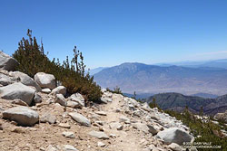
As I started up the final rocky hill to the top of San Gorgonio, a small group of hikers scrambled down from the summit. As was the case earlier in the month, the summit area was nearly empty. On an ascent in September 2019 — when wilderness permits were not required — I’d estimated 40-50 people on, or around, Gorgonio’s summit. The restoration of the permits seemed to have made a big difference.
Relaxing on the summit, I looked over at another high point about 100 yards to the ESE. The traditional U.S.G.S. 1996 7.5′ San Gorgonio Mountain Quadrangle isn’t high enough resolution to show this secondary summit. From the official summit, the other point looks higher, and vice versa.
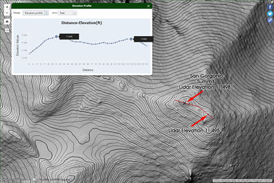
Out of curiosity, following the run I checked the high resolution 3DEP Lidar data for San Gorgonio. It resolves the twin summits, and indicates the official (west) summit is about three feet higher.
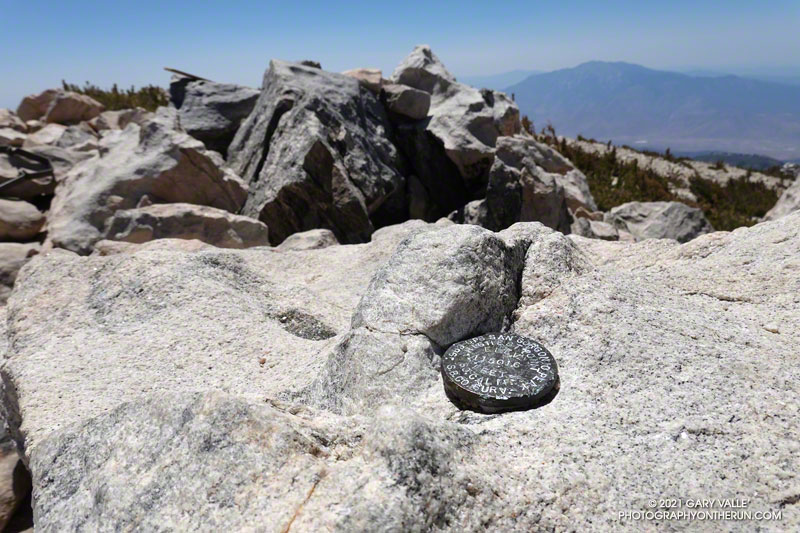
In 1989, the “San Bernardino County Surveyors” determined the elevation of San Gorgonio Mountain to be 11,501.6 feet. They placed this small marker on summit. The USGS page Global Positioning Application and Practice discusses some higher precision GPS equipment and survey methods. The elevation of the mountain has probably shifted a little since that measurement was done.
After comparing notes with a runner doing the clockwise version of the route I was doing, I headed back down the Summit Trail to its junction with the Sky High Trail.
By their very nature, mountain trails are scenic, but the Sky High Trail is exceptionally so. Running down the Sky High Trail is what running in the mountains is all about. It is spectacular! That doesn’t mean it’s a cakewalk. The trail is rough, rocky, and crosses steep slopes. As with any trail on such terrain, snow on the trail can be a serious issue.
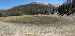
The Sky High Trail ends at Mineshaft Saddle. From here, I picked up the Dry Lake Trail and continued down, down, down. Above Dry Lake, a section of trail pummeled by an avalanche in 2019 had been restored. Continuing, the trail winds down through a complex of glacial moraines above Dry Lake. and then follows the margin of a large moraine down to Dry Lake. The lake dried up early this year, and was already dry on June 6.
It can be very warm in the afternoon on the Dry Lake Trail between Dry Lake and South Fork Meadows, but today gusty winds kept the temperature moderate. At South Fork Meadows, I gulped down a liter-bottle of water, enjoying the cool shade, and then finished the run.
Some related posts: San Gorgonio Mountain: Dollar Lake – Dry Lake Trail Run; San Gorgonio Mountain Snow, Avalanches and Glaciers; El Dorado & Apple Fire Perimeters and San Gorgonio Trails; After the Lake Fire: The Dollar Lake – Dry Lake Loop on San Gorgonio Mountain