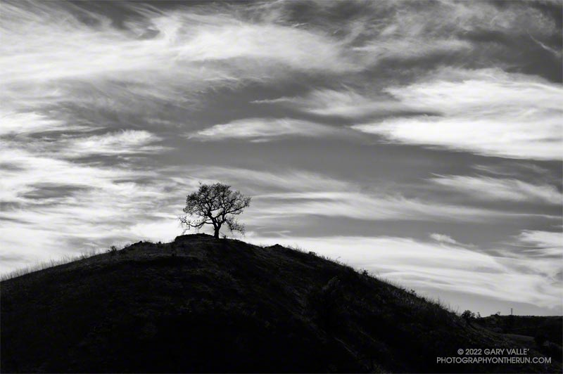
A conspicuous valley oak on a hill to the south of East Las Virgenes Canyon Road/Trail, about a mile from the Victory Trailhead of Upper Las Virgenes Canyon Open Space Preserve (Ahmanson Ranch).

A conspicuous valley oak on a hill to the south of East Las Virgenes Canyon Road/Trail, about a mile from the Victory Trailhead of Upper Las Virgenes Canyon Open Space Preserve (Ahmanson Ranch).
The run up the Phantom Trail from Mulholland Highway and out Heartbreak Ridge is a fun adventure all on its own. When you first see Ladyface from the Phantom Trail, it seems like the trail isn’t going to go anywhere near the peak. But a series of ups, downs, and arounds does eventually get you to an overlook above the junction of Kanan & Cornell Roads. If you were to turn around at this point, the out and back would total a little over 8 miles.
Continuing down to Kanan Road and doing a counterclockwise loop on Ladyface — ascending the East/Northeast Ridge and descending the East/Southeast Ridge — adds another 3.5 miles to the route, and ups the adventure quotient a notch.
I first climbed Ladyface by this route in 2010 and have done Ladyface many times since. It’s a “real” peak with all the pros and cons that come with such a peak. The route isn’t always obvious, and some scrambling using the hands is required. Some sections of trail are steep, gritty and slippery. The quality of the volcanic rock varies. The knobby rock is fun to climb, but can break unexpectedly.
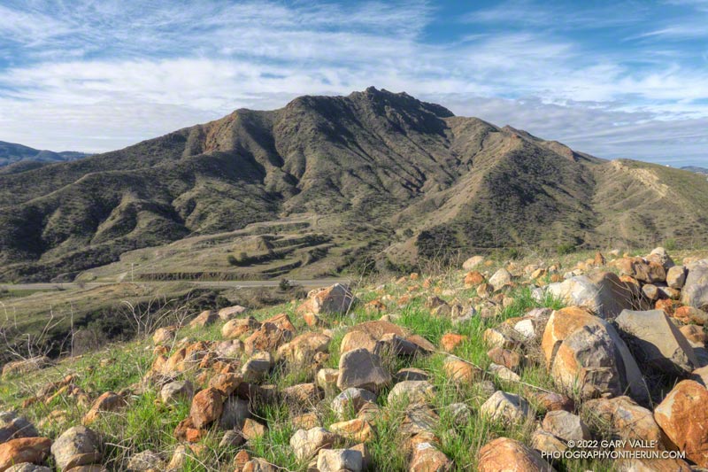
Even with the Ventura Freeway buzzing below the peak, the views from Ladyface are spectacular. A panorama of the Santa Monica Mountains extends from Saddle Peak in the east to Boney Mountain in the west. On the opposite side of the mountain, Hines Peak, Simi Peak and the San Gabriel Mountains fill the scene. On a day with good visibility, San Jacinto Peak can be spotted, far to the east.
Here are a few photos taken along the way, and an interactive, 3D terrain view of the GPS track of my route. The map can be zoomed, tilted, rotated, and panned. To change the view, use the control on the upper right side of the screen. Track and placename locations are approximate and subject to errors. Poor weather, and other conditions may make this route unsuitable for this activity.
Some related posts: Ladyface the Long Way, Ladyface After the Woolsey Fire, Ladyface Loop
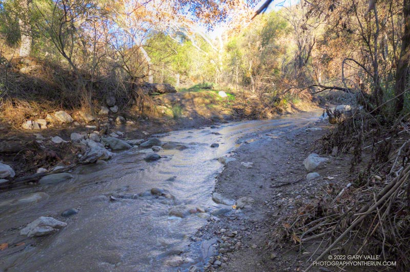
I had just waded down a 50 yard stretch of creek where the Santa Ynez Canyon Trail used to be. Three hikers working up the canyon were trying to find a way past the flooded section without getting their boots wet. That wasn’t going to be easy.
I had been doing the same thing higher in the canyon. It was a chilly morning, and I had no great desire to soak my shoes in cold water. The usual rock and limb crossings had worked well until the trail ended in a broad area of flowing creek. Once my shoes were wet, it simplified the process.
That the trail was flooded following several days of rain wasn’t that surprising. What was a surprise is that there hadn’t been higher flows and more damaging flash floods in the canyon.
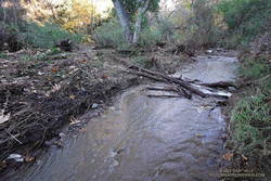
Santa Ynez Canyon was the focus of the Palisades Fire, and a large part of the drainage was burned to a moonscape. Burned slopes often amplify runoff from heavy rain, producing damaging flash floods and debris flows. While there was clearly high flows in the canyon, the levels were less than what I’ve seen in similar circumstances, in other burn areas. One possibility is that unburned trees and brush along the streambed higher in the canyon had attenuated the flow.
After doing the out and back on the Santa Ynez Canyon Trail, I continued down to Trippet Ranch and then, like last week, returned using the Musch, Garapito, and Bent Arrow Trails.
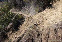
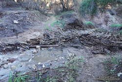
There were a number small rock slides, sluffs, and sediment flows along the trails and roads. A couple of people were working on clearing the limbs and small trees that had fallen across the Garapito Trail. The collapsed oak at the bottom of the Garapito Trail had settled, and was easier to get through this time.
The trail that really took it on the chin was the Bent Arrow Trail. Several sections of the trail were damaged by slides.
I usually do the Santa Ynez Canyon Trail as part of the Trailer Canyon – Santa Ynez – Trippet Ranch Loop. Tacking on the trail as an out and back addition to the loop was slightly shorter, but had a little more elevation gain/loss.
Some related posts: Trippet Ranch Loop After the Palisades Fire, Clouds, Canyons and Wildflowers, Running Between Storms on the Trippet Ranch Loop, Go Figure