
Category Archives: climbing
Strawberry Peak, Switzer’s and the Old Colby Trail
The Colby Canyon Trail is one of the historic trails of the San Gabriel Mountains. When Switzer Camp was established in 1884, Colby Canyon was an irresistible gateway leading deeper into the wilderness. The compelling and sometimes snow-covered peak at its head was one of Switzer’s many attractions.
In the History of Pasadena Hiram A. Reid recounts the story of how the peak was named in 1886 “by some wags at Switzer’s camp” because of its resemblance to a strawberry. He goes on to describe how one of them irreverently added, “We called it Strawberry peak because there weren‘t any strawberries on it.”
While Strawberry may have been climbed previously, the establishment of Switzer’s made it possible to climb the peak recreationally. In Early Mountain Ascents in the San Gabriels (100 PEAKS Lookout, Jul-Aug 1971) John Robinson notes an 1887 ascent of Strawberry Peak by Owen and Jason Brown — sons of abolitionist John Brown. Robinson describes the “Brown Boys” as the first local “peak baggers.”
Climbing Strawberry via Colby Canyon has been a long-time favorite. Last Saturday I’d done Strawberry via Colby Canyon as part of loop — ascending the Colby Canyon Trail to Josephine Saddle, climbing over Strawberry Peak, running down to Red Box and then down the Gabrieleno Trail to Switzer’s. A 0.3 mile connection along Angeles Crest Highway completed the route.
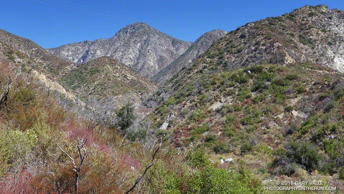
Today I did a variation of the same loop, this time bypassing Josephine Saddle and following (more or less) the route of the old Colby Trail up the ridge at the head of Colby Canyon to Strawberry’s main west ridge.
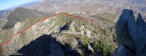
As shown on this USGS Tujunga topo map from 1900, a century ago the Colby Trail was much more direct. It linked Switzer’s Camp in upper Arroyo Seco to the Colby Ranch and other ranches and holdings in Big Tujunga Canyon. It was a much shorter alternative to the roundabout route that ascended to the head of Arroyo Seco (then Long Canyon), and then continued past present day Red Box to Barley Flats and down to Wickiup Canyon. More on the history of Colby Ranch and Big Tujunga Canyon can be found in the Winter 1938 edition of Trails Magazine (12.6 MB PDF).
A well-used game trail wanders up “Colby” ridge, but the path is far from ideal and not always distinct. Our four-legged friends don’t necessarily follow one path, especially where the route is steep and loose. Deer are well-suited to this kind of terrain, their long, skinny legs being perfect for following an overgrown path lined with thorny buck brush. In a couple of places there were short segments of trail that look like they might be remnants of the trail indicated on the 1900 topo.
It’s easy to understand why the old route on the ridge was abandoned; the route to Josephine Saddle is far better and MUCH faster!
These sections of the 1934 Mt. Lowe Quadrangle advance sheet and 1939 Mt. Lowe Quadrangle shows the dramatic changes in the area with the construction of Angeles Crest Highway (LRN 61) between La Canada and Colby Canyon. The 1934 sheet shows the reroute of the Colby Canyon Trail to Josephine Saddle and then contouring around Strawberry, as well as the trails along the west and east ridges of Strawberry and connecting from Lawlor Saddle to Colby Ranch. The updated 1939 sheet includes the Josephine Fire Lookout and the Josephine Fire Road.
Split Rocks, Squeeze Chimneys and the Steck-Salathé
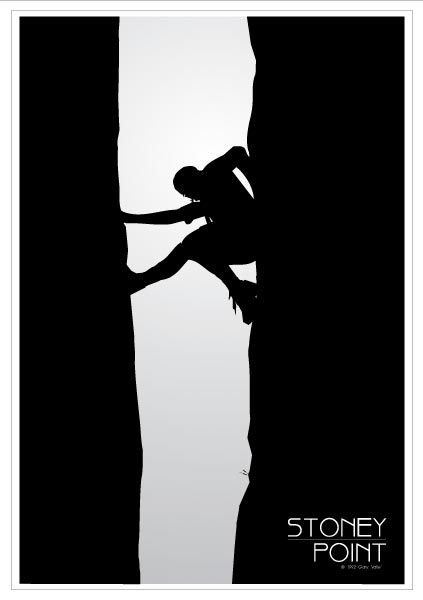
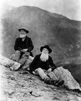
As long as we’re talking about split rocks, the poster above was based on a photo of mine from 1971 of “Split Rock” at Stoney Point, near Los Angeles. Rock climbers of my generation will recognize the Robbins’ “blue boots” that Tom is wearing.
This type of feature is called a “chimney” and the climbing technique being employed is called “chimneying.” Chimneys vary in width from a “squeeze” chimney, in which you can barely fit your body, to chimneys so wide it’s difficult to span their width. One side of Split Rock is average width and the other is a squeeze chimney.
Perhaps the most infamous chimney in the U.S. is the Narrows on the Steck-Salathé route on Sentinel Rock in Yosemite. The chimney abruptly changes from a comfortable width that is easily climbed to an impossibly narrow slot. It’s easy enough to get the top half of your body up into the slot, but the bottom half poses a significant dilemma. How do you make upward progress with your upper body wedged and your legs and feet dangling?
I think my upward progress into the slot might have been measured in millimeters per hour. At least it felt that way. It was so narrow that I could hold myself in place by taking a deep breath! Eventually I was able to get fully into the slot and then it was just a matter of being patient and threading my way through the remainder of the claustrophobic passage. (The photos of the Narrows in Climbing the Steck-Salathé by Guillaume Dargaud illustrate the situation well.)
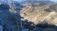
From the top of the Narrows Ron and I still had a few more pitches to climb, and we topped out shortly before sunset. Around us the granite glowed in a rich golden light — the kind of light that seems only to be found on mountains, rivers and other places the sharp edge of adventure dwells.
The day had been long and challenging, but we were not done — we still had to get down. By the time we reached the upper section of the descent gully it was starting to get dark. There were still patches of snow in the gully and the temperature was dropping. Rather than risk a fall on frozen snow or meltwater, we opted to bivi.
Skies were clear and the night was going to be cold. We didn’t have much in the way of warm clothes, but we did have matches and started a small fire on the granite ledge that was going to be our lodging for the night. About the time we were settling in, two headlamps came bobbing down from the direction of Sentinel. The climbers had just come off the Chouinard-Herbert route and were more than happy to call it a day. We shared our meager resources, and with the fire we all had enough to get by.
Ladyface Loop
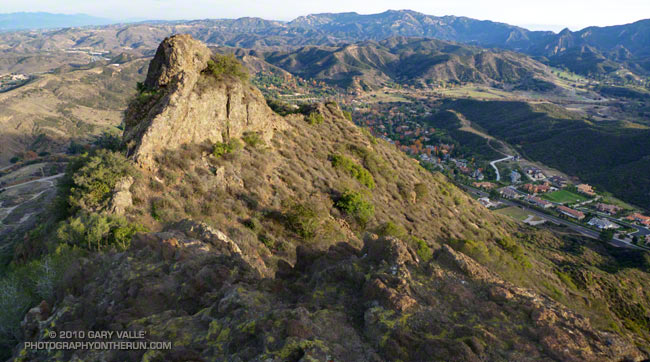
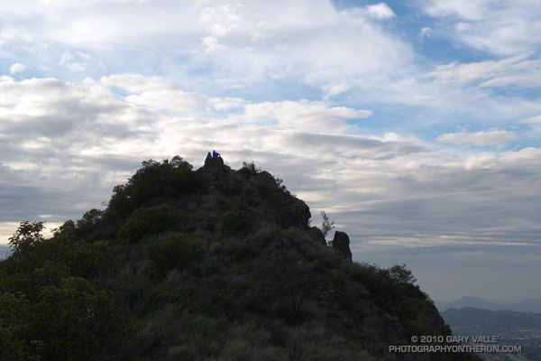
Like many good peaks that are mostly “walkups,” the ascent of Ladyface requires a bit of scrambling. By that I mean some use of the hands is required. And some care. Some of the rock is sound, and some of it isn’t. A few short sections on the frequently used east/southeast ridge are very loose and manky.
I like to do the 2.5 mile loop counterclockwise — ascending the northeast ridge, and descending the east/southeast ridge. The route generally follows the ridges, but the route-finding can be quirky in places.
The path up the northeast ridge doesn’t appear to be as popular as the east/southeast ridge route, but is cleaner overall. Sections of the northeast ridge are brushy, but no significant bushwhacking is required — if you stay on route. The northeast ridge ends a couple hundred feet below the top of the peak. A zig-zag path up the steep north face winds its way through knobby volcanic rocks to the summit.
The volcanic rocks on Ladyface include several components of the Conejo Volcanic Suite, and tell a story of volcanism associated with plate subduction, rifting, and continent-building.
If you don’t pay too much attention to the cars zooming along the 101 Frwy a thousand feet below, the Ladyface loop in Agoura Hills is one of the more scenic and interesting short hikes/climbs in Southern California.
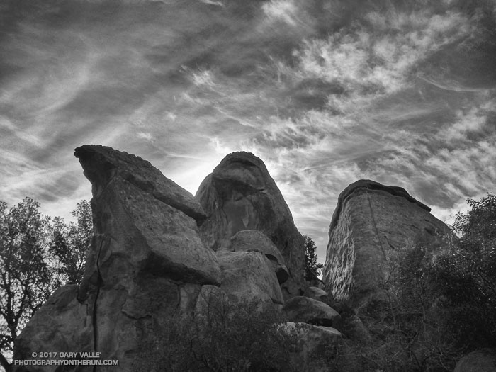
The title photo is of a subsidiary crag, east of the summit of Ladyface. In the background is Saddle Peak, Malibu Creek State Park and Brent’s Mountain.
Related post: Ladyface the Long Way