Category Archives: drought

Los Angeles Rainfall Above Normal, But…

Study of mud on the Musch Trail in Southern California

As of yesterday Downtown Los Angeles (USC) has recorded 8.80 inches of rainfall for both the Rainfall Year (July 1 – June 30) and Water Year (October 1 – September 30). By either measure Los Angeles rainfall is well above normal, and with three well-advertised storms in the forecast it looks like Los Angeles rainfall could remain above normal for at least a few weeks.

Even if it has been a bit wet — and muddy — it’s been great to have a more normal rain season. The rain has been very beneficial and has impacted the drought, at least in the short term. Just how much a continued wet rain season would impact the drought in the long term is a question that has to wait for future analysis.

There has been a five year precipitation deficit of nearly 36 inches at Downtown Los Angeles (USC). It’s hard to appreciate the size of this deficit while running in the rain, splashing through puddles, and trying not to slip in the mud. One tangible indicator of this deficit is that despite above average rainfall, many creeks in the Santa Monica Mountains and Simi Hills have remained dry or are barely flowing. Some have been dry for years.

Update Wednesday, March 1, 2017. The atmospheric river event on February 17 produced high flows on many local streams and many of these streams continue to flow. Rainfall totals in Los Angeles, Ventura and Santa Barbara Counties for the storm generally ranged from 4 to 8 inches with some higher totals recorded. On subsequent trail runs flooding, debris flows and erosion were noted in Upper Sycamore and Blue Canyons in Pt. Mugu State Park. Remarkably, some groundwater monitoring stations in Santa Barbara and San Bernardino Counties remain well below normal.

As of February 28, 2017, Downtown Los Angeles (USC) had recorded 18.50 inches of rain for the Rain Year and Water Year. This is 165% of the normal amount of 11.24 inches for the date, and 124% of the normal amount of rainfall for an entire year. This is the wettest Rain Year (July 1 – June 30) and Water Year (October 1 to September 30) to date since the very wet year of 2004-2005.

Update Tuesday, January 24, 2017. From Wednesday, January 18 through Monday, January 23, Downtown Los Angeles (USC) recorded 5.53 inches of rain, bringing the Rain Year and Water Year precipitation totals to 14.33 inches. This is 217% of the normal amount of 6.65 inches for the date, and 97% of the normal amount of rainfall for the entire Rain Year. It has been the wettest start to the Rain Year (July 1 – June 30) and Water Year (October 1 to September 30) since the very wet year of 2004-2005. There were high rain rates on Sunday, January 22, and Upper Las Virgenes Creek did finally flow for a period of time.

Update Saturday, January 21, 2017. From Wednesday, January 18 through Friday, January 20, Downtown Los Angeles (USC) recorded 2.53 inches of rain, bringing the Rain Year and Water Year precipitation totals to 11.33 inches. The average annual rainfall for Downtown Los Angeles is 14.93 inches. The rain, which was heavy at times on Friday, produced some flooding, rockslides and debris flows. Both branches of upper Garapito Creek are flowing as a result, but Saturday afternoon Upper Las Virgenes Creek was still not flowing.

Upper Las Virgenes Creek – February 22 the flow on Upper Las Virgenes Creek near the Cheeseboro connector and the two downstream crossings was enough that you couldn’t cross without getting your shoes wet. Previously, on January 24, there was no flow near the connector and only a slight trickle downstream. On January 21 the creek was not flowing and there was no evidence it had flowed during a recent storm.

Garapito Creek – On Saturday, January 21, 2017, both branches of upper Garapito Creek were nice burbling brooks. Previously, on January 15, the north branch was just starting to flow, but the south branch was dry.

Upper Sycamore Creek – Flash flooding, debris flows and erosion occurred on this creek following the heavy rain on February 17-18. Nearly 6 inches of rain was recorded at Circle X Ranch, which is also in the western Santa Monica Mountains. Previously, was flowing on February 4, but not on January 1, 2017.

Serrano Creek – Was flowing on February 4, but not on January 1, 2017.

If the wet forecast holds will these streams start to flow? We’ll see!

Rainy December for Los Angeles

Century City and Downtown Los Angeles

Updated January 4, 2017.

Not since the beginning of the drought has Downtown Los Angeles experienced such a wet December. As of December 31, 2016:

• December rainfall was 2.22 inches above the monthly normal of 2.33 inches.

• The 4.55 inches of rain recorded was the wettest December since December 2010 and the most for any month since January 2010.

Since the Rain Year began July 1, 5.95 inches of rain has fallen at Downtown Los Angeles (USC). This is 1.63 inches above the normal July-December rainfall of 4.32 inches. It is the best start to the Rain Year (Jul 1-Jun 30) and Water Year (Oct 1-Sep 30) since 2010.

The photograph of Century City and Downtown was taken from Temescal Ridge while doing the Will Rogers – Temescal Canyon loop from the End of Reseda Saturday (December 24). According to NWS records Downtown Los Angeles recorded 2.32 inches of rain from December 21 to December 24..

After the Station Fire: Strawberry Peak Summit Regrowth

Chaparral regrowth near the summit of Strawberry Peak

Did the Colby Canyon – Strawberry Peak – Red Box loop again over the Thanksgiving holidays. While taking some photos near Strawberry’s summit I was struck by the regrowth that has occurred since the 2009 Station Fire. What caught my eye were the bare limbs of the old growth, burned in the fire, projecting from the new, dense, green growth.

The growth of the chaparral over the seven years since the fire does not appear to have been noticeably impaired by the 2011-2015 drought in Southern California. (In the photograph above note the height of the regrowth compared to my friend near the summit.)

This conclusion is based in part on the observation of chaparral regrowth following other fires, such as the 2005 Topanga Fire, but is also supported by comparing the amount of new growth to the pre-Station Fire growth. This can be inferred by the length of the burned limbs and the approximate age of the chaparral when burned by the Station Fire.

According to the FRAP California geodatabase of fire perimeters, the last fire to burn the summit of Strawberry Peak was the 1979 Sage Fire, which burned approximately 30,000 acres. Before that you have to go back to 1896 to find another fire in the database that burned Strawberry’s summit.

In the absence of fire, it appears that in another 23 years the chaparral in the title photo could reach a similar height and extent to the old growth.

Excursion to Ross Mountain

Ross Mountain on South Ridge of Mt. Baden-Powell.
South Ridge of Mt. Baden-Powell, with Ross Mountain at its end.

Nearly every time I’ve climbed Mt. Baden-Powell I’ve wondered about the long ridge extending south from its summit. And nearly every time I’ve summited Baden-Powell I’ve been in the middle of another running adventure, and unable to explore more than a few hundred yards down the ridge. But today I wasn’t running to Eagles Roost or doing a long loop from Islip Saddle. Today the plan was to climb Ross Mountain, a peak far down on Mt. Baden Powell’s south ridge.

Ross Mountain
Ross Mountain

Major mountain ridges are often isolated, aesthetic and adventurous — characteristics that are magnets to mountaineers. While not technically difficult, the excursion to Ross Mountain is demanding. The first step is to climb Baden-Powell — a four mile trek with 2800′ of gain, that tops out at an elevation of about 9400′. From the top of Baden-Powell a use trail then leads down the south ridge three miles over varied terrain to Ross Mountain.

For the most part the use trail is relatively distinct and follows the anticipated route down the ridge. Even so, it is usually not as easy to follow a use trail as it is a conventional trail. It had rained a few days before, and the tracks of the last group to do Ross were vague. The most distinct tracks on the trail were from the recent passage of a bighorn sheep.

Bench on Mt. Baden-Powell's South Ridge.
Bench on Mt. Baden-Powell’s South Ridge.

The route to Ross drops 2100′ in 2.5 miles, then ascends 200′ over the remaining half-mile to the peak. The descent is not continuous. About a mile from Baden-Powell the ridge is interrupted by a large bench, and there are other ups and downs along the way. The ridge can be seen in profile in this image or the PhotographyontheRun masthead.

Pine Mountain, Dawson Peak, Mt. Baldy, Ontario Peak, Iron Mountain and Santiago Peak.

The ridge projects into one of the more rugged areas of the San Gabriel Mountains — the Sheep Mountain Wilderness. To the west is the deep canyon of the East Fork, with Pine Mountain, Dawson Peak, Mt. Baldy and Iron Mountain towering above. To the west is the very remote canyon of the Iron Fork, sweeping up to form the 9000′ crest between Throop Peak and Mt. Burnham.

The ridge hosts a wide variety of conifers — limber pine, lodgepole pine, white fir, sugar pine, Jeffrey pine and even a few incense cedars. Life on the ridge is tough, and many of the trees are contorted, broken or stunted. It appears to have been a good year for the sugar pines, and some were heavily laden with cones. Overall the health of the trees on the ridge appeared to be good, with surprisingly few trees in obvious distress from the drought.

Mt. Baden-Powell from Ross Mountain.

A little more than three hours after leaving Vincent Gap I zig-zagged up the final few steep steps to the 7402′ summit of Ross Mountain. Not unlike other vantage points along the ridge, the summit was a pretty spot under a sugar pine tree, but in this case with a small cairn and rain-soaked summit register.

After procrastinating a bit and checking out the south side of Ross Mountain’s elongated summit, I began the journey back to Baden-Powell.

Complex geology at head of Mine Gulch on Mt. Baden-Powell.
Complex geology at head of Mine Gulch.

Surprisingly, considering my plodding pace coming back up the ridge, it took almost exactly the same amount of time to get back to Vincent Gap as it had to go to Ross Mountain. As it worked out, the time lost on the climb back up the ridge was offset by the superb run down the Baden-Powell Trail.

According to my Garmin fenix 3’s barometric altimeter the total gain/loss on this adventure was about 5100′. If the gain/loss is calculated from the GPS track using 1/3 arc-sec DEMs it works out to about 5400′. The round trip distance was 14 miles.

Related post: Return to Ross Mountain

Plan B: Barley Flats

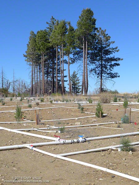
Pines and pine seedlings at Barley Flats

Nearing the junction I debated what to do — turn left on a well-used trail and climb Strawberry Peak or continue straight on an abandoned, overgrown road and go to Barley Flats? If I continued on the road it would be my second bush-whacking adventure of the day. Earlier, I’d abandoned an exploration in upper Colby Canyon when frequent rifle fire made the canyon feel confined and dangerous. This adventure was my plan B.
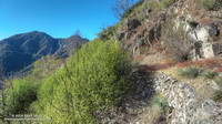
Overgrown Forest Service fire road connecting Red Box and Barley Flats, built in 1926.
Overgrown Forest Service fire road built in 1926.

Each time I’ve done Strawberry Peak from Red Box I’ve wondered about that overgrown old road. In the book The San Gabriels, John Robinson mentions that it was a Forest Service fire road built in 1926. It’s shown on the USGS 1934 Mt. Lowe and Mt. Wilson Advance Sheets connecting Red Box Gap and Barley Flats and then continuing to Charlton Flats, Chilao and the high country. Back then Angeles Crest Highway didn’t go to Shortcut Saddle, it turned at Red Box and went to the top of Mt. Wilson.

At the junction, I stepped over the rocks marking the left turn toward Strawberry Peak and started up the old road. After about five yards, I almost turned back. The trail was so overgrown it seemed nearly impassable. Yucca and whitethorn conspired to block the way, or at least make it too painful to proceed.

Having done my share of bush-whacking I’ve learned that it’s usually not as bad as it looks. With a little patience the determined hiker can usually find a tolerable way through. That was the case here, but not only was the trail overgrown, there were downed trees and limbs from the 2009 Station Fire, and several small rock slides and wash outs partially blocking the trail.
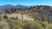
Barley Flats with Waterman Mountain and Twin Peaks in the background and Mt. Baldy in the distance.
Barley Flats

For 2.5 miles I kept repeating, “That wasn’t that bad. I’ll just see what’s around the next corner.” After nearly an hour and a half of seeing what was around the next corner — and almost turning back several times — I finally reached Barley Flats.

Like many places in the San Gabriels, Barley Flats has a colorful history. In the middle 1800s the site was a favored hideout of horse thieves and cattle rustlers. During the cold war it was one of the many Nike defense sites surrounding Los Angeles. More recently it was a Los Angeles County Sheriff’s Probation Camp and Retreat and today continues to be used as a staging area for LASD’s Air Rescue 5. Much of Barley Flats and the surrounding area was burned in the Station Fire.
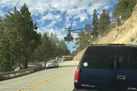
Air Rescue 5 airlifts a traffic accident victim from a tight spot on Angeles Crest Highway.
Air Rescue 5 in action on Angeles Crest Highway

Air Rescue 5 has conducted numerous life-saving missions in Angeles National Forest, including countless air ambulance evacuations from “nearly every corner” of Angeles Crest Highway.

Even before reaching Barley Flats I had decided to take an alternate route back to Red Box. Barley Flats sits on the divide between Upper Tujunga Canyon and the West Fork San Gabriel Canyon. Doing a loop through West Fork sounded a lot more appealing than running the thorny gauntlet back to Red Box on the old road.

It took about one-third of the time to run three miles down paved — and brush-free — Barley Flats Road as it had to bushwhack from Red Box to Barley Flats. There were a few hunters out on Barley Flats road, but all had their rifles shouldered. Since leaving Red Box I had heard only one very distant rifle shot — a big change from the far too frequent rifle fire in Colby Canyon.

From the intersection of (gated) Barley Flats Road and Angeles Crest Highway it was only about 0.7 mile over to Shortcut Saddle. At Shortcut I picked up the Silver Moccasin Trail. As I began to run down the trail toward West Fork, I reached around with one hand and lifted my pack. How much water remained?
Spring at West Fork
Spring at West Fork

The plan was to run down to West Fork, get water, and then run up the Rincon-Red Box fire road to Red Box — completing a loop. The spring at West Fork is usually reliable, but with the drought I couldn’t be 100% sure. Nearby Mt. Wilson was recently forced to close its restrooms and turn off the water spigots used by hikers and runners because of insufficient water.

I was surprised to find the spring was running as strong as it had been in early July during the Mt. Disappointment Endurance Runs. Water was not going to be an issue on the five mile run up to Red Box.

Glimpse of Autumn

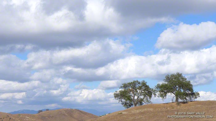
Oaks and clouds Upper Las Virgenes Canyon Open Space Preserve

I was running in the hills along the western margin of the San Fernando Valley and reveling in the Autumn-like weather. The hills were parched, brown, and the soil dessicated. In 128 days it had not rained.

An area of low pressure was producing some clouds and even a little rain in some parts of Los Angeles County. The last time it had been this cool in the afternoon was in mid-June. The pleasant temperature was a welcome change from the 80s, 90s and 100s of Summer.

Precipitation from the 2015-16 Godzilla El Nino fell short of expectations, with Downtown Los Angeles only recording 65% of normal rainfall and the drought continuing into its fifth year. How long would we have to wait  until we received widespread rainfall?

At the moment the expectation is for ENSO Neutral conditions to prevail this Winter. Neutral conditions give forecasters little leverage on which to base their Winter outlook, but based on last year’s Southern California precipitation forecasts, we didn’t have much leverage then either.

With a warming planet, we appear to be in a new regime. Forecasts based on 1950-2000 analogs may no longer be applicable. As of September 15 the Climate Prediction Center’s Precipitation Outlook for Southern California for December, January and February is the equivalent of flipping a three-sided coin.

We may just have to wait and see what the Winter brings.