Category Archives: old trees

Manzanita Trail Plus Mt. Baden-Powell

Approaching Dorr Canyon wash on the Manzanita Trail, on the way to Vincent Gap.
Wash in Dorr Canyon

Update September 3, 2023, 1:15 p.m. Caltrans Quickmap is showing Angeles Crest Highway (Hwy 2)  is now open between Grassy Hollow and Vincent Gap.  Caltrans Road  Conditions says the closure is “5 mi west of Big Pines.” Google Maps and Waze still show the section between Grassy Hollow and Vincent Gap as closed.

Update August 23, 2023. The Big Pines RAWS recorded 6.26 inches of rain, and Lewis Ranch RAWS 7.04 inches from T.S. Hilary. The heavy rain on the north-facing slopes of the eastern San Gabriels may have produced debris flows in the washes crossed by the Manzanita Trail. Excessive runoff may have done more damage to stabilized sections of the Manzanita Trail where it crosses steep slides above Paradise Springs. According to CalTrans, the previously open section of Angeles Crest Highway (Hwy 2) between Grassy Hollow and Vincent Gap is currently closed.

Bigcone Douglas-fir cones, dripping with protective resin.

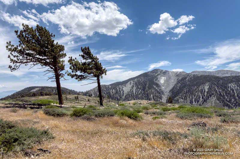
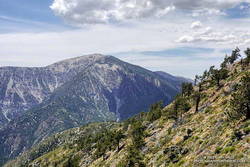
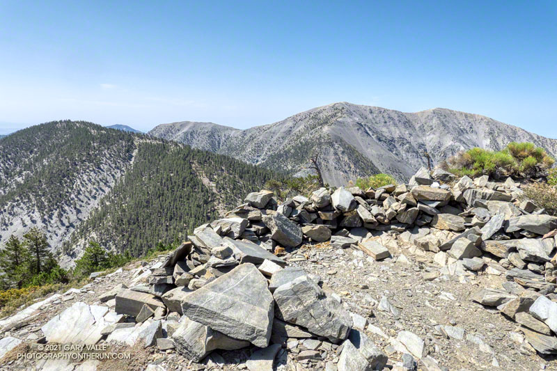
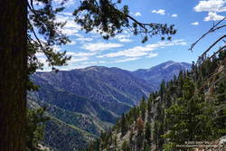
I’d been thinking about doing the South Fork Loop, a challenging loop that I usually start at Islip Saddle. The route descends the South Fork Trail to South Fork Campground (4,565′) and then climbs all the way to the top of Mt. Baden-Powell (9,399′), using the Manzanita Trail and PCT. From the top of Baden-Powell, the PCT is followed back to Islip Saddle.

But there were a couple of problems with this idea. First, the road to Islip Saddle — Angeles Crest Highway — was closed. More importantly, parts of the South Fork Trail were burned in the Bobcat Fire, and heavy snow and rain may have damaged the South Fork Trail or Manzanita Trail.

One of the washes crossed by the Manzanita Trail, about a mile below Vincent Gap.
Wash crossed by the Manzanita Trail, about a mile below Vincent Gap.

The road closure would be easy to work around — the loop could be started at Vincent Gap. But I definitely needed to check the condition of the South Fork and Manzanita Trails. The loop is difficult, even when the trails are in good shape.

I decided to check the Manzanita Trail first. If that trail had issues, then the condition of the South Fork Trail didn’t matter.

So that is what I was doing today. The plan was to run the Manzanita Trail from Vincent Gap down to South Fork Campground, then turn around and — just like on the South Fork Loop — take the Manzanita Trail and PCT to the top of Mt. Baden-Powell.

Brush and debris deposited on the Manzanita Trail a couple of miles below Vincent Gap.
Manzanita Trail obstacle course.

I woke early on Sunday and arrived at Vincent Gap at about 6:45 a.m. With much of Angeles Crest Highway closed, I shouldn’t have been surprised that the main parking lot was already full. I nabbed the last spot in the overflow area across the highway. I could only imagine what it must be like on the trail up Baden-Powell.

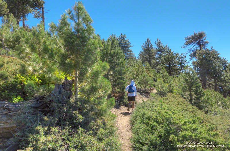
But I didn’t have to worry about that — not for a while. I grabbed my pack from the back of the car and started jogging down the Manzanita Trail. On that trail, I probably wouldn’t see anyone!

Gooseberries along the Manzanita Trail.

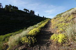
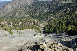
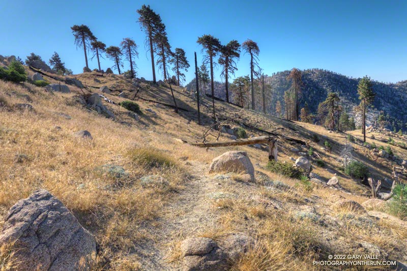
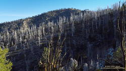
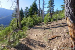
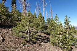
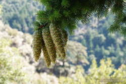
As would be expected on a little-used trail after a hard Winter, the Manzanita Trail was a bit of a mess. In addition to being generally overgrown, there were fallen trees, brush deposited on the trail by runoff or avalanches, minor washouts, and other damage. These slowed the pace but weren’t too much of a problem.

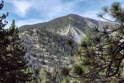
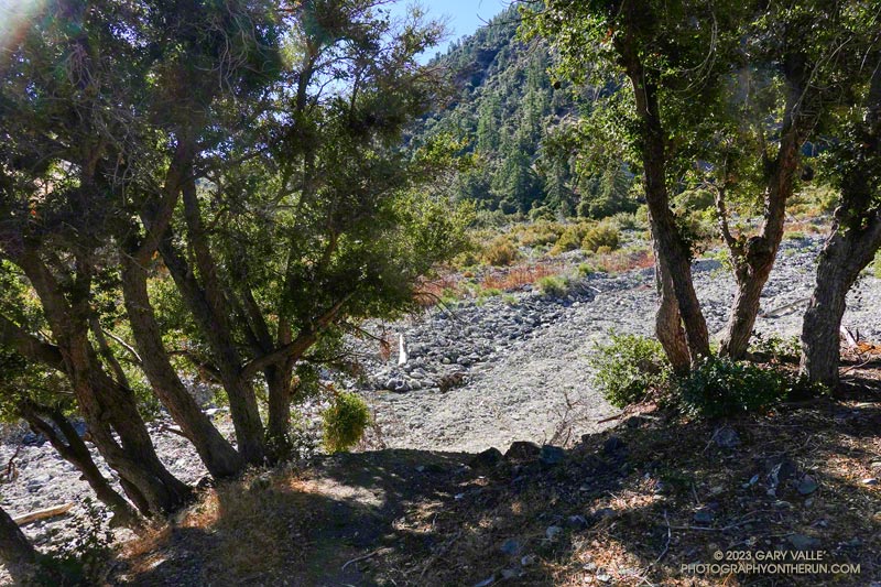
On the other hand, there is a section of the Manzanita Trail that could be a serious issue. It is where the trail crosses several steep, loose, stabilized slides. This area is about 4.4 miles from Vincent Gap and 1.4 miles from South Fork Campground. This section of the trail is almost always damaged, but on past adventures, had always been passable. How bad was it going to be today?

Damaged section of the Manzanita Trail about 1.4 miles above South Fork Campground.
Damaged section of the Manzanita Trail.

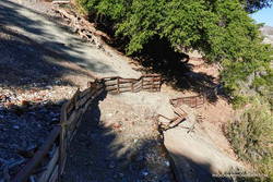
The answer is — pretty bad. As I started across the first slide, it looked like it would go just fine, but then I looked closer. One of the abutments on the down-slope side of the trail had completely given way. The trail had collapsed, leaving only a narrow slice of crumbling dirt along the base of the up-slope barrier. I would have to use the barrier to get past, and it wasn’t in the best shape. I’m sure people have done this, but it seemed like a bad idea. I could see no straightforward way around the collapsed trail. Disappointed, I turned around and started working back up the trail toward Vincent Gap.

Spiral scar on a tree on the Manzanita Trail that was recently been struck by lightning.
Tree on the Manzanita Trail that was struck by lightning.

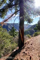
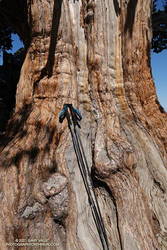
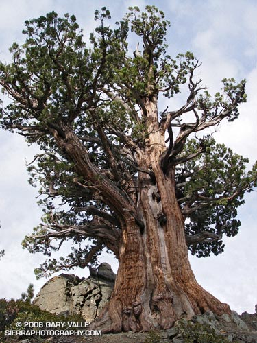
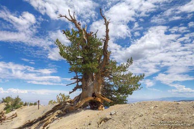
I’d been running for a few minutes when I came across a “lightning tree.” These are trees that have been struck by lightning and have a scar spiraling down their trunk. I’ve photographed a number of them. Some are in a location that you would expect to be struck by lightning, but just as many are along seemingly unexposed sections of trail. Once, I was running down the PCT below Mt. Hawkins, well below the crest, and a tree 50 yards down the slope was smoking from just being struck.

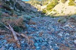
On the way back up to Vincent Gap, there would be a little route-finding fun. The Manzanita Trail crosses some small debris-filled washes. Over time, paths develop through the rubble but can be intermittent and indistinct. Debris flows can destroy a part of nearly all of a path.

Debris-filled wash in Dorr Canyon that is crossed by the Manzanita Trail.
Dorr Canyon wash.

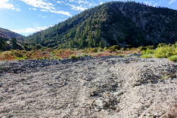
The wash in Dorr Canyon is the largest crossed by the Manzanita Trail. Keeping in mind that Tropical Storm Hilary may have changed things, on August 13th, the path across the wash was mostly intact. One gotcha was that on the west side of the wash, the path ended short of the Manzanita Trail.

Did I mention the gnats, stinging nettle, and Poodle-dog bush? Oh, the gnats. On the way down the trail they weren’t too bad, but as the temperature warmed, they became increasingly annoying and persistent.

Blue Ridge and Pine Mountain from the PCT on the north side of Mt. Baden-Powell.
Blue Ridge and Pine Mountain from the PCT on Mt. Baden-Powell.

When doing the South Fork Loop, I usually stop for water at the stream that feeds Icy Springs. The trail was overgrown near the stream, and mixed in with the greenery was some stinging nettle. Even knowing it was there, I managed to brush against it on the way down the trail and then again coming back up.

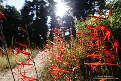
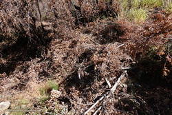
There was also a little Poodle-dog bush on the trail about two miles down from Vincent Gap in a small area that had been burned. As long as you noticed it, it was easy to avoid.

The Wally Waldron Limber Pine, near the summit of Mt. Baden-Powell.
The Wally Waldron Limber Pine.

What the heck? As I topped out at Vincent Gap, the sounds of revelry came from across the highway. It was party time in the Baden-Powell parking lot! A large group of people were gathered at the west end of the lot, near the trailhead. Were they preparing to do a mass ascent of Baden-Powell? I quickly refilled my hydration pack, grabbed some food, and headed up the PCT.

San Gorgonio Mountain, and Pine Mountain, from Mt. Baden-Powell.
San Gorgonio Mountain, and Pine Mountain from Mt. Baden-Powell.

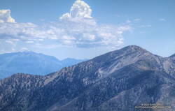
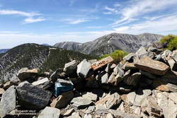
Once I escaped the craziness of the parking lot, it turned out to be one of the most pleasant ascents and descents of Baden-Powell I’ve done. Even with the machinations of the Manzanita Trail earlier in the morning and the additional vertical gain, Baden-Powell couldn’t have gone better. Very few hikers were on the trail, everyone was super-friendly, and when I reached the summit, it was empty — at noon, on a Sunday, in August!

Some related posts: Manzanita Trail Morning, South Fork Adventure, Bear Cubs on the South Fork Trail, San Gabriel Mountains Running Adventure

A Warm Day on Blue Ridge and the North Backbone Trail

Clouds, pines, and Pine Mountain from Blue Ridge in the San Gabriel Mountains

Angeles Crest Highway was still closed between Red Box and Vincent Gap, and the heatwave continued. I was trying to decide where to run.

I briefly considered the Circuit Around Strawberry Peak, but yesterday at 10:00 a.m., the “in-the-shade” temperature at Clear Creek was already 92°F, and the “in-the-sun” fuel temperature 109°F. By 1:00 p.m., the fuel temp reached a scorching 122°F!

Although trailheads such as Three Points and Islip Saddle couldn’t be accessed using Angeles Crest Highway, the highway was open from Wrightwood to Inspiration Point and Vincent Gap. After seeing the temps at Clear Creek, it took about two seconds to make the decision to head to the San Gabriels’ high country.

 sulfur flower-lined section of the PCT east of Inspiration Point
sulfur flower-lined section of the PCT east of Inspiration Point

From Inspiration Point (7,365′), I ran east on the PCT about 7 miles to the North Backbone Trailhead on Mt. Baldy. Over most of that stretch, the temperature was a blissful 60-something degrees. Other times, I’ve driven to this trailhead — which requires a high-clearance vehicle — or run to the trailhead from Wrightwood. But the run along Blue Ridge is a favorite. It is especially scenic, with fantastic views of Mt. Baden-Powell, Iron Mountain, Pine Mountain, and Mt. Baldy.

About a quarter-mile east of the top of the Acorn Trail, the PCT passes within a few feet of one of the Wright Mountain landslides. The canyon-size landslide is prehistoric, but smaller landslides and mudflows occur periodically within the primary scar. The debris cone of a dramatic 1941 mudflow is an unmistakable feature on satellite photos.

Peak 8555 and Pine Mountain from the PCT.

Less than a mile beyond the overlook of the landslide, I left the PCT and jogged down to the North Backbone Trailhead. After a short descent, I started up the steep use trail toward Peak 8555. On the way up, San Gorgonio Mountain and San Jacinto Peak were visible in the haze to the east.

Peak 8555 is the first high point on Baldy’s North Backbone. It is an idyllic spot with a great view of Mt. Baden-Powell and the surrounding terrain. But you might not want to linger here in a thunderstorm — spiral scars on the trunks of trees suggest the point is repeatedly struck by lightning.

Crossing the top of a chute on Mt. Baldy's North Backbone.
Crossing the top of a chute on Mt. Baldy’s North Backbone.

Following a short descent, I resumed climbing the steep, somewhat loose ridge. After about ten minutes, I scrambled onto the crest of the ridge and crossed the top of a prominent, rocky chute. More than a thousand feet below, avalanche-hardened snow gleamed white in the sun at the base of the chute.

Another 10 minutes of climbing and I reached the Pine Mountain Juniper. Straddling the rocky crest at an elevation of about 9000′, this stalwart tree is estimated to be 800 – 1000 years old. It is a remarkable tree in a remarkable location. Except for one short, steep, eroded section, the remainder of the trail to the top of Pine Mountain (9648′) was relatively straightforward.

Dawson Peak and Mt. Baldy from Pine Mountain's south summit.
Dawson Peak and Mt. Baldy from Pine Mountain’s south summit.

Pine is the second-highest peak in the San Gabriels and has excellent views of the surrounding terrain. It is higher than Mt. Baden-Powell (9399′) and Dawson Peak (9575′) but a few hundred feet lower than Mt. Baldy (10,064′).

From Pine Mountain, the North Backbone trail continues over Dawson Peak another 2.5 miles to Mt. Baldy. There was still a long ribbon of snow along the east side of the upper North Backbone, but it looked like the trail might avoid it. I would have liked to confirm that, but today the top of Pine was my planned turnaround point. As it was, with the warm weather, I thought I might run short on water on the return to Inspiration Point.

Leaving Pine behind, I started back down — jogging when it made sense — but trying not to do anything stoopid. On the way down, I kept reaching behind me and squeezing the bladder in my hydration pack. I guess I was hoping that it would magically be more full than the last time I checked. It never was.

San Gabriel beardtongue along the PCT on Blue Ridge.

Back at the North Backbone Trailhead, and definitely low on water, I decided it was a good time to run the dirt road back to the top of the Acorn Trail and see how much shorter it was than the PCT. The answer was not much — only about a tenth of a mile.

I’d been willing to push the water envelope because it had been a heavy snow year. I expected the spring near Guffy Camp would probably be running. I’d passed the side trail to the spring a bunch of times but never ventured down the steep slope. My impression was that the spring was often low or nearly dry. This time when I reached the side trail, I headed down.

Pumphouse at Guffy Spring, surrounded by giant larkspur.

And down and down… It sure seemed like a long way to the spring, but when I checked the track, it was less than a quarter-mile with an elevation loss of about 200′.

As I walked up to the spring, a flurry of birds scattered in every direction. Eight-foot-tall larkspurs surrounded the spring, and an old pump house was adjacent to it. While not exactly gushing, the flow from the spring was more than adequate and refreshingly cold. I drank several cups of water and added some to my hydration pack.

Clouds over Mt. Baden-Powell from the PCT east of Inspiration Point
Clouds over Mt. Baden-Powell

Back on the PCT, the temperature was generally in the mid-eighties but was warmer on south-facing slopes. At about 1:00 p.m., the in-the-sun fuel temperature at the Big Pines RAWS was 109°F. I was very happy to have the extra water.

Here are a few photos from the out and back trail run to Pine Mountain from Inspiration Point.

Explore the scenery and terrain of this out-and-back trail run and hike from Inspiration Point to Pine Mountain using our high resolution,  interactive, 3D viewer. The imagery is so detailed, it’s almost like being there! To change the view, use the control on the upper right side of the screen, the CTRL key and your mouse, or touch gestures. Track and placename locations are approximate and subject to errors. Snow, ice, poor weather, and other conditions may make this route unsuitable for this activity.

Some related posts: Inspiration Point to the Pine Mountain Juniper and Pine Mountain, Mt. Baldy from Wrightwood Via the Acorn and North Backbone Trails, North Backbone Trail Revisited

After the Bobcat and Station Fires: Three Points Loop Around Mt. Waterman (Slideshow, 3D Terrain Maps)

Mt. Waterman Trail

Most of the time, when I do a trail run in the San Gabriel Mountains, it starts from a trailhead along or near Highway 2 — Angeles Crest Highway.

There are many fine point-to-point and out-and-back runs along Hwy 2, but not very many loops. Of the handful of loops that are currently open and accessible, two start and end at Three Points.

One is the Three Points – Mt. Hillyer Loop and the other is the Three Points Loop around Mt. Waterman. The Three Points – Mt. Hillyer Loop was not affected by the Bobcat Fire and is described in this April 2021 post.

On the other hand, significant parts of the Three Points Loop around Mt. Waterman were burned in Bobcat Fire, and the trails that comprise the loop were closed until April of this year (2022).

A large area on Mt. Waterman was burned by both the Bobcat and Station Fires. This can be seen in this interactive, 3D terrain view of the area. The Bobcat Fire is yellow and the Station Fire is red. Where they overlap near Mt. Waterman is orange.

The Three Points Loop is the loop I do most often in the San Gabriel Mountains. The basic loop, not including the side trip to the summit of Mt. Waterman, is about 20 miles long and has about 4000′ of gain/loss. The terrain and trails are varied and interesting, and Buckhorn Campground is conveniently placed near the halfway point of the course. Water is USUALLY — BUT NOT ALWAYS — available when the campground is open.

Doing the side trip to Mt. Waterman adds about 1.7 miles and 350′ of elevation gain. The side trip to Cooper Canyon Falls is even shorter — only about a quarter-mile.

Fire perimeters and burn severity maps don’t tell the whole story, and I’ve been curious to see how the area was affected by the Bobcat Fire; how the Station Fire recovery is continuing; and how the area burned by both fires has fared.

Here is an interactive, 3D terrain view of the Three Points Loop. The map can be zoomed, tilted, rotated, and panned using the navigation control on the right. Track and placename locations are approximate and subject to errors. Poor weather and other conditions may make this route unsuitable for this activity.

This slideshow includes photos from the August 2022 run of the loop, as well as additional information.

Some related posts: Twin Peaks East, Plus Mt. Waterman; Three Points Loop Adventure – July 2020: Bobcat Fire Perimeter and Some Angeles National Forest Trails: 3D Terrain View of Bobcat Fire Soil Burn Severity and Some Angeles National Forest Trails

Regrowth of Trees Along the PCT Following the 2002 Curve Fire

Young pines along the PCT about five miles east of Islip Saddle in an area burned by the 2002 Curve Fire
Tree regrowth along the PCT about five miles east of Islip Saddle

The Curve Fire started on Labor Day Weekend 2002, along Highway 39 in the San Gabriel Mountains. Between Mt. Islip and Throop Peak, the fire burned over the crest and down to Angeles Crest Highway. Between Throop Peak and Mt. Baden-Powell, the fire generally burned up to, but did not breach the crest.

Dead trees on a ridge west of Mt. Hawkins that were burned in the 2002 Curve Fire

The Curve Fire killed many trees, including some large, old-growth trees. The most common species along the trail between Mt. Islip and Throop Peak are white fir, Jeffrey pine, sugar pine, and lodgepole pine. Incense cedar also grows in the area, and limber pine is found on and to the east of Throop Peak. Here is a cross-section of a tree along the PCT about 3.0 miles from Islip Saddle. It is representative of the older trees killed in the Curve Fire.

Prior to the Curve Fire, the FRAP geodatabase of California fires has no record of a large fire that burned along the crest of the San Gabriels between Mt. Islip and Mt. Baden-Powell. The FRAP record extends back to the early 1900s, when the San Gabriel Timberland Reserve became Angeles National Forest. A study of mercury levels in Crystal Lake and newspaper accounts suggest the possibility that a large fire occurred in this area in 1878, or about 124 years before the Curve Fire.

I’ve run and hiked the PCT between Islip Saddle and Mt. Baden-Powell for many years, so have had the opportunity to follow the regrowth of conifers where the Curve Fire burned over the crest. Studying conifer regrowth in this area can provide insights into regrowth in the 2009 Station Fire and 2020 Bobcat Fire burn areas, and in areas burned by more than one of these fires.

The locations of the stands are shown in this Google Earth image, along with the areas burned by the Curve and Bobcat Fires. Of these four areas, Stand #1 is the only one burned by the Curve Fire and Bobcat Fire.

Stand #1

A June 2020 photo of conifer regrowth after the 2002 Curve Fire. These trees were obliterated by the Bobcat Fire.

This stand of young Jeffrey pines looked very healthy in June 2020. The area is about 1.5 miles east of Islip Saddle on the PCT, at an elevation of about 7440 ft. At that time a tree adjacent to the trail stood well overhead.

I almost ran past this area in July 2022. I had to double-check the mileage on my watch. Where were the trees? Here is a comparison of the area before and after the Bobcat Fire.

The young trees were more vulnerable than the mature trees in the area. Eighteen years of Curve Fire regrowth were completely obliterated.

Stand #2

This area of young trees is between Windy Gap and Peak 8426, about 3.0 miles east of Islip Saddle on the PCT, at an elevation of about 7900 ft. Some old-growth Jeffrey pines were killed here. This is what the area looked like on May 30,  2010.

Now the size of the trees ranges from seedlings a few inches tall to this very robust Jeffrey pine that is well over head height.

Stand #3

An assortment of young conifers growing along the PCT west of Mt. Hawkins in an area burned by the 2002 Curve Fire
An assortment of young conifers growing along the PCT west of Mt. Hawkins

This area of young trees is on broad ridge, west of Mt. Hawkins, about 4.2 miles east of Islip Saddle on the PCT. The Curve Fire ran down the ridge to Hwy 2, killing hundreds of trees. The elevation at the PCT is about 8500 ft.

Stand #4

This area of young trees is on a south-facing slope, just west of Throop Peak, about 5.1 miles east of Islip Saddle on the PCT. The elevation is about 8900 ft. Because of its aspect, the new trees are taller than in the other areas photographed. Here’s what this area looked like in May 2012, June 2016, and July 2022.

Some related posts: Did Lightning Start the 2002 Curve Fire, 3D Terrain View of Bobcat Fire Soil Burn Severity and Some Angeles National Forest Trails

Inspiration Point to the Pine Mountain Juniper and Pine Mountain

Dawson Peak and Mt. Baldy from Pine Mountain

This 17 mile trail run and hike is a longer version of the Inspiration Point to the Pine Mountain Juniper adventure run. Additional details and photos can be found in that post.

The adventure combines a seven-mile run on the PCT along Blue Ridge with a strenuous 1.5 mile, 1500′ climb up the North Backbone Trail to the summit of Pine Mountain (9648′). The Pine Mountain Juniper, estimated to be 800-1000 years old, is found at the 9000′ level of the North Backbone Trail.

Massive trunk of the Pine Mountain Juniper
Trunk of the Pine Mountain Juniper. Click for larger image.

On the way out I was glad to see the PCT had been rerouted around a steep, rocky stretch of trail below Mountain High West’s snow-making pond. I stayed on the PCT except for a very short section of dirt road between the top of the Acorn Trail and the overlook of the huge Wright Mountain landslide scar. The single track is more pleasant, and I didn’t have to worry about vehicles or their dust. I left the PCT when I was directly above the North Backbone Trailhead. A short path descended to the road.

The North Backbone Trail was as steep as it has always been. It’s not a constructed and maintained trail, but one that has evolved through use. Stretches of it are very steep, loose and rocky. The tree on Point 8555 that was struck by lightning in 2006 has finally fallen. There must be a lot of lightning activity here because a nearby pine had been recently struck by lightning.

The North Backbone Trail seems to be getting more attention these days. This adventure could be extended to include Dawson Peak and Mt. Baldy. A similar route was part of the 44-mile Big Pines Marathon — possibly the first mountain ultra in the U.S.

Pine Mountain Juniper

Ancient Sierra Juniper (Juniperus occidentalis var. australis) on the rocky slopes of Pine Mountain.

Updated September 19, 2010.

This Sierra Juniper (Juniperus occidentalis var. australis) resides at an elevation of 9000′ on the rocky slopes of Pine Mountain in the Sheep Mountain Wilderness of Southern California. It is an impressive and aged tree. The question is, how old might it be?

Junipers are very slow growing and seem to prefer the dry and difficult conditions that can produce very long-lived trees. Two junipers more than 2000 years old are listed in OLDLIST, a database of scientifically supported tree ages maintained by Rocky Mountain Tree-Ring Research, Inc.

Both of these trees are located in the Sierra near Sonora Pass. OLDLIST lists the age of the Bennett Juniper, a living tree, at an extrapolated age of 2200 years. This estimate is based on a crossdated incremental core. The Scofield Juniper, a tree that died in 1165, has been crossdated at an age of 2675 years.

The Bennett Juniper is a massive tree. The National Register of Big Trees lists its circumference at 481 inches, and height at 78 feet. The juniper on Pine Mountain is not nearly as large, but it is still a sizeable tree.

Update 9/19/2010. I measured the circumference of the Pine Mountain juniper at 14′ 6.5″ or 174.5 inches. This works out to an average diameter of 55.5 inches. The tree is more or less elliptical in cross section, with the major axis aligned along the ridgeline. The tree’s diameter along the major axis is estimated to be 65-70 inches.

If the Bennett Juniper’s diameter is about 153 inches and its age is 2200 years, its average growth in diameter would be 0.0695 inch a year. Applying this same growth rate to the average diameter of the Pine Mountain tree, and its estimated maximum diameter, yields an age range estimate of 800 to 1007 years.

But relative size may not be indicative of relative age. The Pine Mountain Juniper’s shorter rain season and rocky, ridgetop location likely resulted in a slower growth rate than the Bennett tree. The Wally Waldron Limber Pine on nearby Mt. Baden-Powell is estimated to be 1500 years old, and some other Limber Pines on Baden-Powell are thought to be 2000 years old. Whatever its exact age the Pine Mountain Juniper is an extraordinary tree.

The photographs in this post (except for the Wally Waldron tree) were taken on the Mt. Baldy North Backbone Trail and North Backbone Trail Revisited run/hikes.

Some related posts: Inspiration Point to the Pine Mountain Juniper, Mt. Baldy Run Over the Top