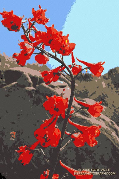
From a run at Sage Ranch earlier this Summer.

From a run at Sage Ranch earlier this Summer.
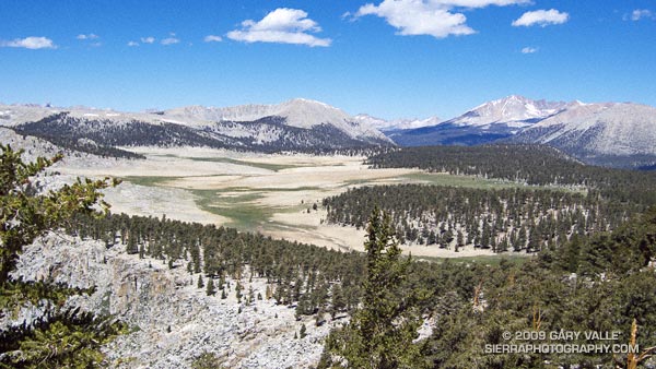
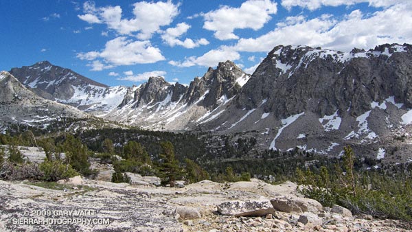
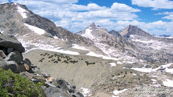
The photograph of Siberian Outpost and Mt. Kaweah was taken from the Pacific Crest Trail, north of Chicken Spring Lake, while running the 22 mile Cottonwood Pass – New Army Pass loop — an outstanding high mountain course that is nearly all above 10,000′.
The large treeless area is Siberian Outpost. Reminiscent of an expanse of tundra, an exposed camp here would certainly have the windswept, isolated character of the north. The high peak on the right side of the photograph is Mt. Kaweah (13,802′). To the left is Mt. Anna Mills and to the right, Mt. Guyot. The peaks of the Great Western Divide can be seen in the distance. Hidden from view, between Mt. Guyot and Mt. Kaweah, is the Kern (River) Trench near Kern Hot Springs.
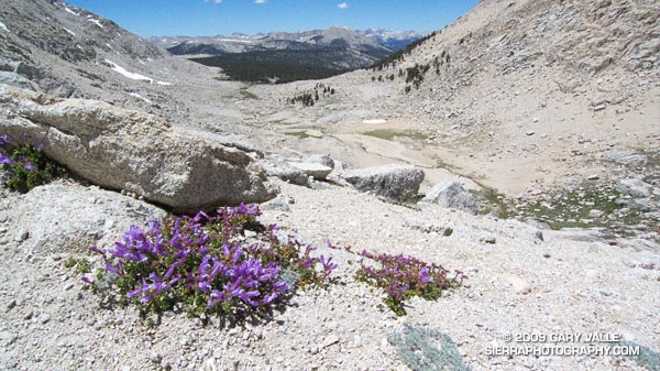
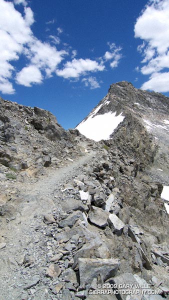
In my experience the loop is a MUCH better run when done in the clockwise direction. Something to keep in mind, particularly in a heavy snow year, is that you approach New Army Pass from the west, and don’t get to see the snow situation on the steep, east side of New Army Pass until you get there — at about mile 13.
This wasn’t a heavy snow year, but the weather this Spring was cool and there were some late season storms. So it wasn’t a big surprise to find a steep patch of snow blocking the trail. With a light pack it was relatively straightforward to find a way around the snow, but earlier in the season, or in a heavier snow year, this might not be the case.
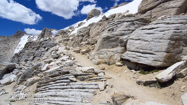
Additional info and photographs can be found in my posts Cottonwood – New Army Pass Loop and New Army Pass – Cottonwood Pass Loop. Here is a Cesium browser View of a GPS trace of the loop.
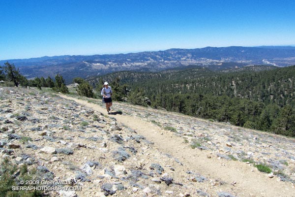
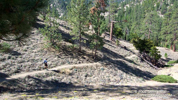
The out and back trail run from the Chula Vista parking lot on Mt. Pinos to the top of Mt. Abel is one of the best “short” mountain runs in Southern California. Most of the run is on the Vincent Tumamait Trail — a technical single track trail in the Chumash Wilderness in Los Padres National Forest.
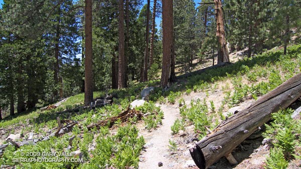
 Ranging in elevation from about 7700′ to 8800′, the run packs a lot into its 15 mile length, combining great scenery with demanding uphills and superb downhills through old growth pine and fir forest. The summit area of Mt. Pinos is open and alpine with views that can range from the ocean to the Sierra.
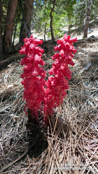
 About 4 miles from the parking lot is the North Fork Trail junction. A short side trip on this trail leads to the seeps, spring and wildflowers at Sheep Camp. The Vincent Tumamait Trail ends at Cerro Noroeste (Mt. Abel) road, but it is not difficult to work up through the pines about 1/3 of a mile to the campground on Mt. Abel’s summit.
Usually about 20-30 degrees cooler than lowland hot spots such as the San Fernando Valley, the run is a great way to beat the heat on a hot summer day. See the post Vincent Tumamait Trail for more info and additional trail running options.
The title photo is of Lynn Longan, running up the switchbacks near the Condor Observation Site on Mt. Pinos.
From Sunday’s out and back trail run from Onion Valley, over Kearsarge Pass, to Glen Pass. University Peak is the peak in shadow on the left of the photograph.
Mt. Cotter and Mt. Clarence King from Glen Pass.
The last time I was on Glen Pass was a brisk and brilliant October morning in the late 70’s. Overnight, the first cold front of the season had covered the trail with a few inches of snow. Working up toward the pass, bright fingers of gold had reached through long shadows to illuminate the angular, lichen-covered rocks, and the new snow had sparkled in celebration of Winter’s rapid approach.
Today, I’m back on Glen Pass, once again reveling in the wildness and beauty of my surroundings. There is almost no wind, and even at 12,000′ the day is warm. Refreshed by late season storms, the remaining snow is bright and youthful, accenting the elegant lines of the rugged alpine terrain. In counterpoint to the snow, a patchwork of clouds decorate the intensely blue sky.
In the outdoors, each place and day is remarkable in its own way.
Here are a few photographs from the run:
University Peak (13,589’/4142 m) from the Kearsarge Pass Trail.
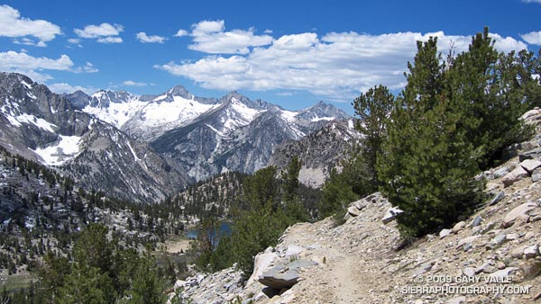
Spectacular running at 11,000′ near Bullfrog Lake. The snowy peaks are (l-r) South Guard, Mt. Brewer, North Guard, and Mt. Francis Farquhar.
Charlotte Dome from the PCT/John Muir Trail, south of Glen Pass.
Switchbacks on the south side of Glen Pass. If you look closely you can see a pair of hikers working up the trail.
Nearing the top of Glen Pass (11,978’/3651 m).
The out and back trail run from Onion Valley (9200’/2804 m), over Kearsarge Pass (11823’/3604 m), to Glen Pass (11,978’/3651 m) worked out to about 20 miles, with an elevation gain/loss of about 4750 ft. Here’s a Cesium browser View of a GPS trace of my route and an elevation profile generated in SportTracks.
Related post: Up and Over Kearsarge Pass
Last year on this date, Southern California was in the middle of a heatwave. On June 20, 2008, Los Angeles Pierce College in Woodland Hills reached a record-setting high of 111°F, and on June 21 the temp reached 108°F!
Not so this June! So far this month, Downtown Los Angeles has not had a day when the average temperature was above normal. And it’s not only the low elevation stations that have been cool. Several times this month the overnight low at the Big Pines RAWS, near Wrightwood in the San Gabriel Mountains, has dropped into the thirties, and daytime temps have averaged more than 10 degrees below normal.
This translates to great running weather in Southern California, and near perfect weather for trail running in the San Gabriel Mountains. Today, did the Three Points – Buckhorn loop, along with a short detour up to the summit of Waterman Mountain. The route worked out to about 23 miles with a reality-checked elevation gain/loss of about 3800′. Here’s a Cesium browser View of a GPS trace of the run.
The title photo is of Dave Burke, cruising down a nice section of the PCT between Cloudburst Summit and Cooper Canyon.
Related post: Three Points Loop Plus Mt. Waterman