Category Archives: nature

Rocky Peak Rainstorm

Rocky Peak Rainstorm

Clouds swirled around me as I worked up the steep trail toward an overlook near Rocky Peak. I stopped and listened to the patter of the rain against the rocks, its intensity rising and falling with the gusts of wind.

The wind-driven rain trickled down my face, tasting cool and clean. It didn’t matter that my running clothes were soaked and that with each gust I could feel a chill. It was raining!

In the same manner that a color will sometimes appear especially pure and vibrant, there was an unusual liveliness to this rain.

Southern California Rain and the 2009-2010 El Niño

Who would think a western Pacific typhoon could so directly affect California’s weather? But that’s what is happening. The moisture from typhoon Melor, which was over Japan just a few days ago, was captured by an extending and strengthening jet stream. This has resulted in an atmospheric river of moisture, stretching across the Pacific and into California.


This morning, Intellicast composite radar shows Northern and Central California already being hammered by the system. Southern California has seen a few showers, and several stations have already recorded significant rainfall. As of 9:00 a.m. the CNRFC Precipitation Map shows isolated 24 hr. rainfall amounts in the foothills and mountains of Santa Barbara, Ventura, and Los Angeles County ranging from about 0.16 inch at Sandberg to 0.61 inch at West Big Pine.

The last day there was measurable rainfall at Downtown Los Angeles (USC) was on June 5, 2009, when 0.13 inch was recorded. Computer weather models forecast the best dynamics and highest rainfall totals will be in the northern two-thirds of the state, but in recent days have been trending wetter in the Los Angeles area, particularly in the mountains.

With so much moisture in the atmosphere, it takes very little lift to produce rain. Onshore winds, full of moisture, are lifted by foothills and mountains across the flow, and the result is rain — sometimes lots of it. In this case it appears the south to west facing mountains and foothills of Santa Barbara, Ventura and Los Angeles counties may record much higher rainfall totals than the lowland areas.

In a decade characterized by unusual El Ninos, the ongoing El Niño of 2009-2010 is another strange one. El Niño signals continue mixed. The Aug-Sep Multivariate ENSO Index (MEI), decreased from 0.978 to 0.754, however other El Niño signals appear to be rebounding. In the last two weeks low level equatorial westerly anomalies have increased significantly. The reduction in the strength of the trade winds, and a downwelling Kelvin wave resulting from a very strong westerly wind burst already appear to be increasing upper ocean heat content in the central equatorial Pacific. The 30 day moving Southern Oscillation Index (SOI) has been dropping, and should return to negative territory in a day or so.

Recurring equatorial westerly wind bursts and enhanced west-central Pacific convection has been slowly migrating eastward. The most recent round of enhanced convection was centered at about 160E. This is consistent with a developing El Niño, and may have contributed to the creation of the atmospheric river now affecting California, by helping to extend the Pacific jet stream following an East Asian mountain torque event.

However, total and relative AAM remain negative, and are lower than is generally the case during a developing El Niño. Of the weak to moderate El Ninos that have occurred Since 1959, only the 1977-78 and 1994-95 El Niños have had negative average July-September relative AAM values comparable to the current El Niño. Since 1959, only 4 of 15 El Niños have had negative average relative AAM values during the Southern California rain season of November to March. (Revised 12/14/09)

Moderate El Niños come in many flavors and have varying impacts. Under the guise of such El Niños Los Angeles experienced its second wettest water year on record in 2004-2005, when 37.25 inches of rain was recorded; then in 2006-2007 had its driest water year on record, when only 3.21″ was recorded. What flavor will the 2009-2010 El Niño be?

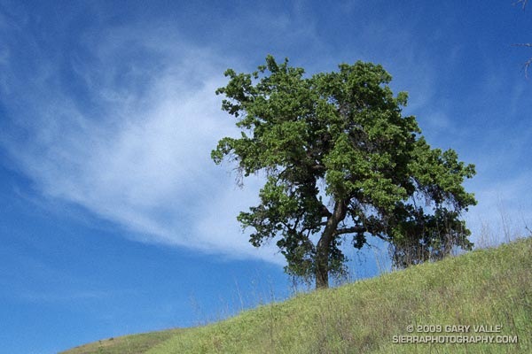
The photo of the tree and clouds is from yesterday’s run at Ahmanson Ranch.

Related post: How Does the El Nino of 2009-10 Compare to Other Warm ENSO Episodes Since 1950?

Scrub Oak Apple Gall

Scrub oak apple gall.

Almost incandescent in the soft light of an overcast sky, the remarkable color of this scrub oak apple gall contrasts sharply with the muted greens, grays and browns of the surrounding chaparral.

The gall forms in response to the larvae of the California gall wasp. The gall protects the developing larvae, as well as providing it a source of food.

On the right side of the gall there appears to be a “sun print” of an oak leaf in the red color, where a nearby leaf may have shielded the surface from sunlight.

From today’s run on the Backbone Trail in the Santa Monica Mountains, near Saddle Peak.

Tri-Peaks, Sandstone Peak and the Backbone Trail

Sandstone Peak, the highest point in the Santa Monica Mountains.

We had been scrambling up the rocky north ridge of Boney Mountain for almost an hour. During that time the clouds along the crest seemed unable to make up their mind — thickening, then thinning, gathering then dissipating. Now, as we climbed the final steep step to the crest, they were gathering and thickening once again. I wondered how difficult the route-finding was going to be in a pea soup fog.

The plan was to work up and over Tri-Peaks to Sandstone Peak, then backtrack on the Backbone Trail to the Chamberlain Trail, following it down into the Sycamore Canyon drainage. From there we would see.


Big Dome from Tri-Peaks, in the Boney Mountain Wilderness
Cresting the top of the ridge, I paused to get oriented. Across the canyon, Tri-Peaks lay cloaked in clouds, with only its broad base visible from my vantage point. As we traversed along the cliff toward the peak’s northern flank, nebulous patches of cloud whisked by, carried on a brisk breeze. Reaching a saddle, we wove our way through giant boulders and chaparral to the crags that form Tri-Peaks’ summit.

As if passing through a hidden portal, the clouds dissolved as we worked over to the south side of the peak — opening to a brilliant blue sky. Across the canyon, Big Dome had wrestled free of its tentacles of fog, and to the east, Sandstone Peak stood Everest-like, its summit wreathed in a veil of cloud.

It was a day energized with the zeal of Autumn — a day to climb a peak, and then run down a mountain, across a valley, and over a distant horizon.

Some related posts: Sandstone Peak from Wendy Drive, Boney Mountain North Side Loop

Climate Change and the Southern Foxtail Pine

Windward side of a southern foxtail pine snag.

The windward side of this foxtail pine snag has been blasted by the icy winds of a multitude of Winter storms. The wind has sculpted the mineral-like wood, exposing and accentuating its inner layers.

The photo is from last Saturday’s Cottonwood Pass – New Army Pass trail run. Nearly all of this route is above 10,000 ft. and 12 miles of it are above 11,000 ft. This relatively dry, high altitude habitat is home to the southern foxtail pine (Pinus balfouriana subsp. austrina).

One of the less common Sierra conifers, the tree is a long-lived species that is closely related to the bristlecone pine. The FEIS database references a southern foxtail pine 3400 years old, and the Gymnosperm Database a specimen with a crossdated age of 2110 years.

Because the tree grows so slowly, the wood is dense, and dead trees are slow to decay. In the vicinity of Cirque Peak, and a few other areas, dead foxtail pines and remnants are found above the current tree line. By crossdating tree ring sequences, a study published in 1997 found that over the past 3500 years the tree line in this part of the Sierra has generally been higher than it is now.

The study deduced that one period of reduced tree abundance and lowered tree line elevation was associated with warmer temperatures, and at least two severe multi-decade droughts. In contrast, the most recent decline has occurred during a cold, wet period that started about 450 BP.

It is remarkable that some of the dead foxtail pines studied here were alive during the Bronze Age, 4000 years BP.