Not all trails will have a smooth tread, good footing, trimmed vegetation, trail signs and other luxuries. What you see is what you get, and sometimes what you get is not perfect.
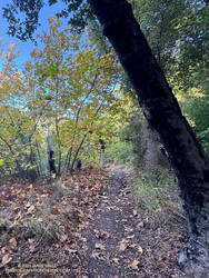
That was the case on last May’s run to the Serrano Valley from Wendy Drive. A long stretch of the Old Boney Trail was all but impassable. The trail was badly overgrown, the day foggy and gray, and everything was dripping wet.
Serrano Canyon Trail
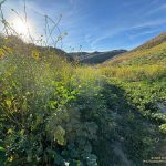
But there is just something about immersing yourself in the good and not-so-good that nature offers. It’s part of what nature is. The splendid display of wildflowers seen on that run was a result of the rainy season that produced the overgrown trail.
Curious to see how that section of trail had changed in seven months, this morning I was back on the Old Boney Trail and on my way to Serrano Valley. It had rained around 4 inches during the week, and I expected the mud to be like glue and creek crossings wet.
Use of the trail had improved its condition. There were still some overgrown sections but most of the time I could see my feet, as well as the ruts and rocks on the trail. It was muddy in the usual places but the globs of mud on my shoes didn’t reach dinner plate proportions.
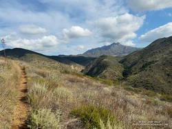
Fireline Trail with Boney Mountain in the distance.
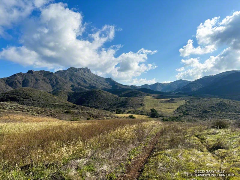
In the wake of the storm, the weather was exhilarating. Postcard clouds decorated the crest of Boney Mountain and a cool breeze filtered through the canyons. Despite all the rain, Serrano Creek was flowing at a modest level, and I emerged from Serrano Canyon with dry shoes.
It was a day for a longer run, and when I reached Sycamore Canyon fire road, I turned left (south) and continued down the canyon to the Fireline Trail. Going up the Fireline Trail to Overlook Fire Road extended the run and expanded the views. A right turn on Overlook Fire Road lead to the top of the Ray Miller Trail, and from there to the Hub. These junctions offer additional opportunities for extending the run.
Today, I ran down Hell Hill, over to the Two Foxes Trail via Wood Canyon Fire Road, then picked up Sycamore Canyon Fire Road near the Danielson Multi-Use Area and followed it to the Upper Sycamore Trail, Danielson Road, and Satwiwa. This interactive, 3D terrain view shows the route.
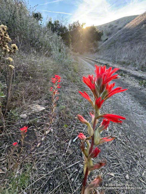
Paintbrush blooming in mid-December in Cheeseboro Canyon
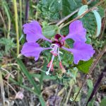
The paintbrush above, and the following Spring-blooming wildflowers were photographed on December 14,2023, on a trail run from the Victory Trailhead of Upper Las Virgenes Canyon Open Space Preserve. With the exception of the black mustard, the wildflowers were found along a half-mile stretch of dirt road connecting upper Las Virgenes and Cheeseboro Canyons.
Elegant Clarkia.
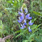
Lupine.
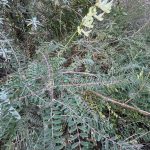
Milk vetch.
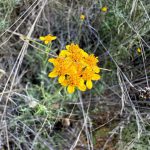
Golden yarrow.
Invasive black mustard and mallow.
The false Spring was the result of rain from Tropical Storm Hilary in August, an extended period of wetter than normal weather, and somewhat warmer Fall temperatures. The Water Year that ended September 30, 2023 was the seventh wettest on record for Los Angeles and Calendar Year 2023 was the sixth wettest.
The photograph above was taken a few steps off the Backbone Trail, between the Corral Canyon Trailhead and Mesa Peak Motorway fire road. Also in the area was a set of table and chairs that might be used for an ocean-view card game or a lunch break.
These scenes were about halfway through a variation of the Bulldog Loop that starts/ends at the Cistern Trailhead on Mulholland Highway. The route follows the Cistern, Lookout, and Cage Creek Trails down to the Crags Road Trail, just east of where it crosses Malibu Creek.
A permanent bridge used to span the creek, but after being washed out several times in Winter floods, a “seasonal” bridge was put in place. The seasonal bridge is removed when there is a threat of flooding, such as during the rainy season.
This morning, the temperature in the canyon was in the mid-thirties. That was cool enough that I didn’t want to get wet, and I hoped the removal of the bridge had been delayed. But several days of rain were in the forecast, and as I neared the creek, I could see the bridge now lay alongside trail.
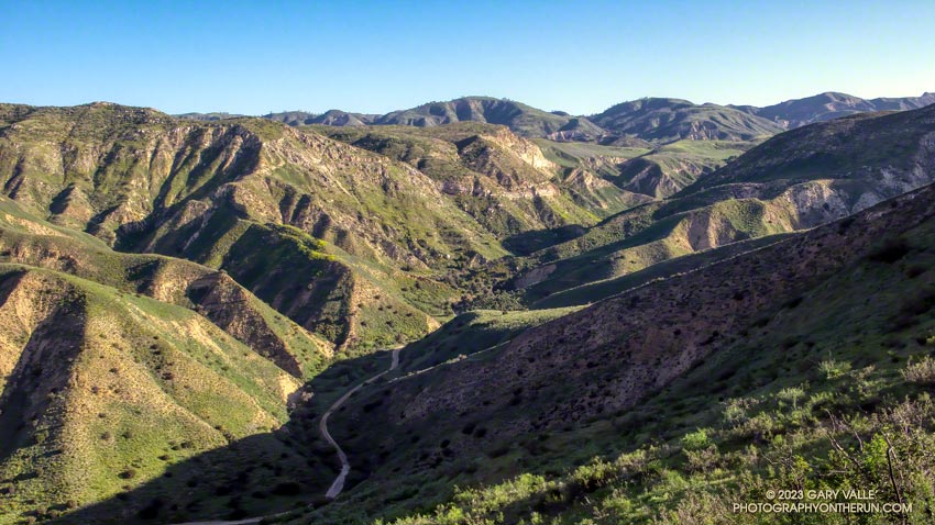
At times the site of a religious colony, a grit mine, an oil field, and a housing development, Las Llajas Canyon is now part of the Marr Ranch Open Space and Rocky Peak Park. Its oak groves, gurgling stream, varied plants, and unique geology make it a popular place to hike, run or ride.
According to California Place Names, Las Llajas might have originated from a misspelling of the Spanish word “llagas,” which literally means sores or wounds. Perhaps this was a reference to the area’s natural oil seeps. These would have been an important resource for the Chumash and early settlers.
The trailhead for Las Llajas Canyon is on Evening Sky Drive in Simi Valley. From the trailhead, it’s about 3.4 miles up the (mostly) dirt road to a windmill and oak-shaded trail junction. From the junction, a connecting trail crosses the creek and then climbs steeply to Rocky Peak Road. A strenuous 9.2 mile loop — Chumash-Las Llajas Loop — follows this route.
There are also some less-used side trails in Las Llajas Canyon. A use trail on the canyon’s east side starts about 0.4 mile from the trailhead and connects to Rocky Peak Road near the highest point in Rocky Peak Park. A very steep, eroded hill marks the beginning of the route. The trail ends at a large cairn near Rocky Peak Road. Fossiliferous limestone, composed of seashells, is found here. It is similar to that found at Coquina Mine.
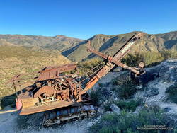
About a half-mile up the trail splits — the Coquina Mine use trail switches back to the right, while a trail connecting to the Marr Ranch Trail continues straight ahead. After the switchback, the Coquina Mine trail traverses across a steep, rocky face that overlooks Las Lajas Canyon and then continues to the top of the peak. As the trail winds up the mountain, there are bits and pieces of rusted mining equipment and abandoned dig sites — signposts of success and failure on the meandering trail of time.
“Thank you so much for this extraordinary image of a P&H 206! Our company built Model 206 machines during the 1920s and 1930s. They were offered in shovel configuration, such as the machine you discovered in Southern California, and also in construction crane, dragline, clamshell, pile driver and backhoe options. It is amazing to behold such a well-preserved Model 206. The arid environment must be a factor.”
“During the last 20 years there has been irregular production from deposits of shell limestone on Rancho Simi, north and east of north from Santa Susana. The quarries are on hills 2 1/2 miles apart and 1 to 2 miles from the Los Angeles County line.”
The report goes on to summarize the operation at Coquina Mine:
“In 1929 Tapo Alto Shell & Fertilizer Company leased the deposit and produced limestone until 1935. They dug limestone with a 1/4-cubic-yard gasoline shovel, and screened and crushed it in a plant having a daily capacity of 15 tons. The principal product was poultry grit…”
“Present quarry is 200 feet long by 70 feet wide, with a 40-foot face. Material is handled by gasoline shovel, having a 1/4-yard dipper, into a l 1/2-ton truck which hauls it about 200 feet to the brow of the hill where it is dumped into a chute 300 feet long. This chute empties into a hopper which discharges into the boot of an elevator; to trommel screen, 4-mesh, screenings to bin, thence to elevator and Cottrell vibrating screens ; products to two-compartment bin ; over-size from trommel to rolls and bin. The plant is so arranged that either product can be put on dump by means of a conveyor. Plant is operated by 25-h.p. Fairbanks Morse gas engine. Plant has a daily capacity of about 15 tons. Products are — 8 + 10-mesh for chickens and — 10-mesh for little chicks.”
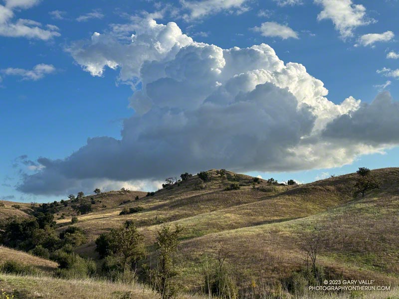
On my way to upper Las Virgenes Canyon from the Victory Trailhead of Ahmanson Ranch, I had to stop running and marvel at the intricacy and beauty of this cumulus cloud.
The cloud developed as another weak trough was passing through Southern California. For a few weeks the long-range outlooks have been advertising a change to a wetter weather pattern, but the expected transition keeps being delayed.
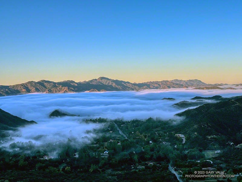
The sun had risen, casting a warm morning light on the Santa Monica Mountains. Overnight, low clouds flowed inland through Malibu Canyon, emphasizing the peaks and covering the valleys.
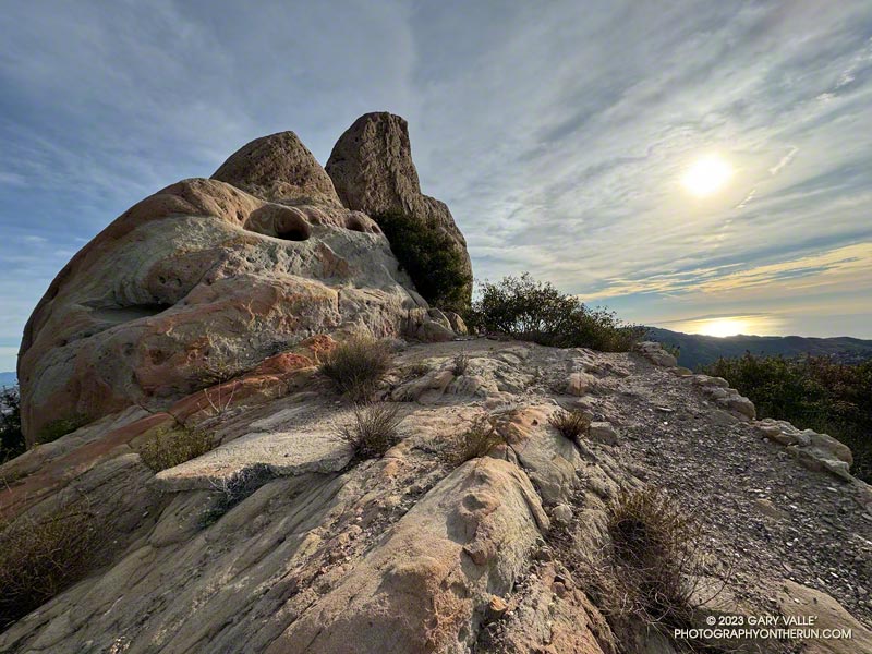
Backbone Trail below Saddle Peak.
I had just started up Topanga Lookout Ridge and was less than a mile into the Topanga Lookout Ridge Loop. Rain had muddied the ground and cleansed the sky, producing crystal clear views in every direction.
The view of the western Santa Monica Mountains extended from the top of the Tapia climb on Mesa Peak Motorway, past Castro Peak, to Boney Mountain and the highest peak in the Santa Monica range — Sandstone Peak.
In my mind, I traced the route of the Backbone Trail along the crest. My route would take me to the Backbone Trail, but this morning I would enjoy running only a few of its sixty-eight spectacular miles.