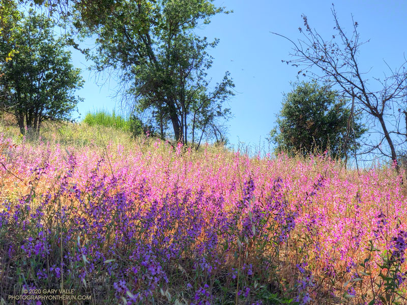
Over many years of running in Upper Las Virgenes Canyon Open Space Preserve (Ahmanson Ranch), I’ve noticed that the height of Elegant Clarkia is closely related to the amount of Spring rainfall. During some years of our most recent drought, the plants were short and scarce.
Spring 2020 was particularly wet in the Los Angeles area. Downtown Los Angeles (USC) recorded 179% of normal rainfall in March, and 332% in April. This was the wettest March and April in Los Angeles since 1992.
This year’s bloom of Elegant Clarkia is the most profuse I’ve seen in Upper Las Virgenes Canyon Open Space Preserve. Look for Elegant Clarkia along the Lasky Mesa Trail and along the Mary Wiesbrock Loop Trail on the north side of Lasky Mesa.
Another Clarkia currently blooming at Ahmanson Ranch is Purple Clarkia (Clarkia purpurea). Look for it along East Las Virgenes Canyon Road/Trail.
“Condor Peak-Elevation 5430 ft. – 1 Day By Vogel Canyon Trail. Drive Big Tujunga Canyon road to Vogel Flat Ranger Station and park auto. Hike trail starting opposite station for short distance up Vogel Canyon, then around mountain slope west of Big Tujunga Dam to summit of Condor Peak. Return by same route. Carry water and cold lunch. No fires permitted. Total hiking distance, 12 miles.”
The relocation of Big Tujunga Canyon Road in the 1950s shifted the starting point, and some other details have been updated, but the route from Vogel Flat to Condor Peak is pretty much the same as it was in 1934.
It’s telling that hikers of that era would have estimated the round-trip distance to Condor Peak at 12 miles. This was probably a “feels like” estimate of distance, based on time. The mileage in the description is far less than the presently accepted distance of 15.5-16.0 miles. Back then, the trail would have been relatively new and in better condition than it is now. Even so, they must have been fit and fast!
The “Vogel Flat” trailhead for the Condor Peak Trail is now a little to the east and above its original location, and is not obvious. If traveling up-canyon on Big Tujunga Canyon Road, it is just past Vogel Flat Road, directly across the highway from the second turnout on the right.
Note: Even in the best of circumstances, hiking, running, or riding a mountain trail involves risks. The nature of the terrain this trail navigates is such that the risk from falling while running, hiking or riding, crossing washouts, and from heat-related illness is high. There are some sketchy sections with large drop-offs. In particular, below Fox Mountain there was a very exposed washout at the top of a steep sandy chute that required extra care to cross.
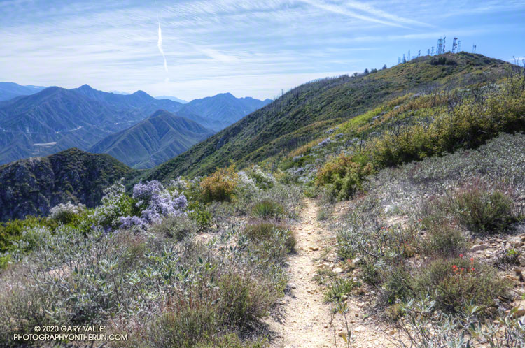
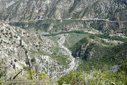
As was the case last week on the Stone Canyon Trail, it looked like some sections of the Condor Peak Trail had been trimmed in the last year or two. And like the Stone Canyon Trail, the trailwork ended partway to the peak. In this case, it ended about two-thirds of the way to Condor Peak, as the trail turns northwest and contours around Fox Mountain. The bushwhacking wasn’t nearly as bad as on the Stone Canyon Trail, and things improved once up on Fox Divide.
Prior to this outing, I’d only attempted to do the peak in December and January. There is almost no shade, and the trail traverses several south and south-east facing canyons that act like solar ovens. The last time I did Condor Peak, in December 2007, the overnight low at Clear Creek had been 34 degrees and the high 52. That day was chilly in the shade, but about right in the sun. Today, the overnight low at Clear Creek was 63 degrees and the high 75. It was warm, but with an early morning start, was OK.
It was a relief to finally reach Fox Divide. In 2007 we climbed Fox Mountain from this point. Today I was running alone and thought the ascent of Fox, as short as it is, might result in me running short of water. I didn’t do Fox, and as things worked out, I finished the last of my water about a half-mile from the end of the run. (There is a spring, but the flow was just a trickle.)
I had not reread my notes from 2007 and had conveniently forgotten the nature of the final 1.5 miles between Fox Mountain and Condor Peak. I won’t spoil the adventure here.
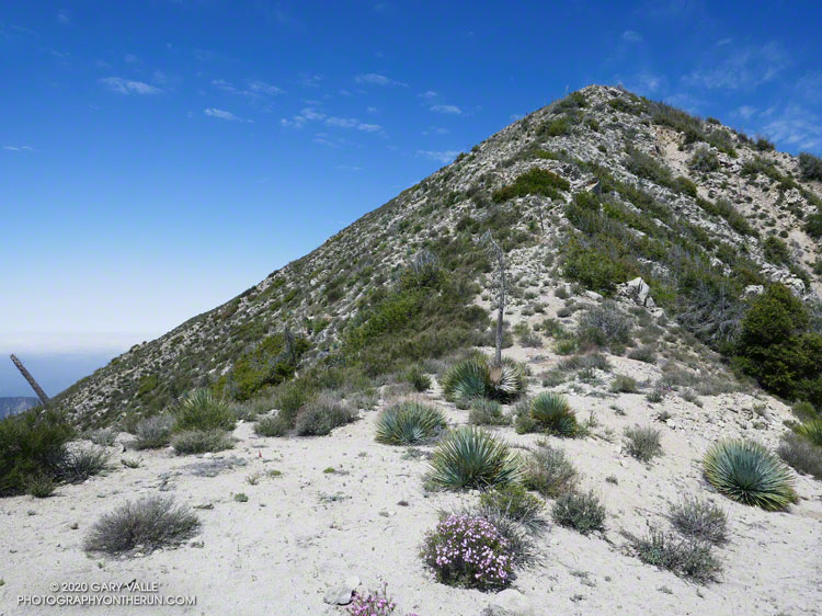
There was a fairly well-defined path up the steep, east ridge of Condor Peak. As in 2007, the red register container was on the western summit. The eastern summit, marked by a robust yucca, is about the same height. Viewed from the summit of Condor Peak (5440+’), Mt. Lukens (5074′) was clearly lower in elevation.
Like last Sunday on the Stone Canyon Trail, I did not see anyone on the way up or down the Condor Peak Trail. Ironically, just a couple miles away, there were over a hundred cars parked along Big Tujunga Canyon Road at the Gold Canyon/Trail Canyon access.
Here’s a 3D Cesium interactive view that shows a GPS track of my route up and down the Condor Peak Trail to Condor Peak. The view can be zoomed, tilted, rotated, and panned. Placemark and track locations are approximate and subject to errors.
Top of the Stone Canyon Trail and the summit of Mt. Lukens.
Update April 4, 2021. Wow! What a difference from last year! The Stone Canyon Trail was in great shape on this morning’s hike/run. All the dead limbs/small trees had been removed. All the washouts had been repaired. A ton of brush had been cleared. I didn’t even get my shoes wet crossing Big Tujunga Creek because there was a causeway of large rocks across the creek. Many thanks to whoever did the work on the trail!
At the deepest part of the creek, the cold water reached mid-thigh. I’d futzed around looking for a way to rock hop across slowly-flowing Big Tujunga Creek, but didn’t find one.
With squishy shoes, I followed the trail eastward along the creek. A little past Stone Canyon wash, the trail turned toward Mt. Lukens and started to climb.
Chaparral whitethorn
The Stone Canyon Trail is one of the trails on my list of trails less-traveled. Today, the trail choice had been between the Stone Canyon Trail and Condor Peak Trail. Recalling the difficulty of the Condor Peak Trail, I thought it would be better to do Mt. Lukens first, and save Condor Peak for later.
As I worked up the trail, I marveled at its condition. It was in surprisingly good shape! It had been groomed relatively recently, and I mentally thanked the person or group that had taken care of the trail. With a clear trail and cool morning temperature, it felt good to push the pace up the steep trail.
Stone Canyon
The last time I’d done this route was in November 2016. That outing followed five years of drought. With growth suppressed, the upper half of the trail was only moderately overgrown, and I did not see any poison oak. Ever the optimist, I thought today’s conditions might be even better.
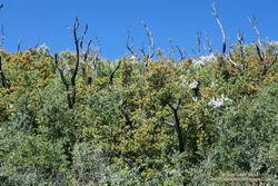
Remnants of scrub oak burned in the 2009 Station Fire
Not this time. I don’t know if Winter rains or the pandemic had intervened, but about halfway up the peak, the trailwork abruptly ended. The upper half of the trail was badly overgrown, and at inconvenient times Spring-green poison oak lined the trail. In a few places, fallen scrub oak trees — burned in the Station Fire — were mixed in with the brush. Where the 2016 ascent had been after a drought, today’s followed a wet period in which three out of the past four years have had normal or above-normal rainfall.
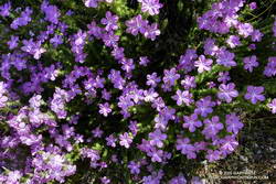
Prickly phlox
With care, patience, and a bit of bushwhacking, I eventually reached the top of the Stone Canyon Trail and the old dirt road on the west side of the peak. A few minutes later I stood alone on the summit of Mt. Lukens. I had not seen anyone on the ascent and would not encounter anyone on the way down.
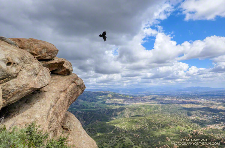
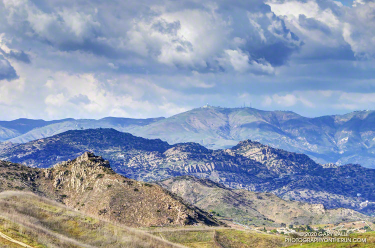
Clouds, sun and shadow accentuate the rugged topography of the northwest rim of the San Fernando Valley.
Castle Peak is the rock-capped summit on the left of the photo. Chatsworth Peak (2314′) is in shadow and behind Castle Peak. The prominent rock bands are Chatsworth Formation sandstone formed more than 65 million years ago. Oat Mountain (3747′) is the sunlit peak in the distance.
Following a December with twice normal rainfall, Downtown Los Angeles (USC) experienced the fourth driest January-February on record. Now it seems the spigot has been turned back on, and March rainfall for L.A. might very well be above normal.
As of 3:00 p.m. today, March 13, Downtown Los Angeles (USC) has recorded 2.05 inches of rain this March, boosting the rain year total (since July 1) to 9.40 inches. This is about 75% of normal for the date.
More rain is forecast over the next week or so, but the major weather models differ on the projected amounts. To make up for the January-February rainfall deficit and finish the rain year close to 100% of normal, Los Angeles needs another 5.5 inches of rain by June 30.
Not impossible, given some of the forecasts, but that would be a lot of rain for this time of year. Well see!
Update July 6, 2020. Remarkably, Downtown Los Angeles (USC) ended the rain year, July 1 to June 30, within 0.07 inch of normal rainfall. It was a tumultuous rain season that saw copious rainfall in December, and then almost none in January and February — usually the wettest months of the year. Just when we started to think “drought,” the wet weather returned. Combined, Match and April precipitation was 221% of normal. That and a little rain in May brought the Los Angeles rain year total up to 14.86 inches, just short of the normal of 14.93 inches.
Update April 12, 2020. Over six consecutive days, from April 5 to April 10, Downtown Los Angeles (USC) recorded 2.96 inches of rain. This is about 325% of the normal amount for the whole month. The precipitation totals of 14.66 inches for the rain year and 14.63 inches for the water year are now above normal for the date and within about one-third of an inch of the normal annual rainfall for Downtown Los Angeles.
Update April 10, 2020. April rainfall picked up right where March left off. As of April 9, Downtown Los Angeles (USC) has recorded 2.80 inches of rain this month. This is more than three times the normal amount of rain for the entire month of April. This brings the rain year and water year totals to 14.50 and 14.47 inches, respectively. For the first time since February 1 the rainfall totals for Los Angeles are above normal for the date. Los Angeles is now within a few tenths of an inch of normal rainfall for the year, and it is still raining today.
Update March 24, 2020. On March 22, Downtown Los Angeles (USC) set a new rainfall record for the date of 1.51 inches. As of March 24, Downtown Los Angeles has recorded 4.35 inches of rain this month. This is 179% of the normal amount of rain in March. The current rain year/water year total of 11.70/11.67 inches is about 88%/90% of normal for the date. The magic number for 100% of normal rainfall is 14.93 inches — either by June 30 (Rain Year) or September 30 (Water Year).
Update March 17, 2020. As of March 16, Downtown Los Angeles (USC) has recorded 2.80 inches of rain this month. This already exceeds the normal amount of rainfall for the entire month of March, which is 2.43 inches. The current rain year/water year total of 10.15/10.12 inches is about 79%/81% of normal for the date.