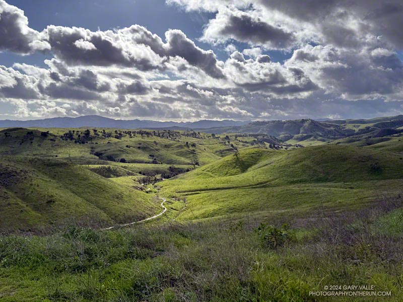
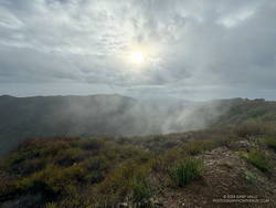
A very wet East Las Virgenes Canyon and Trail on February 8, 2024, following seven days of rain. This was by far the wettest start to February in Los Angeles since recordkeeping began in July 1877.
Over the first six days of February 2024, Downtown Los Angeles recorded 10.2 inches of rain. That’s almost three-quarters of L.A.’s normal ANNUAL rainfall in just a few days and the wettest start to February on record! Some stations in the Santa Monica and San Gabriel Mountains recorded even more — over 13 inches in some locations!
How much did it rain at Ahmanson Ranch (Upper Las Virgenes Canyon Open Space Preserve)? Unfortunately the Remote Automated Weather Station (RAWS) on a hill between Upper Las Virgenes Canyon and Cheeseboro Canyon hasn’t been accurately measuring precipitation. A citizen weather station (KCAWOODL130) near the Victory Trailhead at Ahmanson Ranch recorded over 11 inches from February 1 – 6. Another station near Cheeseboro Road in Agoura (KCAAGOUR41) recorded over 9 inches.
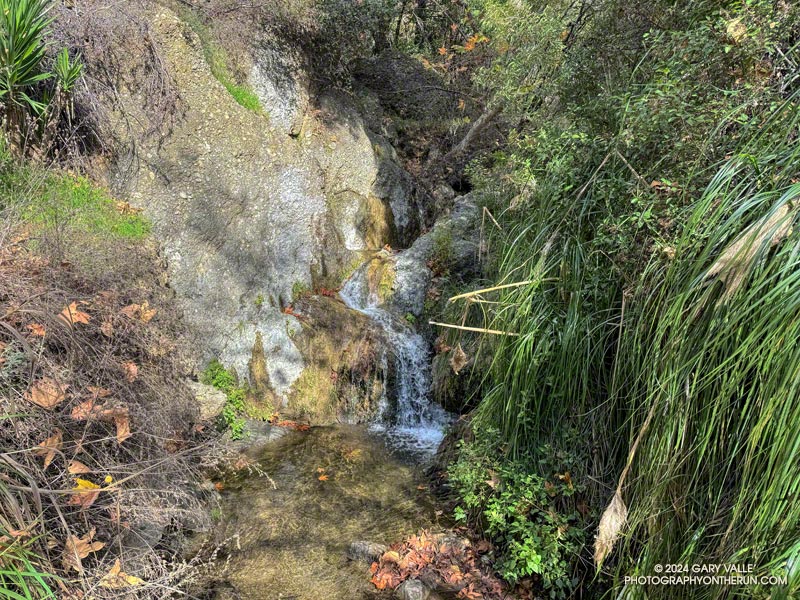
The Temescal Canyon “waterfall” is an immensely popular cascade, most often accessed from Temescal Gateway Park using the Temescal Canyon Trail. Judging from the number of people on the trail, a loop incorporating the Temescal Canyon and Temescal Ridge Trails is also very popular.
Even though many refer to it as a waterfall, it’s not a dramatic river-wide fall, such as Nevada Fall in Yosemite. Picture a Japanese garden with a gurgling little stream, cascading down through rocks into a pool, surrounded by an artistic arrangement of plants and trees. There’s even the requisite bridge to complete the composition. It would be meditative if it were not so popular.
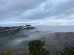
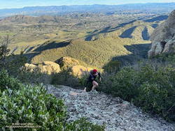
Cloud-shrouded view of the Cathedral Rocks/Hub area.
Over the past few weeks, I’ve run from the Top of Reseda (Marvin Braude Mulholland Gateway Park) to the Temescal Canyon Cascade two ways — a 15-mile out-and-back and a 21-mile loop.
The out-and-back route from the Top of Reseda was one of those “I’ll just go a little bit farther” runs. It had rained the day before and the NWS forecast called for a chance of showers in the morning and then showers likely in the afternoon.
High Point (Goat Peak) from Temescal Ridge.
With the weather unsettled, I didn’t have a particular plan in mind. When I started the run, it looked like it might rain at any time, so I decided to run to Temescal Peak, and then play it by ear from there. Once on Temescal Peak, the weather seemed to be holding, so I continued to Temescal Lookout. From the Lookout, Green Peak was just a “little bit further,” and in a few minutes, I was standing on top.
I continued to be drawn down Temescal Ridge in this fashion, and before I knew it was at the junction of the Temescal Ridge and Temescal Canyon Trails. From there, it was only a half-mile down to the cascade.
Scrambling up Boney Mountain’s Western Ridge
Two weeks later, I was back at the Top of Reseda. It had rained an inch and a half in Downtown Los Angeles a couple of days before, and a well-advertised multi-day rain event was forecast to begin the following day.
The previous weekend, a friend and I had climbed/run to Sandstone Peak from Wendy Drive. Temps in the sun reached into the 80s, and maybe I talked too much and ate and drank too little. On the way back, I hit the wall near the turn onto the Upper Sycamore Trail.
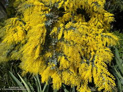
Cootamundra wattle at Will Rogers.
This morning, I had no idea how my legs were going to feel. My loosely defined plan was to run out the Rogers Road segment of the Backbone Trail from the Top of Reseda and see. If the legs held up, I’d continue to Will Rogers State Historic Park. If not, maybe I’d do Goat Peak or something else.
The temperature was in the 40s most of the way down to Will Rogers. With the cool weather, it seemed my running was back to normal. From Will Rogers, I headed over to Rivas Canyon, where I found Sierra Club volunteers hard at work on the Rivas Canyon Trail. This enjoyable trail links Will Rogers to Temescal Canyon and is a key part of the loop.
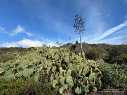
Cactus and agave along the Rivas Canyon Trail.
Once down in Temescal Canyon, there was a constant stream of hikers going up the Temescal Canyon Trail to the cascade. With the recent rain and good weather, the cascade had more water and more people than on the run in January. A large group rested near the bridge, and hikers hustled and bustled up and down the trail. The little cascade gurgled and burbled in the morning sun, glistening bubbles popping up beneath the plunging stream and then disappearing as they wandered downstream.
Soon, I was chugging up the trail toward its junction with the Temescal Ridge Trail, retracing my steps from two weeks before.
Not all trails will have a smooth tread, good footing, trimmed vegetation, trail signs and other luxuries. What you see is what you get, and sometimes what you get is not perfect.
That was the case on last May’s run to the Serrano Valley from Wendy Drive. A long stretch of the Old Boney Trail was all but impassable. The trail was badly overgrown, the day foggy and gray, and everything was dripping wet.
Serrano Canyon Trail
But there is just something about immersing yourself in the good and not-so-good that nature offers. It’s part of what nature is. The splendid display of wildflowers seen on that run was a result of the rainy season that produced the overgrown trail.
Curious to see how that section of trail had changed in seven months, this morning I was back on the Old Boney Trail and on my way to Serrano Valley. It had rained around 4 inches during the week, and I expected the mud to be like glue and creek crossings wet.
Use of the trail had improved its condition. There were still some overgrown sections but most of the time I could see my feet, as well as the ruts and rocks on the trail. It was muddy in the usual places but the globs of mud on my shoes didn’t reach dinner plate proportions.
Fireline Trail with Boney Mountain in the distance.
In the wake of the storm, the weather was exhilarating. Postcard clouds decorated the crest of Boney Mountain and a cool breeze filtered through the canyons. Despite all the rain, Serrano Creek was flowing at a modest level, and I emerged from Serrano Canyon with dry shoes.
It was a day for a longer run, and when I reached Sycamore Canyon fire road, I turned left (south) and continued down the canyon to the Fireline Trail. Going up the Fireline Trail to Overlook Fire Road extended the run and expanded the views. A right turn on Overlook Fire Road lead to the top of the Ray Miller Trail, and from there to the Hub. These junctions offer additional opportunities for extending the run.
Today, I ran down Hell Hill, over to the Two Foxes Trail via Wood Canyon Fire Road, then picked up Sycamore Canyon Fire Road near the Danielson Multi-Use Area and followed it to the Upper Sycamore Trail, Danielson Road, and Satwiwa. This interactive, 3D terrain view shows the route.
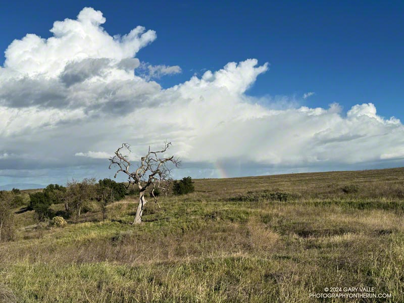
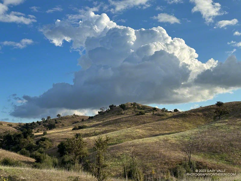
On my way to upper Las Virgenes Canyon from the Victory Trailhead of Ahmanson Ranch, I had to stop running and marvel at the intricacy and beauty of this cumulus cloud.
The cloud developed as another weak trough was passing through Southern California. For a few weeks the long-range outlooks have been advertising a change to a wetter weather pattern, but the expected transition keeps being delayed.