Category Archives: wildfire

Ladyface After the Woolsey Fire

Northeast ridge of Ladyface mountain

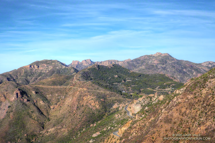
In January, on my way to do a run on the Backbone Trail, I stopped for a moment along Kanan Road to see if the ridges on the east side of Ladyface peak were still accessible. I didn’t see any obvious access issues and made a mental note to get back and do the peak soon.

“Soon” turned out to be earlier this February. While the route and the climbing were about the same as the last time I did the Ladyface Loop, the mountain itself had changed dramatically.

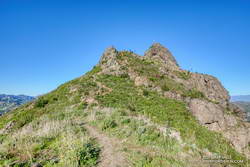
Nearly all of the chaparral on the peak was incinerated by the Woolsey Fire. Compare the title photo above to this photo taken before the fire. Before the Woolsey Fire, the last time Ladyface was burned in a wildfire was in the October 1982 Dayton Canyon Fire — a span of 37 years.

Bush sunflower along the northeast ridge of Ladyface

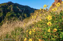
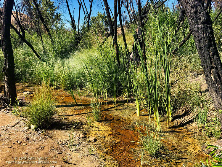
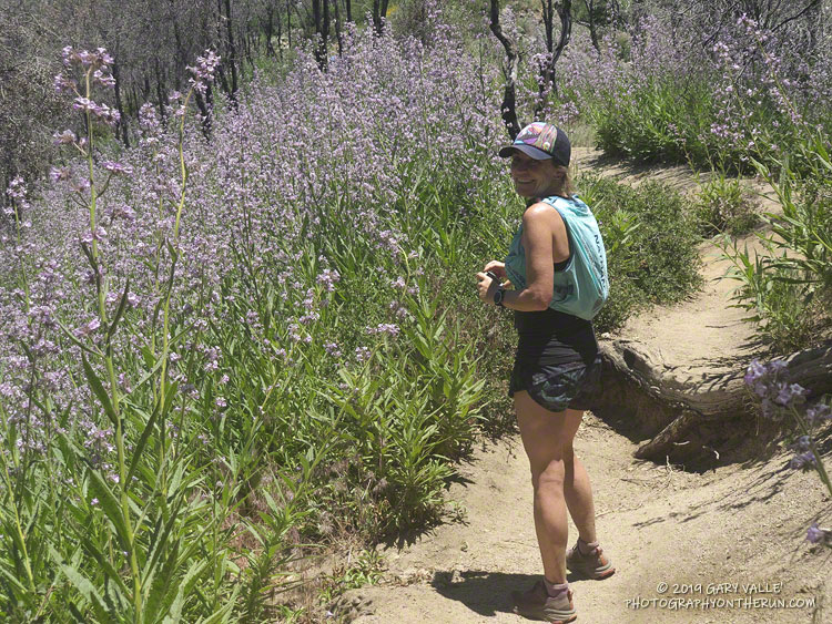
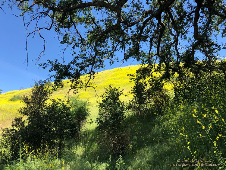
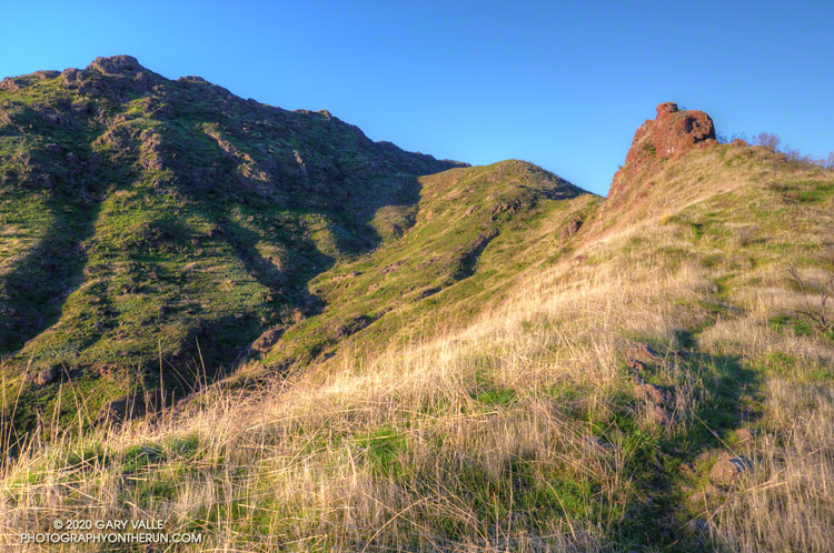
Like other areas burned in the Woolsey Fire, Ladyface is recovering. It will just take time. December’s rains have turned the mountain green, laurel sumac and other chaparral plants are crown-sprouting, and the season’s first wildflowers are blooming along the sun-warmed ridges.

For those with appropriate skills and experience, Ladyface is a relatively straightforward and enjoyable climb. But some of the things that make it interesting are the very things that can make it sketchy.

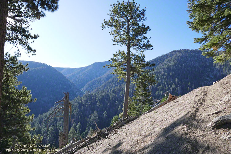
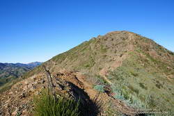
Some climbing with the hands is necessary — and that includes going down the mountain as well as going up. The route-finding isn’t always obvious, and the rock isn’t always sound. The volcanic rock is sharp, and some sections of the trail on the east/southeast ridge are very slippery — especially if wearing smooth-soled shoes.

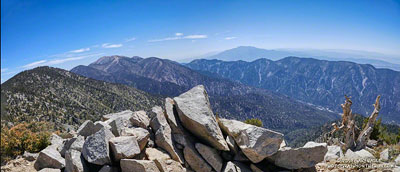
Below are a couple of photos of the east/southeast ridge.

East/Southeast Ridge of Ladyface mountain
Click for a larger image and more info.
East/Southeast ridge of Ladyface mountain.
Click for a larger image and more info.

The loop packs a lot of adventure into its 2.5 miles!

Some related posts: Ladyface Loop, Ladyface the Long Way

Backbone Trail: Encinal Canyon to Mishe Mokwa Out and Back Trail Run

Backbone Trail, Triunfo Lookout, Boney Mountain, and Sandstone Peak from Etz Meloy Mtwy

Several segments of the Backbone Trail are spectacular and have superb scenery, but one of my favorites is the stretch between the Encinal Canyon and Mishe Mokwa Trailheads. Accentuated by dramatic rock faces and outcrops, expansive mountain views are at every turn.

Done as an out and back run, the 21-mile route has a modest 2500′ of elevation gain. This translates to a relatively moderate and runnable course with more than 18 miles of single-track.

I had not run this stretch since the Woolsey Fire ravaged the Simi Hills and western Santa Monica Mountains, a little more than a year ago. While I was discouraged to see the burned limbs of what had been 8′-12′ tall red shanks, it was heartening to see that the area was recovering, and was no longer a barren and blackened “moonscape.”

Here are a few photos taken along the way.

Related post: Kanan to Mishe Mokwa to Wendy Drive

An Out-of-the-Way Trail, Two Peaks, a Wheelbarrow, and Washington’s Monument

Forsee Creek canyon from the John's Meadow Trail in the San Gorgonio Wilderness.

Wow, what a fantastic trail, canyon, and morning!

The view above is from the John’s Meadow Trail, a circuitous trail that winds its way through a less-traveled part of the San Gorgonio Wilderness.

Sugar pine cones
Sugar pine cones along the John’s Meadow Trail.

The prominent canyon in the photo is home to Forsee Creek. During the last ice age, it held one of San Gorgonio’s small glaciers. I’d just crossed the Forsee Creek a few minutes before, and in a few hours would run past its source high on the crest — Trail Fork Springs.

The peak at the head of the canyon is East San Bernardino Peak (10,691′). Its summit marks the crest of the divide and the location of the San Bernardino Peak Divide Trail. That’s where I was headed, but the path would be anything but direct.

From the Forsee Creek crossing at 7270′, the John’s Meadow Trail climbs about 1000′ in 2.3 miles to join the Divide Trail at “wheelbarrow junction,” about 5 miles west of East San Bernardino Peak. From that point I worked up the popular and scenic Divide Trail, visiting Limber Pine Bench (9330′), Washington Monument (10,290′), and San Bernardino Peak (10,649′) along the way to East San Bernardino Peak.

A weather-beaten lodgepole pine at Limber Pine Bench on the San Bernardino Peak Divide Trail.
Weather-beaten lodgepole pine.

Using this roundabout — but very scenic — route, it took me about the same time to reach San Bernardino Peak from the Forsee Creek Trailhead as it does to do San Gorgonio Mountain from the South Fork Trailhead. From San Bernardino Peak it’s a little less than a mile to East San Bernardino Peak and from there only about 0.75 mile to the lateral to Trail Fork Springs.

From the westernmost Trail Fork Springs junction with the Divide Trail the theme was downhill, downhill, and more downhill — about 3800′ of downhill over 6.7 miles.

The running on the Forsee Creek Trail was generally very good. I was glad I did the loop counterclockwise. The John’s Meadow Trail and its extension are enjoyably primitive — they appear to be “use” trails that have evolved over time. On the other hand, the Forsee Creek Trail is a constructed trail. It was designed as a pack trail, so is generally well-behaved. Great for going down, but a long haul up with a heavy pack!

San Gorgonio Mountain and San Jacinto Peak from East San Bernardino Peak.
San Gorgonio and San Jacinto from East San Bernardino Peak.

Here are a few photos taken along the way, and here is an interactive Cesium ion view of the GPS trace of my route. The 3D view can be zoomed, tilted and panned.

Note: Water is generally more reliable and accessible on the John’s Meadow Trail than on the Forsee Creek Trail. Trail Fork Springs and Jackstraw Springs are seasonal water sources that may not have water. Check with the Mill Creek Ranger Station for the current conditions and more info.

Upper Las Virgenes Creek Still Flowing in Mid-July

Upper Las Virgenes Creek, July 17, 2019.

Following our five year drought, Downtown Los Angeles and many neighboring areas recorded above-average rainfall in two of the last three rain years. This has had obvious and observable effects on the area’s plants and animals and aided in the ongoing recovery of habitats affected by drought and wildfire.

This is the first time since the Summer of 2011 that there has been flowing water in upper Las Virgenes Creek in mid-July at the crossing near the Cheeseboro connector. It’s just a trickle, but keep in mind that during some of the drought years, this section of upper Las Virgenes Creek never flowed.

Update November 19, 2019. Increased surface water and pooling in Upper Las Virgenes Creek. See the post Running Into Fall.

Update August 28, 2019.  The surface flow of Upper Las Virgenes Creek near the Cheeseboro connector is down to a bare trickle and some small pools.

Update August 7, 2019. Upper Las Virgenes Creek is still trickling.

Notes: In rain year 2016-17 Downtown Los Angeles (USC) recorded 19.00 inches of rain from July 1 to June 30, and in 2018-19, 18.82 inches. During the intervening rain year, 2017-18, only 4.79 inches was recorded.

Poodle-dog Bush Near the Top of the Mt. Wilson Trail

Poodle-dog bush (Eriodictyon parryi) growing along the Mt. Wilson Trail about a half-mile from the top.
Poodle-dog bush near the top of the Mt. Wilson Trail. June 15, 2019.

The Mt. Wilson – Chantry Flat loop is a favorite that I run a couple times a year. Including a little bonus mileage to get to the Mt. Wilson parking lot before the gate opens, the run is about 18 miles long and gains/loses about 4500′ of elevation. The main trails in the loop are the Rim Trail, Gabrielino Trail, Upper Winter Creek Trail and Mt. Wilson Trail.

The weather was perfect for today’s run. Sunny at the beginning, then partly cloudy for the 4000′ climb from the “green bridge” below Chantry to the parking lot on Mt. Wilson. Although there was a lot of poison oak on the Rim and Gabrielino Trails, it was mostly avoidable. About 30 minutes into the run, I was surprised to hear the unmistakable gobble and rustling of a wild turkey high on the Rim Trail.

Near the end of the loop, on the section of the Mt. Wilson Trail above the Mt. Wilson Toll Road, I saw two solo hikers brush against new, vigorously growing patches of Poodle-dog bush (Eriodictyon parryi). I spoke to them, and they were unaware that, like poison oak, Poodle-dog bush can cause an itchy rash. Some people don’t react at all to the plant and others can have a severe reaction. My own experience is described in this post.

Poodle-dog bush is a fire follower that grows in the San Gabriel Mountains, and some other areas. It became very widespread following the 2009 Station Fire. There are still some diminishing patches of Poodle-dog bush on the north side of Mt. Wilson (and elsewhere) from the Station Fire, but the Poodle-dog bush on this part of the Mt. Wilson Trail is a result of the 2017 Mt. Wilson Fire.

Some related posts: Contact Dermatitis from Turricula parryi – Poodle-dog Bush, Mt. Wilson – Newcomb Pass – Chantry Flat Loop, Misplaced on Mt. Wilson, GSU Mt. Wilson CHARA Telescope Array

Guardian Oaks

Young valley oaks and coast live oaks at the edge of the canopy of large valley oak in Upper Las Virgenes Canyon Open Space Preserve.

One day while running at Ahmanson Ranch, I was admiring the stately limbs of a large valley oak, and noticed that along the margin of the canopy were several sapling oaks. As I continued my run, I found that only a few other valley oaks hosted a brood of young trees.

That oaks would sprout on the margin of the canopy made sense. There is an abundance of acorns at the ends of the limbs. It is also where water drips from the oak’s leaves on foggy days or when there is light rain or drizzle. The mix of sun and shade on the edge of the canopy is the perfect place for a young oak to thrive.

The surprise came when I took a closer look at the young trees. Most were valley oaks — the same as the shepherding tree — but in some cases the young trees were coast live oaks! And sometimes there was no obvious parent coast live oak nearby.

Of course, there are plenty of coast live oaks at Ahmanson and several ways for their acorns to find their way under a valley oak. Birds and squirrels love to stash acorns, and gravity is good at moving round things downhill.

Time is at a different scale for a tree. In my mind’s eye I accelerated time and watched as the young oaks surrounding a guardian oak grew in stature. Fire sweeps through the frame on several occasions. During one fire the old brood tree collapses and in another fire, the collapsed tree disappears from the frame. Of the young oaks that have survived, one dominates, spreading its limbs and growing large and robust. Along the margins of its canopy, I can see several sapling oaks…

Note: The young oaks in the title photo are an older brood that survived the Woolsey Fire, but many younger sapling oaks were killed. Introduced grasses, black mustard, and other introduced plants produce higher fuel loads than native equivalents and increase fire mortality.