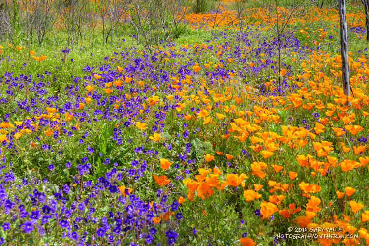
Hundreds of Parry’s Phacelia and California Poppy wildflowers form a multi-hued carpet of purple and orange along the Old Boney Trail in Pt. Mugu State Park.
From the post Wildflowers, a Waterfall, and Recovering from the Woolsey Fire.

Hundreds of Parry’s Phacelia and California Poppy wildflowers form a multi-hued carpet of purple and orange along the Old Boney Trail in Pt. Mugu State Park.
From the post Wildflowers, a Waterfall, and Recovering from the Woolsey Fire.
The sun had not yet risen and the poppies along Danielson Road were still tightly furled against the morning’s chill. The purl of Upper Sycamore Creek resonated in the canyon below — a wonderful tone that in recent years has too often been squelched by drought.
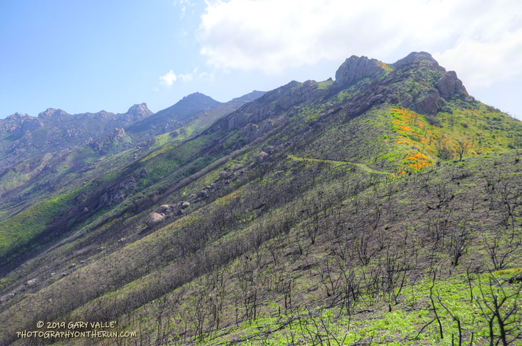
I was running to the Old Boney Trail and the start of the ridge that follows along Boney Mountain’s western escarpment to the massif’s huge summit plateau. Several of the Santa Monica Mountains highest peaks are on this plateau, including the range’s highest peak, Sandstone Peak.
In December I’d climbed this route to check the impact of the Woolsey Fire on the area. From the top of the ridge I’d been disheartened by what I saw. Tri Peaks and Sandstone Peak and much of the top of the Boney Mountain massif were a blackened, barren mess.
Now, three months later, I was headed back to Boney Mountain and would continue to Sandstone Peak for the first time since the fire.
Here are a few photos taken along the way.
Related post: After the Woolsey Fire: Boney Mountain and Pt. Mugu State Park
The Ray Miller Trailhead in Pt. Mugu State Park marks the western end of the Backbone Trail, a 68-mile scenic trail along the spine of the Santa Monica Mountains. The Ray Miller Trail’s long, winding descent into La Jolla Canyon is a favorite of runners and hikers, and a fitting end to those traversing the BBT from east to west.
My run this morning was to the Ray Miller Trailhead (and back) from Satwiwa, starting at the Wendy Drive trailhead in Newbury Park. The Wendy Drive Trailhead is very popular and is the starting point for many good runs, hikes and rides. To get an idea of the route options, see the detailed trail maps on the Pt. Mugu State Park page of VenturaCountryTrails.org.
Today I was looking to do a longer run, so didn’t take the usual route. On the way down Big Sycamore Canyon, I skipped the turns at Wood Canyon (Hell Hill), Wood Canyon Vista Trail (BBT) and Fireline Trail and at Overlook Fire Road, some eight miles into the run, finally headed uphill.
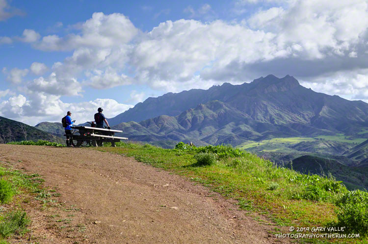
The top of the Ray Miller Trail is a stout 2.5 -mile climb from the bottom of Overlook Fire Road. Along the way there were excellent views of Sycamore Canyon, Serrano Valley and Boney Mountain.
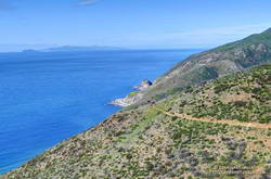
About a half-mile down the Ray Miller Trail there is a popular overlook of the coast. The day was clear and there were stunning views of the Pacific and the Channel Islands. Brushed by whispers of wind, the cerulean blue Pacific filled my view for much of the descent to the parking lot.
It was an odd feeling to run down to the parking lot with runners who were cheerfully finishing their morning run, knowing that I had many more miles to go. After a quick stop at the water spigot, I turned, and sighed, and took the first steps back up the hill and toward Satwiwa.
Here are a few photos taken along the way.
Related post: Ray Miller Training Run
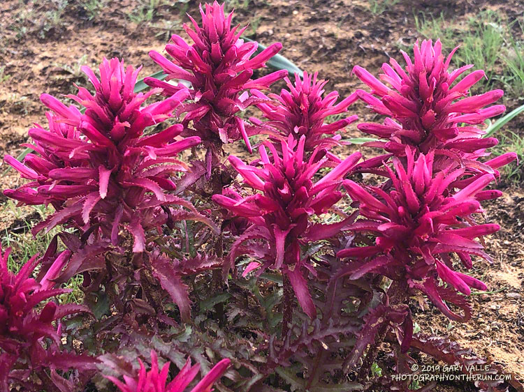
Warrior’s plume (Pedicularis densiflora) along the Cheeseboro Canyon Trail, one of the areas burned in the November 2018 Woolsey Fire.
With this rain season’s abundant rainfall, displays of wildflowers will be more extensive than usual and of greater variety — both inside and outside the Woolsey Fire burn area.
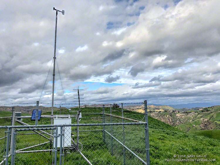
This afternoon’s run was to the Cheeseboro Remote Automated Weather Station (RAWS). The station is perched on the ridge between Las Virgenes Canyon and Cheeseboro Canyon, along the Cheeseboro Ridge power line service road.
It is about 5 miles from the Victory Trailhead of Upper Las Virgenes Canyon Open Space Preserve (formerly Ahmanson Ranch) and one of many good runs from that trailhead into the Cheeseboro – Palo Comado Canyon area.
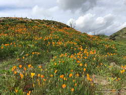
Runs in the Ahmanson Ranch area are especially scenic at the moment. Above average rainfall has produced lush green growth in the oak grasslands following the Woolsey Fire. Many of the oaks are beginning to sprout new leaves and poppies and other wildflowers are beginning to bloom. Today there was a nice show of poppies in Las Virgenes Canyon at the connector leading to Cheeseboro Ridge and Cheeseboro Canyon.
Operated by the BLM and NPS the Cheeseboro RAWS (CEEC1) has been in service since September 1995. The station was in the area burned by the 2005 Topanga and 2018 Woolsey Fires and was active throughout each event.
Following are some of the extremes recorded by the station:
• Highest hourly temperature was 115 °F on July 7, 2018.
• Lowest hourly temperature was 32 °F on December 12, 1998.
• Maximum hourly wind speed was 37 mph on October 22, 2007.
• Maximum wind gust was 92 mph on January 6, 2003.
• Maximum daily precipitation was 5.01 inches on February 12, 2003.
So far this rain year (July 1 to June 30), 15.67 inches of rain has been recorded by the station.
Related post: Southern California Trail Running Temps
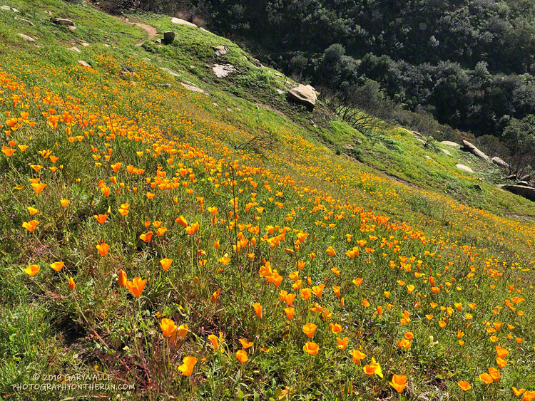
Rounded a corner running down the Lower Stagecoach Trail, above Corriganville, and was suddenly immersed in a sea of orange.
The area was burned in a potentially dangerous fire, the Peak Fire, that started along the 118 Frwy on November 12, 2018, while the Woolsey Fire was still being fought. The fire threatened homes in the eastern Simi Valley and Box Canyon, but was aggressively attacked by firefighters and quickly knocked down.