Category Archives: nature|clouds

Clouds and Crags

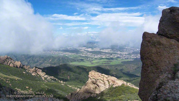
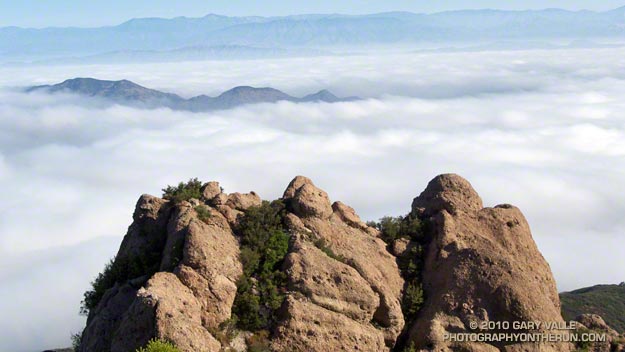
The clouds are in the Conejo Valley and the crags are a prominent highpoint on the ridge that tops the west face of Boney Mountain. Here’s a Google Earth aerial view SSE along the ridge that shows the topography. From the upper cliffs the west face drops over 2000′ to the Backbone Trail in Blue Canyon.


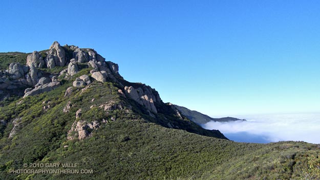
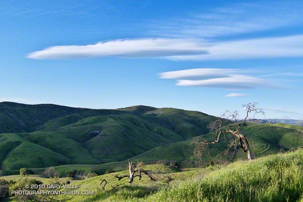
Ascending the western ridge, or easier eastern ridge, is an adventurous way to access the Backbone Trail from Wendy Dr. Once over Tri-Peaks and on the Backbone Trail several loop variations are possible. These range from a relatively direct return on the Boney Trail, to lengthy excursions to Serrano Valley or La Jolla Valley.

Today’s variation worked out to about 20 miles. Once on the upper section of the Backbone Trail, I followed it west down the Chamberlain, Boney and Blue Canyon trails to the Danielson Multi-use area in Sycamore Canyon. After doing a circuit in Sycamore Canyon I picked up the Upper Sycamore Trail and headed back to Danielson Road, Satwiwa, and the trailhead at Wendy Drive.

Some related posts: Boney Mountain Western Ridge & Loop, Sandstone Peak from Wendy Drive, Boney Mountain North Side Loop

Lenticular Wave Clouds

Lenticular wave clouds northwest of Los Angeles.

Because of their unusual “flying saucer” appearance, lens shaped lenticular clouds have long drawn attention. According to a research article in Weather, depictions of wave clouds appear in Gothic art from the 15th century.

Lenticular clouds typically form when wind flows into, and then up and over a mountain range, creating a series of “roller coaster” atmospheric waves downwind of the range. Lenticular clouds can (but don’t always) form in the peaks of the waves, as a layer of air rides up a wave, and cools and condenses. The waves are called standing waves because the peaks and troughs can stay (more or less) in the same place for hours at a time.

The rising air on the windward side of a lee wave can be soared by gliders to high altitudes. According to the FAI, the current world absolute altitude record for gliders is 15,460 meters (50,722 ft.). This record was set by the late Steve Fossett in 2006, soaring a mountain wave in the Andes. Mountain wave soaring was pioneered on the east side of the Sierra, and several single place sailplane world altitude records have been set soaring the Sierra wave.

Lee waves also have a nefarious side. Rotors, breaking waves, and other phenomena associated with mountain waves can create extreme turbulence. A sailplane destroyed in early research on rotors was estimated to have experienced 16 g of acceleration. According to the Australian Transport Safety Bureau, “clear air turbulence associated with a mountain wave ripped apart a BOAC Boeing 707 while it flew near Mt. Fuji in Japan. In 1968, a Fairchild F-27B lost parts of its wings and empennage, and in 1992 a Douglas DC-8 lost an engine and wingtip in mountain wave encounters.”

The wave clouds above were photographed northwest of Los Angeles during a trail run earlier this month. The wind forming the wave clouds appears to be from the north-northeast. The situation was peculiar because the wind at nearly all levels at that time was from the northwest. The tops of the wave clouds are being sheared by winds blowing from the northwest (left to right).

Here’s an animated series of NRL satellite photos showing the waves pictured above, and the complex wind and wave pattern at the time of the photograph.

Conejo Valley Sun and Boney Mountain Clouds

Conejo Valley from the north side of Boney Mountain.

Pushed up and over Boney Mountain’s two thousand foot western escarpment, Pacific winds condense into thick cloud along its jagged crest. At times breaking free of the mountain’s grasp, patches of cloud drift eastward, creating a patchwork of sun and shadow on the steep slopes, and in the valley below.

In the distance, the Ventura Mountains gleam with a mix of snow and cloud, and below the fields of Satwiwa stand out vibrant and green. At my feet hundreds of purple shooting stars dance in the wind; and nearby yesterday’s rain seeps and trickles from moss to lichen on the scraggy volcanic rock.

It is a remarkable morning, and an exceptional one to be doing the Boney Mountain north side loop. Here’s a short video of some of the views along the way.

Pattern Change Ahead

Patterned altocumulus clouds near Los Angeles

Computer models and other tools continue to forecast a shift to an “El Nino like” upper flow pattern next week that could result in an extended period of wet weather in Southern California. I’ll be updating Southern California Weather Notes on Wednesday with additional info.

The photograph of patterned altocumulus clouds is from this afternoon’s trail run along the northern boundary of Ahmanson Ranch, near Los Angeles.