Category Archives: nature|clouds

Malibu Creek Challenge 2009

I glanced at my watch — 5.25 miles. Clouds and fog had kept temps on the cool side for more than three-quarters of the Bulldog climb, but the sun was finally breaking through. Even though temps were down a few degrees, the long climb had still been grueling. The runner next to me was breathing heavily, and I mentally repeated my Bulldog mantra — don’t redline, don’t redline.
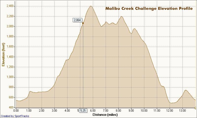

Malibu Creek Challenge 22K Elevation Profile
For many of us, that’s the problem with Bulldog — some of it is runnable and some of it isn’t. For the moment I was running, but I knew the grade well, and just ahead the fire road switchbacked right, and steepened.

I’ve been over the “I can run this hill no matter what” thing for a long time. For me, and the majority of trail runners, walking the steeps is a good thing. The little bit of time lost by walking is generally made up — and more — on other sections of the course.

Rounding a corner, the grade did steepen, and I slowed and started to walk. Taking advantage of the slow pace, I ate a Gu, took a Salt Stick cap, and gulped down some Gatorade. Another runner and I had been swapping leads up the hill, and he passed me — again. As he increased his lead, I wondered if I should be pushing a little harder.

A left turn never felt so good! A few minutes before I had reached the top of Bulldog grade, and the highest point on the course. Now gravity was on my side, and I was enjoying the downhill. There were more challenges ahead, but for now I was lost in the moment — savoring the wind in my face, the far reaching views along the rocky crest, and that wonderful feeling of being a runner.

Here’s a Cesium browser View of a GPS trace of the 22K course with my half-mile splits. (Generated in SportTracks.) See the XTERRA Malibu Creek Trail Run web page for race results and additional info.

Some related posts: Malibu Creek State Park Shadow & Sun, Fog Along Malibu Creek, Bulldog Loop and the Corral Fire, Rock Formations Along the Backbone Trail

Rocky Peak Running Weather

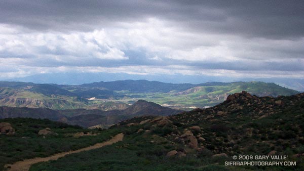
View northwest from Rocky Peak

Brrr… I picked up the pace — even with long sleeves it was COLD on Rocky Peak Road. Another in a series of blustery April systems was stirring up the weather in Southern California. Thickening clouds spritzed rain, and a belligerent wind told me in laughing gusts that I could not run fast enough to stay warm.

Occasionally a patch of sun would find its way through the clouds, briefly warm and encouraging. I needed only  to think of the 100 degree days ahead to appreciate the chilly temps.

Another cool system is forecast to move through Southern California on Friday, bringing with it a chance of rain — and more great running weather. Easter weekend should be spectacular!

Some related posts: Simi Valley from Rocky Peak, San Fernando Valley from Rocky Peak

Sugar Pine & Clouds

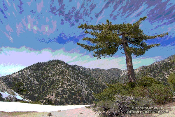
Sugar pine on Kratka Ridge, in the San Gabriel Mountains, near Los Angeles

After a nostalgic hike to the bottom of Switzer Falls, drove to Islip Saddle to check out the snow conditions. Clouds ahead of Sunday’s storm prompted a short run along Kratka Ridge to photograph some of the stunted sugar pines. Here’s the unaltered version of the title image.

Malibu Creek State Park Shadow & Sun

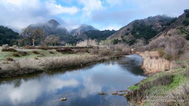
Malibu Creek State Park

My trail running shoes had not been wet or muddy since sometime in December. During the entire month of January, Downtown Los Angeles (USC) recorded about one-third of an inch of rain. Not only had it been dry, it had been warm. On a dozen of those January days, the high temperature topped eighty degrees, setting a new record!

But Winter had returned. The past three days, Los Angeles had received about 1.5 inches of rain, valley and foothill locations 2-4 inches, and some mountain stations as much as 5-7 inches. And more Winter weather was on the way. Excited about the change in the weather, today’s run was one with good muck and mire potential — the Bulldog Loop in Malibu Creek State Park.

We were not disappointed. Near Century Lake, mud the consistency of peanut butter pulled at our shoes and slowed the climb up Crags Rd, Further west, near the M*A*S*H site, calf-deep water on the trail washed the gunk off.


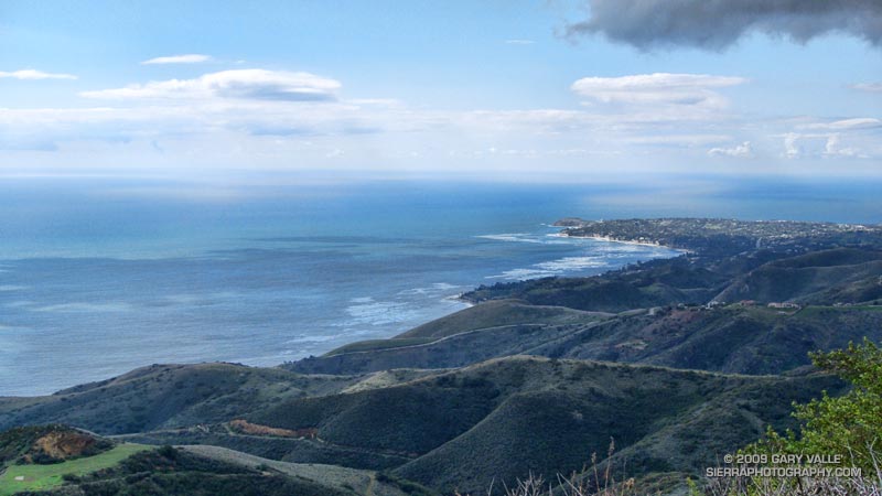
Pt. Dume from the Mesa Peak ridgeline.
The trail conditions on the remainder of the loop were more straightforward. From time to time, shafts of sun would pierce the clouds, resulting in a patchwork of shadow and sun that emphasized the rugged terrain. Along the crest, the ocean views were superb! Before descending to Tapia Park we ran out to Mesa Peak, and then followed the ridgeline to an overlook of the coast. (Marked peak 1800 on the topo.)

Including the side trip to the overlook, this variation of the Bulldog loop worked out to an exhilarating 16.5 miles, with an elevation gain/loss of about 2700 ft.

If current forecasts and outlooks for this month hold true, this won’t be our last wet and muddy trail run this February. In a couple of weeks, Los Angeles rainfall totals may climb above normal for the first time this rain season. We’ll see!

Some related posts: Fog Along Malibu Creek, Bulldog Loop and the Corral Fire

Chumash Clouds

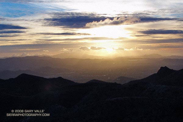
Sunset view of Simi Valley, with Boney Mountain and Conejo Mountain in the distance.

Clouds moving onshore ahead of a low pressure system that is expected to produce rain in Southern California Christmas Eve into Christmas Day. Track of the low is now projected to be a little more to the west, so the heaviest rain may occur just offshore.

From an out and back run yesterday to “fossil point” via the Chumash Trail and Rocky Peak fire road. View is of Simi Valley, with Boney Mountain and Conejo Mountain in the distance.

Clearing Clouds from Sage Ranch

Clearing clouds, northwest of Los Angeles, following the passage of an upper low storm system that resulted in widespread rainfall in Southern California.

Clearing clouds, northwest of Los Angeles, following the passage of an upper low storm system that resulted in widespread rainfall in Southern California. Several rainfall records for November 26 were broken in Los Angeles County.

Update 12/5/08 P.M. High amplitude flow continues to wreak havoc with forecasts. Our on-again, off-again chance of a shower this weekend might be on again. Original cut-off upper low center is still well offshore, but another low center has developed on the downstream side of high amplitude ridge, and this one is much closer to the Southern California coast. The low appears to be entraining some moisture, and could produce some showers, particularly as the low moves onshore and is absorbed in the main flow. We’ll see!

Update 12/5/08 A.M. No rain is expected in SoCal this weekend… The cut-off upper low set up much further west than suggested by models Tuesday and now is spinning out in the eastern Pacific, nearly halfway to Hawaii. At the moment, it looks like it could be mid-month before our next chance for significant rain.

Update 12/2/08. Computer models have been having a tough time with both the short and medium term forecasts for Southern California. Recent runs have been hinting at the possibility of some rain Saturday or Sunday. This would depend on the strength, position and behavior of an upper low that is forecast to form off the Southern California coast Thursday.

From a run at Sage Ranch Park, near Simi Valley, California.