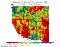
Downtown Los Angeles (USC) ended the Rain Year (July 1, 2021 – June 30, 2022) with 12.40 inches of rain. This is about 87% of the 1991-2020 Climate Normal of 14.25 inches.
Percent of Average Precipitation Western U.S. July 1, 2021 to June 30, 2022.
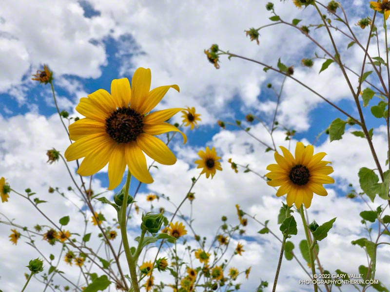
In part because of large amount of rainfall during December — nearly 9.5 inches at Los Angeles — and the meager amount of rain the previous year, the area’s vegetation responded as if there had been above average rainfall. Wildflowers bloomed in abundance and some trails became overgrown.
Looking at the broader picture, much of California, Nevada and western Arizona recorded below average precipitation, exacerbating water supply issues in the Southwest.
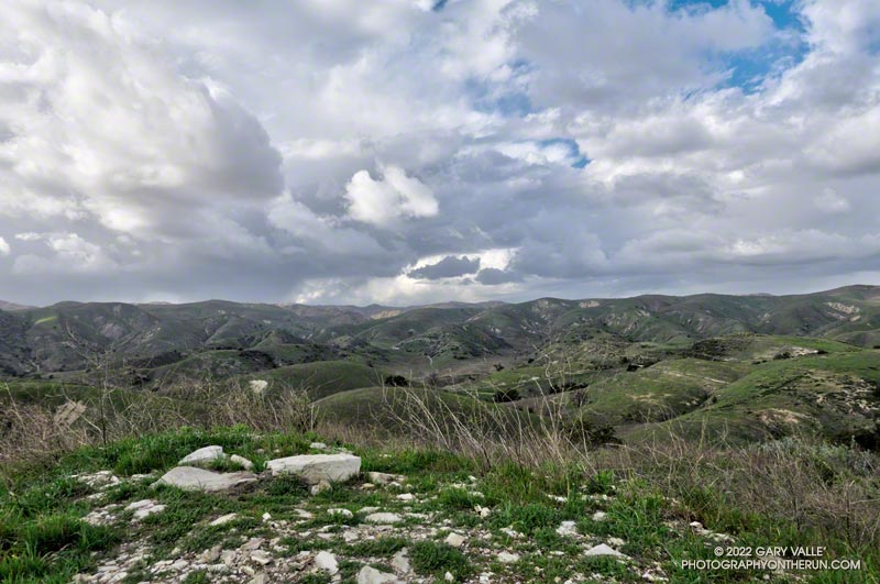
Yep, that was a rumble of thunder. It was a blustery, Spring-like afternoon and a storm cell had developed a few miles to the WNW of Lasky Mesa.
Before driving over to Ahmanson I’d checked the weather radar and seen cells circulating counterclockwise around a cold upper level low. Most were dissipating as they moved north to south, out over the Valley. The wildcard was that the upper low was moving southward, and the cells might strengthen.
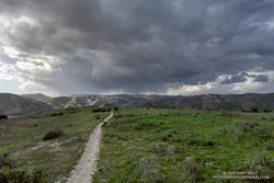
Storm cell WNW of Lasky Mesa.
Again there was a low rumble. The cell didn’t seem any closer, but now I could see additional development to the north and northeast of Ahmanson. I picked up the pace.
There’s nothing like the threat and energy of a thunderstorm to incentivize a runner. All the way back to the trailhead it looked like heck might break loose at any moment.
But it didn’t. It was just starting to rain when I got back to the car, and on the way home the streets were wet. The Cheeseboro RAWS recorded 0.06 inch of rain, as did Downtown Los Angeles (USC).
Even though the Rain and Water Year rainfall totals for Los Angeles are about normal for the date, January and February have seen little rain. Precipitation records for Los Angeles indicate the period January 1 to February 28 will be the fourth driest on record.
The precipitation outlooks for Southern California this March don’t look especially promising, with a typical La Nina precipitation pattern expected for the West Coast.
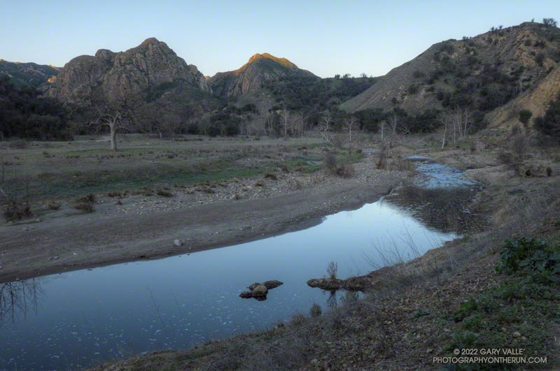
Malibu Creek and Goat Buttes before sunrise. February 6, 2022.
If you’ve done the Bulldog Loop since the first of the year, you’ve no doubt noticed there’s water in Malibu Creek again, and a lot of flood debris along the creek between Century Lake and the M.A.S.H. site. That’s all thanks to the extraordinary amount of rain we had in December. This pile of flood debris is near the old concrete bridge that washed out in the February 2017 flash flood.
This morning it was chilly along this section of creek, so it was worth a little effort to find a way across the creek with a high probability of staying dry. This sketchy log wasn’t one of them, but I found a fairly easy crossing a little upstream. Another runner mentioned there were a couple of planks across the creek just downstream of the old bridge.
Although stream gage data suggests that the peak flow was higher in February 2017, that was the result of one period of very heavy rainfall. In December 2021 there were peaks on three days, corresponding to three periods of rain.
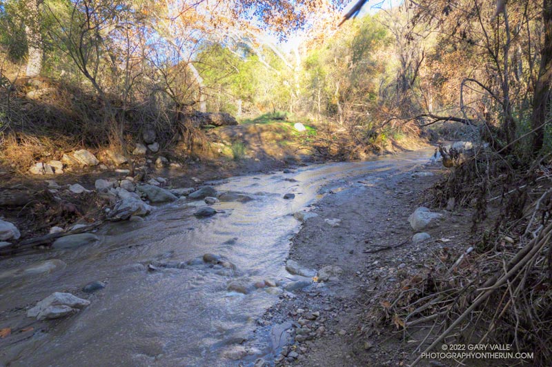
I had just waded down a 50 yard stretch of creek where the Santa Ynez Canyon Trail used to be. Three hikers working up the canyon were trying to find a way past the flooded section without getting their boots wet. That wasn’t going to be easy.
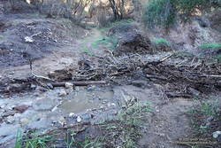
Debris at creek crossing in Santa Ynez Canyon.
I had been doing the same thing higher in the canyon. It was a chilly morning, and I had no great desire to soak my shoes in cold water. The usual rock and limb crossings had worked well until the trail ended in a broad area of flowing creek. Once my shoes were wet, it simplified the process.
That the trail was flooded following several days of rain wasn’t that surprising. What was a surprise is that there hadn’t been higher flows and more damaging flash floods in the canyon.
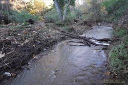
Creek crossing near the Santa Ynez Canyon Trailhead
Santa Ynez Canyon was the focus of the Palisades Fire, and a large part of the drainage was burned to a moonscape. Burned slopes often amplify runoff from heavy rain, producing damaging flash floods and debris flows. While there was clearly high flows in the canyon, the levels were less than what I’ve seen in similar circumstances, in other burn areas. One possibility is that unburned trees and brush along the streambed higher in the canyon had attenuated the flow.
After doing the out and back on the Santa Ynez Canyon Trail, I continued down to Trippet Ranch and then, like last week, returned using the Musch, Garapito, and Bent Arrow Trails.
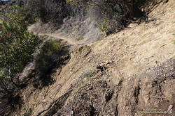
Section of the Bent Arrow Trail damaged by a slide
There were a number small rock slides, sluffs, and sediment flows along the trails and roads. A couple of people were working on clearing the limbs and small trees that had fallen across the Garapito Trail. The collapsed oak at the bottom of the Garapito Trail had settled, and was easier to get through this time.
The trail that really took it on the chin was the Bent Arrow Trail. Several sections of the trail were damaged by slides.
I usually do the Santa Ynez Canyon Trail as part of the Trailer Canyon – Santa Ynez – Trippet Ranch Loop. Tacking on the trail as an out and back addition to the loop was slightly shorter, but had a little more elevation gain/loss.
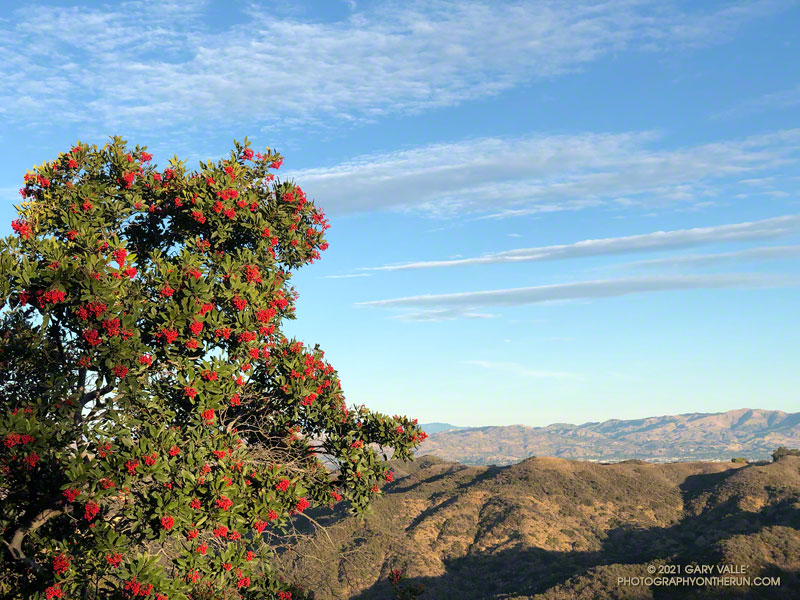
A week after doing the out and back run to the Ray Miller Trailhead, I was back in the Santa Monica Mountains and doing another popular trail run — the Trippet Ranch loop. Near the top of the Garapito Trail it dawned on me I’d seen no berries on the toyon shrubs and trees along the way. These red-orange berries usually add a bit of Holiday color to the chaparral, and at one time were so sought after that a law was passed to protect them.
Toyon usually blooms in the Summer, producing green berries that slowly turn red-orange by the holidays. The title photo — of a toyon heavily loaded with berries — is from last Winter.
For the remainder of the run I checked most of the toyon along the trails back to the Top of Reseda. Not a single toyon had any berries.
How widespread was this? The following two weekends, I did runs in other areas of the Santa Monica Mountains. One was an extended version of the Bulldog Loop, and the other an out and back run from the Top of Reseda to the Oak Tree on Rogers Road segment of the Backbone Trail.
On those three runs I must have passed hundreds (thousands?) of toyon along the trail. Out of all of those I checked, only one had berries. It was near the water tank on Mesa Peak Mtwy fire road, at the top of the climb up from Tapia.
As you might expect, the most likely explanation for the lack of berries is the drought. Precipitation records for Downtown Los Angeles (USC) show that in 2019-2020, the rain season lasted about 5 months — from about mid November to mid April. Leading up to the flowering period for toyon the accumulated rainfall was a little above normal. The result was what you see in the title photo.
On the other hand, in 2020-2021, the rain season effectively began at the end of 2020 and ended in mid March. Less than half of normal rainfall was recorded going into the flowering period of toyon.
The toyon on Mesa Peak fire road that managed to produce some berries is situated near the crest of east-west oriented ridge. It probably benefits from enhanced precipitation because of its location.