Category Archives: nature|wildflowers

Wonderful Wildflowers, a Seasonal Bridge, and a Cranky Rattlesnake on the Bulldog Loop

Canyon sunflowers covering a hillside in Malibu Creek State Park that was burned in the 2018 Woolsey Fire
Canyon sunflowers covering a hillside burned in the 2018 Woolsey Fire

Update May 5, 2023. Did a run this afternoon in Malibu Creek State Park and the seasonal bridge across Malibu Creek on the Crags Road Trail is back in place!

As I approached the M*A*S*H site, I could see some people taking photos. I stopped to say hi, and without skipping a beat, one of them asked, “Did you wade across the creek?”

He was asking about the creek crossing where Crags Road crosses Malibu Creek upstream of Century Lake and east of the M*A*S*H site.

Prickly phlox along the Tapia Spur Trail in Malibu Creek State Park
Prickly phlox along the Tapia Spur Trail.

There’s a substantial log spanning the creek at the moment, and I wanted to answer that I danced across it with my eyes closed. But instead, I explained that I decided to wade — and for sure keep my phone dry — rather than take a chance of falling uncontrolled into three feet of water, ker-splash.

Speaking of which, this morning, I talked to a mountain biker who saw the bridge pulled off to the side of the creek before any flooding had occurred and thought it may have been hauled away. Good news! According to the Malibu Creek Docents, the bridge is seasonal and was designed to be portable. It was removed and stored before this Winter’s rain. It is expected to be reinstalled when the threat of flooding is over — which should be soon.

Vinca growing at the base of a coast redwood in Malibu Creek State Park
Vinca growing at the base of a coast redwood along the Forest Trail.

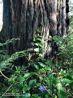
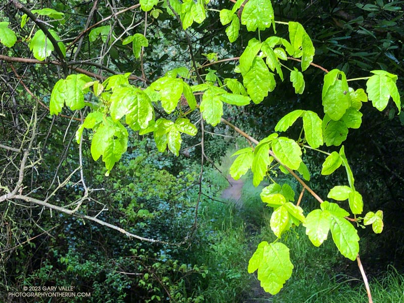
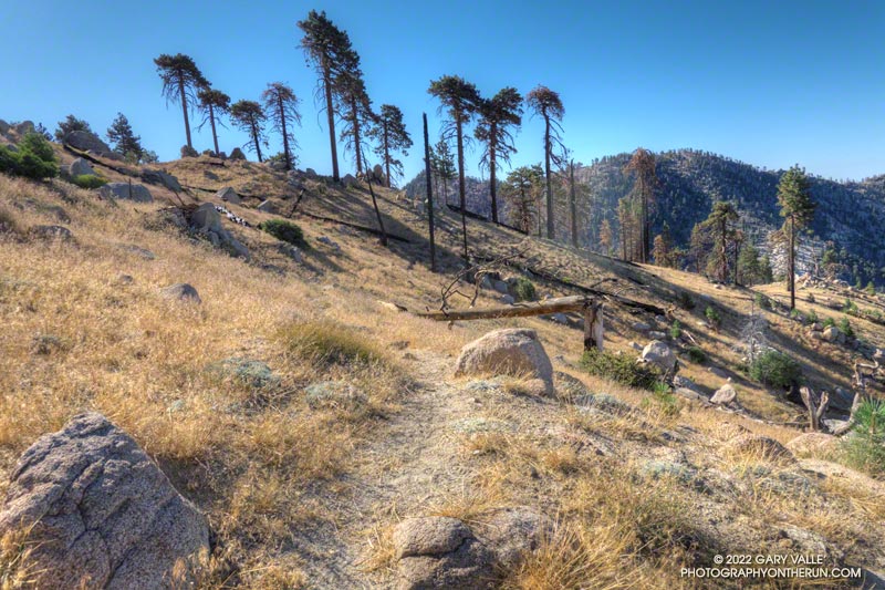
After crossing Malibu Creek and before continuing to the M*A*S*H site, I took a quick detour on the Forest Trail. Bordered by Century Lake on one side, and steep, rocky slopes on the other, the Forest Trail has a character all its own. It’s a wonderful place to observe, reflect, and enjoy nature. It’s also home to several coast redwoods. Unfortunately, less than half the trees originally growing along the trail survived the 2011-2015 drought. This morning, a redwood that died several years ago had fallen and was partially blocking the trail near its halfway point.

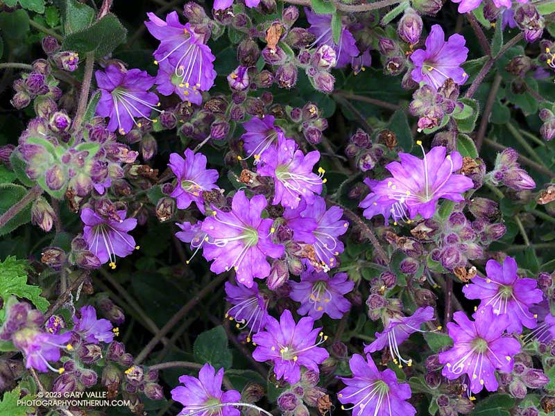
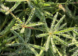
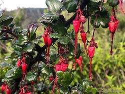
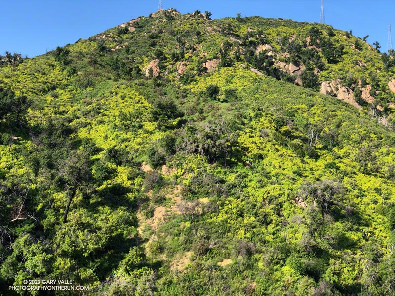
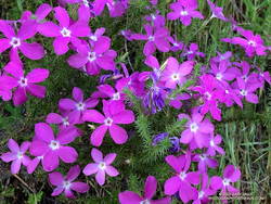
As has been the case in most of Southern California this Spring, the wildflowers on this run were spectacular. Canyon sunflower was particularly prevalent, with many thousands of the bright-yellow blossoms covering the hillsides burned in the 2018 Woolsey Fire.

Very dark Southern Pacific Rattlesnake on a fire road in Malibu Creek State Park
Southern Pacific Rattlesnake on Castro Peak Mtwy fire road.

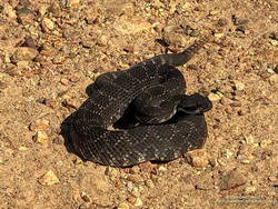
Also exciting was my first rattlesnake encounter of 2023. I was running down Castro Peak Mtwy Fire Road from the Bulldog “T” when I saw something in the road that looked like a partially exposed root. As I neared, I could see it was a very dark — almost black — Southern Pacific Rattlesnake.

The snake was stretched out straight on the road, basking in the sun. As I approached, it did move, and it did not rattle. Usually, snakes in this state are pretty docile, and I can cautiously walk a few feet behind them. Yikes! This one was super-aggressive. In the blink of an eye, it turned and moved toward me, doubling back on itself. I jumped a mile! It coiled but still did not rattle! It must have recently emerged from its Winter hideaway.

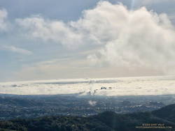
Here are a few photos (primarily wildflowers) taken on the Bulldog Loop.

Some related posts: More Malibu Creek Flooding; Bulldog Training Run; After the Woolsey Fire: Malibu Creek State Park Redwoods, M*A*S*H Site and Bulldog Climb

Also check out the M*A*S*H site web page.

Condor Peak and Fox Mountain Adventure Run

Condor Peak from Fox Mountain

The out and back trail run to Condor Peak (5440’+) and Fox Mountain (5033′) from Vogel Flat is an adventurous 17-mile, lower elevation run in the San Gabriel Mountains.

Exposed stretch of the Condor Peak Trail

When I last did this run (May 2020), portions of the trail below Fox Mountain were washed out and overgrown. Later I learned that this was before the Condor Trail restoration project had been completed. Thanks to the hard work of the Lowlifes Trail Crew the trail has been brought back to life. Today, several groups — including hikers, bikers, and runners — were making their way to Condor Peak.

Hazy view of snow on Mt. Waterman and Twin Peaks from the Condor Peak Trail.
Snow on Mt. Waterman and Twin Peaks from the Condor Peak Trail.

As mentioned in my posts from 2007 and 2020, this adventure is best done when the weather is cool. It can really bake on the south-facing sections of trail. From the Vogel Flat Trailhead on Big Tujunga Canyon Road the trail climbs about 2600′ in 6 miles to reach Fox Divide. Much of this stretch is surprisingly runnable. As with most mountain trails, extra care is required because of steep drop-offs and other hazards.

Today, the trail was in the best shape I’ve seen in years. The weather was relatively cool and good for running. As has been the case in other low elevation areas, a colorful assortment of Spring wildflowers were blooming along the trail. With our copious Winter rain, two small streams were crossed on the traverse above Fusier Canyon. It’s hard to say how long they will last.

USGS Lidar-based 3DEP 1m contour map of Condor Peak

Condor Peak has twin summits. A register and summit sign currently reside on the west peak, but USGS 3DEP 1-meter Lidar-based data suggests the west and east peaks have virtually identical elevations – about 5441′.

This time, after climbing Condor Peak, I also climbed Fox Mountain. Although steep, it’s short, and doing Fox only added about 30 minutes to the total time.

Here are a few photos taken along the way. Additional info, photos, and an interactive map with 3D terrain can be found in the following related posts.

Some relate posts: Condor Peak Out and Back Adventure Run, Condor Peak Trail Run

Wishbone Bush

Winter into Spring the purple flowers of wishbone bush (Mirabilis laevis var. crassifolia) are found along sun-warmed sections of low elevation trails in much of Southern California.

The plant’s common name refers to the stems of the plant, which are forked like a wishbone.

From this morning’s run of the Trippet Ranch loop from the Top of Reseda Blvd.

Between Storms on the Backbone Trail

Fresh new leaves of poison oak hanging above the Backbone Trail

When one of the runners coming down the Rogers Road segment of the Backbone Trail saw me coming up the trail, he commented, “At least now we know the trail goes through!”

He was only half-joking. With all the wet weather, trails may not only be wet and muddy but might be flooded, severely eroded, blocked by trees and debris, or destroyed by runoff, mudslides, or slope failures.

Water droplets on bedstraw (aka cleavers) along the Backbone Trail

It had rained the previous two days, and more rain was forecast in a day or two. I was on this stretch of the Backbone Trail because I wanted to check out a use trail near High Point (Goat Peak) in the Santa Monica Mountains. I could do that by slightly modifying the route described in “Racing the Weather to High Point (Goat Peak) and Back.”

Two use trails connect to the High Point trail near High Point. Both are on the east side of the ridge. When traveling northbound from High Point, the first trail encountered is the “Rivas Ridge Trail.” Its junction with the High Point trail is on a hilltop, a bit more than a tenth of a mile north of High Point. The junction with the other trail — aptly named the “Great Escape” — is about a tenth of a mile north of the Rivas Ridge trail junction and a quarter-mile north of High Point.

Marine layer clouds in the Los Angeles Basin
West L.A and advancing marine layer clouds in the Los Angeles Basin.

Instead of doing the run as a pure out and back, on the way back, I took the Great Escape down to the Backbone Trail. This short use trail connects to the Backbone Trail about 0.4 mile south of “The Oak Tree.” It was an interesting trail to explore and only added about a third of a mile to the regular out-and-back route.

To show this variation, I’ve updated the interactive, 3D terrain view of the High Point (Goat Peak) Out and Back from the Top of Reseda.

Fuchsia-flowered gooseberry along the Backbone Trail

The condition of the Backbone Trail between Fire Road #30 and The Oak Tree was about what you would expect during such an active rain season. There were a few slimy, slippery spots and some eroded stretches of trail. My shoes and socks were already soaked from the wet grass along the trail by the time I reached The Mud Puddle. This was good because I didn’t waste any time looking for a way around the flooded section of trail — I just waded right in. Nearby, a short section of trail had collapsed in a slide, but there was enough of a shoulder to easily go around it.

With the wet rain season, everything is growing like crazy. This includes poison oak, which was already dangling into the trail in several places. More wildflowers were beginning to bloom. This scarlet-red Fuchsia-flowered gooseberry was blooming along the Backbone Trail near its junction with the High Point Trail.

Some related posts: Racing the Weather to High Point (Goat Peak) and Back, High Point (Goat Peak) Via the Rivas Ridge Use Trail, Goat Peak and the High Point Trail

Bigberry Manzanita – A Hummingbird Hotel

Bigberry Manzanita - A Hummingbird Hotel

From a hummingbird perspective, it was the perfect place to spend a cold night.

The big berry manzanita was situated on the spine of a north-south oriented ridge near Topanga Lookout. In that location, a bird might benefit from the warmth of both the setting and rising sun.

In addition, the bush’s thicket of stiff branches afforded some protection from predators, and the multitude of nectar-rich blossoms would provide a badly needed boost of wake-up energy.

The temperature was warmer now, but it had been near freezing at the Cold Canyon trailhead when I started the Topanga Lookout Ridge loop. It had been cold enough that I had jogged the steeper sections of Calabasas Peak fire road, just to ward off the chill.

Humans are funny that way — a small drop in body temperature can be life-threatening. How in the world can a diminutive hummingbird, whose caloric needs require it to feed almost constantly, survive a long, cold Winter night?

Research reveals that hummingbirds accomplish this feat by reducing their body temperature and metabolic rate. This physiological state — called torpor — dramatically reduces their energy requirements.

This particular manzanita apparently receives a lot of 5-star reviews, and at the time I passed, was occupied by several buzzing birds.

From Sunday’s run of the Topanga Lookout Ridge loop.

Related post: Hummingbird Stories

After the Bobcat and Station Fires: Three Points Loop Around Mt. Waterman (Slideshow, 3D Terrain Maps)

Mt. Waterman Trail

Most of the time, when I do a trail run in the San Gabriel Mountains, it starts from a trailhead along or near Highway 2 — Angeles Crest Highway.

There are many fine point-to-point and out-and-back runs along Hwy 2, but not very many loops. Of the handful of loops that are currently open and accessible, two start and end at Three Points.

One is the Three Points – Mt. Hillyer Loop and the other is the Three Points Loop around Mt. Waterman. The Three Points – Mt. Hillyer Loop was not affected by the Bobcat Fire and is described in this April 2021 post.

On the other hand, significant parts of the Three Points Loop around Mt. Waterman were burned in Bobcat Fire, and the trails that comprise the loop were closed until April of this year (2022).

A large area on Mt. Waterman was burned by both the Bobcat and Station Fires. This can be seen in this interactive, 3D terrain view of the area. The Bobcat Fire is yellow and the Station Fire is red. Where they overlap near Mt. Waterman is orange.

The Three Points Loop is the loop I do most often in the San Gabriel Mountains. The basic loop, not including the side trip to the summit of Mt. Waterman, is about 20 miles long and has about 4000′ of gain/loss. The terrain and trails are varied and interesting, and Buckhorn Campground is conveniently placed near the halfway point of the course. Water is USUALLY — BUT NOT ALWAYS — available when the campground is open.

Doing the side trip to Mt. Waterman adds about 1.7 miles and 350′ of elevation gain. The side trip to Cooper Canyon Falls is even shorter — only about a quarter-mile.

Fire perimeters and burn severity maps don’t tell the whole story, and I’ve been curious to see how the area was affected by the Bobcat Fire; how the Station Fire recovery is continuing; and how the area burned by both fires has fared.

Here is an interactive, 3D terrain view of the Three Points Loop. The map can be zoomed, tilted, rotated, and panned using the navigation control on the right. Track and placename locations are approximate and subject to errors. Poor weather and other conditions may make this route unsuitable for this activity.

This slideshow includes photos from the August 2022 run of the loop, as well as additional information.

Some related posts: Twin Peaks East, Plus Mt. Waterman; Three Points Loop Adventure – July 2020: Bobcat Fire Perimeter and Some Angeles National Forest Trails: 3D Terrain View of Bobcat Fire Soil Burn Severity and Some Angeles National Forest Trails