Category Archives: nature|wildflowers

Bulldog Training Run 2022

Runners east of Corral Canyon on the Bulldog Loop

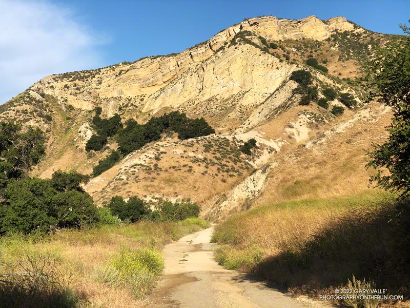
When I parked at Malibu & Piuma to do the Bulldog Loop on Sunday, I didn’t know that I was going to be swept up in a Bulldog Ultra training run.

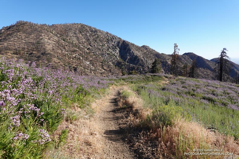
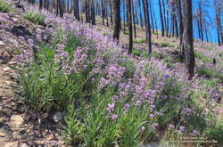
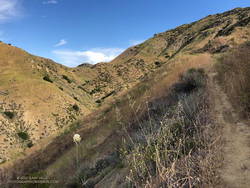
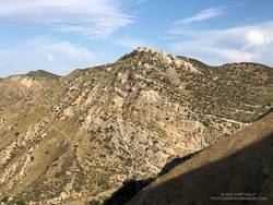
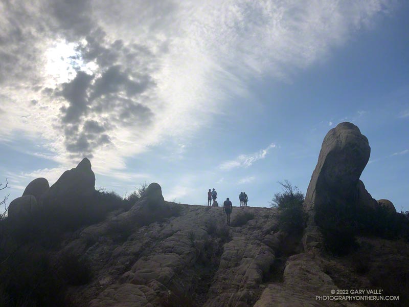
I had just started up Bulldog Mtwy fire road when the first group of speedy runners swarmed past. The strenuous climb to the Castro Peak Mtwy gains about 1750 feet over 3.4 miles. Much of its infamy is due to the oven-like conditions typically experienced on the second loop during the Bulldog 50K.

New bridge extension across Malibu Creek on the Crags Road trail, east of the M*A*S*H site.

This morning, the climb was a little warm in spots, but not bad. There was a good turnout for the training run and nearly everyone was enjoying the run.

On the way up I had an interesting conversation with a runner that had just done their first 100 miler and was going to pace someone in the AC100 this weekend.

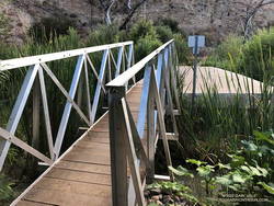
In case you haven’t heard, State Parks has finally come up with a solution to the repeatedly washed-out footbridge across Malibu Creek, east of the M*A*S*H site. An extension was added to the massive block of concrete that formed the foundation of the old bridge. No more shaky log crossings — at least for a while.

Common Madia (Madia elegans) at the bottom of the Bulldog Mtwy fire road.

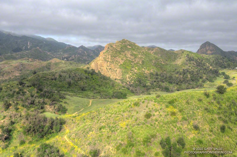
Here’s an interactive, 3D terrain view of the Bulldog loop. The map can be zoomed, tilted, rotated, and panned. To change the view, use the control on the upper right side of the screen. Track and placename locations are approximate and subject to errors. Poor weather and other conditions may make this route unsuitable for this activity.

Good luck to all the runners doing Bulldog — especially those doing their first trail race or ultra!

Some related posts: Sunlit Rocks Along Castro Peak Motorway; Trees, Bees, and a Washed-Out Footbridge on the Bulldog Loop in Malibu Creek State Park; Bulldog Loop Plus the Phantom Loop; After the Woolsey Fire: Bulldog Loop

Poodle-dog Bush Along the PCT Near Islip Saddle

Poodle-dog Bush along the Pacific Crest Trail near Islip Saddle with Mt. Williamson in the background.

Nope, my eyes weren’t deceiving me, the hiker was carrying his full-size poodle up the trail.

I was running down the PCT, east of Islip Saddle, after a run/hike to Mt. Hawkins and Throop Peak. I’m guessing the hiker was carrying his dog to keep it out of the Poodle-dog Bush on both sides of the trail.

Poodle-dog bush along the PCT above Islip Saddle in the San Gabriel Mountain
Poodle-dog bush along the PCT above Islip Saddle

Poodle-dog Bush (Eriodictyon parryi) is a fire-follower that can cause severe dermatitis in some people. In this case the plants sprouted following the 2020 Bobcat Fire.

The last big outbreak of Poodle-dog Bush followed the 2009 Station Fire. At that time many people were unfamiliar with its potential effects, and were caught off-guard.

The plant can get you in a couple of ways — the plant’s resin can affect sensitized people in a manner similar to poison oak, and the plant’s numerous hairs can break off and irritate the skin.

My experience with Poodle-dog Bush is described in the posts Contact Dermatitis from Eriodictyon parryi – Poodle-dog Bush and Getting Over Poodle-dog Bush Dermatitis.

Additional related posts: Trail Runners Describe Reactions to Poodle-dog Bush, Poodle-dog Bush Near the Top of the Mt. Wilson Trail

Not So Flat Las Llajas Canyon

Cliffs along Las Llajas Canyon Road/Trail

Earlier, as I was running up Las Llajas Canyon, I thought of a conversation I had with a runner during a 50K. The runner was from southern Florida, and talked about the difficulty of finding a good hill to run. It sounded like the main options are overpasses, bridges, buildings and stadiums.

Las Llajas Canyon Road/Trail near Evening Sky Drive.

In Southern California we have the opposite problem. It’s hard to find a trail run that doesn’t have hills. And the longer the run, the more likely it is you’re going to be running some hills.

The out and back in Las Llajas Canyon is one of the flatter runs that I do. From Evening Sky Drive it’s about 3.5 miles up to where the trail forks. There is a sign at the split indicating that the left fork leads to a private ranch, and the right fork connects to Rocky Peak Road.

Pass between Las Llajas and Chivo Canyons
Use trail to pass between Las Llajas and Chivo Canyons

On rested legs, the run up Las Llajas from Evening Sky Drive seems pretty flat. Over the 3+ miles up the canyon, the elevation gain is around 565′. That’s not a huge amount, but it’s roughly the equivalent of climbing 56 floors or 900 stairs. After leaving the Marrland aid station at 20 miles, runners doing the Rocky Peak 50K discover that the run up the canyon isn’t as flat as it looks!

If you want more distance or elevation, there are a couple of ways to extend the Las Llajas out and back. One is to take the right fork at the sign and continue up to the top of the hill just before Rocky Peak Road. This adds about 2 miles and 600 feet of elevation gain.

Peak at the head of Chivo Canyon from the pass between Las Llajas Canyon and Chico Canyon.
Peak at the head of Chivo Canyon.

Another interesting way to extend the run, is to do the variation I was doing this morning. About halfway down the canyon on the way back, on the right, is a use trail. The use trail is about 1.6 miles from the turnaround point at the fork at the ranch sign. It is just past the area where steep cliffs tower above the road on the right, and is very easy to miss.

After turning right onto the use trail, about a half-mile up the trail splits. One trail switchbacks to the right and continues up to the top of cliffs and an old seashell grit mine; the other trail continues up the canyon to a  pass between Las Llajas and Chivo Canyons.

The trail over the pass leads to a well-used trail that connects Chivo Canyon to Las Llajas Canyon near Evening Sky Drive. Some refer to this trail as the “Marr Ranch Trail.” This variation adds about 1.3 miles and 500′ of elevation gain.

Yellow mariposa lily (Calochortus clavatus) along the Marr Ranch Trail
Yellow mariposa lily along the Marr Ranch Trail

Here’s an interactive, 3D terrain view of a GPS track of today’s route, as well as the variation that continues to Rocky Peak Road. The map can be zoomed, tilted, rotated, and panned. To change the view, use the control on the upper right side of the screen. Track and placename locations are approximate and subject to errors. Poor weather, and other conditions may make this route unsuitable for this activity.

After I got back from the run, I was curious to see what hilly trails there are in Florida. A quick search turned up the Hilly Trails In Florida page of the Florida Hikes web site. Anybody up for doing Mount Cockroach?

Some related posts: Exploring Las Llajas, Top of Las Llajas, Marr Ranch Wildflowers

Dawn Songs, Wildflowers, and a Rocket Launch from the Phantom Trail

Sun and clouds in Malibu Creek State Park
Clouds & sun at Malibu Creek State Park, near the end of the Phantom Loop

I checked my watch — it was 6:13 a.m. I was part way up the Phantom Trail in Malibu Creek State Park, and had stopped to see if I could hear the launch of the Falcon 9 at Vandenberg Space Force Base.

I’d hoped to see the launch, but low clouds obscured the view skyward. Even so, there was a chance that a thin spot in the cloud deck might reveal the ship, as it propelled its classified payload into orbit.

All was quiet, except for the dawn songs of waking birds and the occasional car or motorcycle on Mulholland Highway. But then, just above the ambient sounds, I heard it — a constant dull roar somewhere to the west. I scanned the sky for any hint of an exhaust plume.

None was evident, but I suspect that if I had looked at the right spot at the right time, I might have glimpsed the rocket’s sun-bright flame. After searching and listening for a couple of minutes, I resumed working up the trail.

Phacelia along the Phantom Trail in Malibu Creek State Park
A sea of Phacelia along the Phantom Trail

Ka-boom! Even though my attention had turned to the trail, the distinctive, two-syllable report of a sonic boom broke my reverie. It had to be the Falcon 9 booster returning to the launch site. The boom wasn’t very loud at my location, but some living closer to Vandenberg apparently mistook the launch and sonic boom as an earthquake.

The remainder of the run went well. I’d run the Ahmanson 12K the day before, and the Phantom Loop (clockwise) was a good follow-up to that run.

I was a bit surprised just how overgrown some sections of the trail were. Mustard wasn’t the only plant crowding the trail, phacelia was as thick along the Phantom Trail as I’ve seen.

A showy patch of Chinese houses wildflowers along the Phantom Trail
Chinese houses along the Phantom Trail

With the cloudy, cool start to the day, the poppies were mostly closed, but several other species of wildflowers added color along the trail. Among them were Elegant Clarkia, Owl’s Clover and Chinese Houses.

Note: A little higher in the Santa Monica Mountains and farther to the west, Jonathan Stewart captured this video of the NROL-85 launch from Boney Mountain.

Some related posts: Phantom Trail: Trade-offs of a Wet Rainy Season; Redwoods, Raptors, and the Phantom Loop; Ladyface Via the Phantom Trail and Heartbreak Ridge

Encelia Eruption

Bush sunflower (Encelia californica) along the Secret Trail in Calabasas

The bush sunflowers (Encelia californica) above are along the Secret Trail in Calabasas. While there have sometimes been showy displays of bush sunflowers along this trail, I don’t recall any quite as prolific as this. There were many other wildflowers as well (slideshow).

It’s been another bizarre rain year. While California water managers worry about water supplies, chaparral plants in the Santa Monica and Santa Susana Mountains seem quite happy with this season’s rainfall. There is a lot of new growth and plants appear to be playing catchup from last year’s dismal rain season. From the trail it looks more like an above average rain year, rather than the somewhat below normal rain year actually recorded.

Goldenbush Blooming in Upper Las Virgenes Canyon Open Space Preserve

Bee on Palmer's goldenbush in Upper Las Virgenes Canyon Open Space Preserve (Ahmanson Ranch)

If you’re a bee in the Ahmanson Ranch area, your Fall menu of wildflowers is usually pretty sparse; particularly when the previous rain year has been below normal.

But life has a way of carving out a niche for itself in the toughest of circumstances. One plant you’ll find blooming in the oak grasslands of Ahmanson Ranch following a long, hot, dry summer is goldenbush. In the case of the title photo, it’s Palmer’s goldenbush.

Another goldenbush in the Lasky Mesa area is coast goldenbush. Here is a photo of coast goldenbush in the Photography on the Run album Weekday Wildflowers.