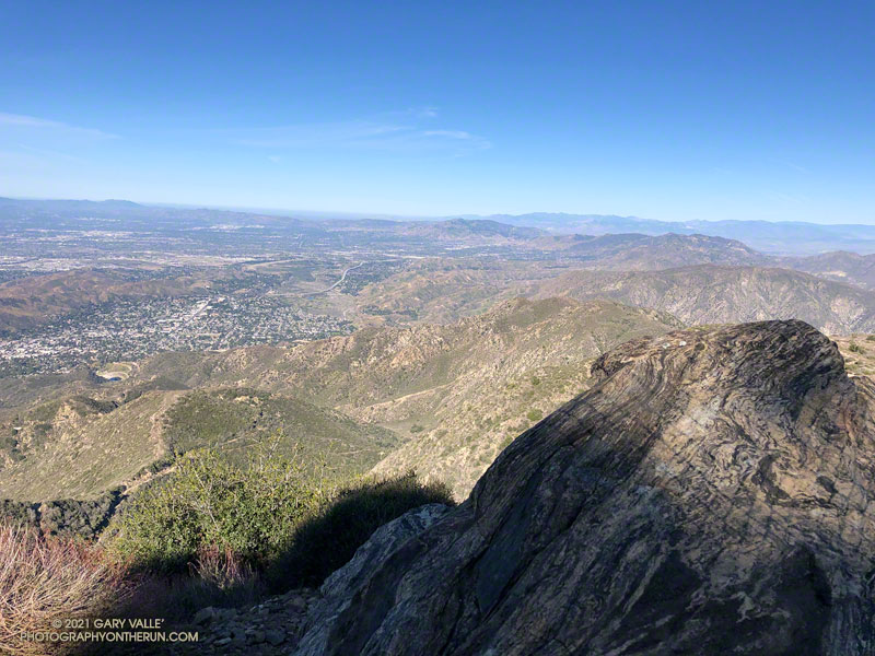
View west from Mt. Lukens, across the Crescenta and San Fernando Valleys.
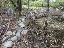
It was a chilly 45 degrees in the canyon, and I had already resigned myself to having to wade across Big Tujunga Creek. But I didn’t even get my shoes wet. The water level was low enough that the large rocks placed across the creek were high and dry.
Low water made it easy to cross Big Tujunga Creek.
It was a good start to what was to be an excellent run and hike. As I gained elevation, it was evident there had been recent work on the trail. Trimmings from the brush along the trail were still green, and in several spots the tread had been freshly manicured. The higher I climbed, the more work had been done. In a couple of places, substantial washouts had been repaired.
Last year, the trailwork ended abruptly about halfway up the trail. Not so this year. An impressive amount of work had been done to clear the trail of a tortuous mix of dead scrub oaks and thorny brush. Without having to crawl over, around, and through those snarls, my roundtrip time to the summit and back was a full hour faster than last year. Many thanks to whoever worked on the trail!
Here’s an interactive, 3D terrain view that shows a GPS track of the route up and down the Stone Canyon Trail on Mt. Lukens. The view can be zoomed, tilted, rotated, and panned. Placemark and track locations are approximate and subject to errors.
Strawberry has always been popular, but because of the Pandemic and fire closures, there has been an increase in the number of people doing the peak. Not having done the peak for a couple of years, I was curious to see if the condition of the use trail on Strawberry’s northwest ridge had changed.
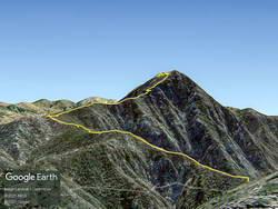
Google Earth image of Strawberry Peak from Josephine Peak, with GPS track
Given my early start, I was surprised to find the small parking area for the Colby Canyon Trail nearly full. I don’t know where all those people went, because I passed only one small group on the way to Josephine Saddle, and I didn’t see anyone between Josephine Saddle and the summit. There was a group on the summit, but they had hiked the trail from Red Box.
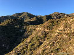
The last time I did the loop over Strawberry was April 2019. At that time sections of the use trail along the ridge leading to the upper northwest ridge of Strawberry were badly overgrown. This time around, increased usage has generally improved the path along the approach ridge. Plus, there has been some work done on the section of trail that was the most overgrown. However, to benefit, you have to stay on the trail. It wanders all over the place, and if you get impatient, you’ll be fighting your way through thick, thorny brush.
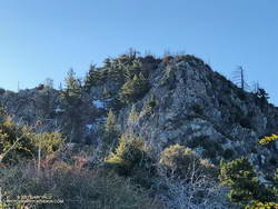
Upper northwest ridge of Strawberry Peak.
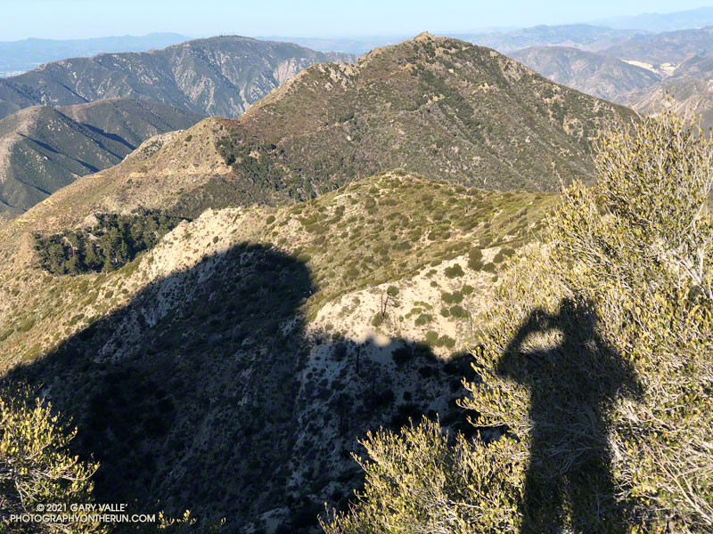
There was a little patchy snow on the steep, deeply shaded, north face of the peak. The snow was generally left of the normal rock climbing route up the northwest ridge. The patch or two on the route were easily avoided. Early or late season, this more technical section can be like a deep freezer. Today, it was cool, but comfortable. As mentioned in other posts, the steep, upper part of Strawberry’s northwest ridge requires good route-finding and some rock climbing skill. It is important to stay on route.
The steep section of the ridge ends a little below the top of Strawberry. I paused there for a moment to enjoy the view… Was that music I heard coming from the summit?
It was. The group that was on the summit was kind of encamped there. It looked like they might be a while, so I just said hi, and started down the east side of the peak.
I expected a lot of people to be on the trail up Strawberry from Red Box. It was busy, but seemed about normal for a Sunday in Spring with idyllic weather. There were fewer large groups coming up from Red Box than in April 2019.
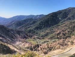
Upper West Fork near Red Box from the Strawberry Trail. Mt. Wilson is in the distance.
At Red Box I stopped to take a look at how the 2020 Bobcat Fire had impacted the upper part of the West Fork drainage. There was a substantial fire scar on the left side of the canyon, but the right side of the canyon looked better than I expected. An upcoming post will include an interactive 3D visualization of the Soil Burn Severity in the Bobcat Fire area, along with the GPS tracks of some popular trails.
For the first time in a long time, I didn’t encounter any mountain bikers on the Gabrielino Trail between Red Box and Switzer’s. There were plenty of tire tracks, so I must have been between groups. I did encounter two misplaced hikers. They stopped me and asked how much farther it was to the falls. Unfortunately, they had gone the wrong direction on the trail from Switzer’s, and were several miles from Switzer Falls.
At Switzer’s, I chugged up the access road to Hwy 2, and then ran on the verge next to road back to the Colby Trailhead. Somehow, more cars were packed into the small parking area.
Starting and ending at the Colby Trailhead, the loop is a little over 12 miles with about 3200′ of elevation gain/loss. Starting at Clear Creek adds about a mile to the loop. Some prefer to do it as keyhole loop, returning to Josephine Saddle from Lawlor Saddle using the Strawberry and Colby Trails. I haven’t done it that way, but the mileage looks to be only slightly less than the full loop through Red Box.
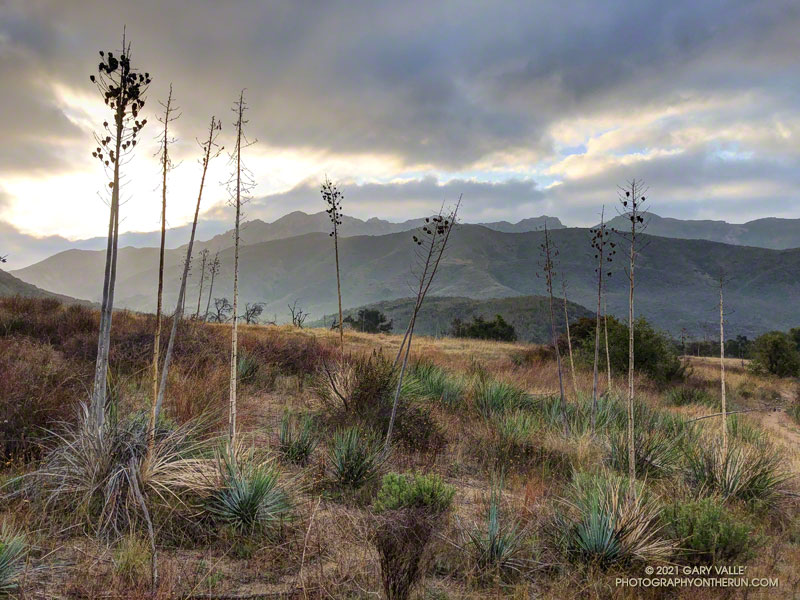
Morning on the Hidden Pond Trail, Boney Mountain in the distance.
The Hidden Pond – Old Boney Loop is a variation of the XTERRA Boney Mountain Trail Run 21K course. The route is about a half-mile longer and has a couple hundred feet more of elevation gain, but all the key trails are the same. It starts/ends at the Wendy Drive & Potrero Road Trailhead.
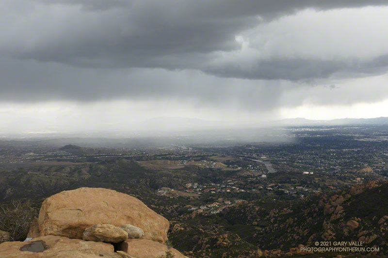
Was that thunder? I warily eyed the dark clouds over the mountains and pondered the situation.
I was about halfway to the top of the Chumash Trail and was planning to run along the crest to Rocky Peak. The run had started in short sleeves and sunshine, but it was pretty obvious that wasn’t going to last.
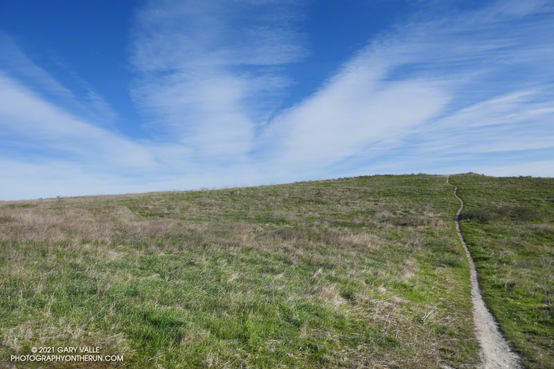
Chumash Trail about a mile from the trailhead
A cold upper-level low had brought badly needed rain to the area for the past two days. The low was moving off to the east, but there was still a chance of afternoon showers and maybe even a thunderstorm.
It was the “thunderstorm” part that I needed to pay attention to. I had enough gear to deal with a downpour and cooling temps, but electrical storms are no fun at all.
I decided to continue to the top of the Chumash Trail and reassess. As I worked up the trail, I pictured the counterclockwise circulation around the low, and how convective cells develop over the mountains and then dissipate as they drift south. The concern was that the cells don’t always dissipate.
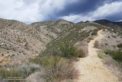
Rocky Peak Road near Rocky Peak
It looked like things weren’t getting any better at the top of the Chumash Trail, but it wasn’t worse either. I hadn’t heard any thunder for a while, and most of the activity seemed to be a few miles to the west and east. Having been starved of stormy weather for much of the rain season, I turned right on Rocky Peak Road and headed south toward Rocky Peak.
The run from the Chumash Trailhead to Rocky Peak is a challenging mix of technical single-track trail and hilly fire road. There are wide-ranging views of Simi Valley & Simi Hills, the San Fernando Valley, Santa Monica Mountains, Ventura County mountains, and San Gabriel Mountains. On a clear day, the view can extend to the Channel Islands, Saddleback, and San Jacinto Peak.
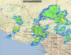
NOAA radar mosaic at the time I was on Rocky Peak
The actual turnaround point for a run to “Rocky Peak” varies. Some like to turnaround at the high point of Rocky Peak Road that is near Rocky Peak. Most of the time, I turnaround at a viewpoint that is at the end of a spur trail that branches off from the high point of Rocky Peak Road. From time to time, it’s fun to hike over to Rocky Peak and scramble to the top. That’s a bit more involved and requires some route-finding.
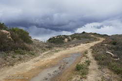
I felt the first raindrops as I reached the high point on Rocky Peak Road and turned onto the spur trail that leads to the overlook. There was some increased development to the east, but it looked like there would be enough time to get over to Rocky Peak, take a couple of pics, and then head back.
Oat Mountain, shrouded by rain
I felt a little exposed on top of Rocky Peak. I hadn’t heard any thunder for the past hour, but a cell to the east was spouting heavy rain over the San Fernando Valley, which meant there was probably enough development to produce lightning. I took the title photo and a couple of others and hurriedly descended from the peak.
Back on Rock Peak Road, the sprinkles increased, and the showers became more steady as I ran north toward the Chumash Trail. Under the dark clouds, a raven perched on a large pinnacle cawed incessantly, either enjoying the rain or complaining about it. In the distance, a siren wailed down in the valley. It was cold, and I was very glad to have an extra shirt, sleeves, gloves and a light rain shell.
Mix of sun and rain on the Chumash Trail.
As I began the descent of the Chumash Trail, the sun briefly broke through the clouds, reflecting brightly on the wet sandstone rocks. I breathed deeply, relishing the smell of the cleansed air and wet chaparral, and continued down the trail.
It looks like Downtown Los Angeles (USC) is going to end February — one of the wettest months of the rain year — with only a trace of rain. The current rain year total for Los Angeles is 4.39 inches, which is about 39% of the normal total for this date.
It’s been one of those years where missed rain opportunities have often turned into strong offshore wind events. This chart from MesoWest shows the wind speed and direction for the past 30 days for the Malibu Hills RAWS. Since mid February there has been five wind events with sustained wind speeds over 30 mph and gusts over 50 mph.
Current forecasts suggest Los Angeles will see at least some rain in March, with the first chance around midweek. We’ll see!
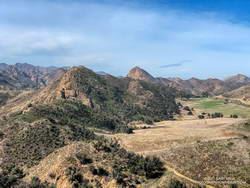
This morning’s running plan morphed from doing a loop I’ve done many times, to exploring a trail I hadn’t done, and hiking along a ridge to the top of a butte with a sweeping view of Malibu Creek State Park.
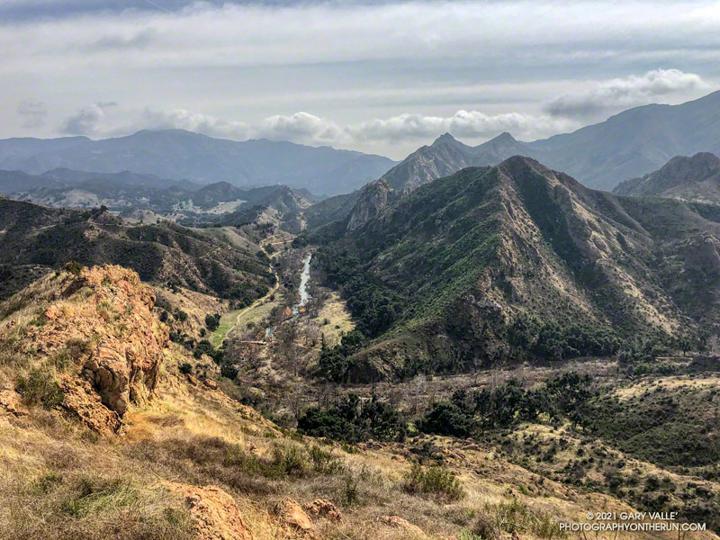
Lake Vista Ridge and Butte in Malibu Creek State Park
My run started at the Cistern Trailhead on Mulholland Highway. After descending the Cistern Trail, I picked up the Lookout Trail and headed west to the top of the Cage Creek Trail and the start of the Yearling Trail. Continuing on the Yearling Trail, I turned left (south) up the Deer Leg Trail, and continued west on the enjoyable, up-and-down single track.
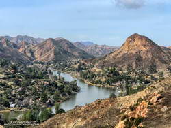
I usually run the Deer Leg trail in the opposite direction and was a little surprised when I happened upon the Lake Vista Trail. How had I managed to run past this trail junction so many times and not notice it? Any trail with “Vista” in the name is worth exploring, so there was little choice but to turn onto the trail and see where it led.
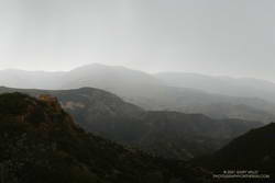
Malibou Lake and Sugarloaf from Lake Vista Ridge
As it climbed toward an obvious ridgeline, the enjoyable single-track trail wound in and out of several small canyons. About 0.7 mile from the Deer Leg Trail junction, the Lake Vista Trail topped out at a very pretty overlook of Malibou Lake (not a typo). My watch showed the mileage to the overlook from the Cistern Trailhead was about 2 miles.
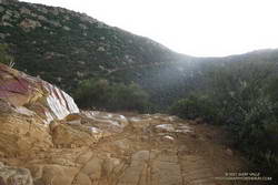
From the overlook an unofficial “use” trail worked back east along a broad ridge to the top of a prominent butte that has an unique exceptional of Malibu Creek, Century Lake and Goat Buttes. Because of the area’s volcanic origins, the use trail is rough and rocky in places, and the trail is not always obvious. It’s a little under a half-mile from the overlook to the summit of the butte. Even though it was Winter, I kept a wary eye and ear out for rattlesnakes.
Once back at the overlook, I made a loop of it by descending the Lake Vista Trail to the Reagan Ranch parking area, and then working back east on the Yearling and Lookout Trails to the Cistern Trail. Here’s an interactive, 3D terrain view of my GPS track of the run and hike.