Category Archives: landscape

Chasing a Sunrise, Taking a Moonshot, Los Padres Snow, and a Dark Line in the Sky

Colorful sunrise in the eastern Santa Monica Mountains

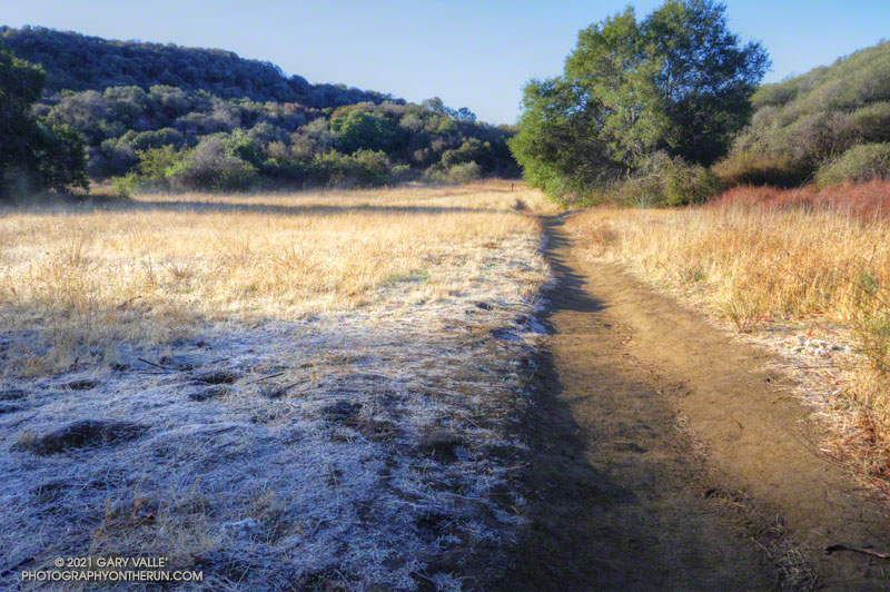
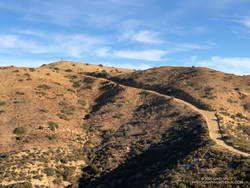
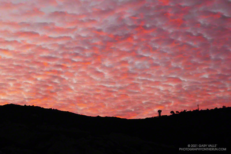
I was running up Calabasas Peak Mtwy fire road trying to get a better view of the eastern sky, but the view in that direction was blocked by a steep hillside. The road turned to the northeast up ahead, and I hoped the best moments of a rapidly-evolving sunrise would not be lost.

A couple of breathless minutes later, I rounded a corner and was rewarded with an unobstructed view of a vivid, pink-red-orange mackerel sky. Focusing on the ridgeline near Topanga tower, I shot several sets of bracketed photos.

Handheld snapshot of the Moon, using a Lumix ZS100
Handheld snapshot of the Moon. Click for larger image and more info.

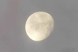
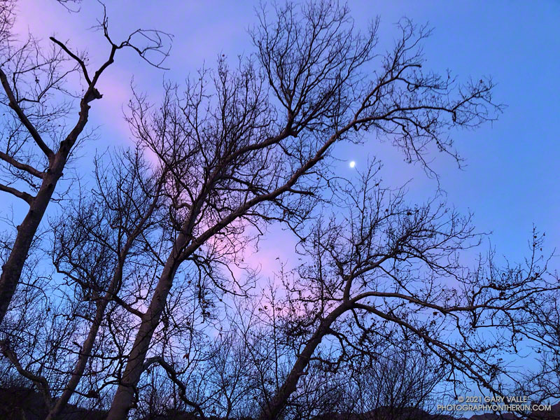
Excited by the sunrise, I continued up the fire road, scanning my surroundings for another photo. My eye settled on the gibbous moon. High in the sky, it’s bright face was subdued by a thin veil of pinkish-gray cloud. I’d previously experimented with handheld shots of the Moon using my running camera — a Lumix ZS100. Zooming to an equivalent focal length of about 250mm, I held my breath, steadied the camera the best I could, and took a few shots. Here’s one of the images — cropped and sharpened — with enough detail to see craters, maria, and some other lunar features.

At the bottom of Topanga Lookout Ridge there were several bigberry manzanita bushes covered with flowers. A hummingbird was up before sunrise, buzzing about the blossoms, busily drinking the precious nectar. Although it had rained a couple days before, this rain year there had been little rainfall, and a corresponding scarcity of early season wildflowers.

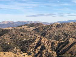
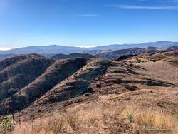
As I climbed higher on the ridge, the mountains northwest of Los Angeles came into view, white with snow from the recent storm. The snow-covered peaks are south of Mt. Pinos and Frazier Mountain, in the area of San Raphael Peak, McDonald Peak, Sewart Mountain and Snowy Peak.

Contrail shadow near Los Angeles
Contrail shadow.

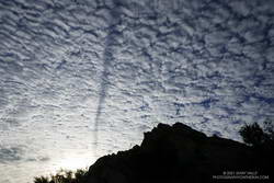
Like snow on a mountain, there is a purity in the form and appearance of clouds. When a long, dark streak appeared across a layer of high clouds, it was hard to miss. In this case, the dark line appears to be the shadow of a contrail of a jet flying above the clouds. At the time LAX was reporting scattered clouds at 19,000′ and 23,000′, with a broken layer of clouds at 28,000′. Given the height of the clouds and orientation of the contrail, it may have been from a flight from San Diego to San Francisco.

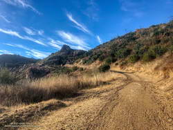
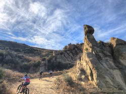
Topping out on the ridge, I smiled when I saw the masked couple dancing on the Lookout, and continued west toward Saddle Peak.

Some related photos: An Early Morning Dance at Topanga Lookout, Fallstreak Hole, Rainbow Colors in Cirrus Clouds Over Los Angeles

Musch Meadow Frost

Frost along the Backbone Trail at Musch Meadow

As I approached Musch Camp, a scrub jay flew from a trailside faucet and into a nearby eucalyptus. There had been a little rain the day before, but the birds at the closed camp were still thirsty. Less than a quarter-inch of rain had fallen, and nearby creeks were still dry.

Melting frost
Melting frost “steaming” at Musch Meadow

I was doing a run from the “Top of Reseda,” and on a warmer day would have topped off my water bottle at the camp. I stopped at the faucet and briefly turned on the spigot. Maybe that would make it easier for the jay.

Leaving the camp behind, I continued south on the Backbone Trail, across frost-covered Musch Meadow. Early morning sun had just reached the meadow, and water vapor from the melting frost steamed in the cold air.

In another mile I reached the Trippet Ranch trailhead, and then begin the six mile run back to the Valley. At several points on the run there had been wintry views of the local mountains. On the way back the best view of the snowy mountains was from the Hub, where Mt. Baldy could be seen gleaming white in the morning sun.

Some related posts: Garapito Trail Runs, Musch Trail Mule Deer, Musch Trail Morning

Moon and Sycamores, Malibu Creek State Park

Moon and Sycamores, Malibu Creek State Park

The photograph Moon and Sycamores was taken at dawn, near Malibu Canyon and Piuma Road, at the start of this morning’s Bulldog Loop trail run in Malibu Creek State Park.

A quarter-mile from the top of Bulldog Mtwy fire road in Malibu Creek State Park.
A quarter-mile from the top of the Bulldog climb.

According to the Tempe sensor on my pack, the temperature ranged from a chilly 32° F along Malibu Creek to around 65° F on the crest. It was a near perfect morning to be outdoors.

Here’s an interactive, 3D terrain view of my GPS track from a previous run of the Bulldog Loop from Malibu & Piuma.

Some related posts: Bulldog Loop Plus the Phantom Loop; Trees, Bees, and a Washed-Out Footbridge on the Bulldog Loop in Malibu Creek State Park; After the Woolsey Fire: Bulldog Loop

Valley Oak Silhouette

Valley oak silhouette

From a late afternoon run in Upper Las Virgenes Open Space Preserve (Ahmanson Ranch).

Some related posts: Guardian Oaks, Fallen Oak, Ahmanson Valley Oaks Battling Drought, After the Woolsey Fire: Ahmanson Ranch

Looking for the Highest Point of Upper Las Virgenes Canyon Open Space Preserve

View south from windmill hill in Upper Las Virgenes Open Space Preserve

From the top of the hill, the blue-sky view extended all the way to Saddle Peak and the Pacific. The gray-green chaparral was brittle and dry, and the grasslands sun-bleached. Rain was in the forecast, but for months, little had fallen. It was the day after Christmas, and I was near the northern border of Upper Las Virgenes Canyon Open Space Preserve. Fourteen years ago, nearly to the day, I had run to the same hill. That rain year had also been dry, and the area had looked much the same.

The Upper Las Virgenes Canyon Trail climbs steeply to windmill hill
Steep fire road to “windmill hill.”

Today’s run had started at dawn at the Victory Trailhead. It had been cold in the canyons for the first few miles — in the low 30s — but eventually temps had warmed. I had run west in East Las Virgenes Canyon, taken a connector trail to Las Virgenes Canyon, and then run north on the Upper Las Virgenes Canyon fire road past Bell Canyon to “windmill hill.”

The hill is labeled with an elevation of 2124′ on the 1967 Calabasas topo map. The top of an old windmill has been placed on its summit. The windmill wasn’t there in 2006, and I wondered if it was from the infamous Runkle Canyon well. From the top of windmill hill I could see the high point of Upper Las Virgenes Canyon Open Space Preserve, a quarter-mile or so to the northeast.

High point of Upper Las Virgenes Canyon Open Space Preserve

Located at its northeastern corner, the point with the highest elevation in the Preserve is a hilltop that’s just south of “hill 2160” on the Calabasas quad. Marked by a prominent pine tree, hill 2160 is on Santa Susana Field Laboratory property. It overlooks an area of the SSFL where a partial meltdown of an experimental reactor occurred in 1959.

Leaving windmill hill behind, I ran east down the hill, and then north along the fire road toward Albertson Mtwy. I was still debating whether to do the side trip to the Preserve’s high point. There was no path or trail to the high point, and the upper part of the slope was thick with brush. After running past the hill and nearly to Albertson Mtwy, curiosity finally got the better of me. I turned around and ran back to a place on the fire road where I could access the high point.

View south from the high point of Upper Las Virgenes Canyon Open Space Preserve

There is a survey marker on the high point labeled “N.A.A.V. INC. L.S. 2379 1953.” This is where the Upper Las Virgenes Canyon Open Space Preserve, SSFL and Runkle Ranch properties meet. According to 3DEP Lidar data, the elevation of the high point is about 2162′.

The side trip to the high point and back took about 20 minutes. After returning to the fire road, I continued down to the junction with Albertson Mtwy, turned left, and followed it west to a junction with an Edison powerline service road. This road meanders south through a rugged canyon, and then climbs up and over a prominent ridge with some spectacular sandstone rock formations.

Mountain bikers in the backcountry of Upper Las Virgenes Canyon Open Space Preserve

After topping out on the ridge, the service road descends to the junction of the Sheep Corral and Cheeseboro Ridge Trails. Today, I followed the Cheeseboro Ridge Trail south to the Las Virgenes – Cheeseboro connector. Once back in Upper Las Virgenes Canyon, I retraced my route from earlier in the day back to the Victory Trailhead.

Here is an interactive, Cesium 3D terrain view of most of the 20-mile route. The bushwhack to the Preserve high point and an exploration of the Norway Trail aren’t shown.

Some related posts: Upper Las Virgenes Canyon – Cheeseboro Ridge Loop, Upper Las Virgenes Canyon Backcountry, Trail Run and Hike to Peak 1842 at Ahmanson Ranch

Trippet Ranch Oak Grassland

Trippet Ranch oak grassland

Taken on today’s trail run from the “Top of Reseda” to Trippet Ranch and back.

Here’s a Cesium 3D interactive view of a GPS track of my usual route. Today I did the Garapito and Musch Trails on the way out, then ran the fire roads on the way back.

Some related posts: The Heavenly Ranch in the Hills, Garapito Trail Runs