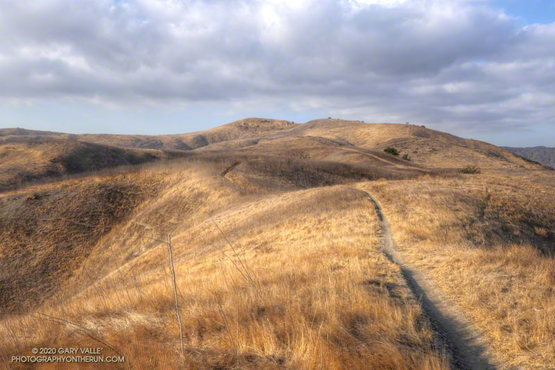
The hill marked with an elevation of 1842′ on the USGS 7.5 minute Calabasas quadrangle appears to be the highest point of the portion of the Ahmanson Ranch property that was going to be developed.
I usually start the 2+ mile trail run to the peak by ascending the Hill Climb Trail — a short, steep hill a little west of the kiosk at the Victory Trailhead. A less steep trail can be found a little farther to the west.
Once at the top of this initial 120′ high hill, I try to run — without walking — all the way to the ridgeline just west of the peak. Whether I walk or not, it’s a fun run with excellent views of the area.
From the ridgeline at the top of the single-track trail, there is usually some sort of a use trail to the top of the peak. The location and clarity of the path varies from year to year. The area can be very overgrown. It’s worth taking the time to find and stay on a use trail. Earlier this December, I encountered a rattlesnake while trying to follow an old route through the brush.
Note: The Ahmanson Ranch project property and Upper Las Virgenes Canyon Open Space were combined to create Upper Las Virgenes Canyon Open Space Preserve.
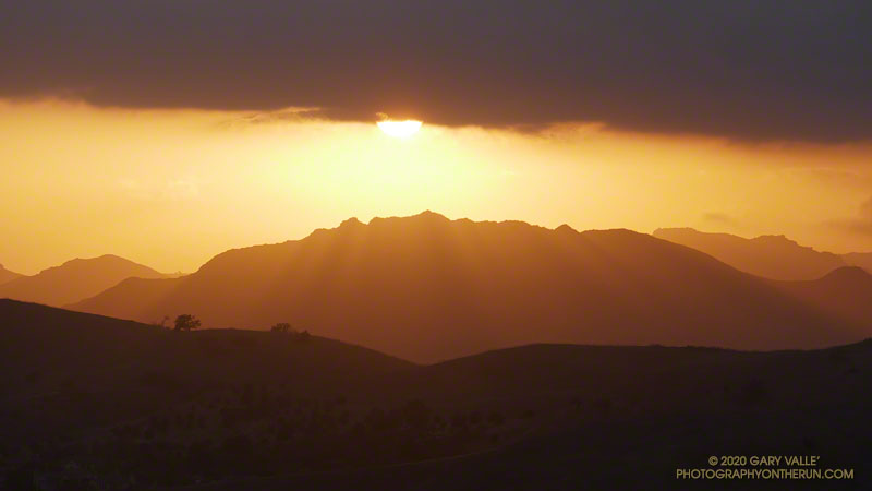
The photograph of Ladyface and the setting sun was taken from Lasky Mesa during an afternoon run in Upper Las Virgenes Canyon Open Space Preserve (Ahmanson Ranch).
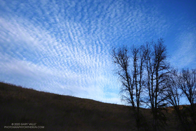
Cirrocumulus clouds form at high altitude. They are primarily composed of ice crystals but also contain supercooled water droplets.
The photograph of cirrocumulus clouds was taken in Las Virgenes Canyon on a trail run from the Victory Trailhead of Upper Las Virgenes Canyon Open Space Preserve, also known as Ahmanson Ranch.
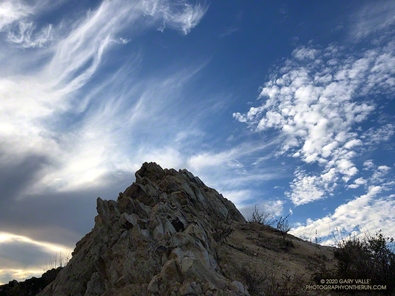
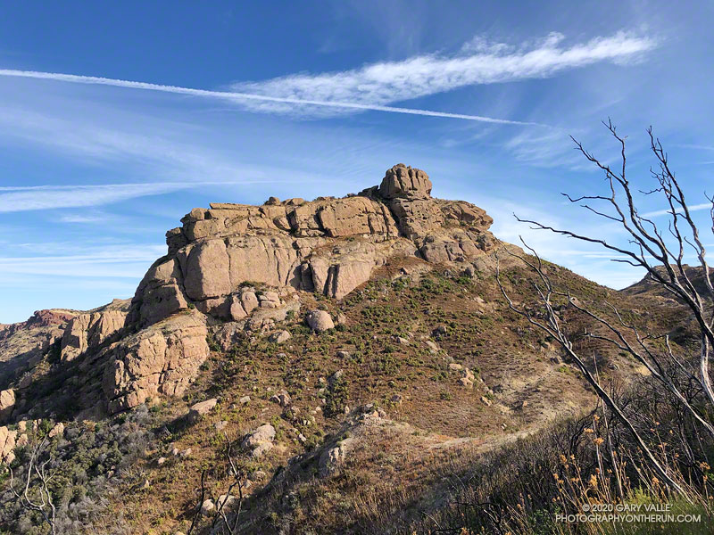
Every time I’ve run the Chamberlain segment of the Backbone Trail, I’ve looked at the intriguing rock formation near the top of the trail and wanted to climb it. Looking a bit like an aircraft carrier that’s run aground on a mountain ridge, it’s one of the most prominent peaks along Boney Mountain’s western escarpment. Named “Boney Bluff” by rock climbers, several sport climbing routes were established on the southeast side of the peak in the early 2000s.
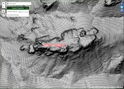
Located just northwest of the junction of the West Tri Peaks Trail and the Backbone Trail, the peak is visible from many points in Pt. Mugu State Park. According to lidar-based 1-meter resolution 3DEP data, its elevation is 2985′, which is slightly higher than the 3DEP elevation of nearby Exchange Peak.
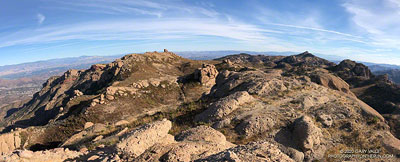
Boney Mountain plateau. Click for larger image.
Boney Bluff is one of many small peaks and rock formations that are found across the Boney Mountain plateau. Comprised of a fused mishmash of volcanic breccia, the rock quality of these formations ranges from very good to quite bad. Seemingly solid handholds or footholds can break, and because of the way the rock erodes, low-angle sections are often littered with granular rocks that can be very slippery.
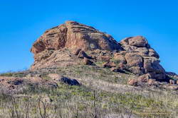
Boney Bluff from the east.
Having climbed the Western Ridge on Boney Mountain, I approached Boney Bluff from the north, via the Tri Peaks Trail. My route climbed a slope to the east side of the peak, then traversed right to the base of a jumbled face with several oddly eroded ledges. A short, steep crack and grassy ramp provided access to the ledges above. NOTE: There may be a better way to climb the peak. I was trying to do a relatively direct route and avoid bushwhacking. The route is somewhat manky, but worked for me.
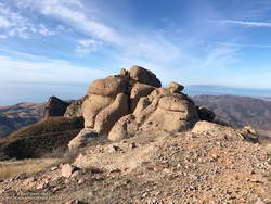
Summit block of Boney Bluff.
The high point of the peak is on top of a summit block that caps the “island of the carrier.” Many of the formations on Boney Mountain have summit blocks, and these are often the most difficult part of the climb. Rule #1 involving summit blocks: Don’t climb up anything you can’t 100% for sure climb down! This one looked like it might be tricky, but with careful route-finding was pretty straightforward.
Because Boney Bluff is perched on the edge of the Boney Mountain plateau, on a clear day there are outstanding panoramic views of Pt. Mugu State Park and the Boney Mountain area from its summit. Today, the visibility was excellent and Mt. Baldy was visible, 75 miles to the east.
Lidar-based 3DEP Elevation Estimates of Some Boney Mountain Peaks
Lida-based 3DEP elevation contours of Boney Bluff. Click for a larger image.
The resolution of the 3DEP Elevation Data is very impressive. While checking the elevation of Boney Bluff, I also noted the 3DEP elevation of several other peaks in the Boney Mountain area. For more info about 3DEP see this U.S.G.S. website.
Sandstone Peak 3116′
Tri Peaks 3039′
Boney Bluff 2985′
Boney Crest 2974′ (Accessed via Western Ridge or Cabin Trail)