Category Archives: landscape

Looking for Boney Mountain

The Backbone Trail west of Exchange Peak, in the Boney Mountain Wilderness

If you look at the traditional USGS 7.5 minute Triunfo Pass and Newbury Park topographic maps, BONEY MOUNTAIN refers to the large, mountainous plateau that extends roughly from Peak 2417 on the west; to Peak 2793 on the north; and to Sandstone Peak on the east. However, when people say they are climbing “Boney Mountain,” they are usually referring to a high point north of Tri Peaks, on the northwest corner of the plateau, above Newbury Park. This illustration shows these features.

This high point has an elevation of about 2935′ and is typically reached by ascending the Upper Cabin Trail or Western Ridge route. When climbing to this point, most start at one of the Satwiwa trailheads, such as at Wendy Drive and Potrero Road. The high point is NOT the same as “Boney Peak,” which on recent maps is ascribed to a peak adjacent to Inspiration Point, and has an elevation of about 2825′.

Today’s running adventure ascended the Western Ridge route to point 2935 and then worked over to the Backbone Trail, by way of Tri Peaks. Part of today’s adventure was to investigate a peak near the top of the Chamberlain Trail that is labeled peak 2880 on traditional topo maps, but is labeled “Boney Mountain” on many online, GIS-based maps.

The traditional, hand-crafted USGS 7.5 minute topographic maps were produced from about 1945 to 1992, with map revisions continuing until 2006. These maps are now part of the USGS Historical Topographic Map Collection (HTMC) and still widely used. The intended replacements are the GIS-based “US Topo” maps, first released in 2012. The USGS  topoView application can be used to view historical and current USGS topo maps.

The USGS “US Topo” maps are digitally produced from GIS data. As a result, some features traditionally included in USGS topographic maps — such as trails, landmarks, buildings and recreational features — may not be included. It also appears there have been some issues with geocoding placenames.

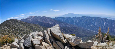
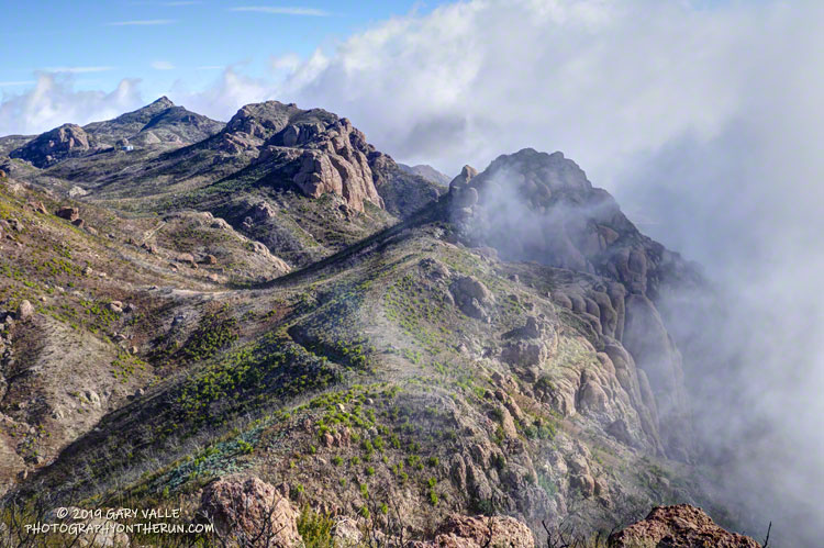
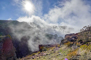
The conditions for today’s run were fantastic. Wind-driven clouds condensed along Boney Mountain’s western escarpment, spilling and tumbling over its edge in dramatic fashion.

Clouds spilling over the lip of Boney Mountain's western escarpment.
Clouds spilling over the lip of Boney Mountain’s western escarpment.

As for the other Boney Mountain — Peak 2880 — it was brushy and the rock wasn’t the best, but climbing it did provide some fresh views of the Boney Mountain area. My guess is that the “BONEY MOUNTAIN” label, which described an area on the traditional maps, was treated like a point feature when geocoded. The nearest point happened to be Peak 2880, which speciously became “Boney Mountain.”

In the 2018 edition of the Triunfo Pass US Topo, the Boney Mountain label was moved to Tri Peaks, and the label for Tri Peaks was moved to another, unnamed, peak. In the current online version of the map, the Boney Mountain label and Tri Peaks label are at Tri Peaks. Over time the maps should improve, but until then, I’ll continue to use the traditional 7.5 minute USGS maps, or commercially produced maps that have been field verified.

And what about point 2935 – the high point on the crest that so many people climb? It really deserves a name. Given it overlooks the Danielson Monument and cabin site, maybe something like “Danielson Peak” would be fitting.

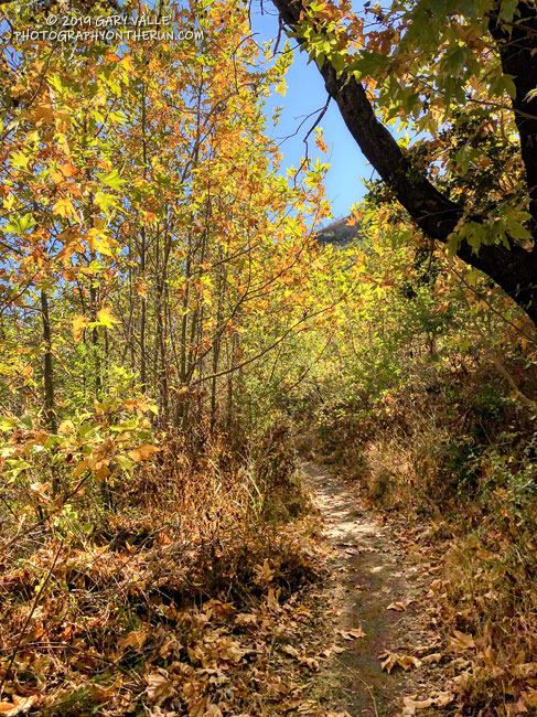
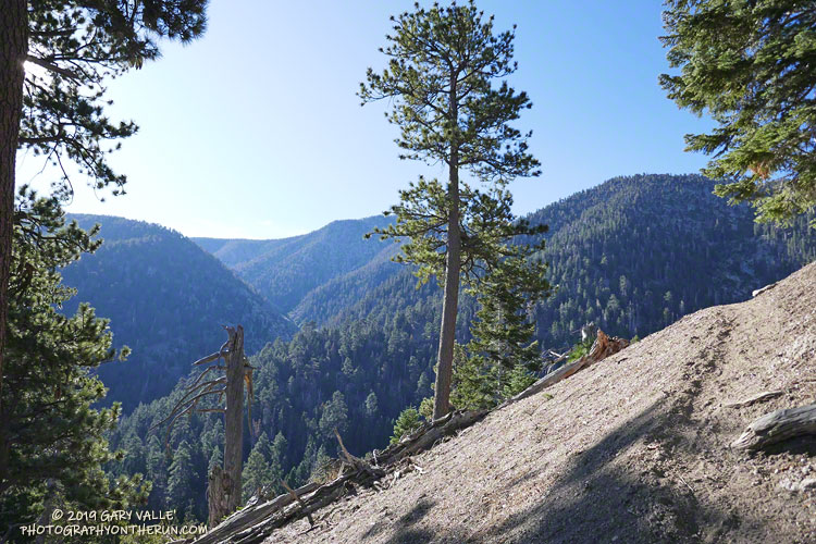
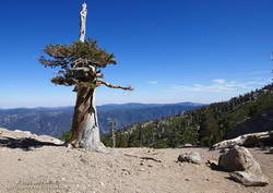
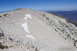
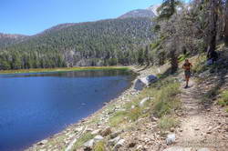
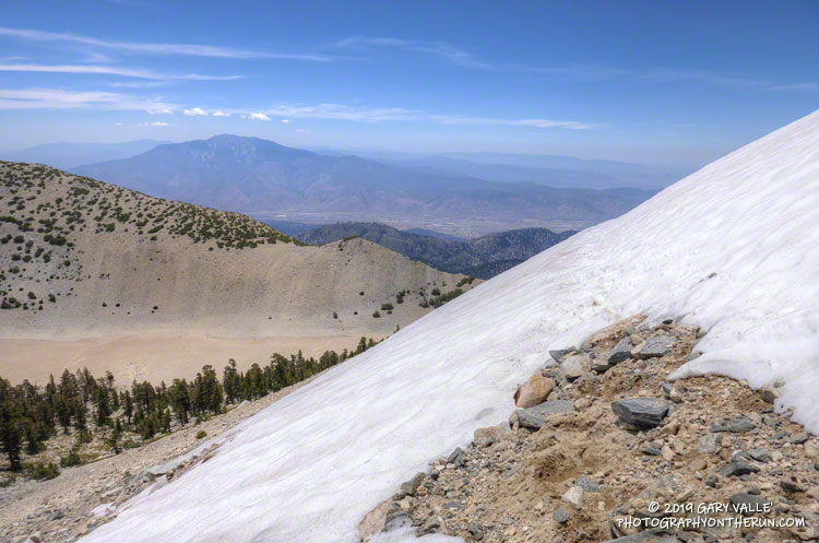
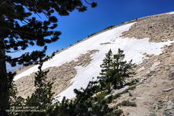
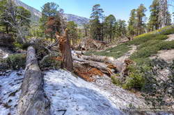
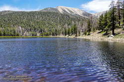
Here are a few photos taken on my hike and run.

Some related posts: After the Woolsey Fire: Boney Mountain and Pt. Mugu State Park, An End of Year Boney Mountain Adventure

Fall on the Upper Sycamore Trail

Fall on the Upper Sycamore Trail in Point Mugu State Park

The Upper Sycamore Trail connects Sycamore Canyon Road and Danielson Road in Pt. Mugu State Park.

The scenic single-track trail crosses upper Sycamore Creek several times as it works through the canyon — a canyon cut by the creek along the trace of the Sycamore Fault. About 1.4 miles long, the trail gains approximately 400′ in elevation on it’s way up to Danielson Road.

This morning I’d done part of the Ray Miller 50K course, along with Mugu Peak, and then returned up-canyon on the Two Foxes Trail and Sycamore Canyon Road. With the low sun, the sycamores changing color, and it being just a few days before Thanksgiving, the run through the canyon on the Upper Sycamore Trail was especially enjoyable.

An Out-of-the-Way Trail, Two Peaks, a Wheelbarrow, and Washington’s Monument

Forsee Creek canyon from the John's Meadow Trail in the San Gorgonio Wilderness.

Wow, what a fantastic trail, canyon, and morning!

The view above is from the John’s Meadow Trail, a circuitous trail that winds its way through a less-traveled part of the San Gorgonio Wilderness.

Sugar pine cones
Sugar pine cones along the John’s Meadow Trail.

The prominent canyon in the photo is home to Forsee Creek. During the last ice age, it held one of San Gorgonio’s small glaciers. I’d just crossed the Forsee Creek a few minutes before, and in a few hours would run past its source high on the crest — Trail Fork Springs.

The peak at the head of the canyon is East San Bernardino Peak (10,691′). Its summit marks the crest of the divide and the location of the San Bernardino Peak Divide Trail. That’s where I was headed, but the path would be anything but direct.

From the Forsee Creek crossing at 7270′, the John’s Meadow Trail climbs about 1000′ in 2.3 miles to join the Divide Trail at “wheelbarrow junction,” about 5 miles west of East San Bernardino Peak. From that point I worked up the popular and scenic Divide Trail, visiting Limber Pine Bench (9330′), Washington Monument (10,290′), and San Bernardino Peak (10,649′) along the way to East San Bernardino Peak.

A weather-beaten lodgepole pine at Limber Pine Bench on the San Bernardino Peak Divide Trail.
Weather-beaten lodgepole pine.

Using this roundabout — but very scenic — route, it took me about the same time to reach San Bernardino Peak from the Forsee Creek Trailhead as it does to do San Gorgonio Mountain from the South Fork Trailhead. From San Bernardino Peak it’s a little less than a mile to East San Bernardino Peak and from there only about 0.75 mile to the lateral to Trail Fork Springs.

From the westernmost Trail Fork Springs junction with the Divide Trail the theme was downhill, downhill, and more downhill — about 3800′ of downhill over 6.7 miles.

The running on the Forsee Creek Trail was generally very good. I was glad I did the loop counterclockwise. The John’s Meadow Trail and its extension are enjoyably primitive — they appear to be “use” trails that have evolved over time. On the other hand, the Forsee Creek Trail is a constructed trail. It was designed as a pack trail, so is generally well-behaved. Great for going down, but a long haul up with a heavy pack!

San Gorgonio Mountain and San Jacinto Peak from East San Bernardino Peak.
San Gorgonio and San Jacinto from East San Bernardino Peak.

Here are a few photos taken along the way, and here is an interactive Cesium ion view of the GPS trace of my route. The 3D view can be zoomed, tilted and panned.

Note: Water is generally more reliable and accessible on the John’s Meadow Trail than on the Forsee Creek Trail. Trail Fork Springs and Jackstraw Springs are seasonal water sources that may not have water. Check with the Mill Creek Ranger Station for the current conditions and more info.

San Gorgonio Mountain Snow Follow Up

Hiker working up the Sky High Trail on San Gorgonio Mountain in Southern California
Hiker on the Sky High Trail

One of the things I’d been curious to see when running the Kodiak 50K in mid-August was how the summit snow band on San Gorgonio Mountain was holding up. The answer turned out to be fairly well. Now, a few weeks later, I was back on Gorgonio, chugging up the South Fork Trail, and on my way to see if any snow remained on the mountain.

Runoff from thunderstorms during the week had left the trail rocky and rutted. From the views of the mountain I’d glimpsed from the trail, I wondered if the rain had also washed away any remaining patches of snow.

Snow band near the summit of San Gorgonio Mountain. September 7, 2019.
Snow band near the summit of San Gorgonio Mountain on September 7, 2019.

In addition to that question, I also want to follow up on my earlier “field checks” this Summer and see how much water there was in Dry Lake, and if any snow remained in the avalanche debris above Dry Lake.

I was about a quarter-mile from the Dry Lake – Dollar Lake junction at South Fork Meadows, making decent time, when I heard footsteps behind me. I stepped to the side so he could pass, and we talked as we worked up the trail. Kevin said he’d been climbing in the Sierra just about every weekend and was really well-acclimated.

I asked him what route he was doing to the summit, and he said the Dry Lake route. I told him I was doing the Dollar Lake Trail route up and the Dry Lake route down. He was clearly moving faster than me and said he was shooting for a time of 4:20 to the summit. I mentioned the Dollar Lake route was shorter and faster, and depending on the number of stops for photos, I expected to get to the summit in around 3:45. We talked about some Sierra peaks and being in the mountains, and after a couple of minutes, he began to pull away.

Trail runner at Dry Lake on San Gorgonio Mountain
Dry Lake on September 7, 2019.

The early morning temperature had been a little more chilly than my earlier trips up Gorgonio this Summer. I debated pulling on my sleeves, but by the time I was in the sun on the Dollar Lake Trail, the temperature had warmed to a comfortable 50-something — perfect for ascending the peak.

The summit of San Gorgonio was a very busy place when I arrived. I’d estimate 40-50 people were on or around the summit. Most were part of one huge group that had come up Vivian Creek.

The good news was part of the summit snow band had not melted. Wow! It was September 7, and there was still snow in Southern California!

Copernicus Sentinel satellite imagery of snow on San Gorgonio Mountain on August 27, 2019.

Kevin caught up to me on the descent of the Sky High Trail. We’d both made the summit within a couple of minutes of our projections, leaving little doubt that the Dollar Lake Trail is the fastest route to the summit from the South Fork Trailhead.

I didn’t see any snow remaining in the avalanche debris above Dry Lake. The lake itself was in great shape, and the streams at South Fork Meadows were flowing nearly as vigorously as they had been a month ago.

I’ve added a couple of photos from this trip to the San Gorgonio Mountain Snow, Avalanches and Glaciers slideshow.

Update November 26, 2019. A small amount of snow from the 2018-19 season has survived on San Gorgonio Mountain until the first persistent snow of the 2019-20 season! Copernicus Sentinel satellite imagery from November 17, 2019 showed small patches of snow in two areas. The first winter storm of the season brought snow to the mountains a couple days later, and more snow is expected over the Thanksgiving holidays.

Update October 21, 2019. Copernicus Sentinel satellite imagery from October 21, 2019 still showed a few very small patches of snow on San Gorgonio Mountain. One of the patches is at a surprisingly low elevation of about 10,360′.

Update September 18, 2019. Copernicus Sentinel satellite imagery from September 18, 2019 still showed a few small patches of snow on San Gorgonio Mountain.

Related post: San Gorgonio Mountain Snow, Avalanches and Glaciers

San Gorgonio Mountain Snow, Avalanches and Glaciers

Snow on the Sky High Trail on San Gorgonio Mountain on July 27, 2019.
Snow on the Sky High Trail on San Gorgonio on July 27. San Jacinto Peak is in the distance.

Update July 21, 2023. Another big snow year. This Google Earth image of San Gorgonio Mountain is overlain with Copernicus/ESA Sentinel 2 imagery taken on July 19, 2023. The GPS track (yellow) is the upper portion of the Dollar Lake – Dry Lake Loop, a keyhole loop that starts at the South Fork Trailhead.

The weather was Southern California perfect. Shorts and short-sleeves were the dress of the day. Winds were light, no thunderstorms were in the forecast and no large wildfires polluted the air. Although temps in the valleys were nearing 100 degrees, the weather on the summit of 11,499′ San Gorgonio Mountain was altitude-conditioned bliss.

I’d spent about 15 minutes enjoying the summit, then run back down the Summit Trail. Turning left onto the Sky High Trail, I continued a keyhole loop that had ascended the South Fork Trail, Dollar Lake, and San Bernardino Divide Trails. Altogether, the route was about 21 miles long and the approximate elevation gain/loss was 4700′.

San Gabriel beardtongue (Penstemon labrosus) along the South Fork Trail.
Penstemon along the South Fork Trail.

From the start of the run, the effects of the wet 2018-19 Winter and big snowpack were everywhere. Wildflowers bloomed in profusion, seeps and small streams greened the landscape, and grasses and ferns grew thick beneath the trees. The roar of the streams at South Fork Meadows left little doubt as to what kind of Winter it had been.

On the way up the Dollar Lake Trail, I’d seen elongated patches of snow in the chutes along the crest. While there was no snow directly on the trail between Dollar Lake Saddle and the summit, there was more snow than usual on the north side of the peaks.

But there was snow on the Sky High Trail. Topping out at over 11,300′, the Sky High Trail is one of the most spectacular trails in Southern California. I marvel at its airy location every time I run it. Near the top of the trail, I’d crossed a small patch of snow and thought, “Well, at least there was a little snow on the trail.”

Large patch of snow on the Sky High Trail at an elevation of about 11,100' on July 27, 2019.
Large patch of snow on the Sky High Trail at an elevation of about 11,100′ on July 27, 2019.

A little disappointed, I’d put my poles away and continued running down the trail. At around 11,100′ I rounded a corner and surprise, surprise — there was a much larger patch of snow on a southeast-facing section of trail. It was about 100 yards across and steep enough that a fall would be a bad idea. Fortunately, the snow conditions were perfect. A few hikers had recently traversed the snowfield, and I followed in their footsteps.

However, that wasn’t the last of the snow. At an elevation of about 10,200′, not far past the C-47 crash site, the trail crosses a long chute that extends nearly to the top of Gorgonio. The snow in that chute had melted just enough that a thin strip of trail was exposed.

Thinking that had to be the last of the snow, I continued the traverse to Mineshaft Saddle (9936′) and began the descent of the Dry Lake Trail. Once past a rocky section of the trail, I picked up the pace, energized by the increased oxygen at lower elevation. Enjoying the downhill, I descended into an area of converging chutes and gullies, when the path through the lodgepole forest abruptly ended.

Avalanche debris on the Dry Lake Trail above Dry Lake. July 27, 2019.
Avalanche debris on the Dry Lake Trail above Dry Lake.

The trail was obliterated. Large trees were ripped from the ground, broken, tossed, and piled up as if they were matchsticks. Underneath the debris were mounds of dense, icy snow — the remnants of an avalanche. This report on SoCalSnow.org includes photos of an avalanche in February 2019 on the north face of San Gorgonio and mentions previous avalanches.

That snow, at an elevation of about 9400′, had finally been the last on the trail. Because the compressed snow is effectively a big block of ice, it could be around for a while.

In the area of the avalanche, the Dry lake Trail enters a large area of rocky rubble that extends into the Big Draw. According to the Dibblee Geologic Map for San Gorgonio Mountain, this rubble is glacial till, produced by the largest of several pocket glaciers that existed on San Gorgonio Mountain, Shields Peak, and San Bernardino Peak.

San Gorgonio Mountain's summit, on the left of the crest, is more than 2400' above Dry Lake.
This is the first time Dry Lake has been full this time of year since 2011.

Continuing down the trail to Dry Lake I saw where some of this season’s meltwater had gone — for the first time since 2011, Dry Lake was full in late July.

Last Saturday’s run was so enjoyable that yesterday I went back to Gorgonio and did it again. As might be expected during a Southern California Summer heatwave, the snow on the Sky High Trail, and elsewhere, is melting fast and won’t be around for long.

Here are a few photos taken along the way. The album includes photos from both the July 27 and August 3 runs. A couple of photos from a run on September 7 were also added.

Some related posts: San Gorgonio Mountain Snow Follow Up, Still a Little Snow in Southern California; San Gorgonio Mountain: Falls Creek Loop, August 2017; After the Lake Fire: The Dollar Lake – Dry Lake Loop on San Gorgonio Mountain

Mt. Pinos to Mt. Abel Out & Back – Plus Sawmill Mountain, Grouse Mountain and Sheep Camp

Paintbrush along the Vincent Tumamait Trail near Mt. Pinos.

The out and back trail run from the Chula Vista parking area on Mt. Pinos to Mt. Abel (Cerro Noroeste) is a long-time favorite. It combines subalpine summits, beautiful pine and fir forests, and a unique flora with uncrowded trails that are fun to run and explore.

The basic out and back to Mt. Abel (Cerro Noroeste) with a stop on the way back at Sheep Camp for water is around 14 miles with an elevation gain/loss of about 3400′. The side trips to Sawmill Mountain and Grouse Mountain are short and add about 0.75 mile to the distance and around 250′ to the elevation gain.

As in other areas of Southern California, the wet 2018-19 Winter has resulted in an abundance of wildflowers in the Mt. Pinos region. Paintbrush, mariposa lily, larkspur, penstemon, lupine, phlox, iris, yarrow and many other plants are blooming in profusion. Limber pines in the area are full of cones and the spring at Sheep Camp is flowing well.

Floras and checklists for Mt. Pinos have been compiled by Tom Chester, CalFlora, Mount Pinos Ranger District, David L. Magney and others.

Here is a Juicebox album of a few photos taken on this trail run on Mt. Pinos.

Some related posts: Up, Down and Around on Mt. Pinos’ Tumamait and North Fork Trails, Thunderstorm, Pinos to Abel Plus