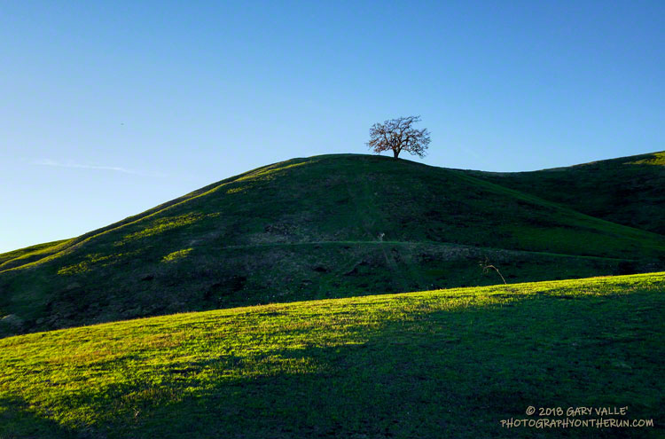
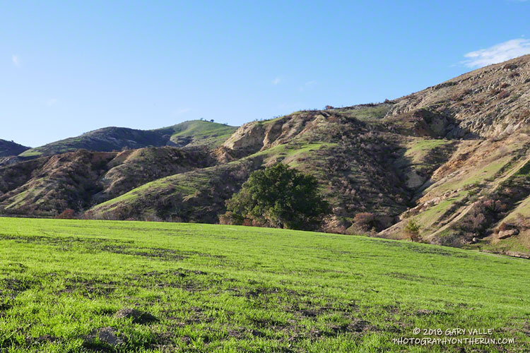
Low in the afternoon sky, the Winter sun highlights new green grass on the hills of Ahmanson Ranch following the Woolsey Fire.
Related post: After the Woolsey Fire: Ahmanson Ranch

Low in the afternoon sky, the Winter sun highlights new green grass on the hills of Ahmanson Ranch following the Woolsey Fire.
Related post: After the Woolsey Fire: Ahmanson Ranch
Note: The open space area formerly known as Ahmanson Ranch is now Upper Las Virgenes Open Space Preserve. Most locals simply refer to the area as “Ahmanson.”
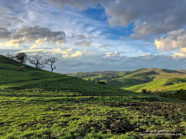
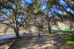
Running along the winding course of East Las Virgenes Canyon I was both disheartened and encouraged by what I saw. Bleak, blackened slopes extended to the west and southwest as far as the eye could see. But along the canyon there were hopeful signs.
The soil burn severity in the Ahmanson Ranch grasslands had generally been low. Scattered across the landscape were small shrubs and other insubstantial plants that had not burned. Some oaks still had green leaves and almost none had gray, ash-colored trunks from being severely burned. Very few trees had become fully involved. Most of the mature trees looked like they would survive.
Even so, there were a number of casualties. Most of these were oaks weakened by drought and heart-rot. The rotten punk wood in the interior of the base of the tree can be ignited through an exterior weakness or indirectly by the heat of the fire. At some point the trunk of the tree is sufficiently weakened that the tree breaks in the wind or collapses.
Preceding the Woolsey Fire, several drought-stressed oaks in the Ahmanson Ranch area collapsed from heart-rot. That is one of the major differences between the impacts of the 2005 Topanga Fire and the Woolsey Fire — the oaks in the Woolsey Fire were drought-stressed, and as a result of increased heart-rot, more susceptible to basal fire. Winds were also stronger in the Ahmanson area during the Woolsey Fire, which may have contributed to the number of downed trees.
Out to check on some special oaks, I breathed a sigh of relief when I rounded a corner and saw the tree was still standing. A one-of-a-kind tree in the area, the 100+ year-old blue oak was singed, but had survived. On a later run, new green leaves could be seen sprouting among its brown leaves.
After checking the blue oak, I headed up to Lasky Mesa to check on a picturesque oak that has “starred” in photo shoots, TV commercials and other productions. This once-flourishing oak has been struggling with the drought and I had my doubts it had escaped the fire. But it did! Although it didn’t appear to be damaged by the fire, it continues to be in very poor condition. Maybe this Winter’s rain will help. It has sprouted a few new leaves, so we’ll see!
The fire was astonishingly efficient at cleaning up dead trees. In some places oaks killed by the drought or the 2005 Topanga Fire were completely consumed by the fire while twiggy, dry shrubs inches away survived.
One area of the Woolsey Fire that burned with higher intensity was near the Las Virgenes Canyon Road trailhead. A large, sprawling valley oak that had survived the 2005 Topanga Fire (and other fires) didn’t make it through the Woolsey Fire. Like most of the valley oaks killed in the fire, it had heart-rot and failed structurally.
Following the fire, I have seen a usual assortment of wildlife in the Ahmanson Ranch area — coyote, rabbit, acorn woodpecker, towee, white-tailed kite, scrub jay, northern harrier, red tailed hawk, raven, quail, and other wildlife. A couple of sightings were unexpected. One was a small, live, Southern Pacific rattlesnake near a firebreak. The other I saw while running on the north side of Lasky Mesa on a drab, overcast day.
I thought I saw a flash of blue against the deep black of the burned slopes, as the bird flittered from tree to tree. I didn’t recognize it. It was the wrong size and shape for a scrub jay, and didn’t fit the coloration or characteristics of other birds I’d seen on Lasky Mesa.
When I got home, I checked the photo, enlarging it as much as I could. It turned out to be a western bluebird! That made me smile!
Here are a few photos taken along the way.
Some related posts: Ahmanson Blue Oak, Tree 75, New Leaves on Drought-Stressed Valley Oak, Fallen Oak
On last Sunday’s run in Malibu Creek State Park, I only had time to check the redwoods and M*A*S*H site and run/hike up about half of the Bulldog climb. Here are a few photos from that run.
Today, Ann, Skye and I did a variation of the Bulldog Loop that starts/ends at the Cistern Trailhead on Mulholland Highway and which covers a large portion of Malibu Creek State Park.
The Woolsey and Hill Fires Watershed Emergency Response Team Final Report included in-depth information concerning these fires, including detailed Values-at-Risk assessments.
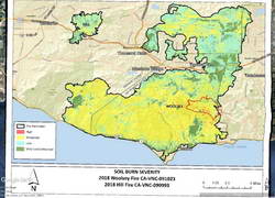
The soil burn severity map included in that report shows that Malibu Creek State Park was one of the most severely burned areas in the Woolsey Fire. This was clearly evident as we ran/hiked along Bulldog Mtwy, Castro Peak Mtwy and Mesa Peak Mtwy. Here is a Google Earth image of the WERT Soil Burn Severity Map with a GPS track of our run added.
As mentioned in last week’s post, there had been some flooding and small debris flows along Crags Road near the M*A*S*H site and at the bottom of Bulldog Mtwy. This week we noted some rockfall along a stretch of Mesa Peak Mtwy that is prone to rockfall. Hazards existed before the fire and hazards exist after the fire.
Bulldog Mtwy and Castro Peak Mtwy had been recently graded and were in decent shape — at least as of December 29. Heavy rain may have changed that assessment.
As badly burned as the park is, there were some things to see on the plus side. The area’s vegetation was taking its first steps toward recovery, with grasses and other annuals, laurel sumac and wild cucumber sprouting. Most of the chaparral along the Mesa Peak Mtwy segment of the Backbone Trail between the picnic table at Puerco Mtwy and Tapia Park was left intact. Most of the Tapia Spur Trail was just outside the fire’s perimeter.
It was was also heartening to see that most of the large oaks along the High Road, west of the parking lot, were OK. Many of the oaks, sycamores, willows and other trees along Crags Road were scorched, but looked like they will recover.
Here are a few photos taken along the way.
Some related posts: Sprouting Live Oak Leaves; Malibu Creek State Park Redwoods, M*A*S*H Site and Bulldog Climb; Boney Mountain and Pt. Mugu State Park
I’d done a long run the day before in Pt. Mugu State Park, so the plan for this morning was to do a short run and check out the Woolsey Fire impacts between Century Lake and the M*A*S*H site in Malibu Creek State Park.
In addition to checking the condition of the coast live oaks and other native trees, I was curious to see how the coast redwoods along the Forest Trail had fared. These trees were planted nearly a century ago and in recent years have struggled with the drought. Had they survived the fire?
It had been about a year since I had checked on the redwoods. The good news is that a few of them still appear to be viable. The bottom limbs on some of the trees were scorched, but I think they will be OK. Of the 16 or so redwoods, about five have died, about five are in poor shape, and five or six appear to be OK. There is one young naturally occurring tree that was severely scorched and may not survive. We’ll just have to see.
While there was some damage to the M*A*S*H site, the picnic tables, ambulance, and signpost made it through the fire. Some repairs will be necessary.
I was supposed to turn around at the M*A*S*H site, but you know how that goes. I wanted to see “just a little” of the Bulldog climb… and a little more… and a little more. I finally ran out of time about 2.5 miles up Bulldog Mtwy and headed back.
Even when you expect it, it is sobering to see areas of high soil burn severity. Thirty-six years of robust chaparral growth were just… gone. Also startling were the stream flows and debris flows that resulted from “only” about 1.5 – 2.0 inches of rainfall in early December. An atmospheric river event of the magnitude that caused the Malibu Creek flooding in February 2017 would be catastrophic.
A lot of work had been done on Bulldog Mtwy. It had been repaired and graded. Where there was still brush and trees along the road the branches had been trimmed!
Here are a few photos taken along the way.
Some related posts: Malibu Creek Flooding, Malibu Creek State Park Redwoods: Fighting the Drought
New grass sprouting in El Escorpión Park about a month after it was burned in the 2018 Woolsey Fire.
Compare to a photo of the same area about a month after the 2005 Topanga Fire.
Related post: The Topanga Fire, Part I: Rain, Wind and Fire
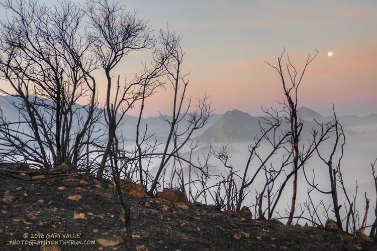
During the later stages of the Woolsey Fire one of the big questions was how far west in the Santa Monica Mountains would it burn. Would it consume Pt. Mugu State Park only five years after the Springs Fire ravaged the area?
The answer to that question became far less clear following the big flare-up in the Sandstone Peak – Boney Mountain area on November 13, and the subsequent advance of the fire into the eastern part of Pt. Mugu State Park.
The Woolsey Fire was fully contained on November 21. A bit of good news in the midst of a whole lot of bad was that fire maps showed the north side of Boney Mountain and most of Pt. Mugu State Park had been spared. That’s what today’s outing was about — checking if the conditions on the ground on the north side of Boney Mountain and in Pt. Mugu State Park matched up to fire maps and data.
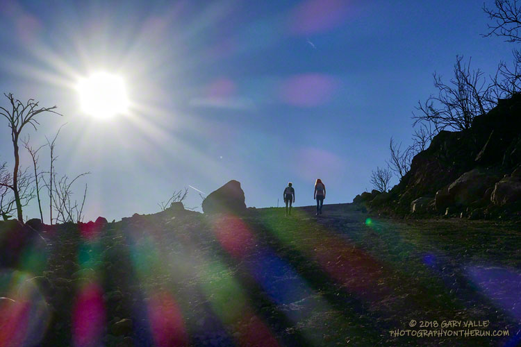
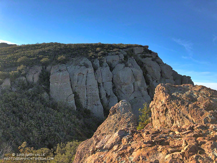
First up was the climb of Boney Mountain’s Western Ridge (Mountaineer’s Route) from Wendy Drive. Except for a little spillover along the crest at the top of the ridge, it was a relief to find that the Western Ridge route and its companion route, the Cabin Trail, were essentially unburned. Both of these routes are used to reach the popular high point along the crest that is generally regarded as “Boney Mountain.” The DEM-based elevation of this point is about 2935′. I enjoy climbing up the Western Ridge and descending the Cabin Trail, so it was good to know that option is still available.
While the north side of Boney Mountain didn’t burn, it was a different story to the south of the crest. The drainage between the top of the Western Ridge and Tri Peaks, and beyond, was badly burned. The last time this area burned was in the 1993 Green Meadows Fire, so the fuel load had been relatively high. From what I could see, the burn severity was generally on the high side of mid-range, but with patches of unburned, low, and more severely burned terrain.
In Pt. Mugu State Park aggressive firefighting and the effects of the 2013 Springs Fire generally — but not entirely — restricted the Woolsey Fire to areas that were not burned in 2013. Much of the Chamberlain Trail did not burn in 2013, and the Woolsey Fire followed this swath of 25-year-old growth westward, burning nearly all of the Chamberlain Trail, as well as the steep slopes to the north of the trail. About half of the large bowl forming Boney Mountain’s western escarpment was burned. As was the case after the Springs Fire, Blue Canyon could once again be at risk from flash floods and debris flows, should a heavy or extended rain event occur.
The westernmost tongue of the Woolsey Fire, near Blue Canyon, reached to within 0.5 mile of the Big Sycamore Canyon Road. For the most part, the fire was held east of the Old Boney Trail. There were several fire retardant drops along this front and the Old Boney Trail was cut into a firebreak/access route. It looked like the dozers came in from Serrano Road. It boggles the mind to think of the logistics required to move firefighting personnel and equipment into wildland areas.
The west side of Serrano Valley and Serrano Canyon turned out to be OK, although you could see where the fire had burned part of the valley and the southwest slopes of Boney Mountain.
Running north on Sycamore Canyon Road, other than the tracks of heavy equipment, there was little to suggest the extent of the devastation to the east. My route back to Satwiwa and Wendy Drive included the Two Foxes Trail, and Upper Sycamore Trail. Except for the Chamberlain Trail, a segment of the Old Boney Trail, and part of the Blue Canyon Trail, other trails and roads in Pt. Mugu State Park appeared to be unaffected by the fire.
Here are a few photos taken along the way. Some additional photos were added from a December 22 run on the Old Boney Trail.