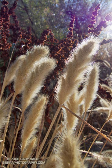
Rabbitfoot grass (Polypogon monspeliensis) along a vernal stream course in East Las Virgenes Canyon in Upper Las Virgenes Canyon Open Space Preserve (formerly Ahamanson Ranch).
This grass is not native to California. From a run in October.

Rabbitfoot grass (Polypogon monspeliensis) along a vernal stream course in East Las Virgenes Canyon in Upper Las Virgenes Canyon Open Space Preserve (formerly Ahamanson Ranch).
This grass is not native to California. From a run in October.
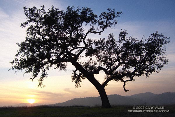
After chugging up the long climb, I pause on the crest of the hill. Open space surrounds me. In a nearby oak, small birds twit and twitter, preparing for the night. In the distance coyotes yip and yell, an announcement on one hilltop, and an answer on another. A cold ribbon of wind brushes against my leg.
I take a deep breath and smile. At sunset the day melds to an end, becoming rich with sights, smells, and sounds. In the moment, senses converge and thoughts coalesce.
There is form in the oak’s twisted limbs. A dove dives from its branches, and I turn for home.
Related post: Return of the Afternoon Sun
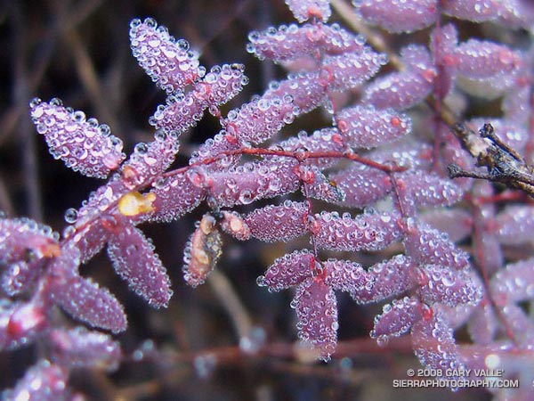
More delicate than the finest holiday crystal, the leaf segments of this coffee fern (Pellaea andromedifolia) are covered in tiny spherical water droplets. The largest of these droplets is about the size of the head of a pin, the smallest perhaps the size of a grain of salt.
Initially green, coffee fern turns various shades of red, brown, or purple with age.
From a run in the Boney Mountain Wilderness in Pt. Mugu State Park on Saturday.
Some related posts: T-storms and Trail Work, Return to Hidden Pond
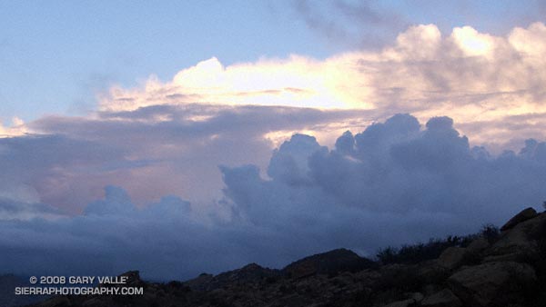
Clearing clouds, northwest of Los Angeles, following the passage of an upper low storm system that resulted in widespread rainfall in Southern California. Several rainfall records for November 26 were broken in Los Angeles County.
Update 12/5/08 P.M. High amplitude flow continues to wreak havoc with forecasts. Our on-again, off-again chance of a shower this weekend might be on again. Original cut-off upper low center is still well offshore, but another low center has developed on the downstream side of high amplitude ridge, and this one is much closer to the Southern California coast. The low appears to be entraining some moisture, and could produce some showers, particularly as the low moves onshore and is absorbed in the main flow. We’ll see!
Update 12/5/08 A.M. No rain is expected in SoCal this weekend… The cut-off upper low set up much further west than suggested by models Tuesday and now is spinning out in the eastern Pacific, nearly halfway to Hawaii. At the moment, it looks like it could be mid-month before our next chance for significant rain.
Update 12/2/08. Computer models have been having a tough time with both the short and medium term forecasts for Southern California. Recent runs have been hinting at the possibility of some rain Saturday or Sunday. This would depend on the strength, position and behavior of an upper low that is forecast to form off the Southern California coast Thursday.
From a run at Sage Ranch Park, near Simi Valley, California.
We stopped for a few moments at the river crossing, where water stood in pools waiting for Winter rain. Instead, cold air flowed down its course, cool and refreshing. From this point there would be little shade. Rarely cold, the climb out from the West Fork San Gabriel River to Shortcut Saddle is often warm, and sometimes debilitating.
Miklos, Krisztina and I were doing the Shortcut Saddle – Mt. Wilson loop — an approximately 22 mile loop that includes two memorable climbs from the Mt. Disappointment 50K and 50M runs. The loop also incorporates the Rim Trail, an adventurous trail that is rough, steep, and washed out at points, but also includes long stretches of excellent trail running. The route starts with almost four miles of downhill on the the Silver Moccasin Trail — a good warmup and a great way to start a trail running day.
Thankfully, today the weather was cool and the Fall shadows long. This translated to more running and a faster pace up Rincon-Edison road. Even so, we were happy to reach the point where the Silver Moccasin Trail shortcuts the last long switchback of the road, and followed this more direct route up to the trailhead.
Our variation of the climb from the W.F. San Gabriel River to Shortcut Saddle on the Rincon-Edison Road was about 5.6 miles long, with an elevation gain of about 1925 ft. The climb from the W.F. San Gabriel River at West Fork campground up the Gabrielino and Kenyon DeVore trails to the Mt. Wilson parking lot worked out to about a 2550′ elevation gain in 5.2 miles. The total elevation gain for the loop is about 4500′.
Related posts: Angeles High Country, Mt. Disappointment 50K 2008 Notes
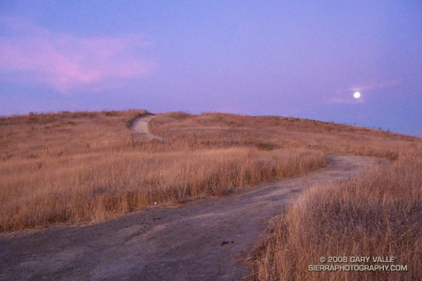
From a run at Ahmanson Ranch, now Upper Las Virgenes Canyon Open Space Preserve, Wednesday evening.