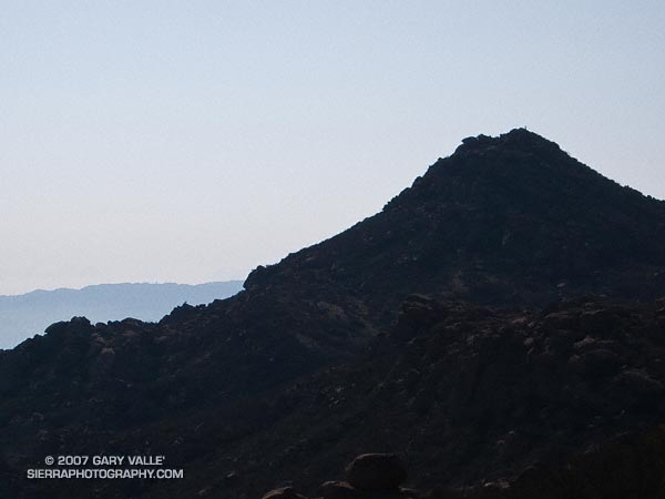
Silhouette of Rocky Peak from the Johnson Mtwy trail in Rocky Peak Park. Note the hiker on the summit. From a run last weekend.
Related post: Rocky Peak

Silhouette of Rocky Peak from the Johnson Mtwy trail in Rocky Peak Park. Note the hiker on the summit. From a run last weekend.
Related post: Rocky Peak
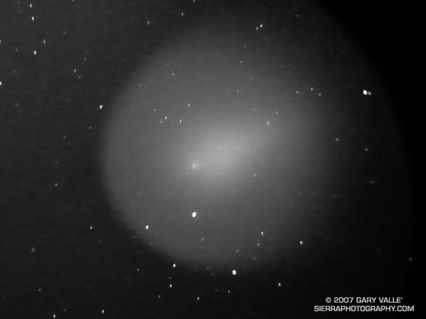
Image of Comet Holmes 17/P taken in the light pollution of the San Fernando Valley, near Los Angeles. It was photographed through the eyepiece of a 5 in. telescope (SCT) using one of my “running” cameras — a 10 Mp compact digital.
An exposure of 60 seconds was used. The raw format image was pushed 2.5 stops and the tone curve adjusted in Adobe Camera Raw to bring out detail in the diffuse outer coma of the comet. The image was flipped so that it is not reversed and is upright.
The comet’s nucleus is at about 8:00 o’clock, near the head of the more dense and bright inner coma. A hint of a tail can be seen projecting in the 2:00 o’clock direction. The tail of the comet isn’t more obvious because from Earth we’re seeing the comet almost head-on.
This illustration, generated using Starry Night Pro, shows the position of Comet Holmes 17/P on 11/13/07 – beyond the orbit of Mars – and its relationship to the Earth, Sun and the plane of the solar system. An orbit visualization and much more info is available on the Comet 17P/Holmes page on TheSkyLive.
Search Comet Holmes 17/P on Google for more info.
From Tuesday’s run at Upper Las Virgenes Canyon Open Space Preserve (formerly Ahmanson Ranch).
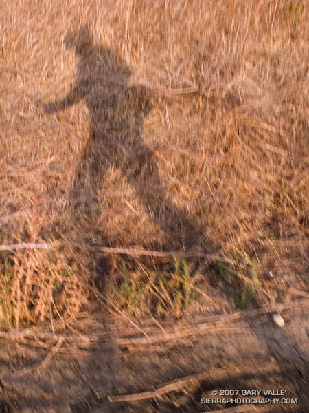
From a run at Upper Las Virgenes Canyon Open Space Preserve (formerly Ahmanson Ranch).
From a run at Upper Las Virgenes Canyon Open Space Preserve (formerly Ahmanson Ranch). Note the hawk in the tree on the left.
Due to fire concerns, Los Padres, Angeles, Cleveland and San Bernardino National Forests remained closed this weekend, so I headed back up to Kernville to meet some friends and run the Whiskey Flat Trail — a sizzling trail in the summertime that has been on my running to-do list for years.
Tucked away in a corner of the Southern Sierra on the banks of the Kern River, and only about a 3 hour drive from Los Angeles, Kernville usually brings to mind images of rafts, kayaks and exciting whitewater, but more than great paddling adventures can be had here.
Sequoia National Forest and the Golden Trout Wilderness afford an extensive array of hiking, mountain biking, climbing, fishing, trail running, and other recreational opportunities. Lower elevation adventures are generally within about a 30 minute drive of Kernville, and higher elevation adventures about an hour’s drive.
We did the approximately 15 mile Whiskey Flat Trail north to south, starting at McNally’s Restaurant and Resort, about 15-20 minutes north of Kernville on highway Mountain 99. The trail is accessed using the Fairview footbridge and is on the opposite side of the river from the highway. It is a gnarly up and down trail, best done in cool weather, with pleasant views of the river and the surrounding mountains.
On it’s way downstream to Burlando Road in Kernville, the trail crosses several creeks and canyons, gaining about 1000 ft. and losing about 1500 ft. Sometimes the trail is yards from the river and at other times so distant as to be taunting. As is the case when paddling this part of the river, the triangular form of peak 6047, near Corral Creek, is a distinctive landmark, that soberly marks progress down the river.
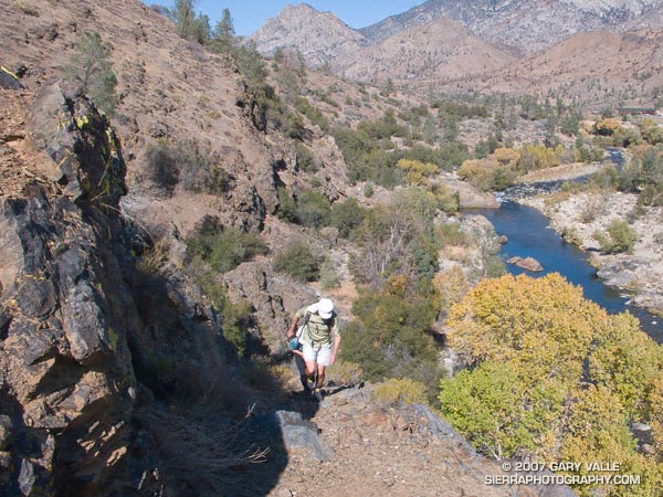
It is a trail that is long for its length and modest elevation gain. There are sandy stretches, rocky sections, stretches with V-ruts, steep uphill sections, and long stretches of perfectly graded downhill. About 8.5 miles into the run a striking section of trail traverses a cliff above Sock’em Dog, a class V rapid on a reach of the river named the Thunder Run.
All in all it was a enjoyable run that would be brutal in hot weather and a high sun. Even with the temperature topping out at only about 80 degrees, I was glad I took extra water!
Here’s a Google Earth image and Google Earth KMZ file of a GPS trace of our route. Near the end of the run, after crossing Bull Run Creek, various use trails have evolved. The main trail forks right and does not cross private property. The various routes can be checked out on Google Earth.
Update 08/17/10. About half of the Whiskey Flat Trail appears to have been within the area burned by the Bull Fire. Here’s a Google Earth interactive browser view of a GPS trace of the Whiskey Flat Trail (from last year’s Burger Run), and the area burned by the Bull Fire based on the most recent GEOMAC fire perimeter (dated 08/01/10). Also included is a GPS trace of the Cannell Plunge route from MountainbikeBill.com.