Category Archives: photography

Mountains and Valleys

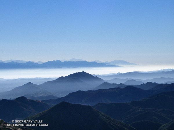
View east from the Mishe Mokwa trail over Ladyface and the San Fernando Valley to the San Gabriel Mountains.

View east from the Mishe Mokwa trail over Ladyface and the San Fernando Valley to the San Gabriel Mountains.

The peaks of the Mt. Wilson area are those in the distance, rising above the marine layer. Mt. Baldy, about 75 miles distant, is the high peak, just left of the centerline of the photograph, in the haze beyond the Mt. Wilson ridgeline.

Related post: Balance Rock, Mt. Wilson Area Peaks From Twin Peaks

Mt. Baldy Run to the Top 2007

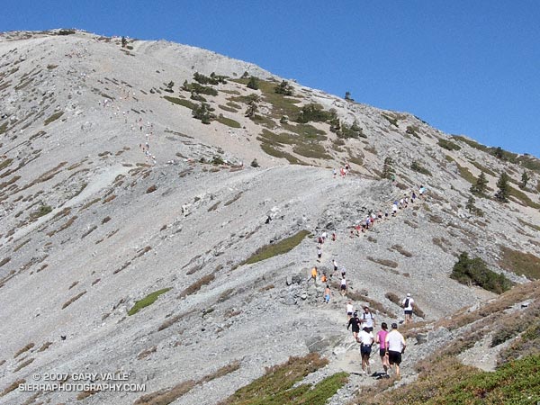
Runners winding their way up the final steep climb to the summit of 10,064 ft. Mt. Baldy during the 2007 Run to the Top race.

Despite an ongoing heat wave and excessive heat warnings, temps were surprisingly moderate for the 42nd running of the Mt. Baldy Run to the Top race. This year the men’s overall winner was Eric Martin in a time of 1:10:04, and the women’s overall winner was Brigid Freyne in a time of 1:30:41. For all of the results see the Run to the Top web site. Many thanks to the race organizers, volunteers, USFS, Mt Baldy Ski Lifts and the Mt. Baldy Fire Department for a great race!

Here are a few images from the race (Flash 8 required), a Google Earth image and Google Earth KMZ file (updated) of a GPS trace of the route.

Related post: Mt. Baldy Runner

Mt. Pinos Improv

The plan had been to do a 2-3 hour run from the Chula Vista parking lot west over Mt. Pinos into the Chumash Wilderness, but due to the Zaca Fire, the trail/road to the summit of Mt. Pinos, the Vincent Tummawait trail, and all of the Chumash Wilderness were closed.

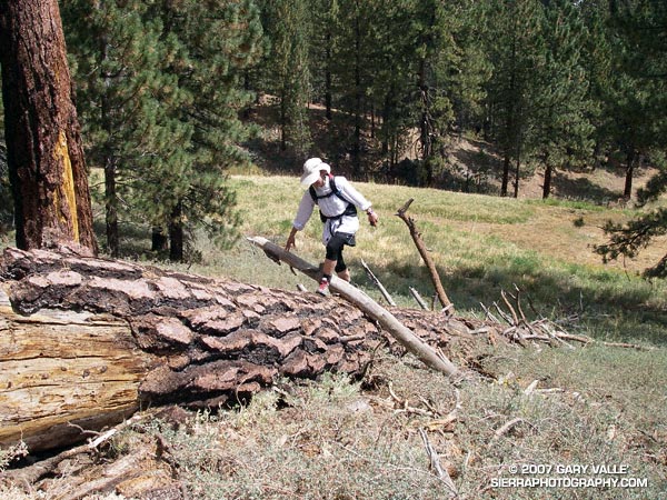
Improvising the best we could, we linked together some cross-country ski trails, use trails, a fallen tree, and the Mt. Pinos road, and were able to get in a good trail run.

Update Friday, August 31, 2007. In a press release dated August 29, 2007, the Forest Service announced that some areas within Los Padres National Forest east of Highway 33 that were previously closed to public entry because of the Zaca Fire would be reopened on August 30.

For more information regarding the Zaca Fire and related closures, see the Los Padres National Forest website.

Some related posts: Mt. Pinos – Mt. Abel Out & Back, Thunderstorm, Vincent Tumamait Trail
Department of Coyote Comportment

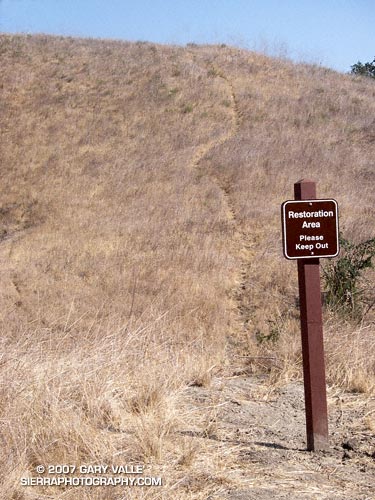
Coyote path at Ahmanson Ranch.

With little new growth this Spring and Summer, coyote paths at Ahmanson Ranch have become so well worn that several have recently been posted with “Restoration Area – Please Keep Out” signs. Whether the canny coyotes will choose to cooperate remains to be seen.

Note: Ahmanson Ranch was acquired as open space in part to protect several sensitive species and their habitats. Some (human) use trails have evolved and “Restoration Area – Please Keep Out” signs are a reminder that the area is a preserve.

From a recent run at Upper Las Virgenes Canyon Open Space Preserve (formerly Ahmanson Ranch).

Related post: Trickster

Leaf Vein Networks

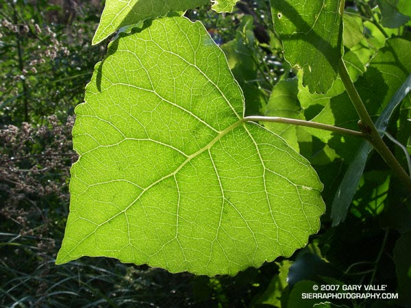
Study of a leaf of a Fremont cottonwood (Populus fremontii) along Las Virgenes Creek in Upper Las Virgenes Canyon Open Space Preserve.

Who hasn’t pondered the intriguing network formed by the interconnected veins of a leaf? Like many apparently complex self-organized structures, there is a recognizable pattern, but the basis of the pattern is difficult to grasp.

Remarkably, research published in 2002 (S. Bohn et al., Phys. Rev. E, June 2002.) found that there is a simple relationship governing the angles between vein segments in the leaves of dicotyledons, and that this relationship is universal. The study also found that the observed vein angles can be reproduced using a simple force model.

Numerical analysis of leaf scans revealed that the angles between vein segments are directly related to the thickness of the segments. When the vein sizes are similar, the connection appears to form a three-way junction with the angle between the veins about 120 degrees. If the vein sizes are dissimilar, with one much larger than the other, the smaller vein joins the larger at about a 90 degree angle.

The photograph is of a leaf of a Fremont cottonwood (Populus fremontii) along Las Virgenes Creek in Upper Las Virgenes Canyon Open Space Preserve. It was taken on a run from the Victory trailhead on May 16, 2007.